Corrie Murrin

Corrie (Glacial Valley) in Angus

Scotland

Corrie Murrin

Dalbrack
Dalbrack Credit: Andrew Curtis

Corrie Murrin is a glacial valley located in Angus, Scotland. Also known as Corrie, this geographical feature is situated in the eastern part of the country, near the town of Kirriemuir. The valley is nestled within the picturesque landscape of the Grampian Mountains, providing visitors with breathtaking views and a serene environment.

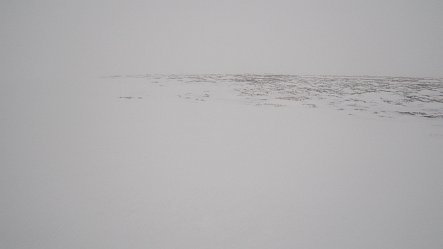
Corrie Murrin was formed during the last Ice Age through glacial erosion. As glaciers moved across the land, they carved out the valley, leaving behind steep slopes and a deep basin. Today, the valley is characterized by its U-shaped appearance, with towering cliffs on either side.

The area surrounding Corrie Murrin is rich in natural beauty and biodiversity. The valley is home to a variety of plant and animal species, including heather, mosses, and birds such as peregrine falcons and golden eagles. The tranquil atmosphere attracts outdoor enthusiasts who enjoy hiking, birdwatching, and photography.

One notable feature of Corrie Murrin is the presence of a small loch within the valley. Loch Corrie Murrin, as it is known, is a peaceful body of water surrounded by the rocky landscape. It provides a tranquil spot for fishing or simply enjoying the scenery.

Corrie Murrin is a popular destination for both locals and tourists seeking to immerse themselves in the beauty of Scottish nature. Its accessibility and stunning vistas make it a must-visit location for anyone exploring the Angus region or embarking on a journey through the Grampian Mountains.

If you have any feedback on the listing, please let us know in the comments section below.

Corrie Murrin Images

Images are sourced within 2km of 56.875222/-2.877624 or Grid Reference NO4676. Thanks to Geograph Open Source API. All images are credited.

Dalbrack
Dalbrack
Grazing land near Dalbrack Grazing land near Dalbrack farm, viewed towards Hare Cairn over the Burn of Bathie
Grazing land near Dalbrack
Grazing land near Dalbrack farm, viewed towards Hare Cairn over the Burn of Bathie
Track near Dalbrack One of the many tracks crossing the hills of Glen Esk offering pleasant walking in the nearby hills. This track passes the north-western flank of Garlet Hill and leads to Cowie Hill.
Track near Dalbrack
One of the many tracks crossing the hills of Glen Esk offering pleasant walking in the nearby hills. This track passes the north-western flank of Garlet Hill and leads to Cowie Hill.
Corrie Murrin A view across Corrie Murrin, over the Burn of Dalbrack.
Corrie Murrin
A view across Corrie Murrin, over the Burn of Dalbrack.
Blue Cairn The summit of Blue Cairn, with hills to the north of Glen Esk visible in the distance.
Blue Cairn
The summit of Blue Cairn, with hills to the north of Glen Esk visible in the distance.
Lochan at the Clash of Dullet A small lochan situated at the Clash of Dullet, between Garlet and Blue Cairn
Lochan at the Clash of Dullet
A small lochan situated at the Clash of Dullet, between Garlet and Blue Cairn
West Knock A view to the north from West Knock, with the monument on the Hill of Rowan visible in the distance.
West Knock
A view to the north from West Knock, with the monument on the Hill of Rowan visible in the distance.
Black Hill Moorland between Glen Esk and Glen Lethnot seen from the small rise of Little Black Hill.
Black Hill
Moorland between Glen Esk and Glen Lethnot seen from the small rise of Little Black Hill.
Coire Breac View from atop a snowdrift on the headwall of the corrie towards Shank of Cochlie
Coire Breac
View from atop a snowdrift on the headwall of the corrie towards Shank of Cochlie
Road, Black Hill Track vehicles use the snow filled ditch on the left and the road is graded so that snow blows off it.
Road, Black Hill
Track vehicles use the snow filled ditch on the left and the road is graded so that snow blows off it.
Road, Black Hill The road is almost clear of snow and has probably been built to blow clear easily. The Angus grouse moor estates have several track laying vehicles for work in the snow and these can use the snow catching ditch at the side of the road. There has been a lot of road building on the Angus moors in recent years.
Road, Black Hill
The road is almost clear of snow and has probably been built to blow clear easily. The Angus grouse moor estates have several track laying vehicles for work in the snow and these can use the snow catching ditch at the side of the road. There has been a lot of road building on the Angus moors in recent years.
Stile on Black Hill There is a double electric fence, degraded by snow but still an awkward obstacle, running along the Esk/Lethnot watershed. Crossing places are spaced, but you will rarely find yourself more than 1km from one.  On this occasion you could easily cross over in several places, thanks to the big snow drifts.
The fence was built to exclude deer, tick carriers, from the grouse moors.

The summit of Black Hill is north of the fence and this stile is nearby to the east.
Stile on Black Hill
There is a double electric fence, degraded by snow but still an awkward obstacle, running along the Esk/Lethnot watershed. Crossing places are spaced, but you will rarely find yourself more than 1km from one. On this occasion you could easily cross over in several places, thanks to the big snow drifts. The fence was built to exclude deer, tick carriers, from the grouse moors. The summit of Black Hill is north of the fence and this stile is nearby to the east.
Summit of Black Hill Bogs and rough stuff is well buried beneath deep consolidated snow, the snow had even rendered the infamous electric fence impotent. Nowhere near a whiteout, although misty, visibility was good enough for easy navigation.
Summit of Black Hill
Bogs and rough stuff is well buried beneath deep consolidated snow, the snow had even rendered the infamous electric fence impotent. Nowhere near a whiteout, although misty, visibility was good enough for easy navigation.
Peat hags between West Knock and Black Hill Perfect conditions for bog trotting - just walk above the peat on deep consolidated snow. Enough smugness, last time I was up on this ridge, the snow was a bit rotten and I had a very tough time.

Summer view: <a href="https://www.geograph.org.uk/photo/564704">NO4675 : Peat Haggs between West Knock and Black Hill</a>
Peat hags between West Knock and Black Hill
Perfect conditions for bog trotting - just walk above the peat on deep consolidated snow. Enough smugness, last time I was up on this ridge, the snow was a bit rotten and I had a very tough time. Summer view: NO4675 : Peat Haggs between West Knock and Black Hill
Electric fence crossing place The gate is a partial solution to getting over the electric fence which runs along the Esk/Lethnot watershed ridge. Unfortunately there are also electric fences running perpendicular to the main fence on the north side. This gate is fine as long as you plan on heading downhill or westward only.

The main fence was built to exclude deer. Recently the grouse shoots on the Braes of Angus have been improved and cutting the tick population through deer exclusion and sheep dipping has been one of the methods used. Being February the grouse were quite vocal.
Electric fence crossing place
The gate is a partial solution to getting over the electric fence which runs along the Esk/Lethnot watershed ridge. Unfortunately there are also electric fences running perpendicular to the main fence on the north side. This gate is fine as long as you plan on heading downhill or westward only. The main fence was built to exclude deer. Recently the grouse shoots on the Braes of Angus have been improved and cutting the tick population through deer exclusion and sheep dipping has been one of the methods used. Being February the grouse were quite vocal.
Electric fence on West Knock A temporary solution to the electric fence problem: snow has buried the double fence which was built to exclude deer from grouse moors. There is a crossing place near the summit of West Knock.
Electric fence on West Knock
A temporary solution to the electric fence problem: snow has buried the double fence which was built to exclude deer from grouse moors. There is a crossing place near the summit of West Knock.
Flobbit A view eastwards towards the Clash of Wirren, a meltwater channel from the southern slopes of West Knock.
Flobbit
A view eastwards towards the Clash of Wirren, a meltwater channel from the southern slopes of West Knock.
Road on Black Hill The road does not stop at the double electric fence on the watershed, but turns left and heads westward.
Road on Black Hill
The road does not stop at the double electric fence on the watershed, but turns left and heads westward.
Show me another place!

Corrie Murrin is located at Grid Ref: NO4676 (Lat: 56.875222, Lng: -2.877624)

Unitary Authority: Angus

Police Authority: Tayside

What 3 Words

///pampered.edges.common. Near Brechin, Angus

Nearby Locations

Corrie Murrin Round Hill

Related Wikis

Tarfside

Tarfside is a small hamlet in Angus, Scotland. It is situated in Glen Esk, on the upper course of the River North Esk, around 8 miles north of Edzell,...

Invermark Castle

Invermark Castle is an oblong tower house dating from the 16th century, at the east of Loch Lee, Angus, Scotland. It is near the head of Glen Esk. ��2...

Invermark Lodge

Invermark Lodge is a hunting lodge which was built near Invermark Castle in 1852 for John Ramsay, 13th Earl of Dalhousie. It is now a listed building...

Loch Lee

National grid reference NO431800 Loch Lee is a loch in Angus, Scotland south of the Grampian Mountains that is fed by the Water of Lee and the Water of...

Have you been to Corrie Murrin?

Leave your review of Corrie Murrin below (or comments, questions and feedback).