Corrie na Berran
Corrie (Glacial Valley) in Angus
Scotland
Corrie na Berran

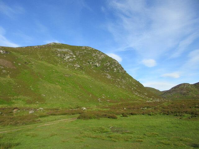
Corrie na Berran, located in Angus, Scotland, is a stunning glacial valley known for its natural beauty and unique geological features. Situated within the Cairngorms National Park, the valley is surrounded by towering mountains, creating a picturesque and awe-inspiring landscape.
The name "Corrie na Berran" translates to "the valley of the berrans," referring to the small, rocky hills that dot the valley floor. These hills were formed by glacial activity during the last ice age, and their presence adds to the area's distinctive charm.
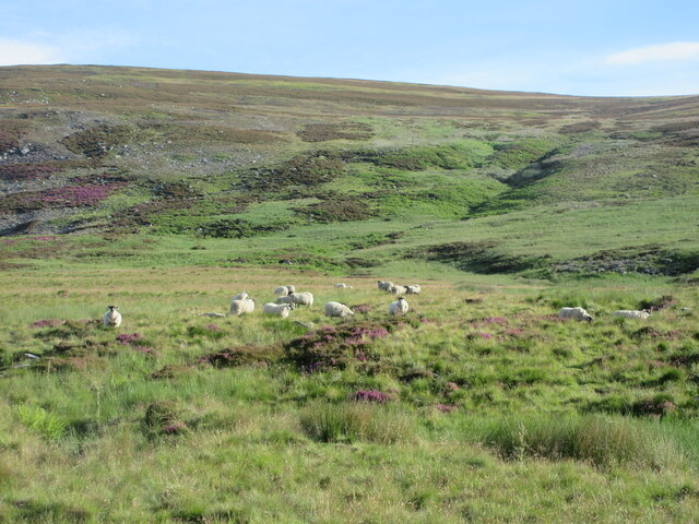
The valley itself is characterized by its U-shaped profile, which is a typical feature of glacially-carved landscapes. The walls of the corrie rise steeply on either side, creating a sense of enclosure and seclusion. As a result, Corrie na Berran offers a peaceful and serene environment, perfect for those seeking solitude and tranquility.
The valley is also home to a variety of plant and animal species, making it a haven for nature enthusiasts and wildlife lovers. Visitors can spot rare alpine plants, such as the delicate purple saxifrage and the vibrant yellow mountain avens, as well as various bird species including ptarmigans and golden eagles.
Hiking and mountaineering are popular activities in Corrie na Berran, with numerous trails catering to different skill levels. The paths offer breathtaking views of the surrounding mountains, lochs, and waterfalls, providing visitors with a truly immersive and unforgettable experience.
In summary, Corrie na Berran is a remarkable glacial valley in Angus, Scotland, showcasing the beauty and power of nature. Its unique geological features, diverse flora and fauna, and opportunities for outdoor activities make it a must-visit destination for nature enthusiasts and adventurers alike.
If you have any feedback on the listing, please let us know in the comments section below.
Corrie na Berran Images
Images are sourced within 2km of 56.838688/-2.9122716 or Grid Reference NO4472. Thanks to Geograph Open Source API. All images are credited.


Corrie na Berran is located at Grid Ref: NO4472 (Lat: 56.838688, Lng: -2.9122716)
Unitary Authority: Angus
Police Authority: Tayside
What 3 Words
///hitters.mime.surveyors. Near Kirriemuir, Angus
Nearby Locations
Related Wikis

Five Glens of Angus
The Five Glens of Angus are the five Highland glens located in the western portion of the Angus region of Scotland. The five glens from westernmost to...

Angus (UK Parliament constituency)
Angus is a county constituency of the House of Commons of the Parliament of the United Kingdom (at Westminster). It elects one Member of Parliament (MP...

Loch Lee
National grid reference NO431800 Loch Lee is a loch in Angus, Scotland south of the Grampian Mountains that is fed by the Water of Lee and the Water of...

Ben Tirran
Ben Tirran (896 m) is a mountain in the Grampian Mountains of Scotland. It lies in the vast Mounth area of the eastern Highlands in Angus, on the northern...
Nearby Amenities
Located within 500m of 56.838688,-2.9122716Have you been to Corrie na Berran?
Leave your review of Corrie na Berran below (or comments, questions and feedback).