Earnhope Slack
Corrie (Glacial Valley) in Peeblesshire
Scotland
Earnhope Slack

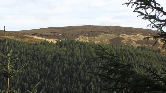
Earnhope Slack is a small glacial valley located in Peeblesshire, Scotland. Situated within the charming village of Corrie, this scenic valley offers breathtaking views and a tranquil atmosphere to visitors. The valley is known for its natural beauty and is a popular destination for nature lovers and outdoor enthusiasts.
Earnhope Slack is characterized by its lush greenery, rolling hills, and meandering streams. The valley is surrounded by towering mountains, creating a picturesque backdrop for hikers and photographers. The area is home to a diverse range of flora and fauna, including various species of wildflowers, birds, and mammals.
The valley is also known for its geological significance. It was formed during the last Ice Age, as glaciers carved out the landscape and left behind a deep, narrow valley. Today, visitors can still observe the remnants of this glacial activity in the form of moraines and U-shaped valleys.
Earnhope Slack offers a range of recreational activities for visitors to enjoy. Hiking trails wind through the valley, allowing visitors to explore its natural wonders and enjoy panoramic views of the surrounding countryside. The area is also popular for birdwatching, with a variety of species known to frequent the valley.
For those seeking a peaceful retreat, Earnhope Slack offers a serene and idyllic setting. The valley is a haven for relaxation and rejuvenation, away from the hustle and bustle of city life. Whether it's taking a leisurely stroll along the streams or simply admiring the beauty of the landscape, Earnhope Slack provides a perfect escape into nature.
If you have any feedback on the listing, please let us know in the comments section below.
Earnhope Slack Images
Images are sourced within 2km of 55.693399/-3.0521801 or Grid Reference NT3344. Thanks to Geograph Open Source API. All images are credited.


Earnhope Slack is located at Grid Ref: NT3344 (Lat: 55.693399, Lng: -3.0521801)
Unitary Authority: The Scottish Borders
Police Authority: The Lothians and Scottish Borders
What 3 Words
///earmarked.wardrobe.spooned. Near Innerleithen, Scottish Borders
Nearby Locations
Related Wikis

Windlestraw Law
Windlestraw Law is a hill in the Moorfoot Hills range, part of the Southern Uplands of Scotland. It is the highest peak of the range, and lies north of...

Dewar, Scottish Borders
Dewar is a village by the Dewar Burn and Peatrig Hill, in the Scottish Borders area of Scotland. Places nearby include Allanshaugh, Borthwick Hall, Fountainhall...

Blackhope Scar
Blackhope Scar is a hill in the Moorfoot Hills range, part of the Southern Uplands of Scotland. It lies to the northeast of the town of Peebles and is...

Peatrig Hill
Peatrig Hill is a minor hill in Scotland, located about 15 km south-southeast of Edinburgh. One of the Moorfoot Hills, it is located in the parish of Heriot...

Moorfoot Hills
The Moorfoot Hills are a range of hills south of Edinburgh in east central Scotland, one of the ranges which collectively form the Southern Uplands....

Bowbeat Hill
Bowbeat Hill is a hill in the Moorfoot Hills range, part of the Southern Uplands of Scotland. It lends its name to Bowbeat Onshore Wind Farm built on the...

Glentress Forest
Glentress Forest is located near Peebles in the Scottish Borders, about 30 miles south of Edinburgh. Part of the Tweed Valley Forest Park along with Traquair...

Nether Horsburgh Castle
Nether Horsburgh Castle is a ruined tower house near Cardrona, in the Scottish Borders, in the former county of Peebleshire. It is situated at the back...
Have you been to Earnhope Slack?
Leave your review of Earnhope Slack below (or comments, questions and feedback).