Corrie of Lick

Corrie (Glacial Valley) in Angus

Scotland

Corrie of Lick

Glenclova Forest and the Burn of Farchal In the distance an area of forest on Cairn Bannoch is being cleared.
Glenclova Forest and the Burn of Farchal Credit: David Purchase

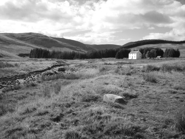
Corrie of Lick, also known as Corrie (Glacial Valley), is a geographical feature located in the Angus region of Scotland. Situated in the eastern part of the country, this glacial valley is nestled within the stunning landscape of the Scottish Highlands.

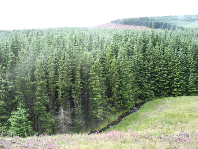
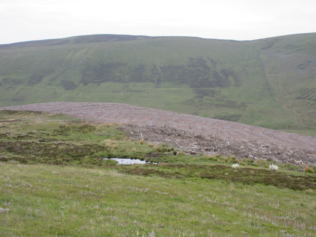
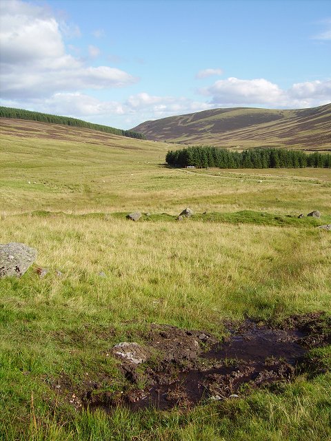
Corrie of Lick was formed during the last Ice Age when glaciers carved out a deep, U-shaped valley through the surrounding mountains. It is characterized by its steep sides and a flat bottom, typical of glacially-carved valleys. The valley is approximately 1 kilometer in length and 400 meters wide, providing a picturesque setting for visitors and nature enthusiasts.

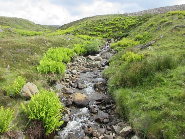
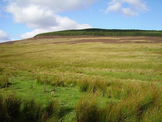
The corrie is surrounded by rolling hills and mountains, adding to its scenic beauty. The slopes around the Corrie of Lick are covered in heather, grasses, and scattered boulders, creating a diverse and vibrant ecosystem. The area is home to a variety of plant and animal species, including mountain hares, red deer, and a range of birdlife.

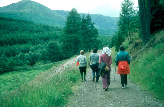
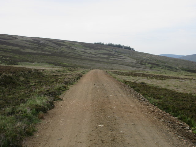
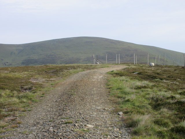
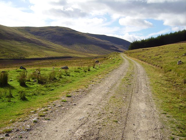
Hiking and walking trails are available for visitors to explore the valley and its surroundings. The Corrie of Lick offers breathtaking panoramic views of the surrounding mountains and the vast expanse of the Scottish Highlands. It is a popular destination for outdoor enthusiasts and photographers looking to capture the natural beauty of the area.

In summary, Corrie of Lick, Angus is a glacial valley in Scotland that offers a stunning landscape, diverse wildlife, and opportunities for outdoor activities. Its geological significance and picturesque surroundings make it a must-visit destination in the Angus region.

If you have any feedback on the listing, please let us know in the comments section below.

Corrie of Lick Images

Images are sourced within 2km of 56.822597/-3.1933942 or Grid Reference NO2770. Thanks to Geograph Open Source API. All images are credited.

Glenclova Forest and the Burn of Farchal In the distance an area of forest on Cairn Bannoch is being cleared.
Glenclova Forest and the Burn of Farchal
In the distance an area of forest on Cairn Bannoch is being cleared.
The road up Glen Prosen
Prosen Water The Prosen Water viewed from the bridge with the mountain of Mayer just visible in the distance.
Prosen Water
The Prosen Water viewed from the bridge with the mountain of Mayer just visible in the distance.
Burn of Louie The Burn of Louie viewed from the track in Glen Prosen.
Burn of Louie
The Burn of Louie viewed from the track in Glen Prosen.
Old Craig Old Craig in the upper reaches of Glen Prosen.
Old Craig
Old Craig in the upper reaches of Glen Prosen.
Cleared woodland above Glen Prosen The cleared forest above Craig Tillelet in Glen Prosen.
Cleared woodland above Glen Prosen
The cleared forest above Craig Tillelet in Glen Prosen.
Bulldozed track above Glen Prosen Bulldozed track above the Corrie of Lick, north of Glen Prosen.
Bulldozed track above Glen Prosen
Bulldozed track above the Corrie of Lick, north of Glen Prosen.
Track on the summit of Lick Track heading northwards over the top of Lick, with Driesh in the background.
Track on the summit of Lick
Track heading northwards over the top of Lick, with Driesh in the background.
Shank of Driesh track The track heading northwards up the Shank of Driesh.
Shank of Driesh track
The track heading northwards up the Shank of Driesh.
Glen Prosen sheep Sheep among the remnants of the cleared forest in the upper reaches of Glen Prosen.
Glen Prosen sheep
Sheep among the remnants of the cleared forest in the upper reaches of Glen Prosen.
Burn of Farchal Deep inside "Glen Clova Forest" a cleared area reveals the burn.  Now foresters never plant to the burn, and always leave a strip. Conifers shade the water and also make the water acidic, with bad consequences for fish stocks.
Burn of Farchal
Deep inside "Glen Clova Forest" a cleared area reveals the burn. Now foresters never plant to the burn, and always leave a strip. Conifers shade the water and also make the water acidic, with bad consequences for fish stocks.
Glen Prosen View down the glen past Old Craig. Deer wallow in the foreground. The glen floor is more grassy, the heather restricted to the slopes.
Glen Prosen
View down the glen past Old Craig. Deer wallow in the foreground. The glen floor is more grassy, the heather restricted to the slopes.
Glen Prosen View up the glen towards Craigie Thieves, along the forestry / estate road that runs up the higher reaches of Glen Prosen.
Glen Prosen
View up the glen towards Craigie Thieves, along the forestry / estate road that runs up the higher reaches of Glen Prosen.
Glen Prosen slopes North side of the glen, above Old Craig.  Sheep grazing country on gentle slopes.
Glen Prosen slopes
North side of the glen, above Old Craig. Sheep grazing country on gentle slopes.
Old Craig Last house in Glen Prosen. Probably a lodge or holiday home. Provisions being unloaded as we passed by.
Old Craig
Last house in Glen Prosen. Probably a lodge or holiday home. Provisions being unloaded as we passed by.
Glen Prosen Just downstream of Old Craig. The old sink in the foreground is used to hold salt licks for livestock.
Glen Prosen
Just downstream of Old Craig. The old sink in the foreground is used to hold salt licks for livestock.
Road up Glen Prosen The road crossing the Prosen Water. The forest block that was once here has been completely felled, and no attempt has been made at replanting. It is now a sheep pasture.
Road up Glen Prosen
The road crossing the Prosen Water. The forest block that was once here has been completely felled, and no attempt has been made at replanting. It is now a sheep pasture.
Prosen Water View upstream with Mayar in the background (peak, right).
Prosen Water
View upstream with Mayar in the background (peak, right).
Show me another place!

Corrie of Lick is located at Grid Ref: NO2770 (Lat: 56.822597, Lng: -3.1933942)

Unitary Authority: Angus

Police Authority: Tayside

What 3 Words

///yachting.prompting.line. Near Kirriemuir, Angus

Related Wikis

Driesh

Driesh (Gaelic: Dris) is a mountain located in the Grampians of Scotland. Apart from Mount Keen (939 m/3,080 ft), it is the most easterly of the Munro...

Mayar (mountain)

Mayar is a mountain in the Grampians, in Angus, Scotland. It is usually climbed together with its near neighbour, Driesh. At an elevation of 928 m, it...

Corrie Fee

Corrie Fee is a glacier-carved corrie situated at the head of Glen Clova in the Angus Glens of Scotland. It forms part of Corrie Fee National Nature Reserve...

Glen Doll

Glen Doll, also sometimes spelt Glendoll, lies within the Cairngorms National Park, Scotland, at the top of Glen Clova, in an area of steep hills, corries...

Nearby Amenities

Located within 500m of 56.822597,-3.1933942
Corrie of Lick
Alt Name: Corlick
Name Gd: Coire Lice
Natural: valley
Place: locality
Lat/Long: 56.8229782/-3.193598
The data included in this document is from www.openstreetmap.org. The data is made available under ODbL.

Have you been to Corrie of Lick?

Leave your review of Corrie of Lick below (or comments, questions and feedback).