Corrie Sharroch

Corrie (Glacial Valley) in Angus

Scotland

Corrie Sharroch

Corrie Fee
Corrie Fee Credit: Steven Brown

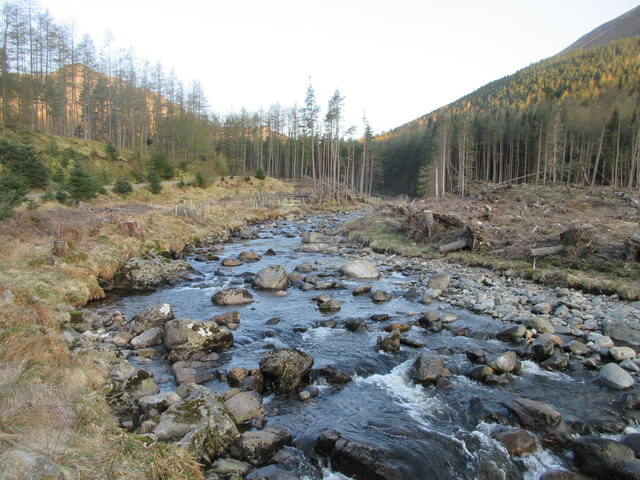
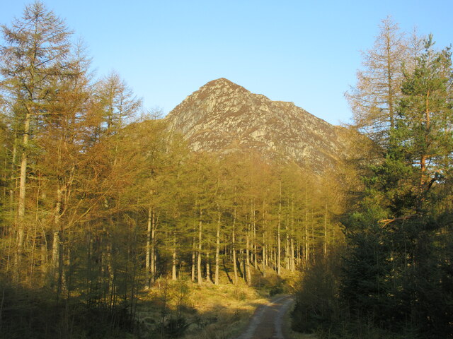
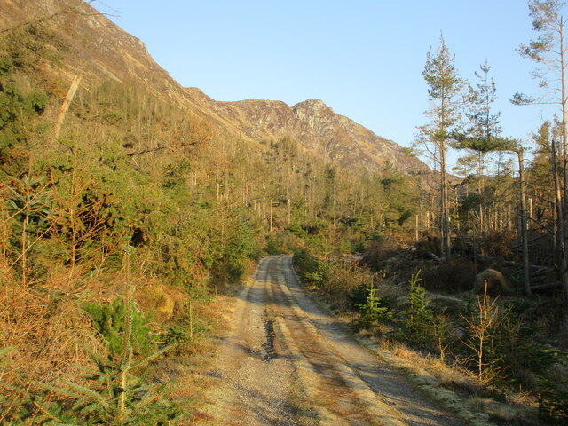
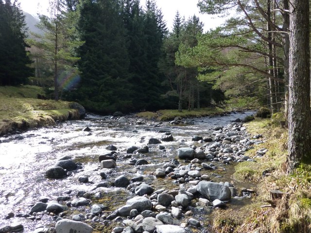
Corrie Sharroch, also known as Corrie (Glacial Valley), is a geographical feature located in the county of Angus, Scotland. A corrie, also called a cirque, is a steep-sided hollow formed by glacial erosion. Corrie Sharroch is situated in the Grampian Mountains, specifically within the Cairngorms National Park, one of the largest national parks in the United Kingdom.

This corrie is characterized by its impressive size and shape. It is a classic example of a glacial valley, with steep and almost vertical walls that enclose a bowl-shaped depression. The corrie was formed during the last Ice Age, when glaciers carved out the landscape, leaving behind this remarkable feature.

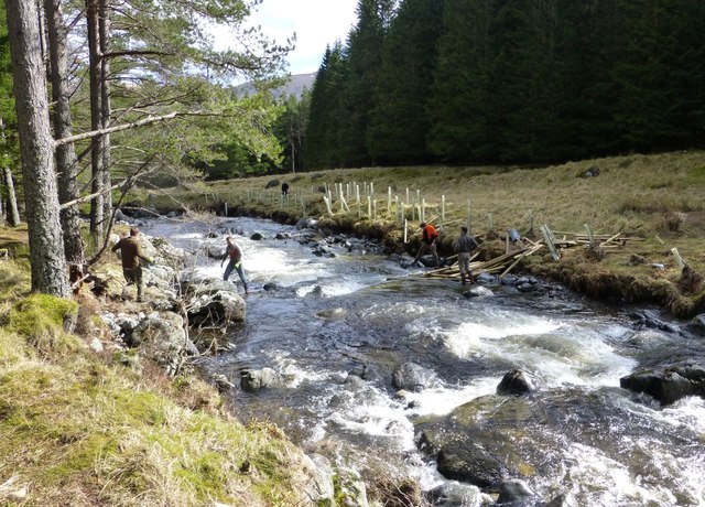
Corrie Sharroch is nestled amidst scenic surroundings, with rugged mountain peaks and lush vegetation adding to its natural beauty. The corrie is often visited by hikers and mountaineers, who are drawn to its dramatic scenery and challenging terrain. Its location within the Cairngorms National Park offers a range of outdoor activities, including hiking, rock climbing, and wildlife observation.

Visitors to Corrie Sharroch can expect breathtaking views of the surrounding mountains and the glacial valley below. The corrie provides a unique opportunity to witness the power of glacial processes and learn about the geological history of the region. With its natural beauty and accessibility, Corrie Sharroch is a popular destination for nature enthusiasts and those seeking an adventure in the Scottish Highlands.

If you have any feedback on the listing, please let us know in the comments section below.

Corrie Sharroch Images

Images are sourced within 2km of 56.855155/-3.222276 or Grid Reference NO2574. Thanks to Geograph Open Source API. All images are credited.

Corrie Fee
Corrie Fee
Waterfall high in Corrie Fee
Cairn atop Mayar
Cairn atop Mayar
Trig and cairn on Driesh
Summit of Mayar Cairn on the summit of the Munro.
Summit of Mayar
Cairn on the summit of the Munro.
Approaching summit of Driesh Flat summit area crowned by a stone shelter and trig pillar.
Approaching summit of Driesh
Flat summit area crowned by a stone shelter and trig pillar.
Corrie Kilbo Seen from the top of the corrie, on the path towards Driesh that crosses the bealach.
Corrie Kilbo
Seen from the top of the corrie, on the path towards Driesh that crosses the bealach.
Going downhill The slope from Little Driesh towards the top of Corrie Kilbo.
Going downhill
The slope from Little Driesh towards the top of Corrie Kilbo.
Decisions on the hillside The path splits. The right hand version cuts across the slope, but the left hand track leads to the rocks that offer a nice spot to sit and rest.
Decisions on the hillside
The path splits. The right hand version cuts across the slope, but the left hand track leads to the rocks that offer a nice spot to sit and rest.
Corrie Kilbo from the bottom The two patches of woodland provide good protection for a large herd of deer.
Corrie Kilbo from the bottom
The two patches of woodland provide good protection for a large herd of deer.
The Summit of Mayar 928m A Munro defined as a mountain in Scotland with a height over 3,000 feet (914.4 m), and which is on the Scottish Mountaineering Club (SMC) official list of Munros; there is no explicit topographical prominence requirement.
The Summit of Mayar 928m
A Munro defined as a mountain in Scotland with a height over 3,000 feet (914.4 m), and which is on the Scottish Mountaineering Club (SMC) official list of Munros; there is no explicit topographical prominence requirement.
Summit of Driesh 947m A Munro defined as a mountain in Scotland with a height over 3,000 feet (914.4 m), and which is on the Scottish Mountaineering Club (SMC) official list of Munros; there is no explicit topographical prominence requirement.
Summit of Driesh 947m
A Munro defined as a mountain in Scotland with a height over 3,000 feet (914.4 m), and which is on the Scottish Mountaineering Club (SMC) official list of Munros; there is no explicit topographical prominence requirement.
Corrie  of Fee panoramic
Corrie of Fee panoramic
White Water The White Water in Glen Doll, looking upstream through the storm damaged forest.
White Water
The White Water in Glen Doll, looking upstream through the storm damaged forest.
Craig Rennet Craig Rennet viewed from the east on the Dounault Road in Glen Doll.
Craig Rennet
Craig Rennet viewed from the east on the Dounault Road in Glen Doll.
Dounalt Road The Dounalt Road in Glen Doll with Craig Maud in the distance, used as an alternative route to the storm damaged forest section of Jock's Road.
Dounalt Road
The Dounalt Road in Glen Doll with Craig Maud in the distance, used as an alternative route to the storm damaged forest section of Jock's Road.
Work party planting trees beside White Water  The first problem is to get the posts and fencing across the river to make an enclosure to keep out the deer before planting any trees.
Work party planting trees beside White Water
The first problem is to get the posts and fencing across the river to make an enclosure to keep out the deer before planting any trees.
White Water in Glen Doll An island in mid stream.
White Water in Glen Doll
An island in mid stream.
Show me another place!

Corrie Sharroch is located at Grid Ref: NO2574 (Lat: 56.855155, Lng: -3.222276)

Unitary Authority: Angus

Police Authority: Tayside

What 3 Words

///songs.took.trump. Near Inverey, Aberdeenshire

Related Wikis

Corrie Fee

Corrie Fee is a glacier-carved corrie situated at the head of Glen Clova in the Angus Glens of Scotland. It forms part of Corrie Fee National Nature Reserve...

Glen Doll

Glen Doll, also sometimes spelt Glendoll, lies within the Cairngorms National Park, Scotland, at the top of Glen Clova, in an area of steep hills, corries...

Mayar (mountain)

Mayar is a mountain in the Grampians, in Angus, Scotland. It is usually climbed together with its near neighbour, Driesh. At an elevation of 928 m, it...

Driesh

Driesh (Gaelic: Dris) is a mountain located in the Grampians of Scotland. Apart from Mount Keen (939 m/3,080 ft), it is the most easterly of the Munro...

Nearby Amenities

Located within 500m of 56.855155,-3.222276
Corrie Sharroch
Natural: valley
Valley: cirque
Lat/Long: 56.8553709/-3.2214245
Shank of Drumfollow
Place: locality
Lat/Long: 56.8534133/-3.2152793
The data included in this document is from www.openstreetmap.org. The data is made available under ODbL.

Have you been to Corrie Sharroch?

Leave your review of Corrie Sharroch below (or comments, questions and feedback).