Corrie of Bellaty

Corrie (Glacial Valley) in Angus

Scotland

Corrie of Bellaty

The house is gone On a gloomy Saturday evening I found out that the colourful wooden shack that has been here until recently is gone, RIP. <a href="https://www.geograph.org.uk/photo/6295939">NO2560 : Western shore of Backwater Reservoir</a>
The house is gone Credit: Aleks Scholz

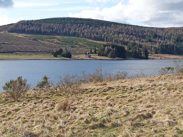
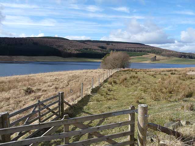
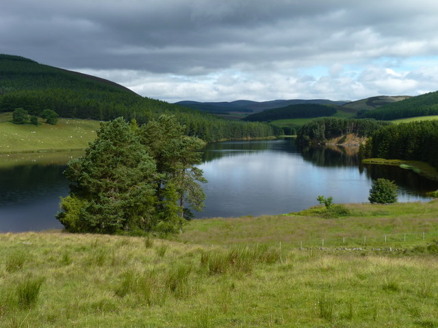
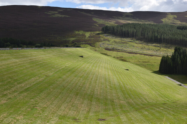
Corrie of Bellaty, also known as Corrie (Glacial Valley), is a spectacular geographical feature located in the region of Angus, Scotland. A corrie, or glacial valley, is a bowl-shaped depression formed by the erosion of a glacier.

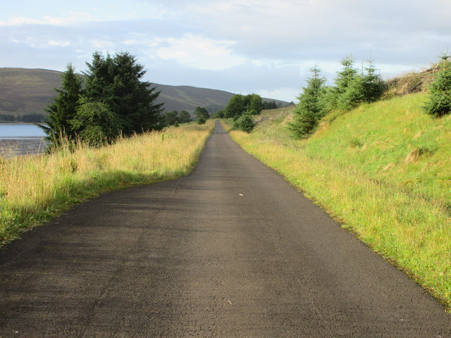
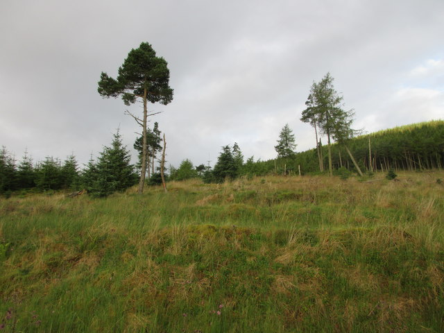
Corrie of Bellaty is situated within the stunning landscape of the Scottish Highlands, surrounded by towering mountains and lush greenery. This glacial valley has been shaped over thousands of years by the movement of ice, which carved out the bowl-like depression and left behind a picturesque scene.

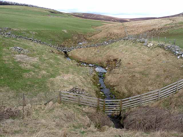
The corrie is characterized by its steep, rugged walls and a flat floor at the bottom. The walls are often covered in scree slopes, formed by loose rocks and debris that have fallen from the surrounding cliffs. The floor of the corrie is often home to a small, tranquil loch, which is typically fed by the melting snow and ice.

Corrie of Bellaty is renowned for its natural beauty and is a popular destination for hikers, mountaineers, and nature enthusiasts. The surrounding mountains offer breathtaking views and challenging climbing opportunities. The corrie provides a unique habitat for a variety of plant and animal species, including rare alpine plants and birds of prey.

Visitors to Corrie of Bellaty can experience the awe-inspiring grandeur of this glacial valley, immerse themselves in the tranquility of the surrounding nature, and witness the powerful forces that shaped this remarkable landscape.

If you have any feedback on the listing, please let us know in the comments section below.

Corrie of Bellaty Images

Images are sourced within 2km of 56.727619/-3.23634 or Grid Reference NO2460. Thanks to Geograph Open Source API. All images are credited.

The house is gone On a gloomy Saturday evening I found out that the colourful wooden shack that has been here until recently is gone, RIP. <a href="https://www.geograph.org.uk/photo/6295939">NO2560 : Western shore of Backwater Reservoir</a>
The house is gone
On a gloomy Saturday evening I found out that the colourful wooden shack that has been here until recently is gone, RIP. NO2560 : Western shore of Backwater Reservoir
Last gate before the bend For several kilometres, the western shore of Backwater Reservoir is pretty much straight. Here the reservoir makes a turn to the east. A sheep field sits on the peninsula. The path meanders through the field and then disappears into the woods. This is the last gate before the turn.
Last gate before the bend
For several kilometres, the western shore of Backwater Reservoir is pretty much straight. Here the reservoir makes a turn to the east. A sheep field sits on the peninsula. The path meanders through the field and then disappears into the woods. This is the last gate before the turn.
Looking south down the Blackwater reservoir
Clump of Scots Pines near East Mill Farm
Sheep and mole hills, near Cammock Lodge
Looking across the Backwater Reservoir The Backwater Reservoir supplies Dundee, and was opened by the Queen in 1969.
Looking across the Backwater Reservoir
The Backwater Reservoir supplies Dundee, and was opened by the Queen in 1969.
Side valley above the Backwater Reservoir
Backwater Reservoir The Backwater Reservoir supplies Dundee, and was opened by the Queen in 1969.
Backwater Reservoir
The Backwater Reservoir supplies Dundee, and was opened by the Queen in 1969.
Top carpark and picnic area, Backwater Reservoir The Backwater Reservoir supplies Dundee, and was opened by the Queen in 1969. Redundant metal noticeboards have been bolted to the table tops as a base for portable barbecues.
Top carpark and picnic area, Backwater Reservoir
The Backwater Reservoir supplies Dundee, and was opened by the Queen in 1969. Redundant metal noticeboards have been bolted to the table tops as a base for portable barbecues.
North end of the reservoir Although it didn't exist until the late 1960s, the Backwater reservoir has blended well into the countryside around it.
North end of the reservoir
Although it didn't exist until the late 1960s, the Backwater reservoir has blended well into the countryside around it.
North end of Backwater Reservoir
Blackwater dam tower
Blackwater Dam
Blackwater Dam
Northern end of Backwater Reservoir Backwater Reservoir supplies the City of Dundee with its fresh water needs.  The reservoir was created in the 1960’s and was inaugurated in 1969.
Northern end of Backwater Reservoir
Backwater Reservoir supplies the City of Dundee with its fresh water needs. The reservoir was created in the 1960’s and was inaugurated in 1969.
Backwater Reservoir Backwater Reservoir supplies the City of Dundee with its fresh water needs.  The reservoir was created in the 1960’s and was inaugurated in 1969.
Backwater Reservoir
Backwater Reservoir supplies the City of Dundee with its fresh water needs. The reservoir was created in the 1960’s and was inaugurated in 1969.
Backwater Reservoir, western road A long straight on the road running up the west side of the Backwater Reservoir.
Backwater Reservoir, western road
A long straight on the road running up the west side of the Backwater Reservoir.
Partially cleared forest Remaining pines on the hillside west of the Backwater Reservoir.
Partially cleared forest
Remaining pines on the hillside west of the Backwater Reservoir.
Bend in the road Curve in the road at the north-western end of the Backwater Reservoir.
Bend in the road
Curve in the road at the north-western end of the Backwater Reservoir.
Show me another place!

Corrie of Bellaty is located at Grid Ref: NO2460 (Lat: 56.727619, Lng: -3.23634)

Unitary Authority: Angus

Police Authority: Tayside

What 3 Words

///loitering.squares.identify. Near Alyth, Perth & Kinross

Related Wikis

Knockshannoch Lodge

Knockshannoch Lodge is a Category B listed building in the Scottish village of Glenisla, Angus, built around 1888. It is a small, single-storey cottage...

Backwater Reservoir

Backwater Reservoir is a reservoir in north west Angus, Scotland. The reservoir's sole purpose is to provide drinking water, and as such, it supplies Angus...

Kirkton of Glenisla

Kirkton of Glenisla consists of a church and graveyard, a hotel, hall and several homes forming the largest concentration of habitation in Glenisla, Angus...

Balintore, Angus

Balintore (Scottish Gaelic: Baile an Todhair) is a village in Angus, Scotland. It lies in Glen Isla, four miles north of the Loch of Lintrathen and seven...

Balintore Castle

Balintore Castle is a Victorian Category A listed building in Scotland. The castle occupies an elevated site in moorland above Balintore village, a few...

Auchinleish

Auchinleish is a village in Angus, Scotland. == References ==

Brewlands Bridge

Brewlands Bridge is a hamlet in Glen Isla, Angus, Scotland. It is lies situated on the River Isla, eleven miles north-west of Kirriemuir and ten miles...

Kilry Glen

Kilry Glen, in Angus, Scotland, is the glen of the Burn of Kilry, a tributary of the River Isla. It is situated west of the B954 road, approximately four...

Have you been to Corrie of Bellaty?

Leave your review of Corrie of Bellaty below (or comments, questions and feedback).