Coire an Luichan Shalaich

Corrie (Glacial Valley) in Banffshire

Scotland

Coire an Luichan Shalaich

Glen Builg The choice of one locality as the subject her is rather artitrary. Loch Builg is on the left, and the Builg Burn flows down from it to join the River Avon at Inchrory, at the bottom of this view. Above and to the right of Inchrory is the long ridge of Ben A'an, with its several summits.
Glen Builg Credit: Anne Burgess

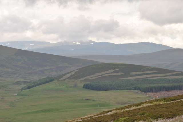
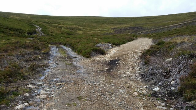
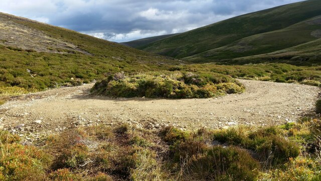
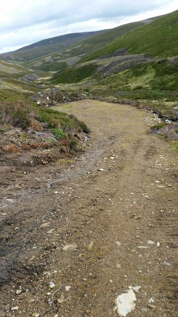
Coire an Luichan Shalaich, also known as Corrie, is a glacial valley located in Banffshire, Scotland. Nestled within the picturesque Cairngorms National Park, it is renowned for its stunning natural beauty and rich geological history.

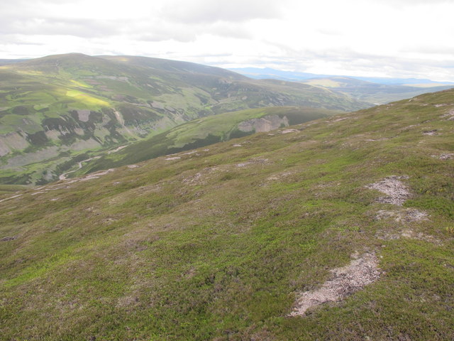
The valley is characterized by its steep sides and a U-shaped profile, which was formed by the movement of glaciers during the last Ice Age. As the glaciers advanced and retreated, they carved out the landscape, leaving behind a deep hollow with a flat floor. This unique feature is a testament to the powerful forces of nature that shaped the area.

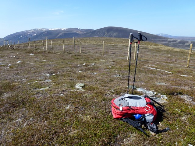
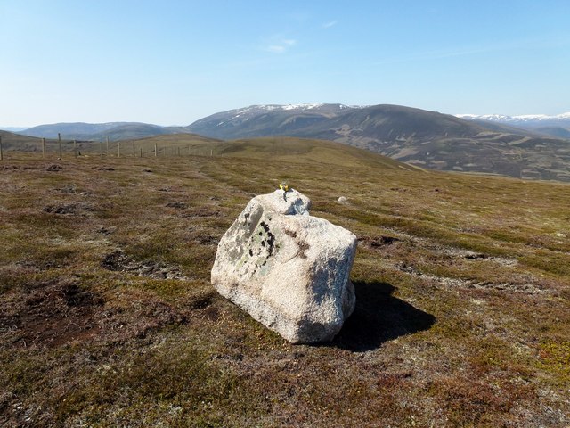
Coire an Luichan Shalaich is surrounded by towering mountains, including several Munros - peaks over 3,000 feet high. These mountains, such as Ben Macdui and Cairn Gorm, provide a breathtaking backdrop to the valley and make it a popular destination for hikers and mountaineers.

The valley is also home to a diverse range of flora and fauna, thanks to its varied habitats. Grasslands, heather moors, and woodlands can all be found here, providing a haven for numerous species of plants and animals. Visitors may spot red deer, golden eagles, ptarmigans, and other wildlife during their explorations.

For those seeking adventure, Coire an Luichan Shalaich offers numerous outdoor activities. Hiking, mountain biking, and skiing are all popular pursuits, allowing visitors to fully immerse themselves in the natural wonders of the area.

Overall, Coire an Luichan Shalaich is a captivating glacial valley that showcases the beauty and power of nature. Whether you are an outdoor enthusiast or simply looking for a tranquil escape, this Banffshire gem is sure to leave a lasting impression.

If you have any feedback on the listing, please let us know in the comments section below.

Coire an Luichan Shalaich Images

Images are sourced within 2km of 57.133401/-3.3342159 or Grid Reference NJ1905. Thanks to Geograph Open Source API. All images are credited.

Glen Builg The choice of one locality as the subject her is rather artitrary. Loch Builg is on the left, and the Builg Burn flows down from it to join the River Avon at Inchrory, at the bottom of this view. Above and to the right of Inchrory is the long ridge of Ben A'an, with its several summits.
Glen Builg
The choice of one locality as the subject her is rather artitrary. Loch Builg is on the left, and the Builg Burn flows down from it to join the River Avon at Inchrory, at the bottom of this view. Above and to the right of Inchrory is the long ridge of Ben A'an, with its several summits.
Foothills of Cairngorm mountains, from the east From the viewpoint near Cock Bridge on A939, Tomintoul to Ballater road looking towards Cairngorm mountains.
Foothills of Cairngorm mountains, from the east
From the viewpoint near Cock Bridge on A939, Tomintoul to Ballater road looking towards Cairngorm mountains.
Little Geal Charn Top, from Corgarff Castle car park in an anticlockwise circuit, in very warm conditions. Electric fence can give a nasty shock and no easy way of getting over it here unlike the 2 earlier possible tops.  True top is over the fence but did not take my camera there.
Name: Brown Cow Hill - Little Geal Charn
Hill number: 6171
Height: 710m / 2329ft
Area: 08B: Cairngorms
Class: sGT
Grid ref: NJ192059 (est)
Drop: 22m
Col: 688m  NJ194058
Little Geal Charn
Top, from Corgarff Castle car park in an anticlockwise circuit, in very warm conditions. Electric fence can give a nasty shock and no easy way of getting over it here unlike the 2 earlier possible tops. True top is over the fence but did not take my camera there. Name: Brown Cow Hill - Little Geal Charn Hill number: 6171 Height: 710m / 2329ft Area: 08B: Cairngorms Class: sGT Grid ref: NJ192059 (est) Drop: 22m Col: 688m NJ194058
Cairn Culchavie First top of circuit, from Corgarff Castle car park in an anticlockwise circuit, in very warm conditions.  Top is a boulder on the west side of the electric fence.
Name: Brown Cow Hill - Cairn Culchavie
Hill number: 4165
Height: 726m / 2382ft
Area: 08B: Cairngorms
Class: GTC
Grid ref: NJ200070 (est)
Drop: 41m
Col: 685m  NJ194058
Cairn Culchavie
First top of circuit, from Corgarff Castle car park in an anticlockwise circuit, in very warm conditions. Top is a boulder on the west side of the electric fence. Name: Brown Cow Hill - Cairn Culchavie Hill number: 4165 Height: 726m / 2382ft Area: 08B: Cairngorms Class: GTC Grid ref: NJ200070 (est) Drop: 41m Col: 685m NJ194058
Glen Builg above Inchrory
Atop Carn Ulie west of Brown Cow Hill, Grampian
New fence on Carn Ulie west of Brown Cow Hill, Grampian
Old boundary fence slightly west of new deer fence on Carn Ulie near Brown Cow Hill, Grampian
Pools on Carn Ulie near Brown Cow Hill, Grampian
Looking across the course of Allt Ulie west of Brown Cow Hill, Grampian
Paraphernalia of old metal boundary fence west of Brown Cow Hill, Grampian
Small boggy plateau on Carn Ulie west of Brown Cow Hill, Grampian
Meall an t-Seangain Seen from the northern slopes of Meall Gaineimh.
Meall an t-Seangain
Seen from the northern slopes of Meall Gaineimh.
Unexpected junction Climbing up the glen this junction in the track, which isn't marked on the OS 1:25k map appears. In reality the right hand fork is just the entrance to a turning circle / parking area.
Unexpected junction
Climbing up the glen this junction in the track, which isn't marked on the OS 1:25k map appears. In reality the right hand fork is just the entrance to a turning circle / parking area.
Turning circle This turning circle isn't marked on the OS 1:25k map.
Turning circle
This turning circle isn't marked on the OS 1:25k map.
Parking area Another bulldozed area for the Royals & guests to park during shoots. Not marked on OS 1:25k map.
Parking area
Another bulldozed area for the Royals & guests to park during shoots. Not marked on OS 1:25k map.
Show me another place!

Coire an Luichan Shalaich is located at Grid Ref: NJ1905 (Lat: 57.133401, Lng: -3.3342159)

Unitary Authority: Moray

Police Authority: North East

What 3 Words

///parkland.onto.hugs. Near Inverey, Aberdeenshire

Related Wikis

Delnadamph Lodge

Delnadamph Lodge was located on the Balmoral Estate about 8 miles (13 km) north of the castle. The lodge and its estate lands were bought by Queen Elizabeth...

Culardoch

Culardoch (900 m) is a mountain in the Cairngorms of Scotland, located northeast of Braemar in Aberdeenshire. A smooth and heathery peak southeast of the...

Corgarff Castle

Corgarff Castle is located slightly west of the village of Corgarff, in Aberdeenshire, north-east Scotland. It stands by the Lecht road, which crosses...

Ben Avon

Ben Avon (Scottish Gaelic: Beinn Athfhinn, 'mountain of the Avon') is a mountain in the Cairngorms of Scotland. It is a sprawling mountain with a broad...

Cock Bridge (Aberdeenshire)

Cock Bridge is a settlement in Aberdeenshire, Scotland, located in the Cairngorms National Park, on the A939 road near Corgarff and Corgarff Castle, between...
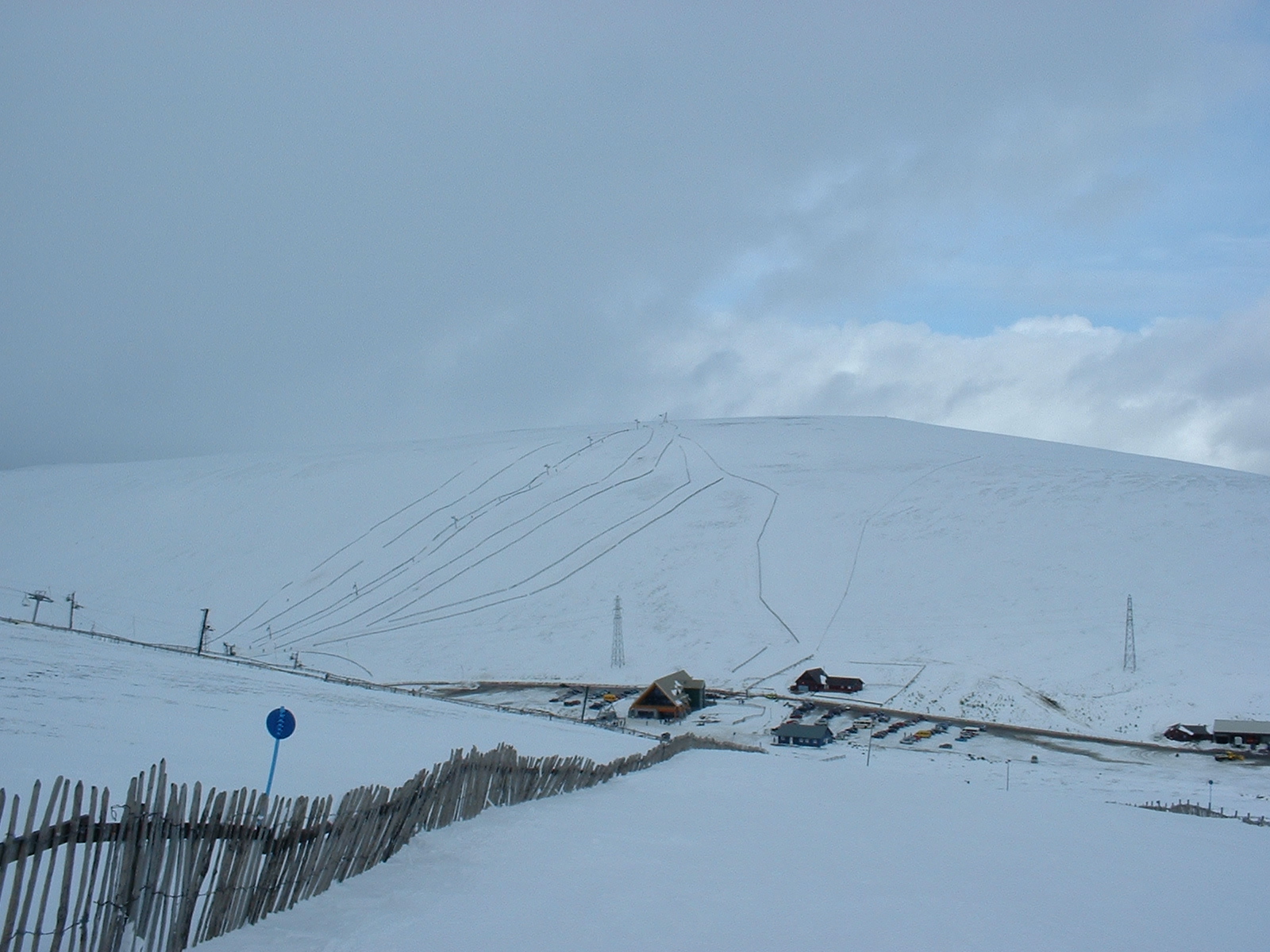
Lecht Ski Centre

The Lecht Ski Centre is an alpine ski area in the Cairngorms in the Scottish Highlands. The ski slopes are set around the mountains Beinn a' Chruinnich...

Corgarff

Corgarff (Scottish Gaelic: Corr Garaidh) is a hamlet in Aberdeenshire, Scotland, in the Grampian Mountains. The nearby Corgarff Castle was used as a military...

Nearby Amenities

Located within 500m of 57.133401,-3.3342159
Little Geal Chàrn
Ele: 708
Natural: peak
Lat/Long: 57.1374009/-3.3350458
The data included in this document is from www.openstreetmap.org. The data is made available under ODbL.

Have you been to Coire an Luichan Shalaich?

Leave your review of Coire an Luichan Shalaich below (or comments, questions and feedback).