Coire an Eas

Corrie (Glacial Valley) in Banffshire

Scotland

Coire an Eas

Heather and birch above River Avon at Inchrory
Heather and birch above River Avon at Inchrory Credit: Alan Reid

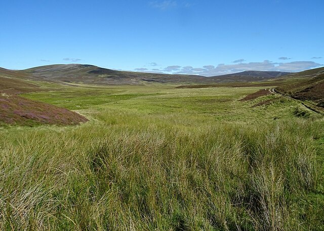
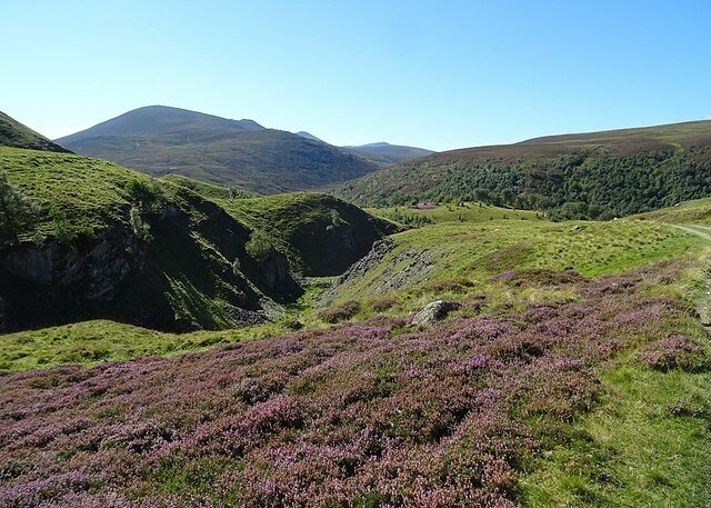
Coire an Eas, also known as Corrie, is a picturesque glacial valley located in Banffshire, Scotland. Nestled within the stunning Cairngorms National Park, it is surrounded by towering mountain peaks and offers breathtaking views of the surrounding landscape.

The name Coire an Eas translates to "valley of the waterfall," and it is aptly named due to the presence of a beautiful waterfall that cascades down the rugged cliffs. The crystal-clear water flows into a small river that meanders through the valley, adding to its natural charm.

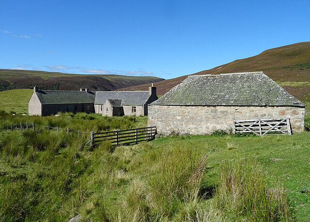
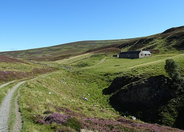
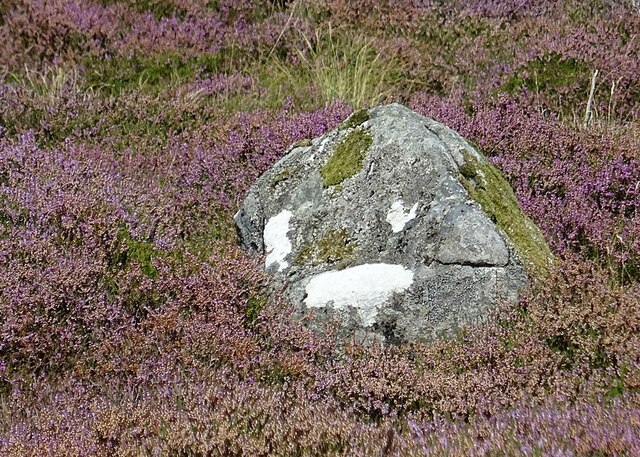
The valley itself was formed during the last Ice Age, as massive glaciers carved out its distinctive U-shaped profile. Today, it serves as a popular destination for outdoor enthusiasts and nature lovers alike. Hiking and walking trails traverse the valley, providing visitors with the opportunity to explore its scenic beauty and observe the diverse flora and fauna that thrive in this unique environment.

Coire an Eas is also home to a variety of wildlife, including red deer, mountain hares, and golden eagles. Birdwatchers will delight in the chance to spot rare species such as ptarmigans and snow buntings that inhabit the higher elevations.

The valley's accessibility and natural beauty make it a favored location for photography, painting, and other artistic pursuits. Many visitors are drawn to capture the dramatic landscapes and ever-changing light conditions that enhance the valley's allure.

Whether one seeks adventure, tranquility, or simply a closer connection with nature, Coire an Eas is a destination that offers an enriching and unforgettable experience in the heart of the Scottish Highlands.

If you have any feedback on the listing, please let us know in the comments section below.

Coire an Eas Images

Images are sourced within 2km of 57.15397/-3.3679859 or Grid Reference NJ1707. Thanks to Geograph Open Source API. All images are credited.

Heather and birch above River Avon at Inchrory
On Drum Loin Looking towards Meall Gaineimh, the northeast top of Ben Avon.
On Drum Loin
Looking towards Meall Gaineimh, the northeast top of Ben Avon.
River Avon below Foal's Craig
On a heathery ridge above Glen Loin Ben Avon forms the background.
On a heathery ridge above Glen Loin
Ben Avon forms the background.
Linn of Avon
Linn of Avon
Inchrory in Glen Avon
Glen Builg The choice of one locality as the subject her is rather artitrary. Loch Builg is on the left, and the Builg Burn flows down from it to join the River Avon at Inchrory, at the bottom of this view. Above and to the right of Inchrory is the long ridge of Ben A'an, with its several summits.
Glen Builg
The choice of one locality as the subject her is rather artitrary. Loch Builg is on the left, and the Builg Burn flows down from it to join the River Avon at Inchrory, at the bottom of this view. Above and to the right of Inchrory is the long ridge of Ben A'an, with its several summits.
Glen Builg and Strath Avon The snow in the foreground is on the eastern end of Ben Avon. To the right is Glen Builg, which joins the River Avon almost in the centre of the view, and then steep-sided Strath Avon continues towards the left. The Ladder Hills are at upper right and Ben Rinnes is just visible left of centre on the horizon.
Glen Builg and Strath Avon
The snow in the foreground is on the eastern end of Ben Avon. To the right is Glen Builg, which joins the River Avon almost in the centre of the view, and then steep-sided Strath Avon continues towards the left. The Ladder Hills are at upper right and Ben Rinnes is just visible left of centre on the horizon.
Glen Avon and Fèith Bhàit The River Avon marks Glen Avon at lower left. It is joined by the River Builg, from lower right, at Inchrory, and continues down Strath Avon to the left. Above Inchrory is a flat boggy area drained by Fèith Bhàit, a headwater of the River Don. The distant snow-capped hills are the Ladder Hills.
Glen Avon and Fèith Bhàit
The River Avon marks Glen Avon at lower left. It is joined by the River Builg, from lower right, at Inchrory, and continues down Strath Avon to the left. Above Inchrory is a flat boggy area drained by Fèith Bhàit, a headwater of the River Don. The distant snow-capped hills are the Ladder Hills.
Inchrory Inchrory has escaped the fate of many a Highand shooting lodge, being still in good condition and in use. From up here the tennis court and walled garden can be seen.
Inchrory
Inchrory has escaped the fate of many a Highand shooting lodge, being still in good condition and in use. From up here the tennis court and walled garden can be seen.
Inchrory and Fèith Bhàit Inchrory is at the bottom of this view, and above it the road that links it to Corgarff via Delnadamph can be seen winding round the flank of Cairn Culchavie. Below the road is the pale boggy expanse from which the Fèith Bhàit, a headwater of the River Don, emerges. The snow-capped mountain at upper right is Morven.
Inchrory and Fèith Bhàit
Inchrory is at the bottom of this view, and above it the road that links it to Corgarff via Delnadamph can be seen winding round the flank of Cairn Culchavie. Below the road is the pale boggy expanse from which the Fèith Bhàit, a headwater of the River Don, emerges. The snow-capped mountain at upper right is Morven.
Fèith Bhàit Fèith means a bog or morass, and this certainly looks like very wet ground. The drove road hugs the slope of the hill for good reason. The bog is the source of the River Don.
Fèith Bhàit
Fèith means a bog or morass, and this certainly looks like very wet ground. The drove road hugs the slope of the hill for good reason. The bog is the source of the River Don.
Lagganauld The deserted house and outbuildings stands on a magnificent but remote site above Inchrory.
Lagganauld
The deserted house and outbuildings stands on a magnificent but remote site above Inchrory.
Lagganauld This is the track down from the abandoned buildings at Lagganauld to Inchrory.
Lagganauld
This is the track down from the abandoned buildings at Lagganauld to Inchrory.
Gonk Stone? We thought that the patches of white lichen made this stone look like the gonk toys that were all the rage in the 1970s.
Gonk Stone?
We thought that the patches of white lichen made this stone look like the gonk toys that were all the rage in the 1970s.
Gully at Lagganauld The burn has carved a deep gully through the Inchrory Limestone below Lagganauld. The view is dominated by Ben Avon.
Gully at Lagganauld
The burn has carved a deep gully through the Inchrory Limestone below Lagganauld. The view is dominated by Ben Avon.
Inchrory Limestone The old maps show at least one lime kiln beside the track between Inchrory and Lagganauld, suggesting that this is part of former limestone quarrying.
Inchrory Limestone
The old maps show at least one lime kiln beside the track between Inchrory and Lagganauld, suggesting that this is part of former limestone quarrying.
Dandelion Pappus (Taraxacum) This is the seed head of one of the 250 or so species of Dandelion found in Britain and Ireland.
Dandelion Pappus (Taraxacum)
This is the seed head of one of the 250 or so species of Dandelion found in Britain and Ireland.
Show me another place!

Coire an Eas is located at Grid Ref: NJ1707 (Lat: 57.15397, Lng: -3.3679859)

Unitary Authority: Moray

Police Authority: North East

What 3 Words

///pity.gloves.scooters. Near Inverey, Aberdeenshire

Related Wikis

Delnadamph Lodge

Delnadamph Lodge was located on the Balmoral Estate about 8 miles (13 km) north of the castle. The lodge and its estate lands were bought by Queen Elizabeth...

Ben Avon

Ben Avon (Scottish Gaelic: Beinn Athfhinn, 'mountain of the Avon') is a mountain in the Cairngorms of Scotland. It is a sprawling mountain with a broad...

Corgarff Castle

Corgarff Castle is located slightly west of the village of Corgarff, in Aberdeenshire, north-east Scotland. It stands by the Lecht road, which crosses...
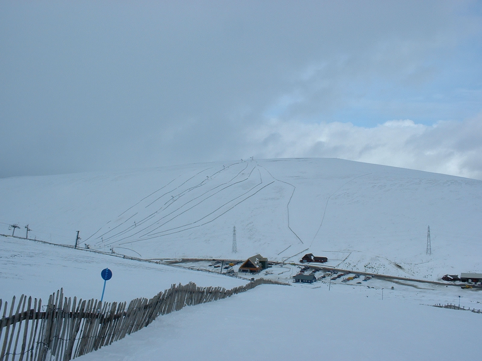
Lecht Ski Centre

The Lecht Ski Centre is an alpine ski area in the Cairngorms in the Scottish Highlands. The ski slopes are set around the mountains Beinn a' Chruinnich...

Cock Bridge (Aberdeenshire)

Cock Bridge is a settlement in Aberdeenshire, Scotland, located in the Cairngorms National Park, on the A939 road near Corgarff and Corgarff Castle, between...

Culardoch

Culardoch (900 m) is a mountain in the Cairngorms of Scotland, located northeast of Braemar in Aberdeenshire. A smooth and heathery peak southeast of the...

Nearby Amenities

Located within 500m of 57.15397,-3.3679859
The data included in this document is from www.openstreetmap.org. The data is made available under ODbL.

Have you been to Coire an Eas?

Leave your review of Coire an Eas below (or comments, questions and feedback).