Coire nan Sac

Corrie (Glacial Valley) in Banffshire

Scotland

Coire nan Sac

Coire nan Sac A small corrie draining into the River Avon near Dail nan Sac.
Coire nan Sac Credit: Anne Burgess

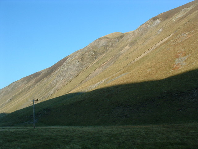
Coire nan Sac, also known as Corrie, is a picturesque glacial valley located in Banffshire, Scotland. Nestled within the Grampian Mountains, this stunning landscape is a popular destination for outdoor enthusiasts and nature lovers.

The valley is characterized by its steep-sided walls, formed by the erosive action of glaciers during the last Ice Age. It is situated at an elevation of approximately 500 meters above sea level and covers an area of around 2 square kilometers. The valley floor is covered in lush vegetation, including heather and grasses, while the surrounding slopes are adorned with a variety of native trees such as birch and rowan.

Coire nan Sac is renowned for its diverse wildlife. Visitors can expect to encounter a wide range of species, including red deer, mountain hares, and various bird species like golden eagles and ptarmigans. The valley is also home to several small lochs and streams, which add to the scenic beauty of the area.

The glacial valley offers a multitude of recreational activities for visitors. Hiking and walking trails crisscross the landscape, providing opportunities to explore the natural beauty of the region. The valley's challenging terrain also attracts climbers and mountaineers looking for an adrenaline rush.

Coire nan Sac is a place of immense natural beauty, offering awe-inspiring vistas and a chance to immerse oneself in the tranquility of the Scottish Highlands. Its unique geological features and abundant wildlife make it a must-visit destination for anyone seeking an authentic outdoor experience in Banffshire.

If you have any feedback on the listing, please let us know in the comments section below.

Coire nan Sac Images

Images are sourced within 2km of 57.176213/-3.3812468 or Grid Reference NJ1610. Thanks to Geograph Open Source API. All images are credited.

Coire nan Sac A small corrie draining into the River Avon near Dail nan Sac.
Coire nan Sac
A small corrie draining into the River Avon near Dail nan Sac.
River Avon Looking upriver, with the steep slope of The Neilead on the left.
River Avon
Looking upriver, with the steep slope of The Neilead on the left.
Allt Nathrach Allt Nathrach joins the River Avon here.
Allt Nathrach
Allt Nathrach joins the River Avon here.
Rocky Outcrop I wonder if this might be a fault plane in the Glenfiddich Pelite Formation.
Rocky Outcrop
I wonder if this might be a fault plane in the Glenfiddich Pelite Formation.
Sròn a' Bhothain Mhòir Sròn a' Bhothain Mhòir is the point on the left bank where the River Avon turns northwards again.
Sròn a' Bhothain Mhòir
Sròn a' Bhothain Mhòir is the point on the left bank where the River Avon turns northwards again.
Burn of Little Fergie The burn and its tributaries have cut a narrow glen though the glacial deposits beside Strath Avon.
Burn of Little Fergie
The burn and its tributaries have cut a narrow glen though the glacial deposits beside Strath Avon.
On Drum Loin Looking towards Meall Gaineimh, the northeast top of Ben Avon.
On Drum Loin
Looking towards Meall Gaineimh, the northeast top of Ben Avon.
River Avon below Foal's Craig
On a heathery ridge above Glen Loin Ben Avon forms the background.
On a heathery ridge above Glen Loin
Ben Avon forms the background.
River Avon The nearer channel is actually from a spring a little further up the strath, which joins the main river here.
River Avon
The nearer channel is actually from a spring a little further up the strath, which joins the main river here.
Strath Avon One left, below the road, is the burn that emerges from a spring at the foot of The Neilead, which is the slope on the left. On the right is the main channel of the River Avon.
Strath Avon
One left, below the road, is the burn that emerges from a spring at the foot of The Neilead, which is the slope on the left. On the right is the main channel of the River Avon.
Glen Avon looking south with Inchrory in the distance. Taken from Geal Charn
Estate Track in Glen Avon It's a long, long walk through Glen Avon!
Estate Track in Glen Avon
It's a long, long walk through Glen Avon!
Estate Track in Glen Avon
Glen Avon After a long two days walking from Linn of Dee over all the Eastern Cairngorm high tops, it's time to stop for the night.
Glen Avon
After a long two days walking from Linn of Dee over all the Eastern Cairngorm high tops, it's time to stop for the night.
Early Morning Mist in Glen Avon
The road to Inchrory. A wealth of physical geographical features can be seen from this point on the road, just beyond where it changes from tarmac to hardcore surface. There is a river terrace, a moraine, river braiding, all in a glaciated valley.
The road to Inchrory.
A wealth of physical geographical features can be seen from this point on the road, just beyond where it changes from tarmac to hardcore surface. There is a river terrace, a moraine, river braiding, all in a glaciated valley.
Foal's Crag. At many places on the valley side, steep rock outcrops appear. Some give rise to scree slopes.
Foal's Crag.
At many places on the valley side, steep rock outcrops appear. Some give rise to scree slopes.
Show me another place!

Coire nan Sac is located at Grid Ref: NJ1610 (Lat: 57.176213, Lng: -3.3812468)

Unitary Authority: Moray

Police Authority: North East

What 3 Words

///wager.broadens.garages. Near Grantown-on-Spey, Highland

Nearby Locations

Coire nan Sac Dail nan Sac

Related Wikis

Delnadamph Lodge

Delnadamph Lodge was located on the Balmoral Estate about 8 miles (13 km) north of the castle. The lodge and its estate lands were bought by Queen Elizabeth...

Tomintoul

Tomintoul ( ; from Scottish Gaelic: Tom an t-Sabhail, meaning "Hillock of the Barn") is a village in the Moray council area of Scotland in the historic...

Corgarff Castle

Corgarff Castle is located slightly west of the village of Corgarff, in Aberdeenshire, north-east Scotland. It stands by the Lecht road, which crosses...
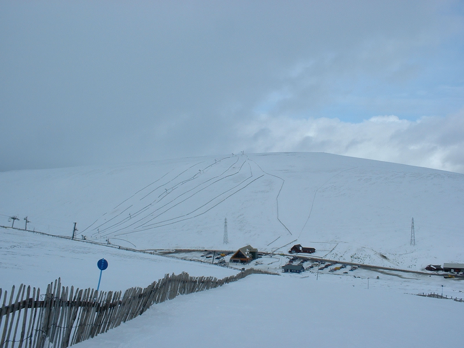
Lecht Ski Centre

The Lecht Ski Centre is an alpine ski area in the Cairngorms in the Scottish Highlands. The ski slopes are set around the mountains Beinn a' Chruinnich...

Cock Bridge (Aberdeenshire)

Cock Bridge is a settlement in Aberdeenshire, Scotland, located in the Cairngorms National Park, on the A939 road near Corgarff and Corgarff Castle, between...

Ben Avon

Ben Avon (Scottish Gaelic: Beinn Athfhinn, 'mountain of the Avon') is a mountain in the Cairngorms of Scotland. It is a sprawling mountain with a broad...

West Aberdeenshire and Kincardine (UK Parliament constituency)

West Aberdeenshire and Kincardine is a county constituency of the House of Commons of the Parliament of the United Kingdom of Great Britain and Northern...

Nearby Amenities

Located within 500m of 57.176213,-3.3812468
Uaimh Abhainn
Place: locality
Lat/Long: 57.1722886/-3.3840314
Dail nan Sac
Place: locality
Lat/Long: 57.1763876/-3.3879501
The data included in this document is from www.openstreetmap.org. The data is made available under ODbL.

Have you been to Coire nan Sac?

Leave your review of Coire nan Sac below (or comments, questions and feedback).