Coire Riabhach

Corrie (Glacial Valley) in Banffshire

Scotland

Coire Riabhach

Burn of Loin From Cnap Chaochan Aitinn. The tributary is Caochan Garvoun.
Burn of Loin Credit: Alan Reid

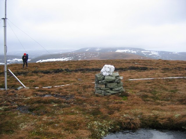
Coire Riabhach, located in Banffshire, Scotland, is a captivating example of a corrie, also known as a glacial valley. With its stunning natural beauty and unique geological features, it attracts many visitors and outdoor enthusiasts.

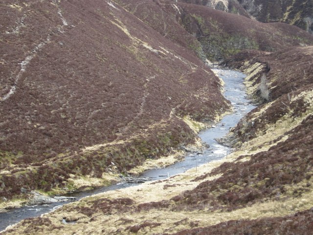
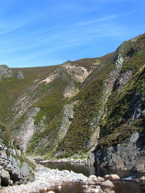
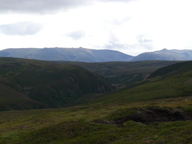
Situated within the Cairngorms National Park, Coire Riabhach is surrounded by towering mountains and steep slopes. The valley was formed during the last Ice Age, when a glacier carved its way through the landscape, leaving behind a deep, U-shaped hollow. The glacial activity also deposited large amounts of rock debris, creating moraines and forming a distinctive landscape.

The valley is renowned for its picturesque scenery, with its rugged cliffs, cascading waterfalls, and lush vegetation. The floor of Coire Riabhach is dotted with small lochs, formed by meltwater from the retreating glacier. These lochs provide habitat for various species of aquatic plants and animals.

The area is a haven for wildlife, with several species making their home in and around the valley. Visitors may spot red deer, mountain hares, and ptarmigans, among other creatures. Birdwatchers will be delighted by the presence of golden eagles and peregrine falcons soaring above the cliffs.

Coire Riabhach offers numerous opportunities for outdoor activities. Hiking and mountaineering are popular pursuits, with trails of varying difficulty leading to stunning viewpoints and peaks. Rock climbers are drawn to the challenging cliffs that surround the valley. During the winter months, the area transforms into a winter wonderland, attracting skiers and snowboarders.

In conclusion, Coire Riabhach in Banffshire is a remarkable corrie that showcases the power of glacial activity and the beauty of the Scottish Highlands. Whether it's exploring the dramatic landscape, observing the diverse wildlife, or engaging in outdoor adventures, visitors to Coire Riabhach are sure to be captivated by its natural charm.

If you have any feedback on the listing, please let us know in the comments section below.

Coire Riabhach Images

Images are sourced within 2km of 57.176256/-3.4373731 or Grid Reference NJ1310. Thanks to Geograph Open Source API. All images are credited.

Burn of Loin From Cnap Chaochan Aitinn. The tributary is Caochan Garvoun.
Burn of Loin
From Cnap Chaochan Aitinn. The tributary is Caochan Garvoun.
Summit of Cnap Chaochan Aitin. A 715m high hill in the eastern Monadh Ruadh was a tough proposition on a very windy day. The estate maintains a radio relay up here; it's quite a cluttered summit.
Summit of Cnap Chaochan Aitin.
A 715m high hill in the eastern Monadh Ruadh was a tough proposition on a very windy day. The estate maintains a radio relay up here; it's quite a cluttered summit.
Track, Glen Loin Hill track going down from Cnap Chaochan Aitinn to meet the main Glen Loin track.
Track, Glen Loin
Hill track going down from Cnap Chaochan Aitinn to meet the main Glen Loin track.
Glen Loin Track passing below Cnap Chaochan Aitinn with the southwestern slopes of Cnap Eas Chaorach ahead.
Glen Loin
Track passing below Cnap Chaochan Aitinn with the southwestern slopes of Cnap Eas Chaorach ahead.
Summit cairn of Cnap Chaochan Aitinn Cnap Chaochan Aitinn is a remote summit of the northern Cairngorms; Cairn Gorm itself is distant, above the cairn and Bynack Mor is left of the aerial-like structure.
Summit cairn of Cnap Chaochan Aitinn
Cnap Chaochan Aitinn is a remote summit of the northern Cairngorms; Cairn Gorm itself is distant, above the cairn and Bynack Mor is left of the aerial-like structure.
Water of Caiplich Water of Caiplich looking upstream
Water of Caiplich
Water of Caiplich looking upstream
Water of Caiplich The Water of Caiplich looking downstream from above the southern bank
Water of Caiplich
The Water of Caiplich looking downstream from above the southern bank
Water of Caiplich Water of Caiplich looking upstream above the Castle
Water of Caiplich
Water of Caiplich looking upstream above the Castle
North side of Cnap Chaochan Aitinn. Taken at NJ143106 this is typical of a vast area around here, moorland given over to deer stalking and grouse shooting. Grouse butts are just visible.
North side of Cnap Chaochan Aitinn.
Taken at NJ143106 this is typical of a vast area around here, moorland given over to deer stalking and grouse shooting. Grouse butts are just visible.
Gorge at The Castle
Gorge at The Castle
Gorge at The Castle Slopes of Carn na Ruabraich to right
Gorge at The Castle
Slopes of Carn na Ruabraich to right
Track Junction The left track goes to grouse butts on Geal Charn, the right goes to Glen Loin
Track Junction
The left track goes to grouse butts on Geal Charn, the right goes to Glen Loin
Track Junction on Cnap Chaochan Aitinn On the west side of the hill, the main track goes on to zig zag down into Glen Loin while the track to the left goes up towards the summit.
Track Junction on Cnap Chaochan Aitinn
On the west side of the hill, the main track goes on to zig zag down into Glen Loin while the track to the left goes up towards the summit.
Upper Ailnack gorge Looking up the Water of Ailnack over the upper part of the gorge towards The Castle, with distant views of Ben Avon and Beinn a Bhuird
Upper Ailnack gorge
Looking up the Water of Ailnack over the upper part of the gorge towards The Castle, with distant views of Ben Avon and Beinn a Bhuird
Walking towards Cnap Chaochan Aitinn
Bog on course of stream on Carn an t-Sleibhe An estate road climbs across Carn an t-Sleibhe and crosses a feeding stream of the Allt Bheithachan where this colourful bog is a feature. Geal Charn Beag is the distant hill.
Bog on course of stream on Carn an t-Sleibhe
An estate road climbs across Carn an t-Sleibhe and crosses a feeding stream of the Allt Bheithachan where this colourful bog is a feature. Geal Charn Beag is the distant hill.
Estate road on north side of Cnap Chaochan Aitinn A roughly constructed estate road climbs towards the top of the Graham of Cnap Chaochan Aitinn; Geal Charn is seen distantly in line with the road, beyond the flat top of Carn na Ruabraich.
Estate road on north side of Cnap Chaochan Aitinn
A roughly constructed estate road climbs towards the top of the Graham of Cnap Chaochan Aitinn; Geal Charn is seen distantly in line with the road, beyond the flat top of Carn na Ruabraich.
Cairn beside fence line east of Carn na Ruabraich Carn na Ruabraich is an unremarkable and remote hill both west and north of Glen Avon. East of its highest point the cairn seen here stands beside a fence line close to an area named on OS. maps at the 1:25 000 scale as Fead Mhor. The view beyond is to the north.
Cairn beside fence line east of Carn na Ruabraich
Carn na Ruabraich is an unremarkable and remote hill both west and north of Glen Avon. East of its highest point the cairn seen here stands beside a fence line close to an area named on OS. maps at the 1:25 000 scale as Fead Mhor. The view beyond is to the north.
Show me another place!

Coire Riabhach is located at Grid Ref: NJ1310 (Lat: 57.176256, Lng: -3.4373731)

Unitary Authority: Moray

Police Authority: North East

What 3 Words

///shortcuts.nails.slicer. Near Grantown-on-Spey, Highland

Nearby Locations

Coire Riabhach

Related Wikis

Ben Avon

Ben Avon (Scottish Gaelic: Beinn Athfhinn, 'mountain of the Avon') is a mountain in the Cairngorms of Scotland. It is a sprawling mountain with a broad...

Tomintoul

Tomintoul ( ; from Scottish Gaelic: Tom an t-Sabhail, meaning "Hillock of the Barn") is a village in the Moray council area of Scotland in the historic...

Delnadamph Lodge

Delnadamph Lodge was located on the Balmoral Estate about 8 miles (13 km) north of the castle. The lodge and its estate lands were bought by Queen Elizabeth...

Bynack More

Bynack More (Scottish Gaelic: A' Bheithneag Mhòr or Beinn Bheithneag) is a Scottish Mountain that is situated in the Cairngorms range, 16 kilometres east...

Nearby Amenities

Located within 500m of 57.176256,-3.4373731
Càrn na Ruabraich
Ele: 689
Natural: peak
Lat/Long: 57.179483/-3.4405158
The data included in this document is from www.openstreetmap.org. The data is made available under ODbL.

Have you been to Coire Riabhach?

Leave your review of Coire Riabhach below (or comments, questions and feedback).