Coire Riabhach

Corrie (Glacial Valley) in Banffshire

Scotland

Coire Riabhach

Track, Glen Loin Hill track going down from Cnap Chaochan Aitinn to meet the main Glen Loin track.
Track, Glen Loin Credit: Dorothy Carse

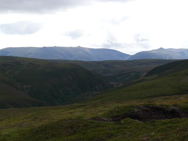
Coire Riabhach, also known as Corrie, is a glacial valley located in Banffshire, Scotland. It is situated in the eastern Highlands, within the Cairngorms National Park. The valley is surrounded by stunning mountainous landscapes, making it a popular destination for outdoor enthusiasts and nature lovers.

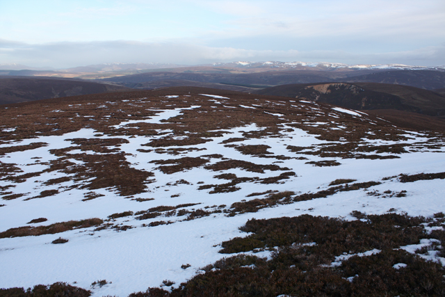
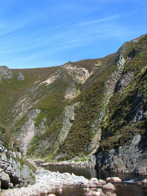
Coire Riabhach is characterized by its U-shaped valley, which was formed by glacial activity during the last ice age. The valley is approximately 4 kilometers long and is flanked by steep sides, reaching heights of over 1,000 meters. These towering mountains include some of the highest peaks in the Cairngorms, such as Ben Macdui and Cairn Gorm.

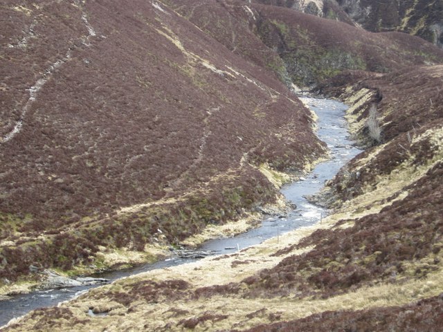
The valley is home to a variety of flora and fauna, including heather moorland, birch trees, and alpine plants. It is also a habitat for various bird species, such as ptarmigans and golden eagles. Additionally, Coire Riabhach boasts a number of small lochs and fast-flowing streams that add to its picturesque scenery.

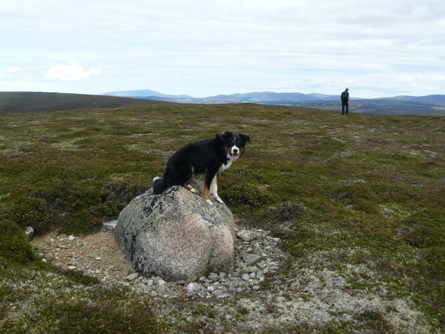
For outdoor enthusiasts, Coire Riabhach offers a range of recreational activities. Hiking and mountaineering are popular pursuits, with numerous trails and routes available for all skill levels. The valley also attracts climbers who seek to tackle the challenging rock faces and crags found in the area.

In conclusion, Coire Riabhach is a breathtaking glacial valley nestled in the heart of Banffshire. Its stunning natural beauty, diverse wildlife, and opportunities for outdoor adventure make it a must-visit destination for those seeking to explore the Scottish Highlands.

If you have any feedback on the listing, please let us know in the comments section below.

Coire Riabhach Images

Images are sourced within 2km of 57.182716/-3.4482786 or Grid Reference NJ1211. Thanks to Geograph Open Source API. All images are credited.

Track, Glen Loin Hill track going down from Cnap Chaochan Aitinn to meet the main Glen Loin track.
Track, Glen Loin
Hill track going down from Cnap Chaochan Aitinn to meet the main Glen Loin track.
Northern slopes of Geal Charn Beag
Carn Ruadh-bhreac Seen from a Dorback estate track.
Carn Ruadh-bhreac
Seen from a Dorback estate track.
Green bothy below Carn Ruadh-bhreac A lunch bothy on Dorback estate.
Green bothy below Carn Ruadh-bhreac
A lunch bothy on Dorback estate.
Landrover track , Geal Charn Beag Giving access to grouse butts on the NE slopes of the hill.
Landrover track , Geal Charn Beag
Giving access to grouse butts on the NE slopes of the hill.
Track on Geal Charn Beag Landrover track used as access to grouse butts on the NE side of the hill.
Track on Geal Charn Beag
Landrover track used as access to grouse butts on the NE side of the hill.
Snow filled track on Geal Charn Beag Near the end of a landrover track to grouse butts on the NE slopes of the hill.  The Ladder Hills can be seen in the distance.
Snow filled track on Geal Charn Beag
Near the end of a landrover track to grouse butts on the NE slopes of the hill. The Ladder Hills can be seen in the distance.
Slopes of Geal Charn Beag Snow patches lying NE of the summit.  The Ladder Hills can be seen in the distance.
Slopes of Geal Charn Beag
Snow patches lying NE of the summit. The Ladder Hills can be seen in the distance.
Geal Charn Beag summit plateau A flat area of bogs and peat hags.  Looking south towards Ben Avon.
Geal Charn Beag summit plateau
A flat area of bogs and peat hags. Looking south towards Ben Avon.
View from Geal Charn Beag On the broad NW ridge looking towards Ben Avon.  Some posts can be seen on the line of an old fence.
View from Geal Charn Beag
On the broad NW ridge looking towards Ben Avon. Some posts can be seen on the line of an old fence.
Water of Caiplich Water of Caiplich looking upstream
Water of Caiplich
Water of Caiplich looking upstream
Water of Caiplich The Water of Caiplich looking downstream from above the southern bank
Water of Caiplich
The Water of Caiplich looking downstream from above the southern bank
Water of Caiplich Water of Caiplich looking upstream above the Castle
Water of Caiplich
Water of Caiplich looking upstream above the Castle
Gorge at The Castle
Gorge at The Castle
Gorge at The Castle Slopes of Carn na Ruabraich to right
Gorge at The Castle
Slopes of Carn na Ruabraich to right
Summit boulder, Carn Ruadh-bhreac The only feature on the top of the hill. Very distant view of Ben Rinnes
Summit boulder, Carn Ruadh-bhreac
The only feature on the top of the hill. Very distant view of Ben Rinnes
Upper Ailnack gorge Looking up the Water of Ailnack over the upper part of the gorge towards The Castle, with distant views of Ben Avon and Beinn a Bhuird
Upper Ailnack gorge
Looking up the Water of Ailnack over the upper part of the gorge towards The Castle, with distant views of Ben Avon and Beinn a Bhuird
Landslip on Carn Ruabraich / Water of Ailnack This huge landslip in possibly two or more stages (seen from the other side of the Water of Ailnack) affect the whole 140+ m height of the side of Carn Ruabraich, caused by undercutting by the river.
Landslip on Carn Ruabraich / Water of Ailnack
This huge landslip in possibly two or more stages (seen from the other side of the Water of Ailnack) affect the whole 140+ m height of the side of Carn Ruabraich, caused by undercutting by the river.
Show me another place!

Coire Riabhach is located at Grid Ref: NJ1211 (Lat: 57.182716, Lng: -3.4482786)

Unitary Authority: Moray

Police Authority: North East

What 3 Words

///misted.lifeguard.formal. Near Grantown-on-Spey, Highland

Nearby Locations

Coire Riabhach

Related Wikis

Tomintoul

Tomintoul ( ; from Scottish Gaelic: Tom an t-Sabhail, meaning "Hillock of the Barn") is a village in the Moray council area of Scotland in the historic...

Ben Avon

Ben Avon (Scottish Gaelic: Beinn Athfhinn, 'mountain of the Avon') is a mountain in the Cairngorms of Scotland. It is a sprawling mountain with a broad...

Bynack More

Bynack More (Scottish Gaelic: A' Bheithneag Mhòr or Beinn Bheithneag) is a Scottish Mountain that is situated in the Cairngorms range, 16 kilometres east...

A939 road

The A939 'Lecht Road' connects the A96 at Nairn on the Moray Coast with the A95 Grantown on Spey, then it continues to the A93 at Ballater by way of the...

Have you been to Coire Riabhach?

Leave your review of Coire Riabhach below (or comments, questions and feedback).