Coire nam Freumh

Corrie (Glacial Valley) in Aberdeenshire

Scotland

Coire nam Freumh

Morrone South Top This small cairn marks a top slightly south of Morrone, next to the path that leads down on gentle slopes. The Cairngorms beyond.
Morrone South Top Credit: Aleks Scholz

Coire nam Freumh, also known as Corrie (Glacial Valley), is a stunning geographical feature located in Aberdeenshire, Scotland. Situated in the eastern part of the country, this glacial valley is a natural marvel that attracts visitors from far and wide.

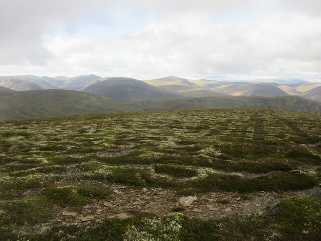
The valley is nestled within the Cairngorms National Park, one of the most picturesque and biodiverse areas in Scotland. Coire nam Freumh is surrounded by towering mountains and is characterized by its steep and rugged terrain, making it a favorite spot for hikers, mountaineers, and nature enthusiasts.

The formation of this glacial valley can be traced back to the last Ice Age, when massive glaciers carved through the landscape, shaping the land into its current form. The valley itself is narrow and elongated, with a U-shaped cross-section, which is a typical feature of glacial erosion.

Coire nam Freumh is famous for its breathtaking beauty, with its rocky cliffs, cascading waterfalls, and lush vegetation. The valley is home to a diverse range of flora and fauna, including mosses, lichens, and various species of birds and mammals. It offers a haven for wildlife, giving visitors the chance to observe and appreciate the natural environment.

For those seeking outdoor adventure, Coire nam Freumh offers excellent opportunities for hiking, climbing, and photography. The valley is accessible via well-marked trails, allowing visitors to explore and soak in the stunning views. It is recommended to visit during the summer months when the weather is milder, and the valley is alive with vibrant colors.

Coire nam Freumh is a true gem of Aberdeenshire, offering a unique and awe-inspiring experience for anyone who visits.

If you have any feedback on the listing, please let us know in the comments section below.

Coire nam Freumh Images

Images are sourced within 2km of 56.965795/-3.4463792 or Grid Reference NO1286. Thanks to Geograph Open Source API. All images are credited.

Morrone South Top This small cairn marks a top slightly south of Morrone, next to the path that leads down on gentle slopes. The Cairngorms beyond.
Morrone South Top
This small cairn marks a top slightly south of Morrone, next to the path that leads down on gentle slopes. The Cairngorms beyond.
Track towards Morrone The last stretch of the gently sloping track that leads to Morrone from the south.
Track towards Morrone
The last stretch of the gently sloping track that leads to Morrone from the south.
Morrone summit installations The assortment of old and new masts and huts that are gathered on top of Morrone.
Morrone summit installations
The assortment of old and new masts and huts that are gathered on top of Morrone.
Morrone Cairn Cairn on the summit of Morrone, with the Cairngorms beyond.
Morrone Cairn
Cairn on the summit of Morrone, with the Cairngorms beyond.
Morrone Track Track heading towards Morrone from the south-west.
Morrone Track
Track heading towards Morrone from the south-west.
Heather moor on the south side of Morrone Looking south-west over moorland on the southern flank of Morrone, with the Glen Ey mountains in the distance.
Heather moor on the south side of Morrone
Looking south-west over moorland on the southern flank of Morrone, with the Glen Ey mountains in the distance.
Single cloud A single low cloud floating above Coire na Meanneasg.
Single cloud
A single low cloud floating above Coire na Meanneasg.
Coire na Meanneasg Looking south-west from the Morrone track towards Coire na Meanneasg.
Coire na Meanneasg
Looking south-west from the Morrone track towards Coire na Meanneasg.
Cairn The cairn has fine views over the Clunie and Coire Yaltie. The wooden post is the highest of a series of very basic grouse butts.
Cairn
The cairn has fine views over the Clunie and Coire Yaltie. The wooden post is the highest of a series of very basic grouse butts.
Cairngorm MRT radio relay hut Predates much of the rest of the paraphernalia on the summit, I think.
Cairngorm MRT radio relay hut
Predates much of the rest of the paraphernalia on the summit, I think.
The Morrone path Looking down the hill path as it heads towards Glen Clunie.
The Morrone path
Looking down the hill path as it heads towards Glen Clunie.
Summit of Morrone Cairn and trig pillar on the summit also known as Morven. A communication mast and building is just behind this shot.
Summit of Morrone
Cairn and trig pillar on the summit also known as Morven. A communication mast and building is just behind this shot.
Morrone or Morven? There is some slight dispute over the name but Morrone is the more usual. The OS sits on the fence and gives both. Taken from the transmitting station access track which winds up the south slope of the hill.
Morrone or Morven?
There is some slight dispute over the name but Morrone is the more usual. The OS sits on the fence and gives both. Taken from the transmitting station access track which winds up the south slope of the hill.
Summit of Morrone, 1981 The communications mast has been replaced by a higher tower since this was taken.
Summit of Morrone, 1981
The communications mast has been replaced by a higher tower since this was taken.
Automatic weather station, Morrone summit 1981 In the late 1970s Heriot-Watt University and Edinburgh Instruments Ltd built a second automatic weather station identical to that on Cairn Gorm summit <a href="https://www.geograph.org.uk/photo/1754571">NJ0003 : Heriot-Watt weather station, Cairn Gorm summit</a>. This second station was installed on the hut on Morrone summit for a project run by the Institute of Offshore Medicine, Aberdeen University, to study the effects of exposure and heat loss on human metabolism. A purpose-built display of the data was set up in nearby Braemar, linked by landline. 

The 'Danger 33,000 volts' sign was something of an exaggeration to keep prying hands away!
Automatic weather station, Morrone summit 1981
In the late 1970s Heriot-Watt University and Edinburgh Instruments Ltd built a second automatic weather station identical to that on Cairn Gorm summit NJ0003 : Heriot-Watt weather station, Cairn Gorm summit. This second station was installed on the hut on Morrone summit for a project run by the Institute of Offshore Medicine, Aberdeen University, to study the effects of exposure and heat loss on human metabolism. A purpose-built display of the data was set up in nearby Braemar, linked by landline. The 'Danger 33,000 volts' sign was something of an exaggeration to keep prying hands away!
Morrone communication tower
Loose boulders on the summit of Morrone In the distance, the Cairngorms.
Loose boulders on the summit of Morrone
In the distance, the Cairngorms.
Summit cairn, Carn Mor Morrone in view along the heathery ridge from Carn na Drochaide.
Summit cairn, Carn Mor
Morrone in view along the heathery ridge from Carn na Drochaide.
Show me another place!

Coire nam Freumh is located at Grid Ref: NO1286 (Lat: 56.965795, Lng: -3.4463792)

Unitary Authority: Aberdeenshire

Police Authority: North East

What 3 Words

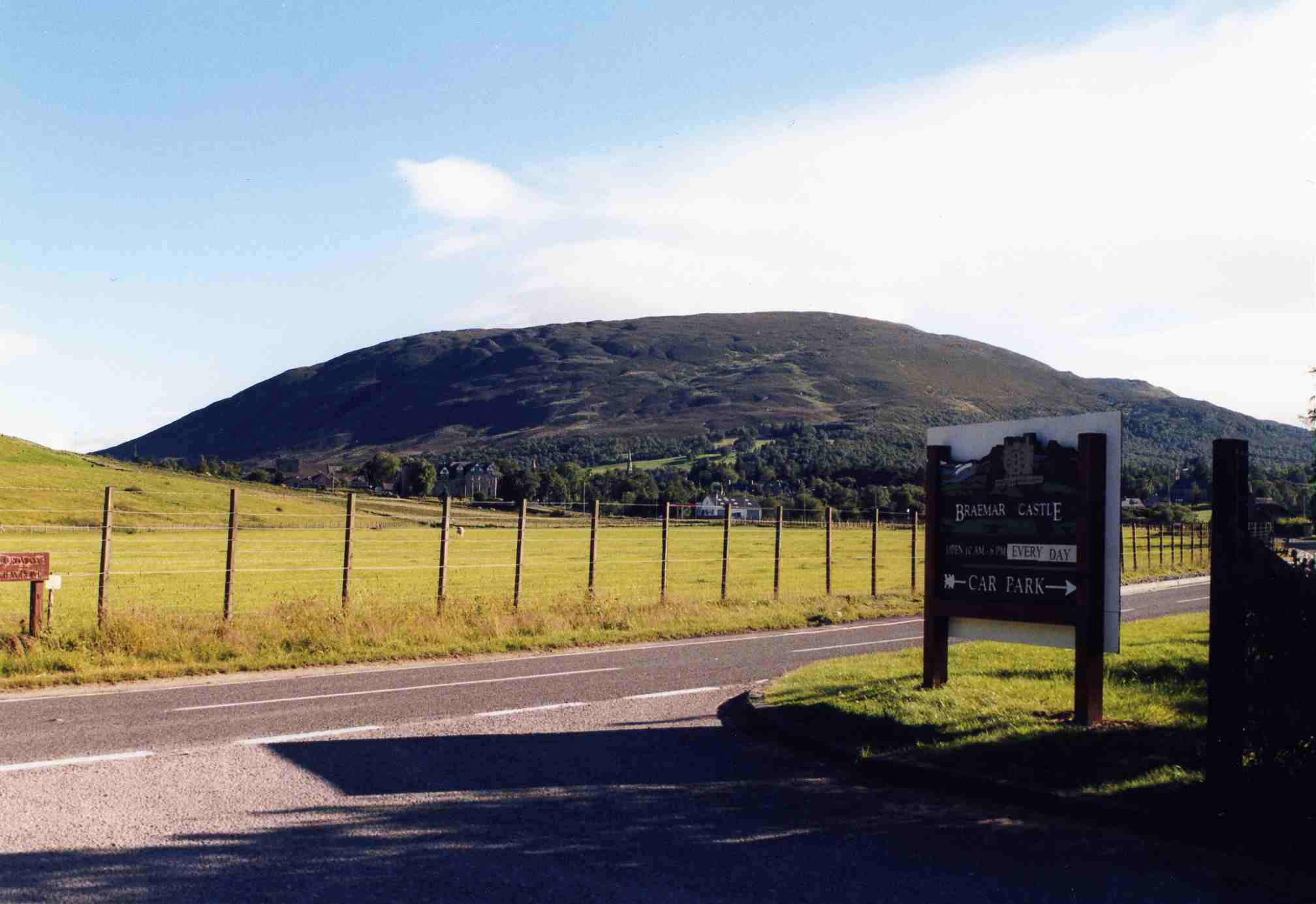
///clay.structure.logo. Near Inverey, Aberdeenshire

Related Wikis

Have you been to Coire nam Freumh?

Leave your review of Coire nam Freumh below (or comments, questions and feedback).