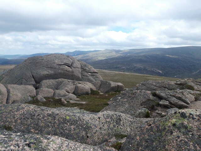
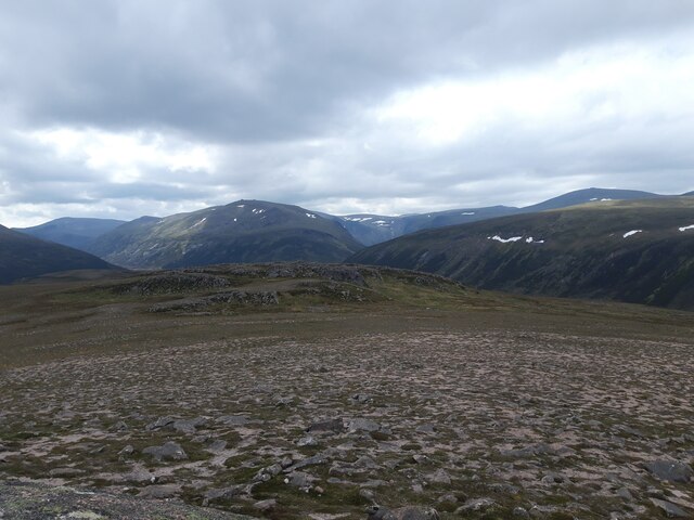
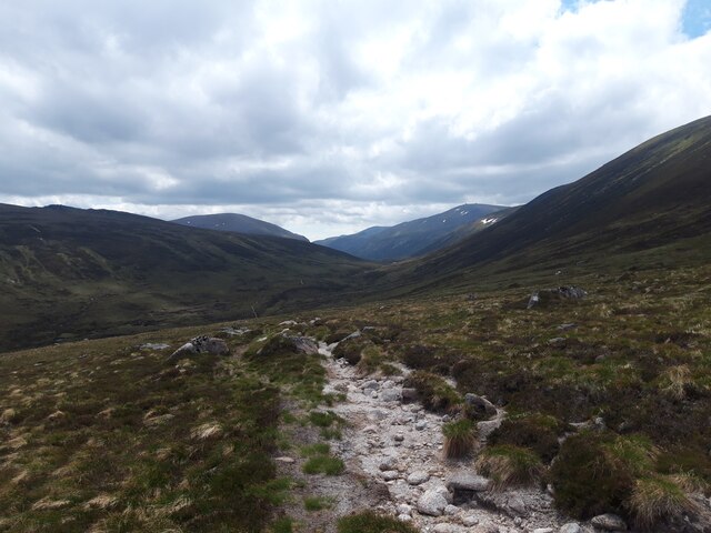
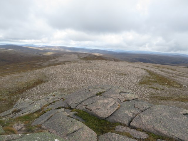
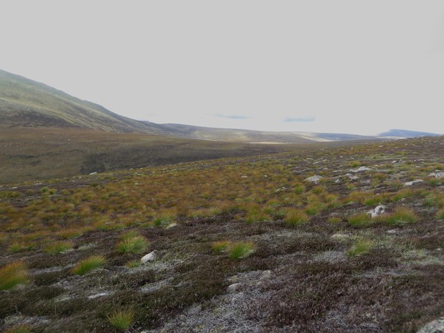
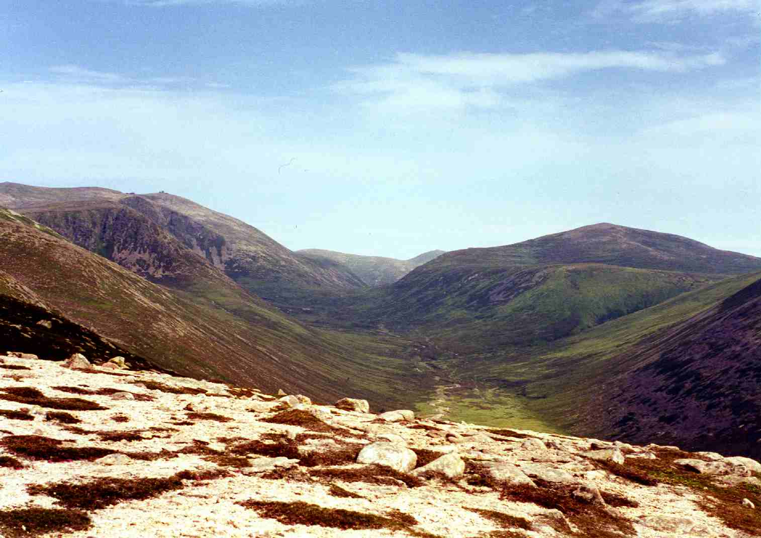
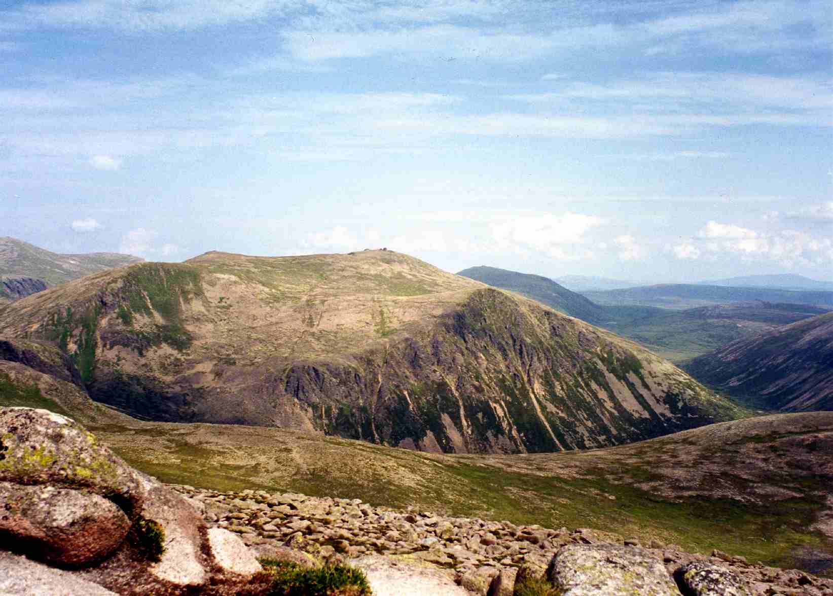
Coire Robaidh

Corrie (Glacial Valley) in Banffshire

Scotland

Coire Robaidh

Summit tor on Creag Mhòr Looking towards mountainsides on the opposite side of Glen Avon.
Summit tor on Creag Mhòr Credit: Alan O'Dowd

The requested URL returned error: 429 Too Many Requests

If you have any feedback on the listing, please let us know in the comments section below.

Coire Robaidh Images

Images are sourced within 2km of 57.117769/-3.5534234 or Grid Reference NJ0604. Thanks to Geograph Open Source API. All images are credited.

Summit tor on Creag Mhòr Looking towards mountainsides on the opposite side of Glen Avon.
Summit tor on Creag Mhòr
Looking towards mountainsides on the opposite side of Glen Avon.
Creag Mhòr summit plateau The 895 metre-high Creag Mhòr is dwarfed by the higher Cairngorm peaks, some of which are visible in the distance here.
Creag Mhòr summit plateau
The 895 metre-high Creag Mhòr is dwarfed by the higher Cairngorm peaks, some of which are visible in the distance here.
Descending into the Corrie of the Barns This corrie takes its name from the Barns of Bynack, massive granite tors situated about 300 metres above the corrie floor, on the plateau of Bynack More.
Descending into the Corrie of the Barns
This corrie takes its name from the Barns of Bynack, massive granite tors situated about 300 metres above the corrie floor, on the plateau of Bynack More.
Lochan on Creag Mhor, with Bynack More behind
Lochan a' Bhainne Looking across the small lake of Lochan a' Bhainne which lies between Bynack More and Creag Mhor.
Lochan a' Bhainne
Looking across the small lake of Lochan a' Bhainne which lies between Bynack More and Creag Mhor.
Looking down to Lochan a' Bhainne Looking down to Lochan a' Bhainne from the slopes of Creag Mhor.
Looking down to Lochan a' Bhainne
Looking down to Lochan a' Bhainne from the slopes of Creag Mhor.
Approaching Creag Mhor Approaching the summit of Creag Mhor by climbing straight up the flank of the hill from beside Lochan a' Bhainne.
Approaching Creag Mhor
Approaching the summit of Creag Mhor by climbing straight up the flank of the hill from beside Lochan a' Bhainne.
The summit of Creag Mhor A rocky outcrop marks the undoubted summit of the top of Creag Mhor.
The summit of Creag Mhor
A rocky outcrop marks the undoubted summit of the top of Creag Mhor.
View south from the top of Creag Mhor Looking south across the barren top of Creag Mhor.
View south from the top of Creag Mhor
Looking south across the barren top of Creag Mhor.
Looking south west from the top of Creag Mhor Looking south west from the highest point of Creag Mhor across the barren top of the hill towards an outcrop which forms a subsidiary summit of the hill.
Looking south west from the top of Creag Mhor
Looking south west from the highest point of Creag Mhor across the barren top of the hill towards an outcrop which forms a subsidiary summit of the hill.
Exposed rocks on Creag Mhor Exposed rocks, eroded into various interesting shapes to the east of the top of Creag Mhor.
Exposed rocks on Creag Mhor
Exposed rocks, eroded into various interesting shapes to the east of the top of Creag Mhor.
The eastern side of Creag Mhor Looking down the eastern slope of Creag Mhor. The River Avon flows along the valley floor.
The eastern side of Creag Mhor
Looking down the eastern slope of Creag Mhor. The River Avon flows along the valley floor.
The summit of Dagrum The high point of Dagrum, which in effect is a high point on the northern side of Creag Mhor. The summit of Creag Mhor can be seen in the distance.
The summit of Dagrum
The high point of Dagrum, which in effect is a high point on the northern side of Creag Mhor. The summit of Creag Mhor can be seen in the distance.
Looking east from Dagrum Looking east across the barren landscape from the summit of Dagrum.
Looking east from Dagrum
Looking east across the barren landscape from the summit of Dagrum.
View north from Dagrum Looking in a northerly direction from the top of Dagrum. The barren area around the top of the hill made walking blissfully easy compared to negotiating the heather lower down the hills.
View north from Dagrum
Looking in a northerly direction from the top of Dagrum. The barren area around the top of the hill made walking blissfully easy compared to negotiating the heather lower down the hills.
Barren slopes west of Dagrum The barren western slopes of Dagrum, vegetation is restricted to low clumps of heather and a few tussocks of grass.
Barren slopes west of Dagrum
The barren western slopes of Dagrum, vegetation is restricted to low clumps of heather and a few tussocks of grass.
The western side of Dagrum Looking across the western side of Dagrum.
The western side of Dagrum
Looking across the western side of Dagrum.
Creag Mhor (summit tor) Looking towards Beinn Mheadhoin from the summit of Creag Mhor.
Creag Mhor (summit tor)
Looking towards Beinn Mheadhoin from the summit of Creag Mhor.
Show me another place!

Coire Robaidh is located at Grid Ref: NJ0604 (Lat: 57.117769, Lng: -3.5534234)

Unitary Authority: Moray

Police Authority: North East

What 3 Words

///soap.lightbulb.processes. Near Inverey, Aberdeenshire

Nearby Locations

Coire Robaidh

Related Wikis

Bynack More

Bynack More (Scottish Gaelic: A' Bheithneag Mhòr or Beinn Bheithneag) is a Scottish Mountain that is situated in the Cairngorms range, 16 kilometres east...

Beinn a' Chaorainn (Cairngorms)

Beinn a' Chaorainn is a Scottish mountain in the heart of the Cairngorms range. It is quite a remote hill, being located roughly 19 kilometres south east...

Beinn Mheadhoin (Cairngorms)

Beinn Mheadhoin or Beinn Meadhain (Scottish Gaelic for 'middle mountain') is a mountain in the Highlands of Scotland. It is a Munro with a height of 1...

Lairig an Laoigh

The Lairig an Laoigh ( LAR-ig ən LOO-ee; Scottish Gaelic: Làirig Laoigh) is a mountain pass through the Highlands of Scotland. In speech and sometimes...

Have you been to Coire Robaidh?

Leave your review of Coire Robaidh below (or comments, questions and feedback).