Coire Buidhe

Corrie (Glacial Valley) in Banffshire

Scotland

Coire Buidhe

Path in Coire Raibeirt
Path in Coire Raibeirt Credit: Steven Brown

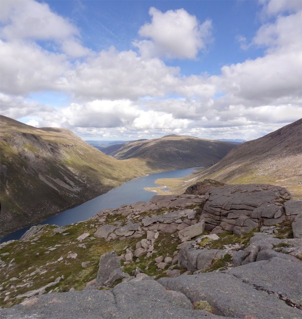
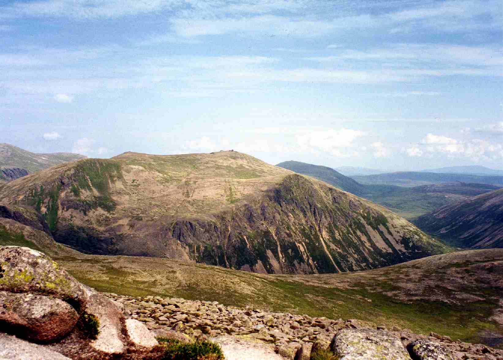
Coire Buidhe, located in Banffshire, Scotland, is a picturesque glacial valley known for its stunning natural beauty and rich biodiversity. Also referred to as a corrie, this geological feature was formed during the last ice age when a glacier carved out the landscape.

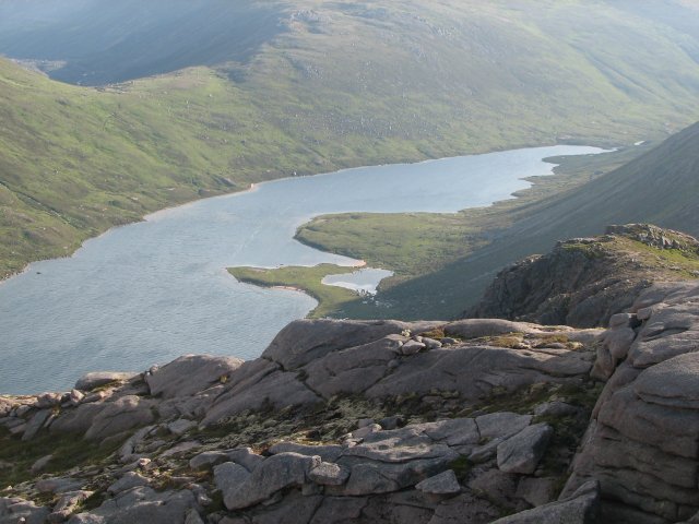
Nestled within the Cairngorms National Park, Coire Buidhe offers visitors a unique opportunity to experience the ruggedness and tranquility of the Scottish highlands. The valley is surrounded by steep mountains and cliffs, creating a dramatic and awe-inspiring landscape. The slopes are covered in heather, grasses, and scattered rocks, while the valley floor is home to a small loch and a meandering river.

This corrie is a haven for wildlife enthusiasts and nature lovers alike. It provides a habitat for a variety of bird species, including golden eagles, peregrine falcons, and ptarmigans. The loch and river are teeming with fish, such as trout and salmon, attracting anglers from far and wide.

Hiking and climbing enthusiasts are drawn to Coire Buidhe for its challenging terrain and breathtaking views. There are several walking trails and routes to explore, catering to all levels of experience. These trails offer an opportunity to witness the valley's beauty up close, with its cascading waterfalls, lush vegetation, and panoramic vistas.

Coire Buidhe is a place of natural wonder and tranquility, providing a sanctuary for both wildlife and humans seeking solace in the great outdoors. Its unique geological features and rich biodiversity make it a must-visit destination for those seeking an authentic Scottish Highland experience.

If you have any feedback on the listing, please let us know in the comments section below.

Coire Buidhe Images

Images are sourced within 2km of 57.095555/-3.626688 or Grid Reference NJ0101. Thanks to Geograph Open Source API. All images are credited.

Path in Coire Raibeirt
Allt Coire Raibeirt
Allt Coire Raibeirt
Beach on Loch Avon
Beach on Loch Avon
Head of Loch Avon
Head of Loch Avon
Path towards Loch Etchachan
Path near Loch Etchachan
Barn on Beinn Mheadhoin Barns in the Cairngorms are what are known as tors elsewhere.
Barn on Beinn Mheadhoin
Barns in the Cairngorms are what are known as tors elsewhere.
Barns of Beinn Mheadhoin
Summit area of Beinn Mheadhoin
Avalanche debris below rock slabs The slabs are above a location named as The Saddle. It seems clear that deep snow lying on the angled slabs fractured and slid down in a modest-sized avalanche. Liz Gray has an image of the slabs without any snow at all - <a title="https://www.geograph.org.uk/photo/3175394" href="https://www.geograph.org.uk/photo/3175394">Link</a> .
Avalanche debris below rock slabs
The slabs are above a location named as The Saddle. It seems clear that deep snow lying on the angled slabs fractured and slid down in a modest-sized avalanche. Liz Gray has an image of the slabs without any snow at all - Link .
Cairngorm Mountains Thanks to GPS, I can be sure exactly where this was taken from, but I am less certain about what it shows. The loch is Loch Avon, so Cairn Gorm mustr be hidden in the cloud. The river is the River Avon, and the conical mountain on the left will be Beinn a' Chaorainn. Taken from a motor glider.
Cairngorm Mountains
Thanks to GPS, I can be sure exactly where this was taken from, but I am less certain about what it shows. The loch is Loch Avon, so Cairn Gorm mustr be hidden in the cloud. The river is the River Avon, and the conical mountain on the left will be Beinn a' Chaorainn. Taken from a motor glider.
View towards Loch Etchachan The ground in front of the camera is very typical of the Cairngorm Plateau. Beyond Loch Etchachan which is mostly in NO 0000, and to the left of the loch is Càrn Etchacan. On the skyline is Cairngorm .
View towards Loch Etchachan
The ground in front of the camera is very typical of the Cairngorm Plateau. Beyond Loch Etchachan which is mostly in NO 0000, and to the left of the loch is Càrn Etchacan. On the skyline is Cairngorm .
The path to Loch Avon The path from Strath Nethy begins its descent from the Saddle. Carn Etchachan can be seen ahead, with the distinctive Shelter Stone Crag to its right. Slopes descending from Beinn Mheadhoin can be seen on the left.
The path to Loch Avon
The path from Strath Nethy begins its descent from the Saddle. Carn Etchachan can be seen ahead, with the distinctive Shelter Stone Crag to its right. Slopes descending from Beinn Mheadhoin can be seen on the left.
Descent to the Loch Descending the steep path beside the Allt Coire Raibeirt to the sparkling turquoise waters of Loch Avon.
Descent to the Loch
Descending the steep path beside the Allt Coire Raibeirt to the sparkling turquoise waters of Loch Avon.
Loch Avon Looking east to Loch Avon and the slopes of Beinn Mheadhoin on a lovely early autumn day.
Loch Avon
Looking east to Loch Avon and the slopes of Beinn Mheadhoin on a lovely early autumn day.
Heading to Loch Avon Magnificent mountain scenery looking to the western end of Loch Avon with Carn Etchachan and the Shelter Stone Crag towering above.
Heading to Loch Avon
Magnificent mountain scenery looking to the western end of Loch Avon with Carn Etchachan and the Shelter Stone Crag towering above.
Beach Bums Nearly 60 miles from the sea and there is a lovely sandy beach to walk on at the western end of Loch Avon.
Beach Bums
Nearly 60 miles from the sea and there is a lovely sandy beach to walk on at the western end of Loch Avon.
View from Stacan Dubha Standing atop the rocky promontory of Stacan Dubha, it is a long drop to Loch Avon. In the distance is the munro of Bynack More.
View from Stacan Dubha
Standing atop the rocky promontory of Stacan Dubha, it is a long drop to Loch Avon. In the distance is the munro of Bynack More.
Show me another place!

Coire Buidhe is located at Grid Ref: NJ0101 (Lat: 57.095555, Lng: -3.626688)

Unitary Authority: Moray

Police Authority: North East

What 3 Words

///motor.convert.tangent. Near Inverey, Aberdeenshire

Nearby Locations

Stacan Dubha Coire Buidhe

Related Wikis

Beinn Mheadhoin (Cairngorms)

Beinn Mheadhoin or Beinn Meadhain (Scottish Gaelic for 'middle mountain') is a mountain in the Highlands of Scotland. It is a Munro with a height of 1...

Cairngorm Lochs

Cairngorm Lochs is a protected wetland area in the Cairngorms, in the Grampian and Highland regions of Scotland. With a total area of 173 hectares, it...

Loch A'an

Loch A'an is a remote freshwater loch set deep within the central Cairngorms plateau, in the Cairngorms National Park, located in the eastern Highlands...

Loch Etchachan

Loch Etchachan is a remote freshwater loch set deep within the central Cairngorms plateau, in the Cairngorms National Park, located in the eastern Highlands...

Nearby Amenities

Located within 500m of 57.095555,-3.626688
Stacan Dubha
Ele: 1014
Natural: peak
Lat/Long: 57.0940412/-3.632226
Beinn Mheadhoin SW Top
Ele: 1163
Natural: peak
Lat/Long: 57.091768/-3.6228061
Ford: yes
Lat/Long: 57.0998584/-3.6288031
The data included in this document is from www.openstreetmap.org. The data is made available under ODbL.

Have you been to Coire Buidhe?

Leave your review of Coire Buidhe below (or comments, questions and feedback).