Coire Raineach

Corrie (Glacial Valley) in Ross-shire

Scotland

Coire Raineach

Beinn nan Ramh A hill between Loch Fannich and Kinlochewe. View along the length of the loch. There is quite a distinctive corrie at the east end of the hill.
Beinn nan Ramh Credit: Richard Webb

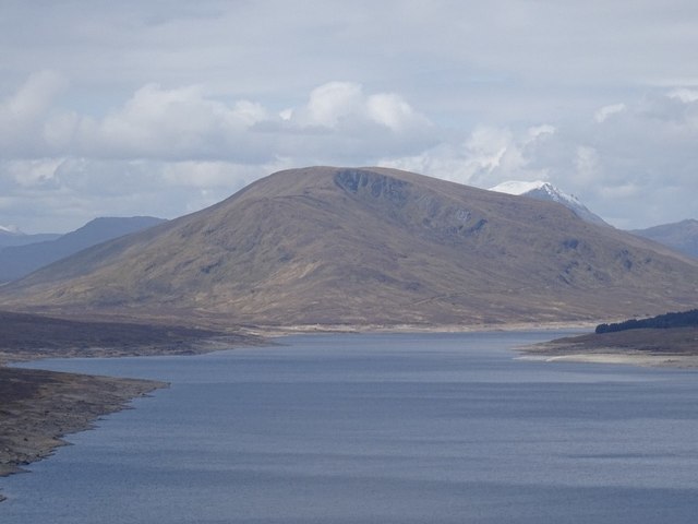
Coire Raineach, located in Ross-shire, Scotland, is a stunning glacial valley known for its breathtaking natural beauty. Nestled among the majestic Scottish Highlands, this picturesque coire, or corrie, is a popular destination for hikers, nature lovers, and outdoor enthusiasts.

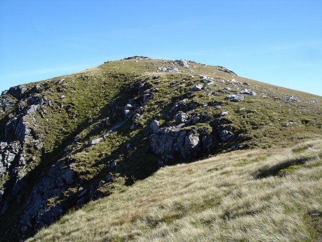
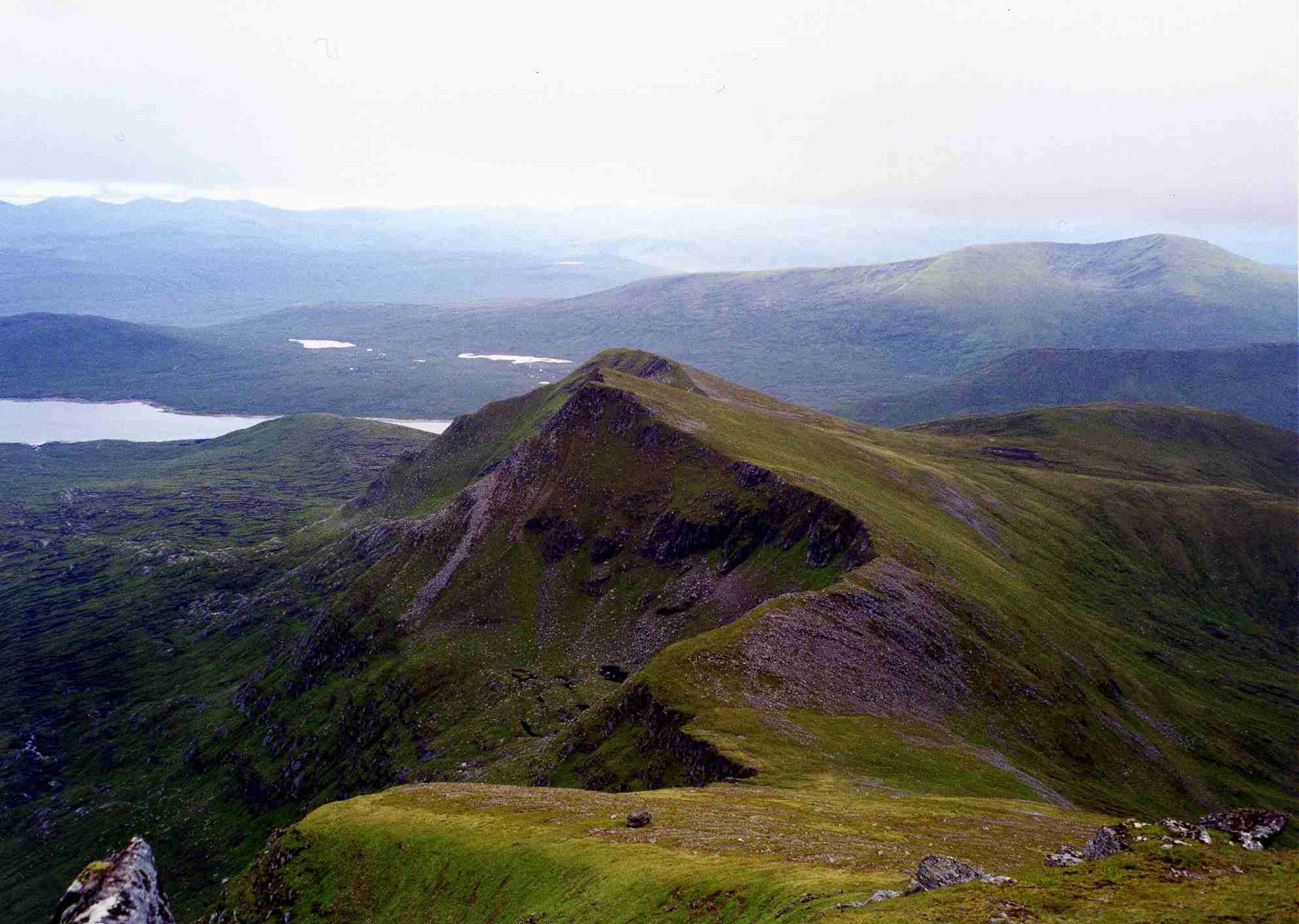
The valley was formed thousands of years ago during the last ice age when large glaciers carved their way through the landscape, leaving behind a deep, U-shaped valley. Coire Raineach is characterized by steep, rugged slopes, towering cliffs, and a central basin that is often filled with a small loch or a meandering river.

The surrounding landscape of Coire Raineach is dominated by lush greenery, heather-covered moorlands, and rocky outcrops. The valley is home to a diverse range of plant and animal species, including rare alpine plants, birds of prey, and small mammals.

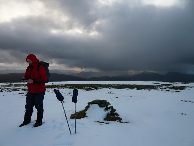
Hiking is a popular activity in Coire Raineach, with various trails catering to different skill levels. The challenging terrain offers adventurous hikers the opportunity to scramble up the slopes and enjoy panoramic views of the surrounding mountains and glens. The coire is also a gateway to the nearby Munros, which are mountains over 3,000 feet in height, attracting more experienced climbers and mountaineers.

Visitors to Coire Raineach can experience the tranquility and solitude of the Scottish wilderness. The unspoiled beauty and rugged charm of this glacial valley make it a must-visit destination for those seeking a true Scottish Highland experience. Whether it's exploring the dramatic landscape, spotting wildlife, or simply admiring the breathtaking vistas, Coire Raineach offers a memorable adventure in the heart of nature.

If you have any feedback on the listing, please let us know in the comments section below.

Coire Raineach Images

Images are sourced within 2km of 57.64837/-5.1053971 or Grid Reference NH1466. Thanks to Geograph Open Source API. All images are credited.

Beinn nan Ramh A hill between Loch Fannich and Kinlochewe. View along the length of the loch. There is quite a distinctive corrie at the east end of the hill.
Beinn nan Ramh
A hill between Loch Fannich and Kinlochewe. View along the length of the loch. There is quite a distinctive corrie at the east end of the hill.
Beinn nan Ramh shines out in the gloom Yes, we got wet that day, but it was worth it!
Beinn nan Ramh shines out in the gloom
Yes, we got wet that day, but it was worth it!
Beinn nan Ramh summit cairn A winter's day drawing to a close, and a long, dark walkout ahead from Loch Fannich back out to the Glen Carron road. Beinn nan Ramh is a long, rounded ridge, with peat-hags in its dips, and a featureless summit plateau.
Beinn nan Ramh summit cairn
A winter's day drawing to a close, and a long, dark walkout ahead from Loch Fannich back out to the Glen Carron road. Beinn nan Ramh is a long, rounded ridge, with peat-hags in its dips, and a featureless summit plateau.
Above western end of Loch Fannich Looking down the ridge from Toll Beag to Loch Fannich. The corries is quite craggy, but the ridge is grassy.
Above western end of Loch Fannich
Looking down the ridge from Toll Beag to Loch Fannich. The corries is quite craggy, but the ridge is grassy.
Loch Fannich from high up Beinn nan Ramh Looking down the east ridge from the eastern top of Beinn nan Ramh, Toll Beag. You can see virtually the full length of Loch Fannich stretching away.
Loch Fannich from high up Beinn nan Ramh
Looking down the east ridge from the eastern top of Beinn nan Ramh, Toll Beag. You can see virtually the full length of Loch Fannich stretching away.
High grassland on northern slopes of Beinn nan Ramh In the wide expanse of grassland on the summit of Beinn nan Ramh, two deer can just be seen in the left centre of the photo. In the distance can be seen the Fisherfield group of munros. The leftmost distant hill, just poking over the shoulder of Beinn nan Ramh, is the corbett, Beinn Lair.
High grassland on northern slopes of Beinn nan Ramh
In the wide expanse of grassland on the summit of Beinn nan Ramh, two deer can just be seen in the left centre of the photo. In the distance can be seen the Fisherfield group of munros. The leftmost distant hill, just poking over the shoulder of Beinn nan Ramh, is the corbett, Beinn Lair.
Eastern ridge of Beinn nan Ramh This photo shows the long eastern summit ridge of Beinn nan Ramh. It is more than a kilometre along this top part of the ridge with very little drop from the summit and is an easy walk across the short grass.
Eastern ridge of Beinn nan Ramh
This photo shows the long eastern summit ridge of Beinn nan Ramh. It is more than a kilometre along this top part of the ridge with very little drop from the summit and is an easy walk across the short grass.
From the Coire Buidhe Although a stream flows from this coire, it is more of a gentle indentation in the hill than a coire but it does give a good view of the munro, Fionn Bheinn, across Strath Chrombaill.
From the Coire Buidhe
Although a stream flows from this coire, it is more of a gentle indentation in the hill than a coire but it does give a good view of the munro, Fionn Bheinn, across Strath Chrombaill.
Rolling Easter Eggs on Beinn nan Ramh summit Looking west from the summit cairn of Beinn nan Ramh on a glorious Easter Sunday. A very remote place to roll your Easter eggs but as the summit is so flat it was better to play boules with the eggs, with the cairn as the target. Left to right are Slioch, Beinn Lair and the Fisherfield Munros.
Rolling Easter Eggs on Beinn nan Ramh summit
Looking west from the summit cairn of Beinn nan Ramh on a glorious Easter Sunday. A very remote place to roll your Easter eggs but as the summit is so flat it was better to play boules with the eggs, with the cairn as the target. Left to right are Slioch, Beinn Lair and the Fisherfield Munros.
Show me another place!

Coire Raineach is located at Grid Ref: NH1466 (Lat: 57.64837, Lng: -5.1053971)

Unitary Authority: Highland

Police Authority: Highlands and Islands

What 3 Words

///degree.salaried.regulator. Near Achnasheen, Highland

Nearby Locations

Coire Raineach

Related Wikis

Fionn Bheinn

Fionn Bheinn is a mountain located south of Loch Fannich in the northwestern Scottish Highlands. It has a height of 933 m (3061 ft) and is listed as a...

Sgùrr Breac

Sgùrr Breac is a mountain with a height of 999 metres (3,278 ft) in Wester Ross in the Northwest Highlands of Scotland. A remote mountain, Sgùrr Breac...

Sgùrr nan Each

Sgùrr nan Each is a Scottish mountain situated in the group of hills known as the Fannichs. It is 27 kilometres (17 mi) south of Ullapool in the Ross and...

A' Chailleach (Fannichs)

A' Chailleach (Scottish Gaelic for 'the old woman or Cailleach') is a mountain in the Northwest Highlands of Scotland. It lies in the Fannichs of Wester...

Have you been to Coire Raineach?

Leave your review of Coire Raineach below (or comments, questions and feedback).