Coire Odhar

Corrie (Glacial Valley) in Inverness-shire

Scotland

Coire Odhar

Coire Allt Donaich A corrie on Mullach Fraoch-choire seen from Glen Affric.
Coire Allt Donaich Credit: Richard Webb

Coire Odhar, located in Inverness-shire, Scotland, is a captivating glacial valley widely known for its stunning natural beauty and diverse wildlife. Also referred to as Corrie, this geographical feature is nestled amidst the majestic Cairngorms National Park, attracting numerous nature enthusiasts and outdoor adventurers.

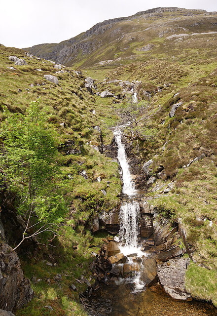
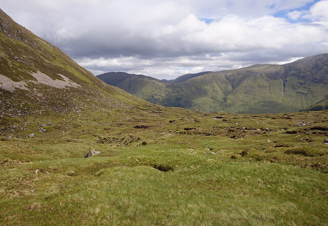
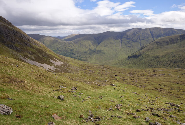
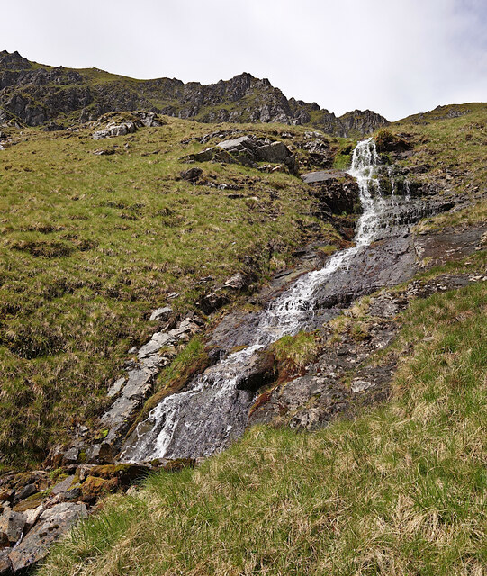
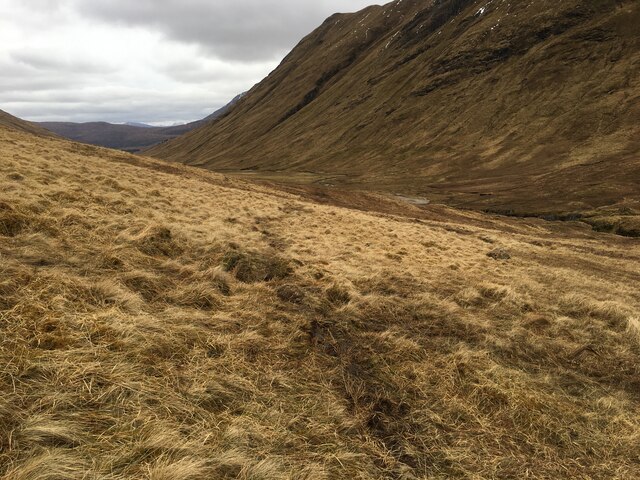
The valley itself is characterized by its U-shaped morphology, a telltale sign of its glacial origin. Carved by the movement of glaciers during the last Ice Age, Coire Odhar boasts steep sides and a flat bottom, giving it a distinct appearance. The valley is dotted with picturesque lochs, streams, and waterfalls, adding to its allure.

Coire Odhar offers a haven for various species of flora and fauna. The valley is home to a wide range of plants, including heather, mosses, and hardy alpine species, which thrive in the challenging mountainous environment. The area is also a haven for birdwatchers, with a variety of bird species, such as golden eagles and ptarmigans, frequently spotted in the region. Additionally, red deer and mountain hares are commonly seen roaming the valley, providing ample opportunities for wildlife photography and observation.

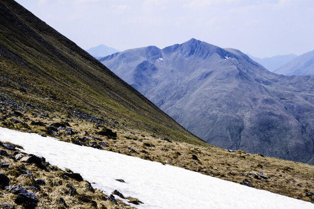
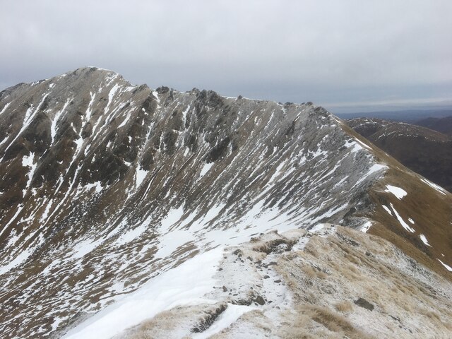
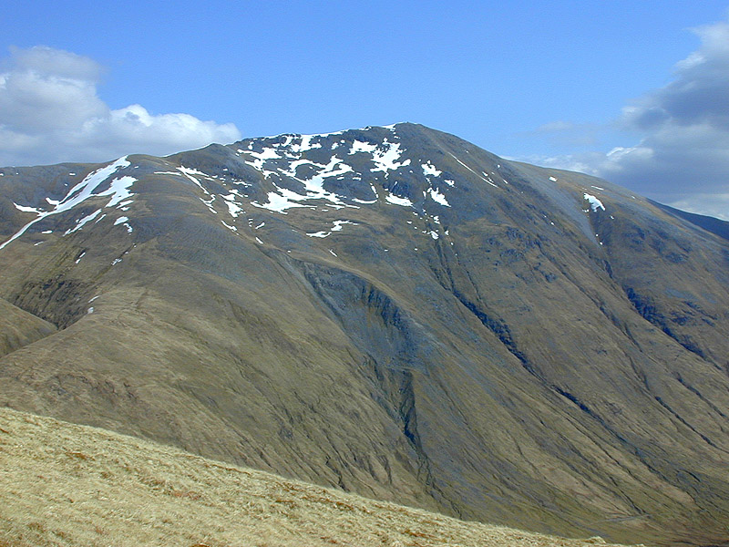
For outdoor enthusiasts, Coire Odhar presents a paradise for hiking, mountaineering, and other outdoor activities. The valley offers a multitude of trails catering to different skill levels, providing breathtaking views of the surrounding mountain peaks, including Ben Macdui, the second highest peak in the UK. During the winter months, the valley's slopes become a popular destination for skiing and snowboarding enthusiasts.

In conclusion, Coire Odhar in Inverness-shire is a remarkable glacial valley, offering visitors a unique opportunity to experience the raw beauty of Scotland's natural landscape. With its stunning geological features, diverse wildlife, and a range of outdoor activities, this enchanting valley continues to be a popular destination for nature lovers and adventurers alike.

If you have any feedback on the listing, please let us know in the comments section below.

Coire Odhar Images

Images are sourced within 2km of 57.202172/-5.1664783 or Grid Reference NH0816. Thanks to Geograph Open Source API. All images are credited.

Coire Allt Donaich A corrie on Mullach Fraoch-choire seen from Glen Affric.
Coire Allt Donaich
A corrie on Mullach Fraoch-choire seen from Glen Affric.
Waterfall, Coire na Geurdain A small stream flowing down towards Gleann na Cìche. Several rowan trees growing on the rocks alongside.
Waterfall, Coire na Geurdain
A small stream flowing down towards Gleann na Cìche. Several rowan trees growing on the rocks alongside.
Coire na Geurdain The eastern slopes of Mullach Fraoch-choire, looking towards Gleann na Cìche. Mostly rough grass and peat hags.
Coire na Geurdain
The eastern slopes of Mullach Fraoch-choire, looking towards Gleann na Cìche. Mostly rough grass and peat hags.
Rocks at summit area of Mullach Fraoch-choire Beyond the rocks of the summit area of  Mullach Fraoch-choire,  the continuing south ridge turns down to the right then rises to Stob Coire na Cralàig, (out of view in the image), before climbing to A' Cràileag, the peak seen right of centre in the image.
Rocks at summit area of Mullach Fraoch-choire
Beyond the rocks of the summit area of Mullach Fraoch-choire, the continuing south ridge turns down to the right then rises to Stob Coire na Cralàig, (out of view in the image), before climbing to A' Cràileag, the peak seen right of centre in the image.
Steep mountain slope rising to Stob Coire na Cralàig Stob Coire na Cralàig is an intermediate top along the mountain ridge connecting Mullach Fraoch-choire and A' Chràlaig. Coire Odhar lies below the snow patch.
Ciste Dubh is the obvious central mountain.
Steep mountain slope rising to Stob Coire na Cralàig
Stob Coire na Cralàig is an intermediate top along the mountain ridge connecting Mullach Fraoch-choire and A' Chràlaig. Coire Odhar lies below the snow patch. Ciste Dubh is the obvious central mountain.
View over Coire na Geurdain The eastern slopes of Mullach Fraoch-choire, looking towards Gleann na Cìche. Quite steep rough slopes, covered by grass and rocks.
View over Coire na Geurdain
The eastern slopes of Mullach Fraoch-choire, looking towards Gleann na Cìche. Quite steep rough slopes, covered by grass and rocks.
Waterfalls by Na Geurdain A small stream flowing down the steep rocky slopes of Mullach Fraoch-choire.
Waterfalls by Na Geurdain
A small stream flowing down the steep rocky slopes of Mullach Fraoch-choire.
North ridge of Mullach Fraoch-choire A wide grassy ridge, with a few rocky outcrops and pools of water. A view towards Loch Affric.
North ridge of Mullach Fraoch-choire
A wide grassy ridge, with a few rocky outcrops and pools of water. A view towards Loch Affric.
North ridge of Mullach Fraoch-choire Close to the 858m spot height, a wide grassy ridge. Loch Affric visible to the right.
North ridge of Mullach Fraoch-choire
Close to the 858m spot height, a wide grassy ridge. Loch Affric visible to the right.
Snow patch, Mullach Fraoch-choire A small patch of snow, on the northern slopes of Mullach Fraoch-choire, shortly before midsummer.
Snow patch, Mullach Fraoch-choire
A small patch of snow, on the northern slopes of Mullach Fraoch-choire, shortly before midsummer.
North ridge of Mullach Fraoch-choire A view from near the summit.
North ridge of Mullach Fraoch-choire
A view from near the summit.
Summit cairn and shelter, Mullach Fraoch-choire A stone cairn and shelter.
Summit cairn and shelter, Mullach Fraoch-choire
A stone cairn and shelter.
Boggy path towards Loch Cluanie
Path towards Loch Cluanie
Small waterfall, Coire na Craileig
Cairn on Mullach Fraoch-choire
Steep western slope of Mullach Fraoch-choire
View to Na Guerdain
View to Na Guerdain
Show me another place!

Coire Odhar is located at Grid Ref: NH0816 (Lat: 57.202172, Lng: -5.1664783)

Unitary Authority: Highland

Police Authority: Highlands and Islands

What 3 Words

///figure.munch.apes. Near Glenelg, Highland

Nearby Locations

Coire Odhar

Related Wikis

Mullach Fraoch-choire

Mullach Fraoch-choire is a 1,102-metre (3,615 ft) mountain – a Munro – in the Northwest Highlands of Scotland on a ridge extending north for 8 kilometres...

A' Chràlaig

A' Chralaig (Scottish Gaelic: A' Chràileag) is a mountain in the Northwest Highlands of Scotland, north of Loch Cluanie and south of Glen Affric. It is...

Ciste Dhubh

Ciste Dhubh is a mountain in the Scottish Highlands, between Glen Shiel and Glen Affric. With a height of 979 metres (3,212 ft), it is classed as a Munro...

Am Bàthach

Am Bàthach is a Scottish mountain situated at the head of Glen Shiel, at the western end of Loch Cluanie some 38 km (24 mi) south east of Kyle of Lochalsh...

Nearby Amenities

Located within 500m of 57.202172,-5.1664783
Coire Odhar
Place: locality
Lat/Long: 57.2023878/-5.1691135
The data included in this document is from www.openstreetmap.org. The data is made available under ODbL.

Have you been to Coire Odhar?

Leave your review of Coire Odhar below (or comments, questions and feedback).