Coire Dubh

Corrie (Glacial Valley) in Ross-shire

Scotland

Coire Dubh

Faochaig View from the west, across Coire Shlat.
Faochaig Credit: Richard Webb

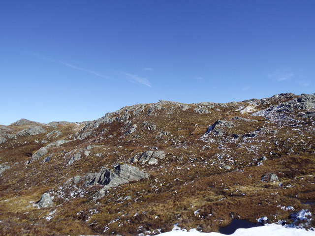
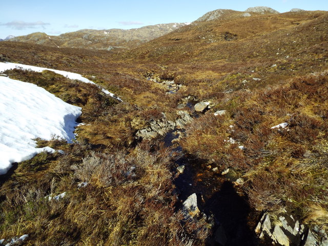
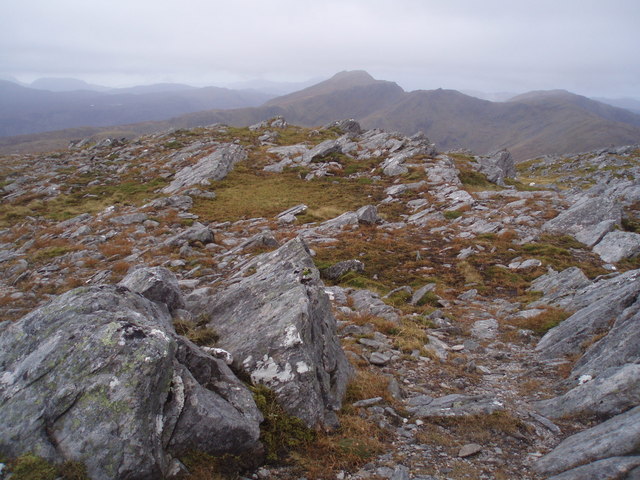
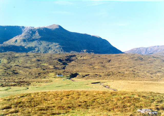
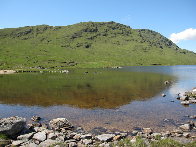
Coire Dubh is a glacial valley located in Ross-shire, Scotland. The valley is surrounded by steep, rocky cliffs and is characterized by its rugged and dramatic landscape. It is a popular destination for hikers and outdoor enthusiasts looking to explore the Scottish Highlands.

The valley is home to a variety of flora and fauna, including heather, mosses, and lichens, as well as red deer and birds of prey such as golden eagles and peregrine falcons. The clear waters of the river that runs through the valley provide a habitat for fish such as salmon and trout.

Coire Dubh is also known for its archaeological significance, with evidence of human habitation dating back to prehistoric times. The remains of ancient settlements and stone circles can be found in the valley, offering a glimpse into the area's rich history.

Overall, Coire Dubh is a picturesque and captivating destination for those looking to immerse themselves in the natural beauty and history of the Scottish Highlands.

If you have any feedback on the listing, please let us know in the comments section below.

Coire Dubh Images

Images are sourced within 2km of 57.340672/-5.2929407 or Grid Reference NH0132. Thanks to Geograph Open Source API. All images are credited.

Faochaig View from the west, across Coire Shlat.
Faochaig
View from the west, across Coire Shlat.
Waterfall at end of Allt a' Choire Chaoil Looking up stream towards Coire Shlat.
Waterfall at end of Allt a' Choire Chaoil
Looking up stream towards Coire Shlat.
General view NH0031 Eastern of three coires radiating out from this view point.
In former times this was probably an area of summer grazing, now primarily used for deer stalking.
General view NH0031
Eastern of three coires radiating out from this view point. In former times this was probably an area of summer grazing, now primarily used for deer stalking.
Tigh Uisdein In English, "Hugh's House". 
Located in the centre of the photo.
On the 1858 OS 6" the building is shown as "roofed", but on the 1902 revision it is shown as a "yard".  Neither edition shows a path from Coire-domhain as is the current situation.
Tigh Uisdein
In English, "Hugh's House". Located in the centre of the photo. On the 1858 OS 6" the building is shown as "roofed", but on the 1902 revision it is shown as a "yard". Neither edition shows a path from Coire-domhain as is the current situation.
Faochaig summit Looking back to Sguman Coinntich from the summit cairn (868m).
Faochaig summit
Looking back to Sguman Coinntich from the summit cairn (868m).
Rocky ridge bounding shallow coire on Carn na Saobhaidhe in Killilan Forest, Kintail
View south from the slopes of Carn na Sean-luibe in Killilan Forest, Kintail
Looking across coire east of Allt a' Choire Dhuibh in Killilan Forest
Burn course east of Carn na Saobhaidhe in Killilan Forest, Kintail
Burn east of Carn na Saobhaidhe in Killilan Forest, Kintail
Rocky skyline east of Carn na Saobhaidhe in Killilan Forest, Kintail
Tributary of Allt a' Choire Dhuibhe in Killilan Forest
Rock pimple near Carn na Saobhaidhe in Killilan Forest
Meandering burns west of Bealach nam Luib Feadaig in Killilan Forest
Burn course above waterfalls near Carn na Saobhaidhe in Killilan Forest
Upper waterfall on burn course near Carn na Saobhaidhe in Killilan Forest
Lower waterfall on burn course near Carn na Saobhaidhe in Killilan Forest
Faochaig Summit View Looking west from the summit of the Corbett, Faochaig - the whelk - to Sgumman Coinntich another Corbett.
Faochaig Summit View
Looking west from the summit of the Corbett, Faochaig - the whelk - to Sgumman Coinntich another Corbett.
Show me another place!

Coire Dubh is located at Grid Ref: NH0132 (Lat: 57.340672, Lng: -5.2929407)

Unitary Authority: Highland

Police Authority: Highlands and Islands

What 3 Words

///mallets.guardian.comic. Near Lochcarron, Highland

Related Wikis

Aonach Buidhe

Aonach Buidhe (899 m) is a remote mountain in the Northwest Highlands of Ross and Cromarty in northwest Scotland. The nearest village is Dornie. The usual...

Sguman Coinntich

Sguman Coinntich (879 m) is a mountain in the Northwest Highlands, Scotland, east of the village of Dornie in Ross-shire. Sguman Coinntich is the highest...

Beinn Dronaig

Beinn Dronaig (797 m) is a mountain in the Northwest Highlands of Wester Ross, Scotland. A remote peak northeast of the village of Dornie, it is located...

Falls of Glomach

The Falls of Glomach, in Ross-shire, Scotland, is one of the tallest waterfalls in Britain, with a drop of 113 m (370 ft). The falls border Kintail, donated...

Have you been to Coire Dubh?

Leave your review of Coire Dubh below (or comments, questions and feedback).