Coire Breac

Corrie (Glacial Valley) in Ross-shire

Scotland

Coire Breac

Cliffs on south side of Ruadh Stac Mor Looking west-north-west up a burn that flows down from Poll Eadhar Dha Stac, below cliffs on the south flank of Ruadh Stac Mor. Poll Eadhar Dha Stac is the bealach visible below the cliffs on the left skyline.
Cliffs on south side of Ruadh Stac Mor Credit: Andrew McMahon

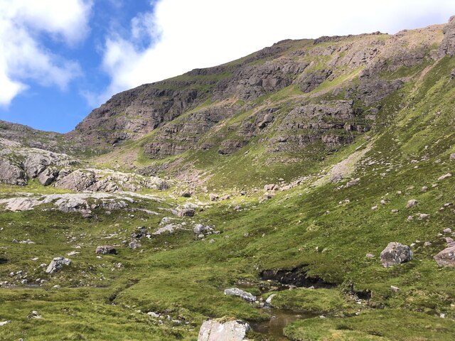
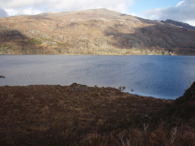
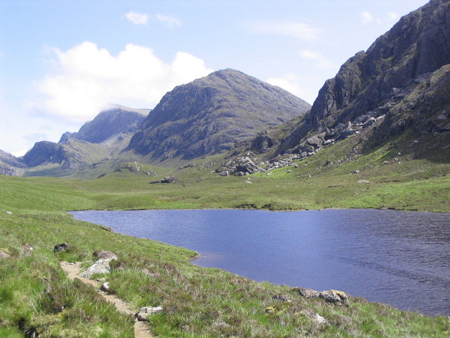
Coire Breac, also known as Corrie, is a glacial valley located in Ross-shire, Scotland. Nestled amidst the stunning Scottish Highlands, this natural wonder offers breathtaking views and an array of outdoor activities for nature enthusiasts and adventure seekers.

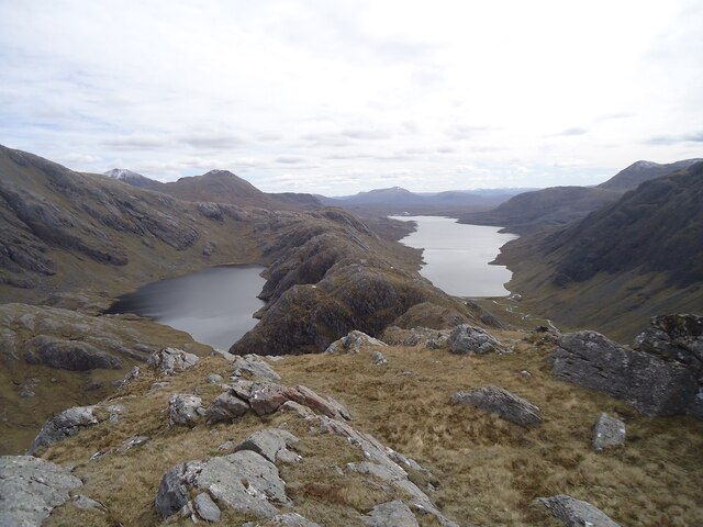
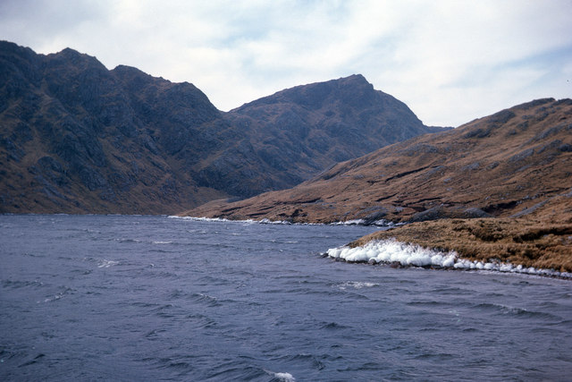
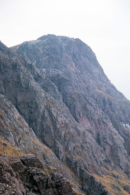
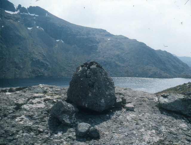
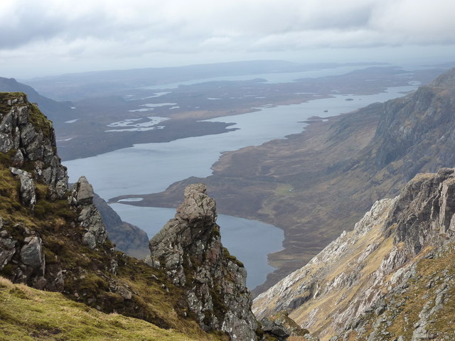
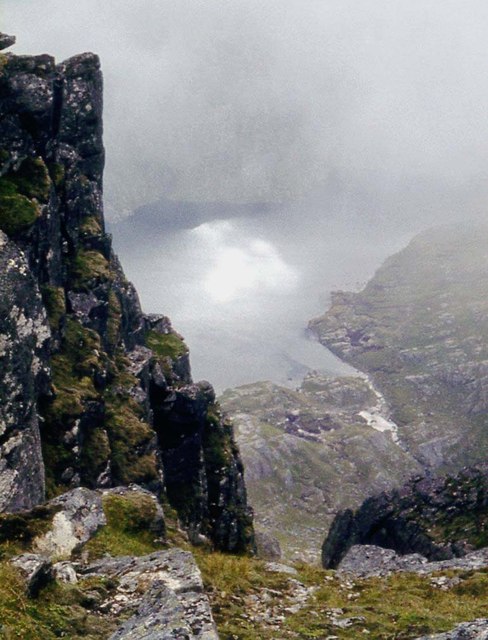
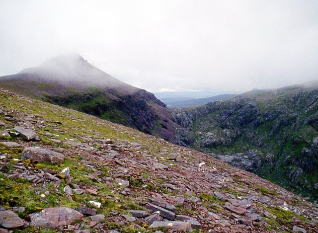
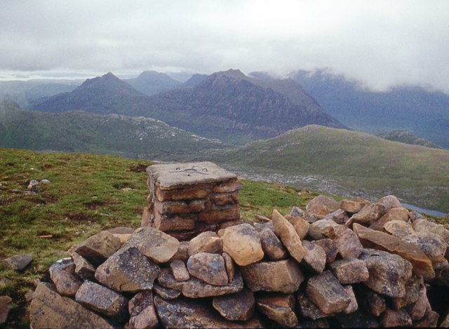
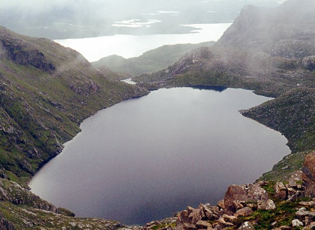
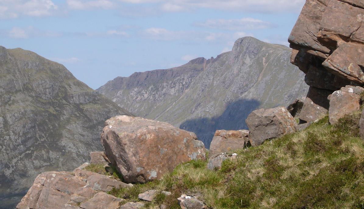
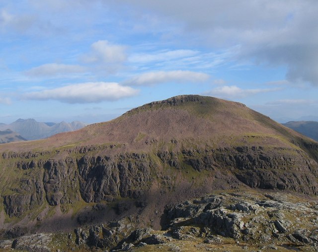
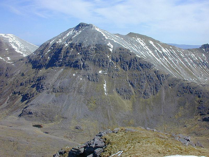
The valley is characterized by its U-shaped glacial morphology, which was carved out by the movement of glaciers during the last ice age. Surrounded by towering mountains, Coire Breac boasts a rugged and dramatic landscape, with steep slopes and craggy cliffs that add to its charm.

The valley is home to diverse flora and fauna due to its unique geographical features. Visitors can expect to see heather moorland, grassy slopes, and scattered patches of woodland. The area is also rich in wildlife, with red deer, mountain hares, and golden eagles being common sights.

Coire Breac offers a range of outdoor activities for all levels of fitness and interests. Hiking is a popular choice, with various trails catering to different abilities. The valley also provides opportunities for rock climbing, with its challenging cliffs attracting climbers from all over.

For those seeking a more relaxed experience, simply taking in the breathtaking scenery and enjoying a picnic in the tranquil surroundings is a perfect option. Coire Breac is also a photographer's paradise, offering countless opportunities to capture the raw beauty of the Highlands.

In summary, Coire Breac is a magnificent glacial valley in Ross-shire, Scotland. Its stunning landscape, diverse wildlife, and range of outdoor activities make it a must-visit destination for nature lovers and adventure enthusiasts alike.

If you have any feedback on the listing, please let us know in the comments section below.
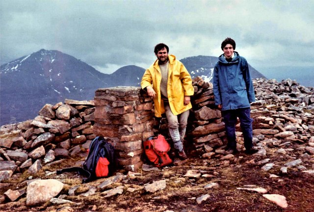
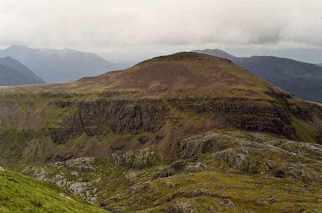
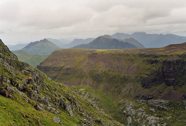
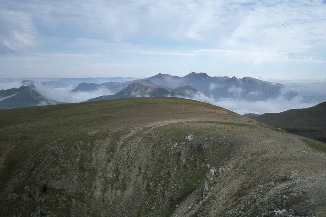
Coire Breac Images

Images are sourced within 2km of 57.719432/-5.3585312 or Grid Reference NH0074. Thanks to Geograph Open Source API. All images are credited.

Cliffs on south side of Ruadh Stac Mor Looking west-north-west up a burn that flows down from Poll Eadhar Dha Stac, below cliffs on the south flank of Ruadh Stac Mor. Poll Eadhar Dha Stac is the bealach visible below the cliffs on the left skyline.
Cliffs on south side of Ruadh Stac Mor
Looking west-north-west up a burn that flows down from Poll Eadhar Dha Stac, below cliffs on the south flank of Ruadh Stac Mor. Poll Eadhar Dha Stac is the bealach visible below the cliffs on the left skyline.
Ridge of Beinn Tharsuinn Chaol This is the south-east ridge of Beinn Tharsuinn Chaol (652m), with Gorm Loch Mor on the left and Lochan Fada on the right. The lower slopes of A' Mhaighdean, usually regarded as the most remote Munro, are on the left. In the far distance the hill beyond Lochan Fada is Fionn Bheinn (933m).
Ridge of Beinn Tharsuinn Chaol
This is the south-east ridge of Beinn Tharsuinn Chaol (652m), with Gorm Loch Mor on the left and Lochan Fada on the right. The lower slopes of A' Mhaighdean, usually regarded as the most remote Munro, are on the left. In the far distance the hill beyond Lochan Fada is Fionn Bheinn (933m).
Beinn Tharsuinn Chaol across Gorm Loch Mòr A cold day with ice lingering at the loch side. The highest point of Beinn Tharsuinn Chaol at 641 m (NG 9897874445) is the prominent peak in the image.  Curiously only a digital version of OS mapping has identified the Grid Reference as the summit of the elongated ridge of Beinn Tharsuinn Chaol.
Beinn Tharsuinn Chaol across Gorm Loch Mòr
A cold day with ice lingering at the loch side. The highest point of Beinn Tharsuinn Chaol at 641 m (NG 9897874445) is the prominent peak in the image. Curiously only a digital version of OS mapping has identified the Grid Reference as the summit of the elongated ridge of Beinn Tharsuinn Chaol.
Summit of A' Mhaighdean The summit was the realised objective of a day's climb from a campsite at the south end of the Dubh Loch causeway.  The tents had collapsed in the wind in the early morning and we returned from the Munro to a session of tent-mending. We took a direct route up A' Mhaighdean from the outflow of Gorm Loch Mor.
Summit of A' Mhaighdean
The summit was the realised objective of a day's climb from a campsite at the south end of the Dubh Loch causeway. The tents had collapsed in the wind in the early morning and we returned from the Munro to a session of tent-mending. We took a direct route up A' Mhaighdean from the outflow of Gorm Loch Mor.
Ruadh Stac Mor The trig point and shelter on the summit of Ruadh Stac Mor.

 MacAoidh (left) and fellow Geograph contributor Leslie Barrie after a long hard day climbing the Fisherfield 6 from Shenavall : Beinn a' Chlaidheimh, Sgurr Ban, Mullach Coire Mhic Fhearchair, Beinn Tarsuinn, A' Mhaighdean and Ruadh Stac Mor.

Incidentially Ruadh Stac Mor was my 200th Munro.
Ruadh Stac Mor
The trig point and shelter on the summit of Ruadh Stac Mor. MacAoidh (left) and fellow Geograph contributor Leslie Barrie after a long hard day climbing the Fisherfield 6 from Shenavall : Beinn a' Chlaidheimh, Sgurr Ban, Mullach Coire Mhic Fhearchair, Beinn Tarsuinn, A' Mhaighdean and Ruadh Stac Mor. Incidentially Ruadh Stac Mor was my 200th Munro.
Approaches to Fuar Loch Mòr As the stalkers path climbs south east, Fuar Loch Mòr itself is hidden at first by this plateau. Enticing views of A' Mhaighdean rise beyond, however.
Approaches to Fuar Loch Mòr
As the stalkers path climbs south east, Fuar Loch Mòr itself is hidden at first by this plateau. Enticing views of A' Mhaighdean rise beyond, however.
The north west ridge of A' Mhaighdean Seen from near A' Mhaighdean's northern summit. In the distance, Fionn Loch can be seen on the left and Beinn a' Chaisgeinn Mòr on the right.
The north west ridge of A' Mhaighdean
Seen from near A' Mhaighdean's northern summit. In the distance, Fionn Loch can be seen on the left and Beinn a' Chaisgeinn Mòr on the right.
Ruadh Stac Mòr, from A' Mhaighdean Seen from near the northern summit.
Ruadh Stac Mòr, from A' Mhaighdean
Seen from near the northern summit.
The northern tail of Ruadh Stac Mòr Seen from low down on the final climb up A'Mhaighdean. Beinn Dearg Mòr can be seen beyond, with Beinn Dearg Beag to its left, and An Teallach in the distance.
The northern tail of Ruadh Stac Mòr
Seen from low down on the final climb up A'Mhaighdean. Beinn Dearg Mòr can be seen beyond, with Beinn Dearg Beag to its left, and An Teallach in the distance.
An Teallach from A' Mhaighdean Looking NNE from the 967m summit with the northern spur to the 948m summit ahead. Beyond is the spiky profile of An Teallach with Beinn Dearg Mor intervening.
An Teallach from A' Mhaighdean
Looking NNE from the 967m summit with the northern spur to the 948m summit ahead. Beyond is the spiky profile of An Teallach with Beinn Dearg Mor intervening.
Fuar Loch Mor
Fuar Loch Mor
A' Mhaighdean Close to the top looking towards Poolewe.
A' Mhaighdean
Close to the top looking towards Poolewe.
The precipice above Gorm Loch Mhòr This remote area is spectacular with lochs at many levels among rocky peaks.
The precipice above Gorm Loch Mhòr
This remote area is spectacular with lochs at many levels among rocky peaks.
Fuar Loch Mòr
Fuar Loch Mòr
Lower slopes of Ruadh Stac Mòr drop to Fuar Loch Mòr
Slopes of Ruadh Stac Mòr
Summit of Ruadh Stac Mòr looking to the Beinn Deargs
Fuar Loch Mòr
Fuar Loch Mòr
Show me another place!

Coire Breac is located at Grid Ref: NH0074 (Lat: 57.719432, Lng: -5.3585312)

Unitary Authority: Highland

Police Authority: Highlands and Islands

What 3 Words

///manicured.host.observer. Near Kinlochewe, Highland

Related Wikis

A' Mhaighdean

A' Mhaighdean is one of the least accessible of the munros in northern Scotland. It is 8 miles (13 km) north of Kinlochewe but most easily accessible from...

Ruadh Stac Mor

Ruadh Stac Mor or Ruadh-Stac Mòr (Gaelic) is a mountain with a height of 919 metres (3,015 ft) in the Northwest Highlands of Scotland. It is located in...

Beinn Lair

Beinn Lair (859 m) is a mountain in the Northwest Highlands, Scotland. It lies in the Letterewe estate on the northeastern shore of Loch Maree in Wester...

Lochan Fada, Letterewe

Lochan Fada (The long long) is a large remote and deep freshwater loch that is located three miles north-east of Loch Maree in Wester Ross in the Northwest...

Beinn Tarsuinn (Munro)

Beinn Tarsuinn (934 m) is a mountain in the Northwest Highlands of Wester Ross, Scotland. It lies in the heart of the remote Dundonnell and Fisherfield...

Meall Mheinnidh

Meall Mheinnidh (722 m) is a mountain in the Northwest Highlands of Scotland. It lies in the Wester Ross region, north of Loch Maree. A very remote peak...

Mullach Coire Mhic Fhearchair

Mullach Coire Mhic Fhearchair (1,015 m) is a mountain in the Northwest Highlands of Wester Ross, Scotland. It lies in the remote Dundonnell and Fisherfield...

Dundonnell and Fisherfield Forest

The Dundonnell and Fisherfield Forest covers a large mountainous area of Wester Ross in the Northwest Highlands of Scotland, lying between Loch Maree and...

Have you been to Coire Breac?

Leave your review of Coire Breac below (or comments, questions and feedback).