Coir' a' Chriostail

Corrie (Glacial Valley) in Argyllshire

Scotland

Coir' a' Chriostail

The navigable channel of Loch Tarbert
The navigable channel of Loch Tarbert Credit: Alan Reid

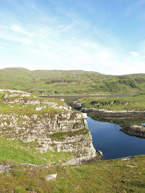
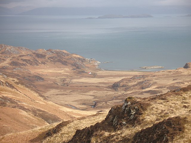
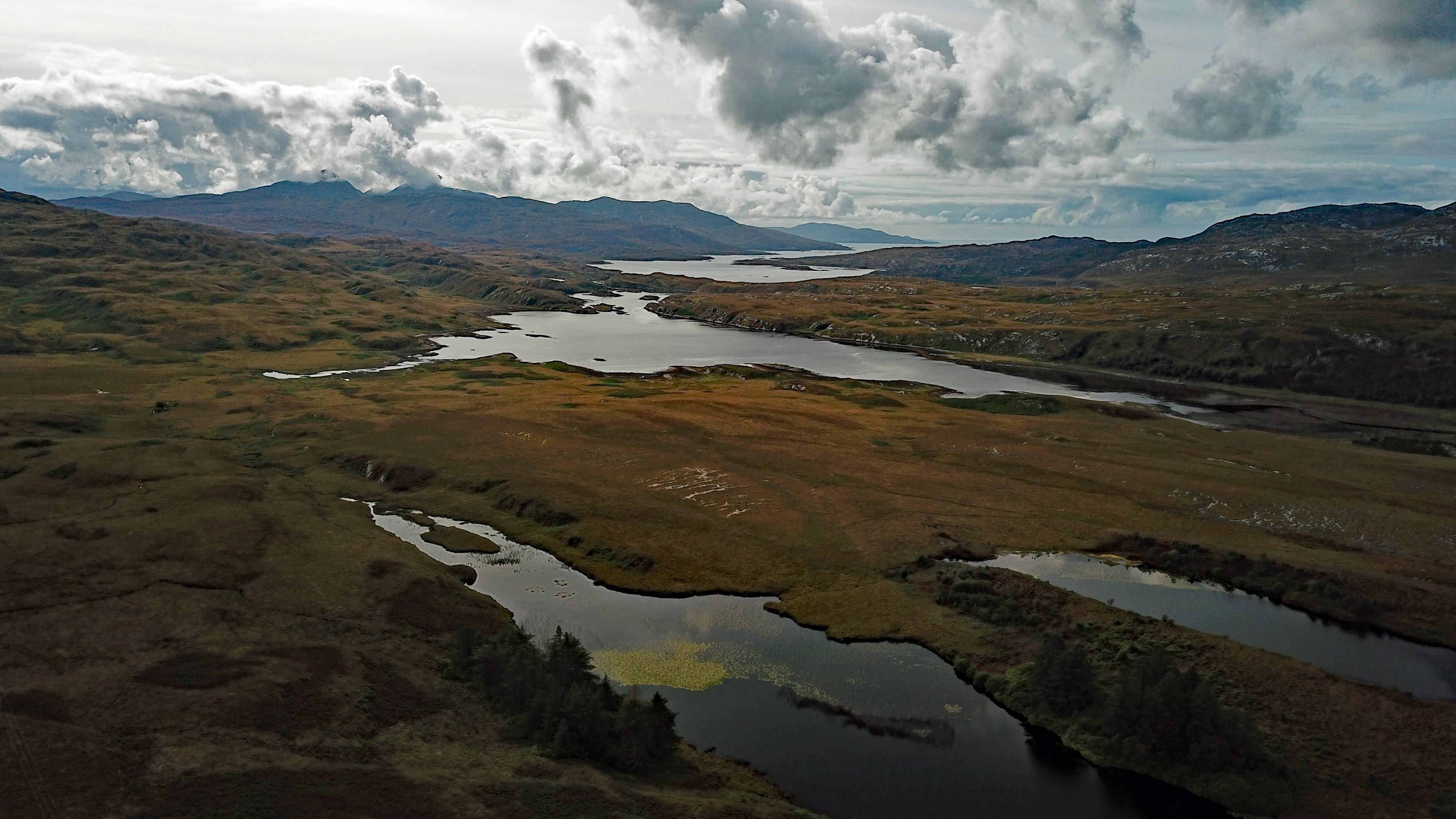
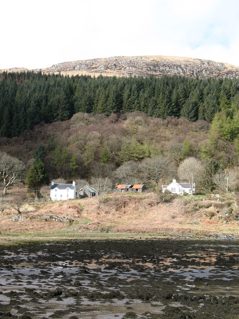
Coir' a' Chriostail, located in Argyllshire, Scotland, is a stunning glacial valley known for its breathtaking natural beauty. The valley, also known as Corrie, is surrounded by rugged mountains and rolling hills, creating a picturesque and tranquil setting for visitors to explore.

The valley is home to a variety of flora and fauna, making it a popular destination for nature lovers and outdoor enthusiasts. Hiking and walking trails wind through the valley, offering visitors the opportunity to immerse themselves in the stunning landscape and wildlife.

Coir' a' Chriostail is also known for its rich history and cultural significance. The valley is dotted with ancient ruins and archaeological sites, providing a glimpse into the area's past. Visitors can explore these historic sites and learn about the valley's fascinating history.

Overall, Coir' a' Chriostail is a must-visit destination for those looking to experience the natural beauty and history of Argyllshire. Whether you're interested in hiking, wildlife spotting, or exploring ancient ruins, this glacial valley has something to offer for everyone.

If you have any feedback on the listing, please let us know in the comments section below.

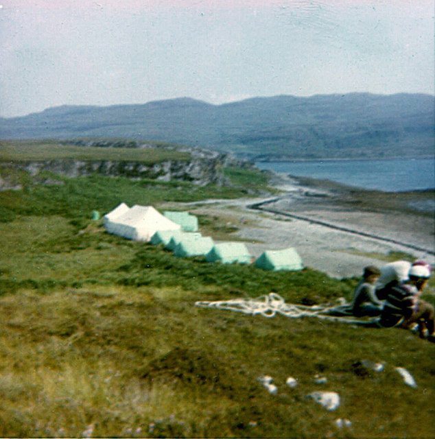
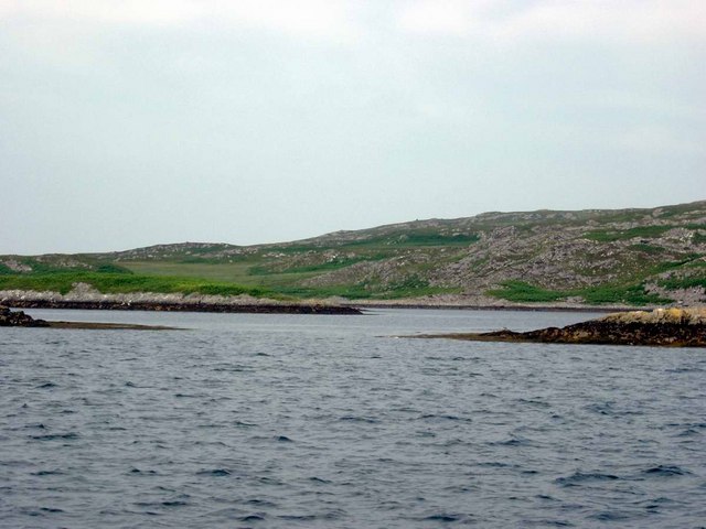
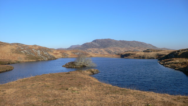
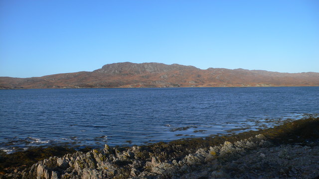
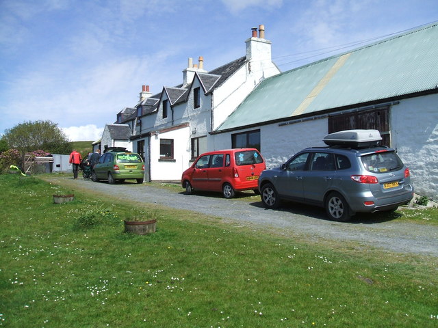
Coir' a' Chriostail Images

Images are sourced within 2km of 55.980005/-5.9085405 or Grid Reference NR5683. Thanks to Geograph Open Source API. All images are credited.

The navigable channel of Loch Tarbert
Tents on the beach near Cruib Lodge The temporary campsite was set up for the Schools Hebridean Society <span class="nowrap"><a title="http://www.schools-hebridean-society.co.uk" rel="nofollow ugc noopener" href="http://www.schools-hebridean-society.co.uk">Link</a><img style="margin-left:2px;" alt="External link" title="External link - shift click to open in new window" src="https://s1.geograph.org.uk/img/external.png" width="10" height="10"/></span> expedition in 1973. The exact location of photographer is an estimate as it was a long time ago!
Tents on the beach near Cruib Lodge
The temporary campsite was set up for the Schools Hebridean Society LinkExternal link expedition in 1973. The exact location of photographer is an estimate as it was a long time ago!
Cruib Bothy Cruib Bothy, formerly known as Cruib Lodge, and marked as such on OS maps, belongs to the Ruantallain Estate, but is maintained as an unlocked bothy, free for anyone to use, by the Mountain Bothies Association (MBA).  The MBA assumed responsibility for it in 2012, and it was extensively refurbished at that time, as can be seen by comparing this photograph with the one taken by Gordon Brown in 2006.
Cruib Bothy
Cruib Bothy, formerly known as Cruib Lodge, and marked as such on OS maps, belongs to the Ruantallain Estate, but is maintained as an unlocked bothy, free for anyone to use, by the Mountain Bothies Association (MBA). The MBA assumed responsibility for it in 2012, and it was extensively refurbished at that time, as can be seen by comparing this photograph with the one taken by Gordon Brown in 2006.
Loch Tarbert, Isle of Jura This narrow 'gut' called the Chumhainn Bhig (Little Strait) connects the middle loch to the passage leading to the inner loch.  You can just see two of the leading marks, beyond the cliff on the left of the picture.
Loch Tarbert, Isle of Jura
This narrow 'gut' called the Chumhainn Bhig (Little Strait) connects the middle loch to the passage leading to the inner loch. You can just see two of the leading marks, beyond the cliff on the left of the picture.
Cruib Lodge, Loch Tarbert, Jura
Skerries in Middle Loch Tarbert Eilean Ard on the right, Eilean Dubh a Chumhain Mhoir on the left.
Skerries in Middle Loch Tarbert
Eilean Ard on the right, Eilean Dubh a Chumhain Mhoir on the left.
Abhainn a' Ghleann Duirch reaches the sea The Glen Duirch stream goes over a waterfall, then a last couple of bends before reaching the estuary, which is an almost enclosed sea loch that empties at low tide. It is part of Loch Tarbert.
Abhainn a' Ghleann Duirch reaches the sea
The Glen Duirch stream goes over a waterfall, then a last couple of bends before reaching the estuary, which is an almost enclosed sea loch that empties at low tide. It is part of Loch Tarbert.
Un-named Jura lochan There are so many lochans in this part of Jura (must be the Jura version of the Lake District ! ) that this one is not named on the map, though it may have a local name as it is fished.
Un-named Jura lochan
There are so many lochans in this part of Jura (must be the Jura version of the Lake District ! ) that this one is not named on the map, though it may have a local name as it is fished.
Above Loch Tarbert Bracken covered slopes above Loch Tarbert. What looks like a river mouth across Loch Tarbert is actually the entrance to the almost completely enclosed Upper Loch Tarbert, a very safe anchorage.
Above Loch Tarbert
Bracken covered slopes above Loch Tarbert. What looks like a river mouth across Loch Tarbert is actually the entrance to the almost completely enclosed Upper Loch Tarbert, a very safe anchorage.
Lochan with Cruib in the background
Heading East Above Loch Tarbert Following an 'agrocat' track down towards Garbh Uisge, with Cruib in the background
Heading East Above Loch Tarbert
Following an 'agrocat' track down towards Garbh Uisge, with Cruib in the background
Scree Slope on the West Flank of Cruib Looking southwest over a series of lochans towards Loch Tarbert.
Scree Slope on the West Flank of Cruib
Looking southwest over a series of lochans towards Loch Tarbert.
West of Cruib Walking north-northeast from Cruib Lodge.
West of Cruib
Walking north-northeast from Cruib Lodge.
Looking north across Loch Tarbert with Cruib above the north shore
Wreck on the beach at Sailean a' Gharbh-uisge This wreck, assumed because of the winding gear, to be a wooden-hulled fishing boat, is on the stony beach just south of the Garbh Uisge outflow.
Wreck on the beach at Sailean a' Gharbh-uisge
This wreck, assumed because of the winding gear, to be a wooden-hulled fishing boat, is on the stony beach just south of the Garbh Uisge outflow.
Cumnann Beag The start of the narrow channel between Inner Loch Tarbert and Top Pool
Cumnann Beag
The start of the narrow channel between Inner Loch Tarbert and Top Pool
Entrance of Cumnann Beag The Loch Tarbert end of Cumnann Beag, the channel between Inner Loch Tarbert and Top Pool.
Entrance of Cumnann Beag
The Loch Tarbert end of Cumnann Beag, the channel between Inner Loch Tarbert and Top Pool.
Unnamed Lochan The unnamed lochan at NR548825, with the western end of Cruib behind.
Unnamed Lochan
The unnamed lochan at NR548825, with the western end of Cruib behind.
Show me another place!

Coir' a' Chriostail is located at Grid Ref: NR5683 (Lat: 55.980005, Lng: -5.9085405)

Unitary Authority: Argyll and Bute

Police Authority: Argyll and West Dunbartonshire

What 3 Words

///passenger.dampen.sitting. Near Craighouse, Argyll & Bute

Nearby Locations

Coir' a' Chriostail

Related Wikis

Battle of the Western Isles

The Battle of the Western Isles was a series of conflicts in 1585 and 1586 on the islands of Jura, Islay, Mull and Tiree, Scotland as well as the peninsula...

Loch Tarbert, Jura

Loch Tarbert is a sea loch on the west coast of Jura, an island in Scotland. As the name Tarbert suggests, it comes close to cutting the island in half...

Tarbert, Jura

Tarbert is a hamlet on Tarbert Bay, on the east coast of the island of Jura, in the council area of Argyll and Bute, Scotland. The Tarbert estate is owned...

Lagg, Jura

Lagg is a hamlet on Lagg Bay, on the east coast of the island of Jura, in the council area of Argyll and Bute, Scotland. It is on the A846 8 miles (13...

Have you been to Coir' a' Chriostail?

Leave your review of Coir' a' Chriostail below (or comments, questions and feedback).