Lower Strensham

Settlement in Worcestershire Wychavon

England

Lower Strensham

Clouds & Floods Looking South along the M5 from Strensham under a stormy sky. The river Avon is in flood and to the left is the edge of the Cotswolds.
Clouds & Floods Credit: David Stowell

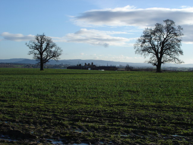
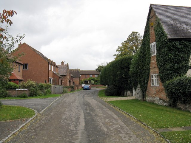
Lower Strensham is a small village located in the county of Worcestershire, England. Situated on the banks of the River Avon, it is part of the Wychavon District and lies approximately 10 miles southeast of Worcester. The village is surrounded by picturesque countryside, offering residents and visitors a tranquil and rural setting.

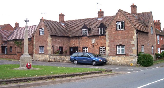
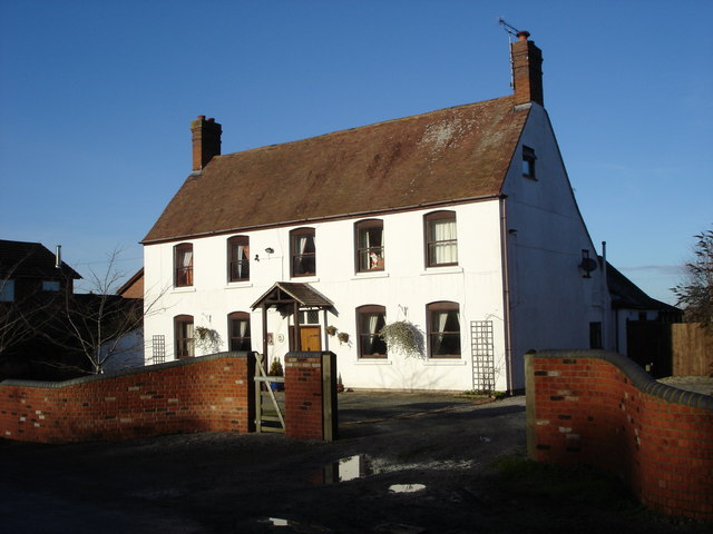
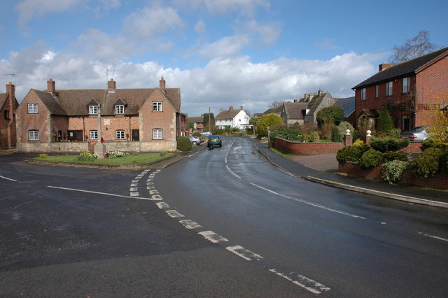
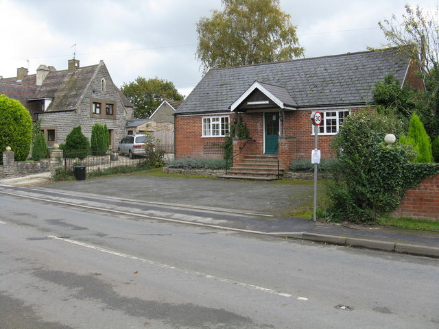
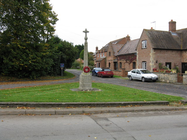
Lower Strensham is known for its charming architecture, with many traditional stone cottages and buildings that reflect its historical past. The village has a close-knit community and a population of around 400 residents.

Despite its small size, Lower Strensham has a few amenities to cater to the needs of its residents. These include a village hall, which hosts various community events and gatherings, as well as a local pub that serves as a social hub. The village also benefits from a primary school, providing education for the younger population.

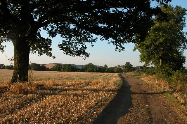
The surrounding area offers numerous opportunities for outdoor activities. The nearby River Avon provides scenic walks and fishing spots, while the Worcestershire countryside is ideal for hiking, cycling, and exploring nature.

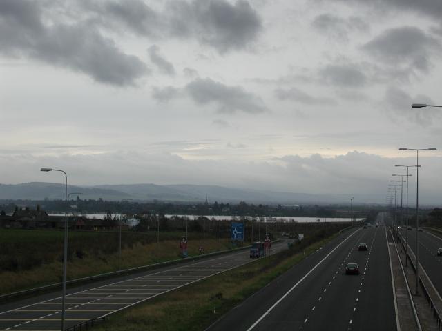
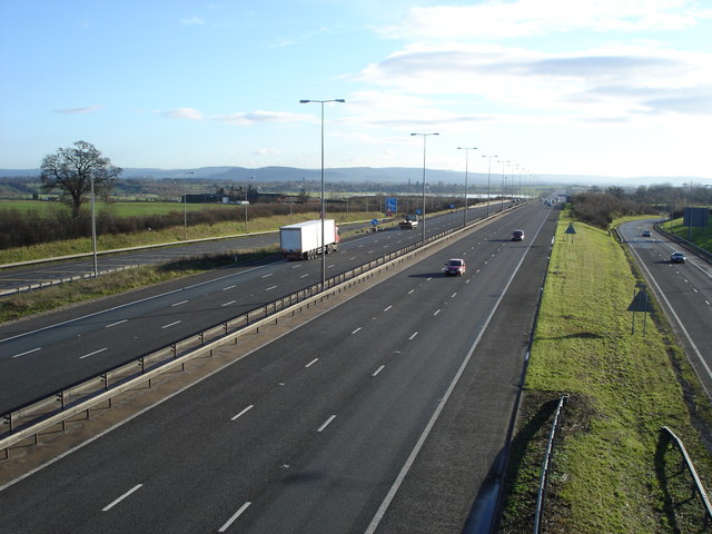
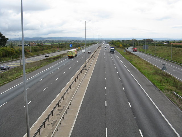
Lower Strensham enjoys good transport links, with the M5 motorway passing close by, providing convenient access to Worcester and other major cities in the region. The village is also well-connected to nearby towns and villages through a network of local roads.

Overall, Lower Strensham is a peaceful and idyllic village, offering a charming countryside lifestyle while remaining accessible to nearby amenities and transport links.

If you have any feedback on the listing, please let us know in the comments section below.

Lower Strensham Images

Images are sourced within 2km of 52.064012/-2.141464 or Grid Reference SO9040. Thanks to Geograph Open Source API. All images are credited.

Clouds & Floods Looking South along the M5 from Strensham under a stormy sky. The river Avon is in flood and to the left is the edge of the Cotswolds.
Clouds & Floods
Looking South along the M5 from Strensham under a stormy sky. The river Avon is in flood and to the left is the edge of the Cotswolds.
Strensham War Memorial and Almshouses. The almshouses bear a crest and date of 1697.
Strensham War Memorial and Almshouses.
The almshouses bear a crest and date of 1697.
Stubble field on Bredon Fields Farm Beyond this stubble field on Bredon Fields Farm is Strensham Water Treatment Works which takes water from its intake on the River Severn near Upton-upon-Severn and after treatment the water is then pumped to Coventry.
Stubble field on Bredon Fields Farm
Beyond this stubble field on Bredon Fields Farm is Strensham Water Treatment Works which takes water from its intake on the River Severn near Upton-upon-Severn and after treatment the water is then pumped to Coventry.
Strensham South Motorway Services Strensham South Motorway Services, on the M5.
Strensham South Motorway Services
Strensham South Motorway Services, on the M5.
Bredon Field Farm Bredon Field Farm viewed from Mill Lane. The Cotswolds can be seen on the horizon.
Bredon Field Farm
Bredon Field Farm viewed from Mill Lane. The Cotswolds can be seen on the horizon.
The M5 junction 8 View to the south from the bridge carrying Mill Lane. Bredon Field Farm can be seen above the white lorry, one mile south of this junction the M5 crosses the River Avon which at the time of this picture was in flood. The Cotswolds can be seen on the horizon.
The M5 junction 8
View to the south from the bridge carrying Mill Lane. Bredon Field Farm can be seen above the white lorry, one mile south of this junction the M5 crosses the River Avon which at the time of this picture was in flood. The Cotswolds can be seen on the horizon.
Former public house, Strensham This used to be the Cavalier and previously the Pelican Inn, though it is many years since this was a pub.
Former public house, Strensham
This used to be the Cavalier and previously the Pelican Inn, though it is many years since this was a pub.
Strensham Strensham village centre, on the left is the war memorial and almshouses.
Strensham
Strensham village centre, on the left is the war memorial and almshouses.
Strensham south M5 motorway services. Newly rebuilt.
Strensham south M5 motorway services.
Newly rebuilt.
Strensham Court Mews These former mews belonged to Strensham Court (demolished in the 1970s) and were converted to residential accommodation in the 1980s.
Strensham Court Mews
These former mews belonged to Strensham Court (demolished in the 1970s) and were converted to residential accommodation in the 1980s.
Highways depot at Strensham Highsway depot located near Strensham's southbound services.
Highways depot at Strensham
Highsway depot located near Strensham's southbound services.
Back lane in Upper Strensham
Strensham Village Hall Although situated in Upper Strensham, the village hall is labelled without any distinction.
Strensham Village Hall
Although situated in Upper Strensham, the village hall is labelled without any distinction.
Strensham war memorial and village green
Upper Strensham telephone box and bus shelter The telephone box still worked when photographed, but you'll have a fair old wait for a bus.
Upper Strensham telephone box and bus shelter
The telephone box still worked when photographed, but you'll have a fair old wait for a bus.
Parting of the (motor)ways Centre, the M5 heads straight across the Avon valley pell mell toward Gloucester and Bristol.  On either side are the slip roads to the M50 which opened rather earlier than the 'main line'.  Sadly, junction 8 of the M5 is no longer a classic UK "trumpet" design, just a commonplace roundabout.
Parting of the (motor)ways
Centre, the M5 heads straight across the Avon valley pell mell toward Gloucester and Bristol. On either side are the slip roads to the M50 which opened rather earlier than the 'main line'. Sadly, junction 8 of the M5 is no longer a classic UK "trumpet" design, just a commonplace roundabout.
Elegant engineering The M5, just north of the "new" M50 junction, at which point there are multiple flows on either side for the junction and accesses to/from Strensham services. Nicely engineered with smooth flowing curves and adequate land take to ensure that there are no sudden conflicts.  Not as much fun as the old "trumpet" design for junction 8 though!
Elegant engineering
The M5, just north of the "new" M50 junction, at which point there are multiple flows on either side for the junction and accesses to/from Strensham services. Nicely engineered with smooth flowing curves and adequate land take to ensure that there are no sudden conflicts. Not as much fun as the old "trumpet" design for junction 8 though!
Show me another place!

Lower Strensham is located at Grid Ref: SO9040 (Lat: 52.064012, Lng: -2.141464)

Administrative County: Worcestershire

District: Wychavon

Police Authority: West Mercia

What 3 Words

///sunbeam.competing.readers. Near Eckington, Worcestershire

Related Wikis

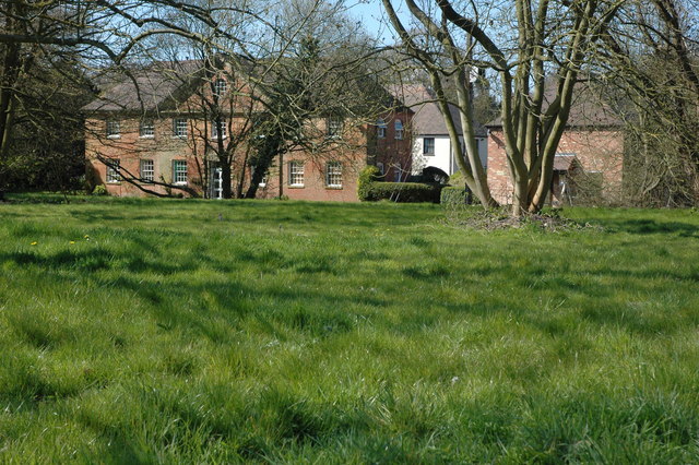
St John the Baptist's Church, Strensham

St John the Baptist's Church is a redundant Anglican church in the village of Strensham, Worcestershire, England. It is recorded in the National Heritage...
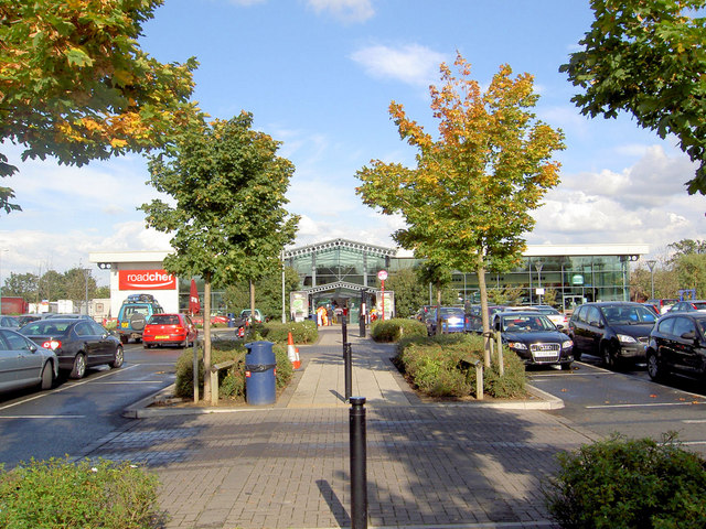
Strensham services

Strensham services is a motorway service station on the M5 in Worcestershire, England. It is operated by Roadchef. In August 2011, it was rated as 4 stars...

Strensham

Strensham is a village in the Wychavon district of Worcestershire. In the 2001 census, the civil parish of Strensham had a population of 314 across 127...

Hill Croome

Hill Croome is a village, and a civil parish which covers 1000 acres, in the Malvern Hills District in the county of Worcestershire, England. Historically...

Eckington railway station

Eckington railway station was a railway station to serve Eckington in Worcestershire. The station was opened by the Birmingham and Gloucester Railway...

Eckington, Worcestershire

Eckington is a small village near to the southern border of the English county of Worcestershire, according to the 2001 census it had a population of 1...

Bow Brook

The Bow Brook is a substantial brook that flows for 28.8 miles (46.3 km) through Worcestershire, England. It is a lower tributary of the River Avon which...

Eckington Bridge

Eckington Bridge is a stone bridge over the River Avon in Eckington in the English county of Worcestershire. It is a Grade II* listed building and has...

Nearby Amenities

Located within 500m of 52.064012,-2.141464
Moat Farm
Naptan AtcoCode: 2000G065400
Naptan Bearing: N
Naptan BusStopType: CUS
Naptan CommonName: Moat Farm
Naptan Crossing: Baughton Lane
Naptan Indicator: opp
Naptan Landmark: Moat Farm
Naptan NaptanCode: wocdtdtm
Naptan Street: Bourne Road
Naptan Verified: no
Source: naptan_import
Lat/Long: 52.062141/-2.1431103
Bench
Lat/Long: 52.0630525/-2.1427842
Post Box
Collection Times: Mo-Fr 16:15; Sa 09:00
Post Box Type: lamp
Ref: WR8 145
Royal Cypher: EIIR
Royal Cypher Wikidata: Q33102113
Source: GPS Survey
Lat/Long: 52.0637271/-2.1422905
Power: pole
Lat/Long: 52.067424/-2.1377194
Location Transition: yes
Power: pole
Lat/Long: 52.0678482/-2.1397938
Power: pole
Lat/Long: 52.0630088/-2.1348915
Power: pole
Lat/Long: 52.0630461/-2.1347123
Power: pole
Lat/Long: 52.0631065/-2.1344234
Moat Farm
Power: pole
Transformer: distribution
Voltage Primary: 11000
Lat/Long: 52.0633109/-2.1419294
Power: pole
Lat/Long: 52.0635878/-2.1350215
Power: pole
Lat/Long: 52.0636064/-2.1356224
Power: pole
Lat/Long: 52.0636124/-2.1409715
Power: pole
Lat/Long: 52.063856/-2.1356542
Power: pole
Lat/Long: 52.0639277/-2.1399787
Power: pole
Lat/Long: 52.0642014/-2.1363707
Power: pole
Lat/Long: 52.0642391/-2.1389818
Power: pole
Lat/Long: 52.0645558/-2.137986
Power: pole
Lat/Long: 52.0648107/-2.136464
Power: pole
Lat/Long: 52.064817/-2.1371361
Power: pole
Lat/Long: 52.064832/-2.1368603
Power: pole
Lat/Long: 52.0653366/-2.1374881
Power: pole
Lat/Long: 52.0653562/-2.1371529
Power: pole
Lat/Long: 52.0655014/-2.1379778
Power: pole
Lat/Long: 52.06593/-2.1451727
Power: pole
Lat/Long: 52.0659524/-2.1418331
Power: pole
Lat/Long: 52.0659539/-2.1401162
Power: pole
Lat/Long: 52.0659583/-2.1385604
Power: pole
Lat/Long: 52.066179/-2.1468578
Power: pole
Lat/Long: 52.0663119/-2.1385935
Power: pole
Lat/Long: 52.0665133/-2.1385388
Power: pole
Lat/Long: 52.0668703/-2.1396944
Power: pole
Lat/Long: 52.0674722/-2.140045
Power: pole
Lat/Long: 52.0675248/-2.1404859
Power: pole
Lat/Long: 52.067643/-2.1399009
Location Transition: yes
Power: pole
Lat/Long: 52.0680281/-2.1406248
Power: pole
Lat/Long: 52.0681506/-2.1422373
Power: pole
Lat/Long: 52.0680894/-2.1403947
Power: pole
Lat/Long: 52.0680498/-2.1401051
Power: pole
Lat/Long: 52.0634222/-2.1424721
Power: pole
Lat/Long: 52.0642516/-2.1434431
Power: pole
Lat/Long: 52.0635248/-2.1429643
Lower Strensham
Power: pole
Transformer: distribution
Voltage Primary: 11000
Lat/Long: 52.0643485/-2.144178
Local
Power: transformer
Transformer: distribution
Voltage Primary: 11000
Lat/Long: 52.0675436/-2.1403787
Strensham 11kV
Power: transformer
Transformer: distribution
Voltage Primary: 11000
Lat/Long: 52.067631/-2.1405959
Strensham 66kV
Power: transformer
Transformer: converter
Voltage Primary: 66000
Voltage Secondary: 11000
Lat/Long: 52.0679872/-2.1402781
Location Transition: yes
Power: pole
Lat/Long: 52.0680576/-2.1402828
The data included in this document is from www.openstreetmap.org. The data is made available under ODbL.

Have you been to Lower Strensham?

Leave your review of Lower Strensham below (or comments, questions and feedback).