Coir' a' Chinn-Chlach
Corrie (Glacial Valley) in Argyllshire
Scotland
Coir' a' Chinn-Chlach

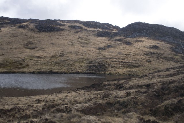
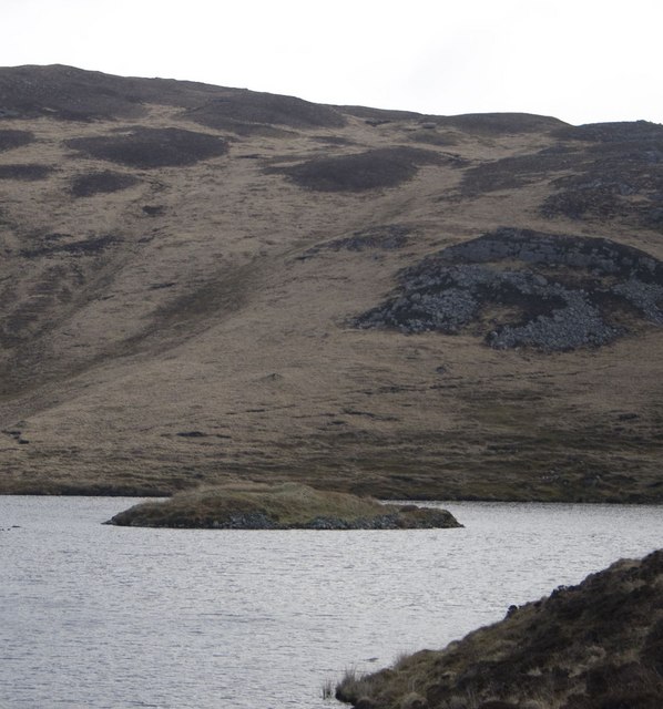
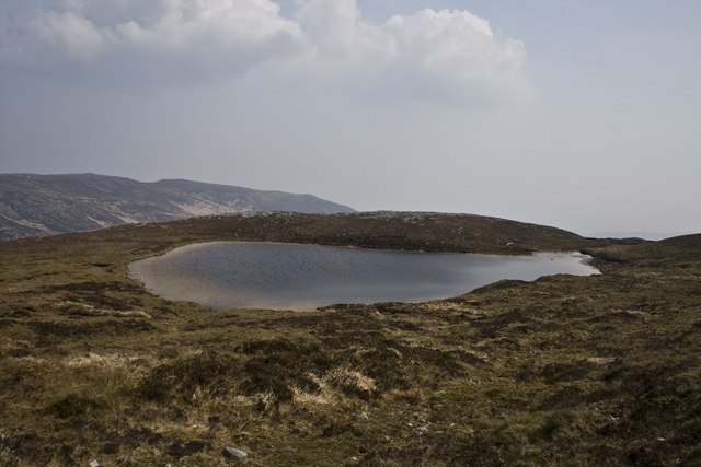
Coir' a' Chinn-Chlach, also known as Corrie (Glacial Valley), is a stunning geological feature located in Argyllshire, Scotland. This glacial valley is situated on the northeastern shore of Loch Awe, near the small village of Inverinan Beg.
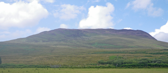
Coir' a' Chinn-Chlach is characterized by its steep, U-shaped valley, which was formed by the movement of glaciers during the last Ice Age. The valley is surrounded by towering mountains, such as Ben Cruachan and Beinn a' Bhuiridh, adding to its dramatic and picturesque landscape.
The glacial action that shaped Coir' a' Chinn-Chlach is evident in the presence of moraines, drumlins, and other glacial deposits throughout the valley. These features provide valuable insights into the geological history of the area.
The valley is also home to diverse flora and fauna, including a variety of plant species such as heather, mosses, and ferns. The surrounding mountains provide habitats for wildlife, including red deer, mountain hares, and golden eagles, making it a popular destination for nature enthusiasts and wildlife photographers.
Coir' a' Chinn-Chlach is a haven for outdoor activities, with numerous hiking trails and viewpoints offering breathtaking vistas of the valley and Loch Awe. The valley's tranquil atmosphere and unspoiled natural beauty make it an ideal location for those seeking peace and solitude.
In summary, Coir' a' Chinn-Chlach in Argyllshire is a remarkable glacial valley, shaped by the forces of nature over thousands of years. Its awe-inspiring scenery, rich geological history, and abundant wildlife make it a must-visit destination for nature lovers and adventurers alike.
If you have any feedback on the listing, please let us know in the comments section below.
Coir' a' Chinn-Chlach Images
Images are sourced within 2km of 55.735869/-6.1346683 or Grid Reference NR4056. Thanks to Geograph Open Source API. All images are credited.


Coir' a' Chinn-Chlach is located at Grid Ref: NR4056 (Lat: 55.735869, Lng: -6.1346683)
Unitary Authority: Argyll and Bute
Police Authority: Argyll and West Dunbartonshire
What 3 Words
///drooling.mildest.gambles. Near Bridgend, Argyll & Bute
Nearby Locations
Related Wikis
Beinn Bheigeir
Beinn Bheigeir (occasionally anglicised as "Ben Vicar") is a hill on the island of Islay in Scotland, UK. At 491 m, it is the highest of the seven 'Marilyn...

Islay
Islay ( EYE-lə; Scottish Gaelic: Ìle, Scots: Ila) is the southernmost island of the Inner Hebrides of Scotland. Known as "The Queen of the Hebrides",...

Dun Nosebridge
Dun Nosebridge is an Iron Age fort southeast of Bridgend, Islay, Scotland. The fort is on the right bank of the River Laggan.The name's origin is probably...
Mulindry House
Mulindry House, also known as Caisteal Mhic Dhomhnuill or Mullintrae House, was a fortified house north of Mulindry Farm, Islay, Scotland. == History... ==
Have you been to Coir' a' Chinn-Chlach?
Leave your review of Coir' a' Chinn-Chlach below (or comments, questions and feedback).