Aite-faire Creag an Fhèilidh

Coastal Marsh, Saltings in Inverness-shire

Scotland

Aite-faire Creag an Fhèilidh

Mealt Waterfall
Mealt Waterfall Credit: Chris Morgan

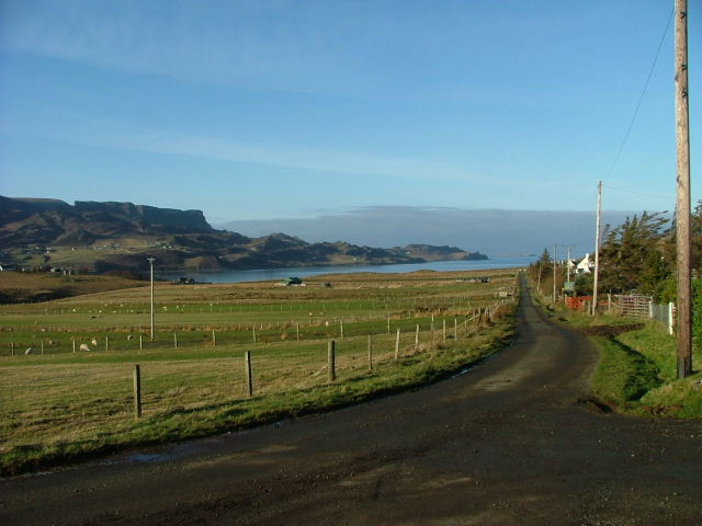
Aite-faire Creag an Fhèilidh, located in Inverness-shire, Scotland, is a coastal marsh and saltings area that is rich in biodiversity and natural beauty. The site is characterized by its diverse habitats, including salt marshes, mudflats, and sand dunes, which support a wide variety of plant and animal species.

The salt marshes at Aite-faire Creag an Fhèilidh are home to a number of important plant species, such as sea lavender, sea aster, and sea purslane, which thrive in the saline conditions. These plants provide important habitat and food sources for a variety of bird species, including waders and waterfowl.

The mudflats and sand dunes at the site are also important habitats for a number of species, including invertebrates, fish, and crustaceans. These habitats provide feeding grounds for birds and other wildlife, making Aite-faire Creag an Fhèilidh an important site for both resident and migratory species.

Overall, Aite-faire Creag an Fhèilidh is a valuable natural area that provides important habitat for a wide range of plant and animal species. It is a popular destination for birdwatchers, nature enthusiasts, and outdoor enthusiasts looking to explore and appreciate the natural beauty of the Scottish coast.

If you have any feedback on the listing, please let us know in the comments section below.

Aite-faire Creag an Fhèilidh Images

Images are sourced within 2km of 57.61043/-6.171323 or Grid Reference NG5065. Thanks to Geograph Open Source API. All images are credited.

Mealt Waterfall
Mealt Waterfall
View south by Mealt Waterfall
Loch Mealt The eastern portion of the loch, separated from the main body of water by the causeway carrying the A855.
Loch Mealt
The eastern portion of the loch, separated from the main body of water by the causeway carrying the A855.
Kilt Rock The stripes and pleats of the kilt highlighted at sunrise. A light mist was just burning off the face of the cliff.
Kilt Rock
The stripes and pleats of the kilt highlighted at sunrise. A light mist was just burning off the face of the cliff.
Coastal cliffs north of Mealt Waterfall Looking towards the Kilt Rock.
Coastal cliffs north of Mealt Waterfall
Looking towards the Kilt Rock.
Coastline south of Mealt The basalt sea-cliffs illuminated by the rising sun.
Coastline south of Mealt
The basalt sea-cliffs illuminated by the rising sun.
Mealt Waterfall The fall from Loch Mealt drops about 60m into the Sound of Raasay. The flow of water today is lighter than usual.
Mealt Waterfall
The fall from Loch Mealt drops about 60m into the Sound of Raasay. The flow of water today is lighter than usual.
Mealt Waterfall The outflow burn from Loch Mealt seen dropping down its 60m waterfall to the sea.
The causeway that divides the loch in two carries the A855 Portree to Staffin road. Beyond the loch are the cloud topped hills of the Trotternish Ridge.
Mealt Waterfall
The outflow burn from Loch Mealt seen dropping down its 60m waterfall to the sea. The causeway that divides the loch in two carries the A855 Portree to Staffin road. Beyond the loch are the cloud topped hills of the Trotternish Ridge.
Valtos Sandstone This sandstone is of Jurassic age, and was laid down in shallow lagoons about 165 million years ago. It readily forms concretions, which are lumps of harder material in the sandy matrix. Although the sandstone is named after Valtos here in Skye, the most dramatic examples of concretions are found in it on the Isle of Eigg - see <a href="https://www.geograph.org.uk/photo/3963134">NM4788 : Another Concretion</a> and nearby examples.
Valtos Sandstone
This sandstone is of Jurassic age, and was laid down in shallow lagoons about 165 million years ago. It readily forms concretions, which are lumps of harder material in the sandy matrix. Although the sandstone is named after Valtos here in Skye, the most dramatic examples of concretions are found in it on the Isle of Eigg - see NM4788 : Another Concretion and nearby examples.
Houses at Bhaltos (Valtos) Traditional stone houses at the north end of Bhaltos. (In Gaelic, the combination of 'bh' at the beginning of a word or name is pronounced as 'v' is pronounced in English and French.)
Houses at Bhaltos (Valtos)
Traditional stone houses at the north end of Bhaltos. (In Gaelic, the combination of 'bh' at the beginning of a word or name is pronounced as 'v' is pronounced in English and French.)
Dùn Dearg Dùn Dearg means 'red fort' and this probably refers to the colour of the columnar jointed lava on which it stands.
Dùn Dearg
Dùn Dearg means 'red fort' and this probably refers to the colour of the columnar jointed lava on which it stands.
Mealt waterfall A straight drop of 60m into the sea.
Mealt waterfall
A straight drop of 60m into the sea.
Mealt Falls The falls taken from the viewing point with Kilt Rock visible in the background.
Mealt Falls
The falls taken from the viewing point with Kilt Rock visible in the background.
Dinosaur Information Plaque The information outlining the availability of Dinosaur remains around the area of Staffin on the Isle of Skye.
Dinosaur Information Plaque
The information outlining the availability of Dinosaur remains around the area of Staffin on the Isle of Skye.
Cliffs at Mealt Falls The cliffs next to the view point looking away from Mealt Falls.
Cliffs at Mealt Falls
The cliffs next to the view point looking away from Mealt Falls.
Mealt Waterfall Dramatic outfall of Loch Mealt in to the Sound of Raasay
Mealt Waterfall
Dramatic outfall of Loch Mealt in to the Sound of Raasay
Picnic bench at the Kilt Rock viewpoint
Mini loch at Kilt Rock Car Park
Show me another place!

Aite-faire Creag an Fhèilidh is located at Grid Ref: NG5065 (Lat: 57.61043, Lng: -6.171323)

Unitary Authority: Highland

Police Authority: Highlands and Islands

Also known as: Kilt Rock Viewpoint

What 3 Words

///grinders.invite.disengage. Near Uig, Highland

Related Wikis

Ellishadder

Ellishadder (Scottish Gaelic: Ealaiseadar) is a crofting township, situated close to the north shore of the freshwater Loch Mealt, on the Trotternish peninsula...

Loch Mealt

Loch Mealt is an inland fresh-water loch on the Isle of Skye in Scotland. It lies close to Ellishadder and south of Staffin, on the eastern side of the...

Garafad

Garafad or Garafad, (Scottish Gaelic: An Garradh Fada) is a linear crofting settlement on the east coast of the Trotternish Peninsula of Skye in the...

Staffin

Staffin (Scottish Gaelic: Stafain) is a district with the Gaelic name An Taobh Sear, which translates as "the East Side", on the northeast coast of the...

Nearby Amenities

Located within 500m of 57.61043,-6.171323
Created By: dmgroom_coastlines
Source: PGS
Lat/Long: 57.60675/-6.1688
Created By: dmgroom_coastlines
Source: PGS
Lat/Long: 57.60702/-6.16925
Created By: dmgroom_coastlines
Source: PGS
Lat/Long: 57.60728/-6.16923
Created By: dmgroom_coastlines
Source: PGS
Lat/Long: 57.60753/-6.16921
Created By: dmgroom_coastlines
Source: PGS
Lat/Long: 57.6078/-6.16967
Source: PGS
Lat/Long: 57.6079654/-6.1704292
Source: PGS
Lat/Long: 57.6081475/-6.1705716
Source: PGS
Lat/Long: 57.6085022/-6.1708408
Source: PGS
Lat/Long: 57.6089168/-6.1711269
Source: PGS
Lat/Long: 57.6092806/-6.1712535
Source: PGS
Lat/Long: 57.6096231/-6.171292
Source: PGS
Lat/Long: 57.6101224/-6.1714984
Source: PGS
Lat/Long: 57.6110571/-6.1721577
Source: PGS
Lat/Long: 57.6113201/-6.1723513
Source: PGS
Lat/Long: 57.6117592/-6.1725434
Source: PGS
Lat/Long: 57.612104/-6.1730433
Source: PGS
Lat/Long: 57.612534/-6.1735815
Created By: dmgroom_coastlines
Source: PGS
Lat/Long: 57.61326/-6.17354
Created By: dmgroom_coastlines
Source: PGS
Lat/Long: 57.61379/-6.17398
Created By: dmgroom_coastlines
Source: PGS
Lat/Long: 57.61405/-6.17396
Created By: dmgroom_coastlines
Source: PGS
Lat/Long: 57.6143/-6.17394
Kilt Rock Viewpoint
Tourism: viewpoint
Lat/Long: 57.610864/-6.1721482
Mealt Waterfall
Waterway: waterfall
Lat/Long: 57.6113098/-6.172524
Bus Stop
Ellishadder, Road End
Naptan AtcoCode: 670096
Naptan NaptanCode: 45343279
Lat/Long: 57.6120999/-6.177194
Bench
Historic: memorial
Memorial: bench
Lat/Long: 57.6102099/-6.1718773
Power: pole
Lat/Long: 57.6120754/-6.1787667
The data included in this document is from www.openstreetmap.org. The data is made available under ODbL.

Have you been to Aite-faire Creag an Fhèilidh?

Leave your review of Aite-faire Creag an Fhèilidh below (or comments, questions and feedback).