Damgate Marshes
Coastal Marsh, Saltings in Norfolk Broadland
England
Damgate Marshes

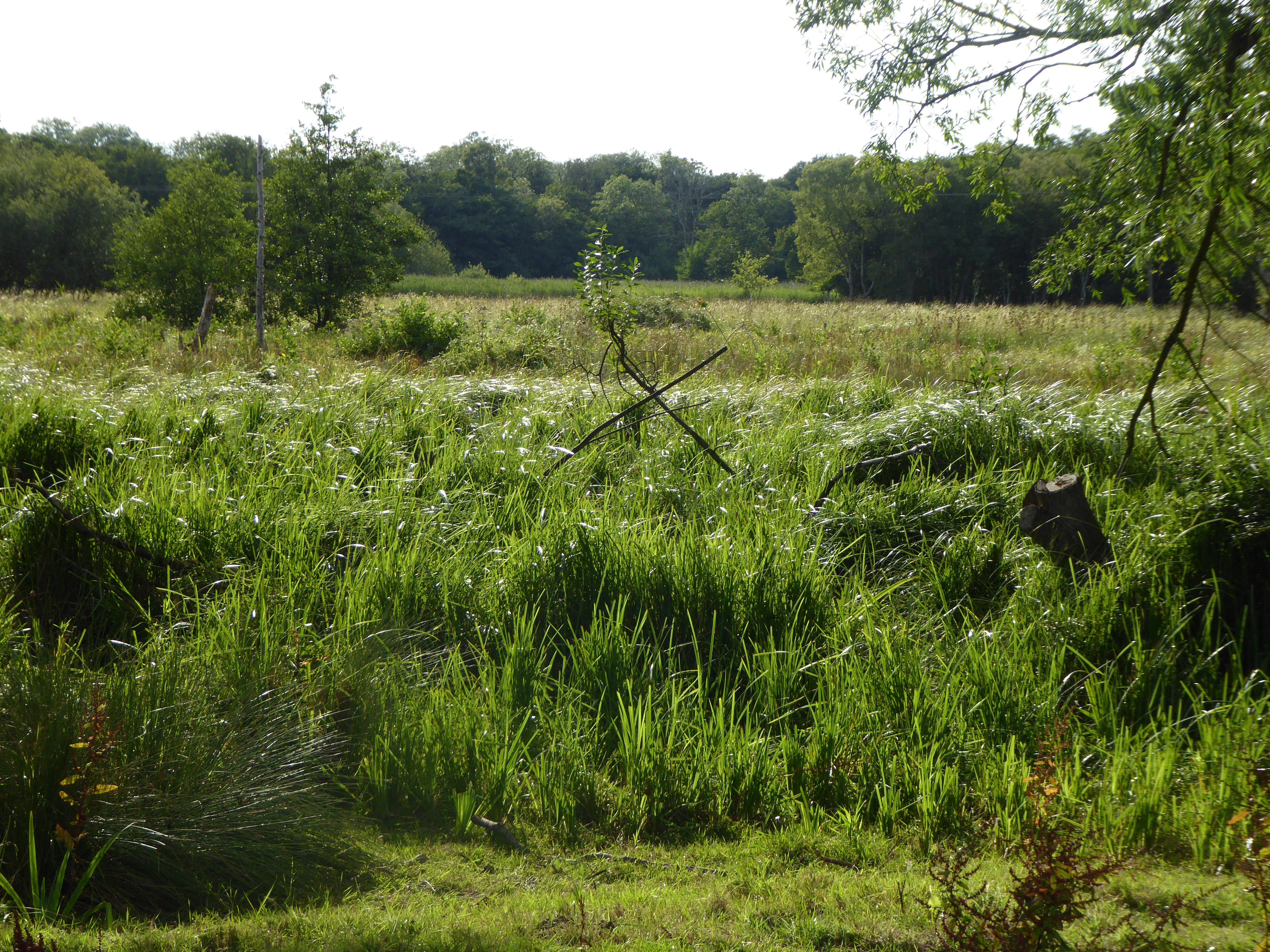
Damgate Marshes is a coastal marshland located in Norfolk, England. Stretching across an area of approximately 100 hectares, it is a significant part of the broader coastal marshes and saltings ecosystem of the North Norfolk Coast. The marshes are situated within the Norfolk Coast Area of Outstanding Natural Beauty, making them an important site for wildlife conservation and recreation.
The landscape of Damgate Marshes is characterized by its flat and open terrain, featuring a mosaic of saltmarsh, reedbeds, and tidal channels. These habitats support a diverse range of plant and animal species, including salt-tolerant vegetation such as sea lavender, sea aster, and glasswort. The marshes serve as a vital breeding ground and feeding area for various bird species, including waders like redshanks, curlews, and oystercatchers.
The site is managed by the Norfolk Wildlife Trust, which works to protect and enhance the natural environment of the marshes. They employ various conservation measures, such as grazing by cattle and sheep, to maintain the ecological balance and promote biodiversity. Visitors to Damgate Marshes can enjoy picturesque walks along the marked footpaths, observing the rich birdlife and the ever-changing tides.
Additionally, the marshes play a crucial role in flood prevention by acting as a buffer zone during storm surges and high tides. The natural vegetation and topography of the area help absorb and slow down the flow of water, reducing the risk of coastal erosion and flooding in nearby communities.
Overall, Damgate Marshes in Norfolk is a stunning coastal marshland that offers a valuable habitat for wildlife, a place for outdoor recreation, and a natural defense against coastal flooding.
If you have any feedback on the listing, please let us know in the comments section below.
Damgate Marshes Images
Images are sourced within 2km of 52.631182/1.5648742 or Grid Reference TG4109. Thanks to Geograph Open Source API. All images are credited.


Damgate Marshes is located at Grid Ref: TG4109 (Lat: 52.631182, Lng: 1.5648742)
Administrative County: Norfolk
District: Broadland
Police Authority: Norfolk
What 3 Words
///forehand.buzz.nails. Near Acle, Norfolk
Nearby Locations
Related Wikis

Damgate Marshes, Acle
Damgate Marshes, Acle is a 64.7-hectare (160-acre) biological Site of Special Scientific Interest between Norwich and Great Yarmouth in Norfolk. It is...

Acle
Acle ( AY-kəl) is a market town on the River Bure on the Norfolk Broads in Norfolk, located halfway between Norwich and Great Yarmouth. It has the only...

Blofield and Flegg Rural District
Blofield and East and West Flegg Rural Districts were adjacent rural districts in Norfolk, England from 1894 to 1935.They were formed under the Local Government...
Decoy Carr, Acle
Decoy Carr, Acle is a 56-hectare (140-acre) biological Site of Special Scientific Interest south of Acle in Norfolk. It is part of the Broadland Ramsar...
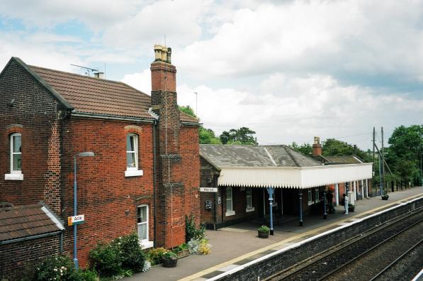
Acle railway station
Acle railway station is on the Wherry Lines in the east of England, serving the town of Acle, Norfolk. It is 10 miles 34 chains (16.8 km) down the line...
Tunstall, Norfolk
Tunstall is a village and former civil parish, now in the parish of Halvergate, in the Broadland district of Norfolk, England. It lies some 14 miles (22...

Stokesby with Herringby
Stokesby with Herringby is a civil parish in the English county of Norfolk. It comprises the village of Stokesby and the surrounding rural area. It is...
Acle Academy
The Acle Academy, formerly known as Acle High School, is a secondary school which is located in Acle, Norfolk, England. This is in the centre of the Norfolk...
Nearby Amenities
Located within 500m of 52.631182,1.5648742Have you been to Damgate Marshes?
Leave your review of Damgate Marshes below (or comments, questions and feedback).