Horseshoe

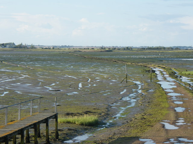
Coastal Marsh, Saltings in Essex Tendring

England

Horseshoe

Hamford Water; near Skippers Island
Hamford Water; near Skippers Island Credit: Mr James D

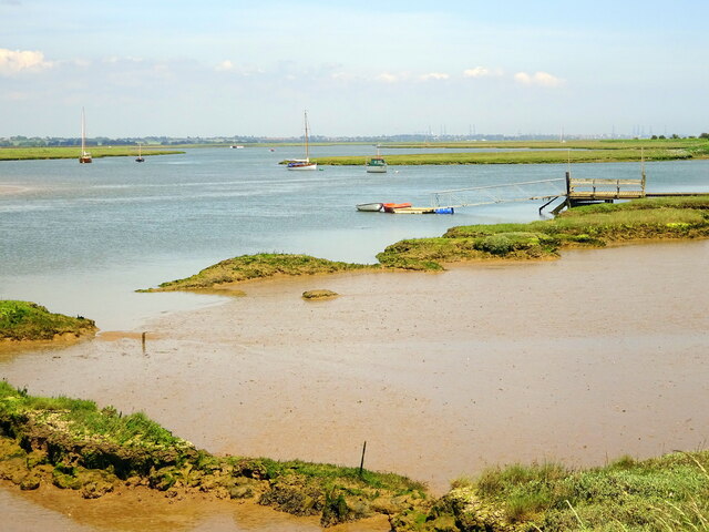
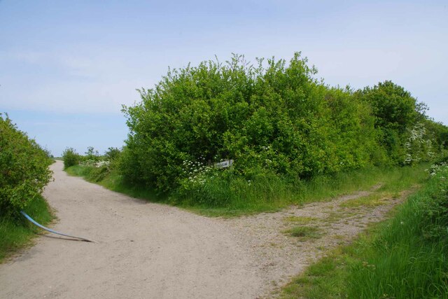
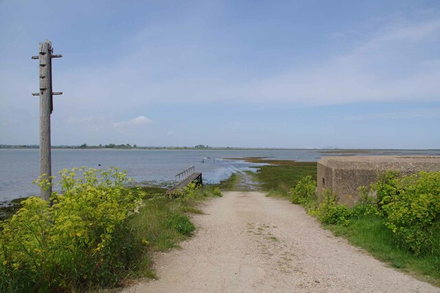
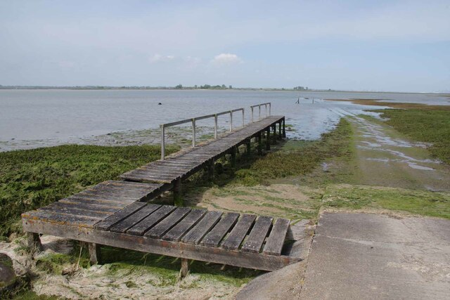
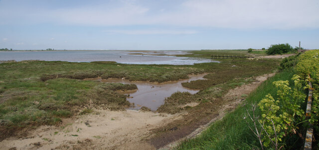
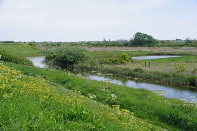
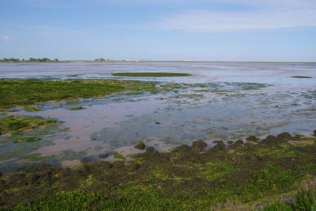
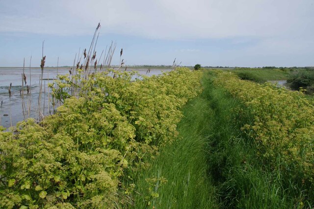
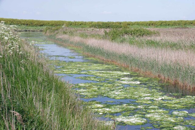
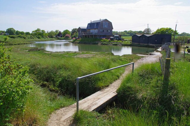
Horseshoe, Essex is a picturesque coastal marshland located in southeastern England. It is renowned for its stunning salt marshes, known as the Horseshoe Saltings, which stretch along the coast for approximately three miles. This unique landscape is characterized by vast expanses of marsh grasses, mudflats, and tidal creeks, offering a haven for numerous species of flora and fauna.

The Horseshoe Saltings are a designated Site of Special Scientific Interest (SSSI) due to their ecological significance. The salt marshes provide a vital habitat for a wide range of bird species, including wading birds, ducks, and geese, making it a popular destination for birdwatchers. Additionally, the marshes are home to several rare plant species that have adapted to the saline conditions.

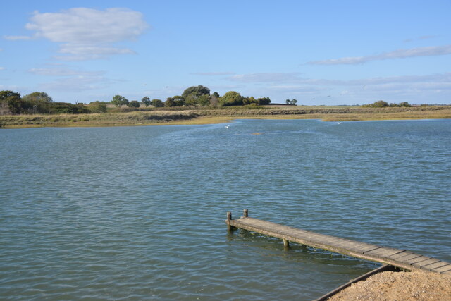
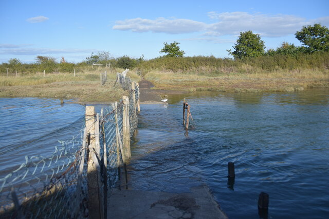
The area is influenced by the changing tides of the North Sea, resulting in a dynamic and ever-changing landscape. At high tide, the mudflats are submerged, creating a serene and reflective surface, while at low tide, the vast expanse of exposed mudflat becomes a feeding ground for numerous wading birds.

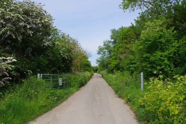
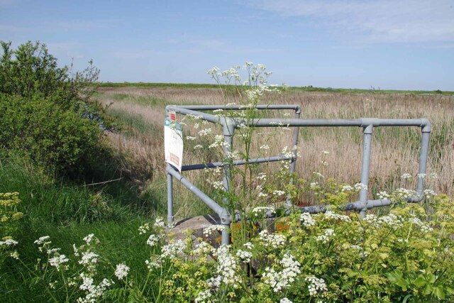
Visitors to Horseshoe can enjoy various activities such as walking, birdwatching, and photography. Several designated footpaths and trails offer opportunities to explore the marshes and observe the diverse wildlife. The area is also popular with nature enthusiasts who appreciate the tranquility and natural beauty of the marshland.

Horseshoe, Essex, with its unique salt marshes and diverse wildlife, is a haven for nature lovers and a prime example of the natural beauty that can be found along the English coast.

If you have any feedback on the listing, please let us know in the comments section below.

Horseshoe Images

Images are sourced within 2km of 51.860929/1.2396721 or Grid Reference TM2323. Thanks to Geograph Open Source API. All images are credited.

Hamford Water; near Skippers Island
Walton Road, Kirby-le-Soken Looking east along this main road through Kirby-le-Soken, taken from the end of Quay Lane.
Walton Road, Kirby-le-Soken
Looking east along this main road through Kirby-le-Soken, taken from the end of Quay Lane.
Part of Hamford Water National Nature Reserve Near the Quay, Kirby-le-Soken, is this small jetty used by swimmers in the tidal water.
Part of Hamford Water National Nature Reserve
Near the Quay, Kirby-le-Soken, is this small jetty used by swimmers in the tidal water.
High tide thwarts points-bagger I had intended to walk this path to access three more squares I haven't visited but didn't have suitable footwear for the high tide.
High tide thwarts points-bagger
I had intended to walk this path to access three more squares I haven't visited but didn't have suitable footwear for the high tide.
Bollard on Turpins Lane The no cycling sign on the right sends out <a href="https://www.geograph.org.uk/photo/7490406">TM2321 : Mixed Messages</a>
Bollard on Turpins Lane
The no cycling sign on the right sends out TM2321 : Mixed Messages
Mixed Messages Who's bright idea was it to put a cycle path logo on a no cycling sign?
Mixed Messages
Who's bright idea was it to put a cycle path logo on a no cycling sign?
Samphire Meadows Humm..... with a name like that it might be fun trying to get flood insurance! Just one of what appear to be dozens of building sites all over Tendering.
Samphire Meadows
Humm..... with a name like that it might be fun trying to get flood insurance! Just one of what appear to be dozens of building sites all over Tendering.
Island Lane Before the lane to Horsey Island is designated as a footpath.
Island Lane
Before the lane to Horsey Island is designated as a footpath.
The Way to Horsey Island The old Island Lane and footpath is out of shot to the left.
The Way to Horsey Island
The old Island Lane and footpath is out of shot to the left.
Pillbox and Horsey Causeway Looking across Hamford Water towards Horsey Island <span class="nowrap"><a title="https://en.wikipedia.org/wiki/Horsey_Island" rel="nofollow ugc noopener" href="https://en.wikipedia.org/wiki/Horsey_Island">Link</a><img style="margin-left:2px;" alt="External link" title="External link - shift click to open in new window" src="https://s1.geograph.org.uk/img/external.png" width="10" height="10"/></span>
Pillbox and Horsey Causeway
Looking across Hamford Water towards Horsey Island LinkExternal link
Jetty For Horsey Island A receding tide on Hamford Water <span class="nowrap"><a title="https://en.wikipedia.org/wiki/Horsey_Island" rel="nofollow ugc noopener" href="https://en.wikipedia.org/wiki/Horsey_Island">Link</a><img style="margin-left:2px;" alt="External link" title="External link - shift click to open in new window" src="https://s1.geograph.org.uk/img/external.png" width="10" height="10"/></span>
Jetty For Horsey Island
A receding tide on Hamford Water LinkExternal link
Horsey Jetty Panorama Looking along the sea wall back towards the <a href="https://www.geograph.org.uk/photo/7490432">TM2322 : Jetty For Horsey Island</a>.
Horsey Jetty Panorama
Looking along the sea wall back towards the TM2322 : Jetty For Horsey Island.
Borrow Dike Near St Peters Point The Alexanders in the foreground are prolific on the sea wall.
Borrow Dike Near St Peters Point
The Alexanders in the foreground are prolific on the sea wall.
Saltmarsh in the Wade Looking across Hamford Water.
Saltmarsh in the Wade
Looking across Hamford Water.
Alexanders On the Sea Wall Looking along Frinton & Walton Footpath 36 that follows the seawall.
Alexanders On the Sea Wall
Looking along Frinton & Walton Footpath 36 that follows the seawall.
Algae on the Borrow Dike Looking towards St Peters Point.
Algae on the Borrow Dike
Looking towards St Peters Point.
Decoy Hall Sluice Looking towards St Peter's Point
Decoy Hall Sluice
Looking towards St Peter's Point
Kirby Quay The footbridge carries Frinton & Walton Footpath 32  across the ditch.
Kirby Quay
The footbridge carries Frinton & Walton Footpath 32 across the ditch.
Show me another place!

Horseshoe is located at Grid Ref: TM2323 (Lat: 51.860929, Lng: 1.2396721)

Administrative County: Essex

District: Tendring

Police Authority: Essex

What 3 Words

///tinted.crows.flaunting. Near Walton-on-the-Naze, Essex

Related Wikis

Harwich (UK Parliament constituency)

Harwich was a parliamentary constituency represented in the House of Commons of the Parliament of the United Kingdom until its abolition for the 2010...

The Sokens

The Sokens is a name often used to describe the area containing the traditional parishes of Thorpe, Kirby and Walton, which now lie in Tendring district...
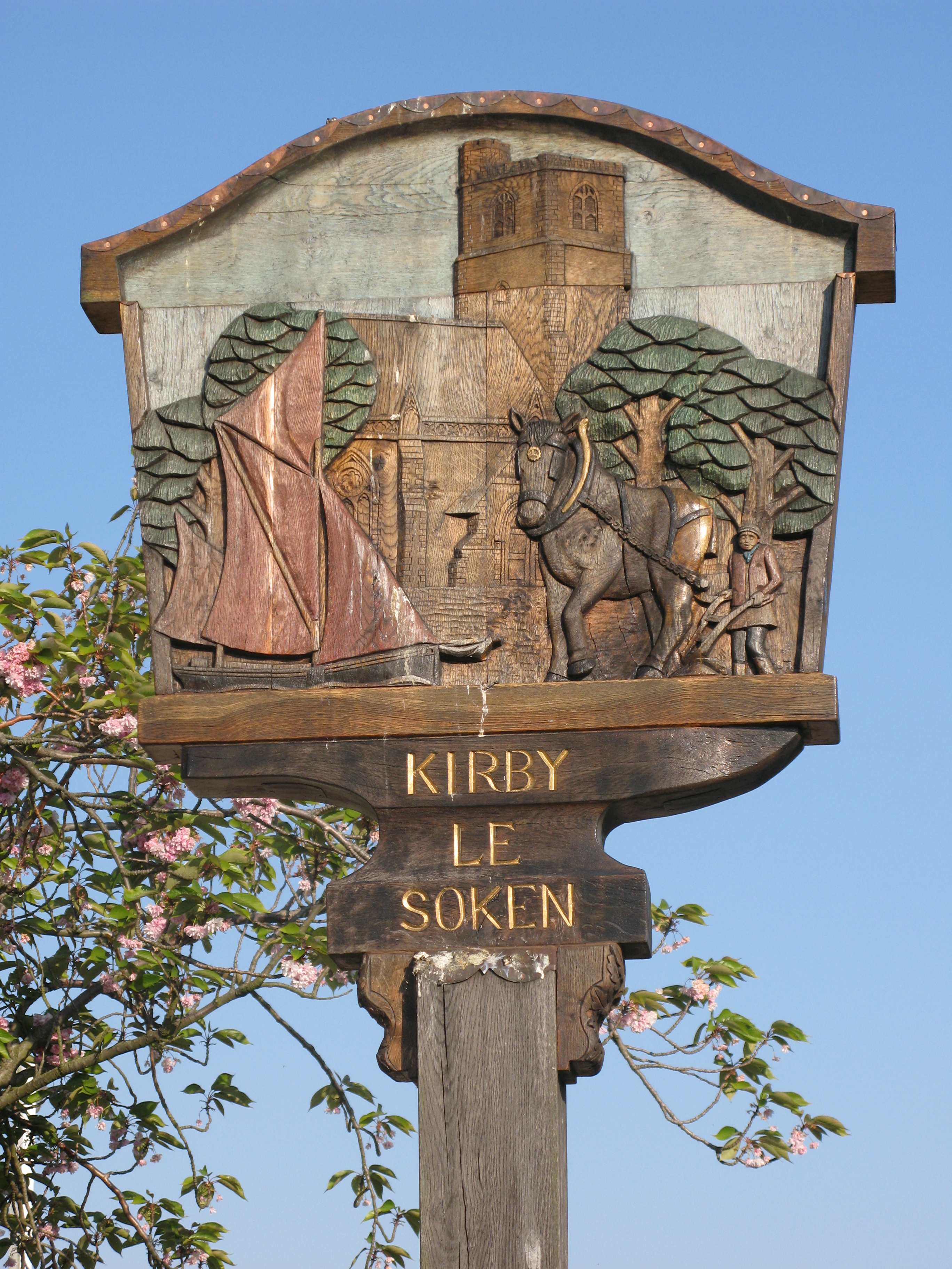
Kirby-le-Soken

Kirby-le-Soken is a village and former civil parish, now in the parish of Frinton and Walton, in the Tendring district of North East Essex, England, which...

Horsey Island

Horsey Island is an island in the parish of Thorpe-le-Soken, Essex. It lies in Hamford Water and is part of the Hamford Water National Nature Reserve,...

Nearby Amenities

Located within 500m of 51.860929,1.2396721
The Wade
Place: locality
Source: OS_OpenData_StreetView
Lat/Long: 51.8648041/1.2424009
The data included in this document is from www.openstreetmap.org. The data is made available under ODbL.

Have you been to Horseshoe?

Leave your review of Horseshoe below (or comments, questions and feedback).