Hall Point

Coastal Marsh, Saltings in Suffolk Babergh

England

Hall Point

Woolverstone Marina
Woolverstone Marina Credit: Chris Holifield

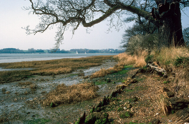
Hall Point is a stunning coastal marsh located in Suffolk, England. Situated along the eastern coast of the county, it forms part of the larger Suffolk Coast and Heaths Area of Outstanding Natural Beauty. This area is renowned for its diverse and rich ecosystem, offering visitors a unique opportunity to explore the natural wonders of the region.

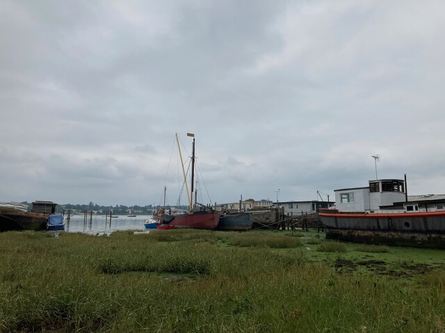
The marshland at Hall Point is characterized by its extensive salt marshes and saltings, which are flooded by the tides. These marshes provide a vital habitat for a variety of wildlife species, including numerous bird species, small mammals, and insects. Birdwatchers flock to this area to catch glimpses of rare and migratory birds, such as avocets, lapwings, and marsh harriers.

The landscape at Hall Point is visually striking, with expansive mudflats and salt pans that stretch out towards the North Sea. The intertidal areas of the marsh are teeming with marine life, including crabs, shellfish, and various fish species. The marshes are also home to an array of salt-tolerant plants, such as glasswort and sea lavender, which add vibrant colors to the landscape.

Visitors to Hall Point can enjoy a range of activities, including walking along the designated trails that wind through the marshes, or simply taking in the breathtaking views from the various observation points. The area is also popular with photographers, who are drawn to the unique and ever-changing scenery.

Overall, Hall Point in Suffolk is a captivating coastal marsh that offers visitors a chance to immerse themselves in the beauty of nature. Whether it's observing the diverse wildlife or simply appreciating the tranquility of the surroundings, this area is a must-visit for nature enthusiasts and those seeking a peaceful escape.

If you have any feedback on the listing, please let us know in the comments section below.

Hall Point Images

Images are sourced within 2km of 52.00551/1.2052392 or Grid Reference TM2038. Thanks to Geograph Open Source API. All images are credited.

Woolverstone Marina
Woolverstone Marina
B1456 Main Road, Chelmondiston
Nacton shore of the River Orwell My mother was born in Nacton and she talked about taking the track to the Orwell. On this occasion my wife and I did the walk in her memory. The damaged tree in the foreground may be the same tree as appears toppled in later images.  Still standing in  <a href="https://www.geograph.org.uk/photo/861632">TM2139 : Hulk on the shore</a>.
Nacton shore of the River Orwell
My mother was born in Nacton and she talked about taking the track to the Orwell. On this occasion my wife and I did the walk in her memory. The damaged tree in the foreground may be the same tree as appears toppled in later images. Still standing in TM2139 : Hulk on the shore.
Crop field beside woodland
Bend in National Cycle Route 51 Ipswich Road towards Nacton.
Bend in National Cycle Route 51
Ipswich Road towards Nacton.
Nacton church
Nacton church
Wrecks on the foreshore at Pin Mill Compare with <a href="https://www.geograph.org.uk/photo/5917649">TM2138 : Wrecks near Pin Mill</a> taken in 2018
Wrecks on the foreshore at Pin Mill
Compare with TM2138 : Wrecks near Pin Mill taken in 2018
Houseboats and barge "Melissa" at Pin Mill "Melissa" is a steel hulled Thames Barge built by J.G. Fay at Southampton 1899: <span class="nowrap"><a title="https://thamesbarge.org.uk/boats/melissa/" rel="nofollow ugc noopener" href="https://thamesbarge.org.uk/boats/melissa/">Link</a><img style="margin-left:2px;" alt="External link" title="External link - shift click to open in new window" src="https://s1.geograph.org.uk/img/external.png" width="10" height="10"/></span>
Houseboats and barge "Melissa" at Pin Mill
"Melissa" is a steel hulled Thames Barge built by J.G. Fay at Southampton 1899: LinkExternal link
Harry King's boatyard, Pin Mill
View towards Butterman's Bay
Woolverstone Marina Wolverstone Marina is the Home of many pleasure crafts.  It is also next to the “Cat House” where it was said that years ago was the home to a man who was sympathetic to boats carrying contraband along the river.  He had a pet cat which he loved.  When it died he had it stuffed and when he could see that no customs boats were patrolling the river put the cat in the window for any smugglers to see, signalling that all was well.
Woolverstone Marina
Wolverstone Marina is the Home of many pleasure crafts. It is also next to the “Cat House” where it was said that years ago was the home to a man who was sympathetic to boats carrying contraband along the river. He had a pet cat which he loved. When it died he had it stuffed and when he could see that no customs boats were patrolling the river put the cat in the window for any smugglers to see, signalling that all was well.
A long drive Woolverstone Hall Woolverstone Suffolk.Now a school. More info see <span class="nowrap"><a title="http://en.wikipedia.org/wiki/Woolverstone_Hall" rel="nofollow ugc noopener" href="http://en.wikipedia.org/wiki/Woolverstone_Hall">Link</a><img style="margin-left:2px;" alt="External link" title="External link - shift click to open in new window" src="https://s1.geograph.org.uk/img/external.png" width="10" height="10"/></span>
A long drive
Woolverstone Hall Woolverstone Suffolk.Now a school. More info see LinkExternal link
Snowdrops in Woolverstone wood
St Michael's, Woolverstone Taken from the drive down to the marina.
St Michael's, Woolverstone
Taken from the drive down to the marina.
The lodge at the entrance to Woolverstone Park
Farmhouse at Walnut Tree Farm
Foreshore at Woolverstone Looking upstream from the end of the public footpath towards the Orwell Bridge.
Foreshore at Woolverstone
Looking upstream from the end of the public footpath towards the Orwell Bridge.
Cottage in a clearing Sympathetically extended cottage in a clearing in Woolverstone Woods.
Cottage in a clearing
Sympathetically extended cottage in a clearing in Woolverstone Woods.
Show me another place!

Hall Point is located at Grid Ref: TM2038 (Lat: 52.00551, Lng: 1.2052392)

Administrative County: Suffolk

District: Babergh

Police Authority: Suffolk

What 3 Words

///songbook.riverbed.hoaxes. Near Holbrook, Suffolk

Related Wikis

Ipswich High School, Suffolk

Ipswich High School is a co-educational private school at Woolverstone Hall near Ipswich, England. Formerly an exclusive school for girls, it was converted...

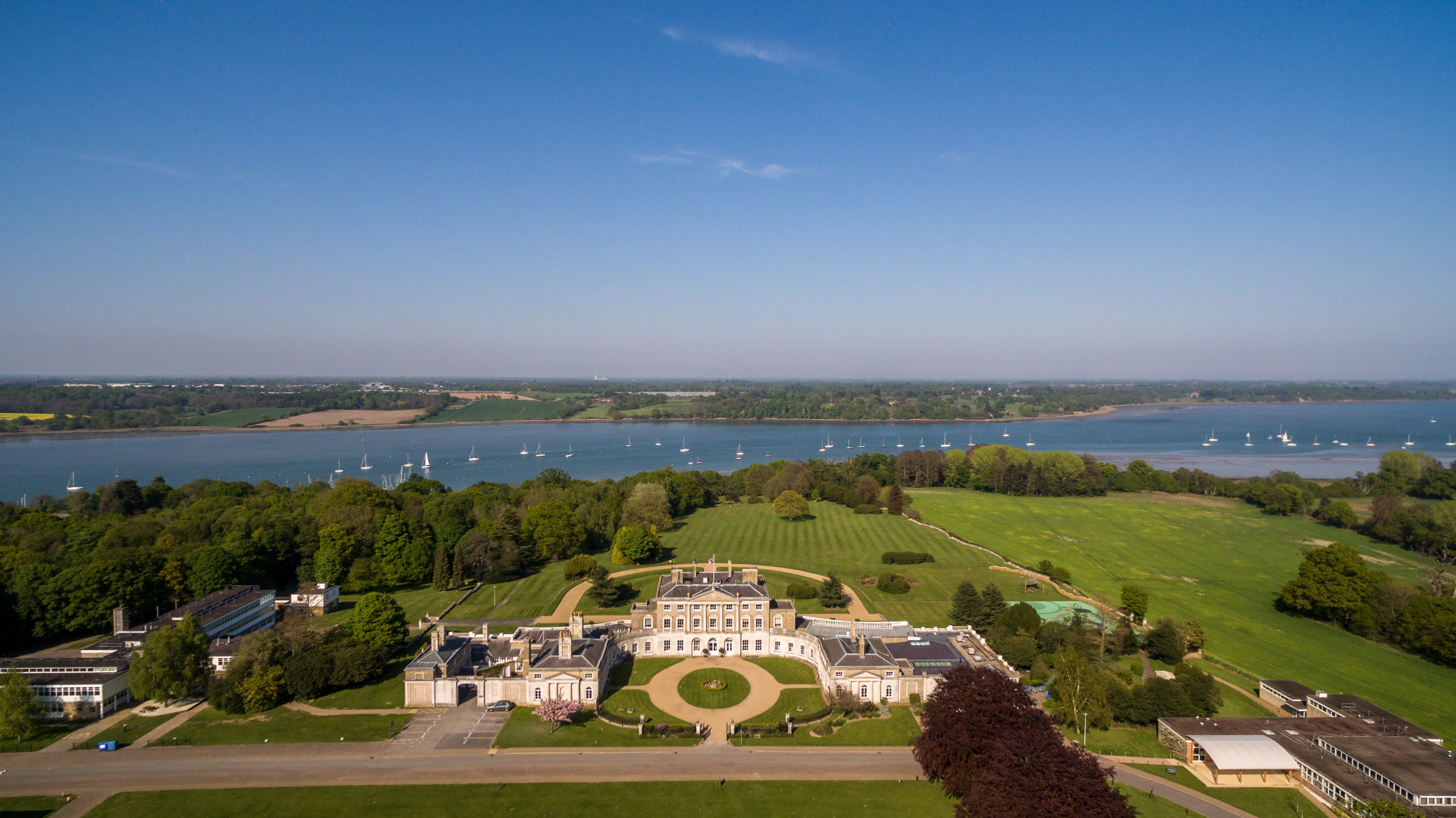
Woolverstone Hall School

In the early 1950s the London County Council obtained use of Woolverstone Hall near Ipswich, Suffolk, and some 50 acres (200,000 m2) of adjoining land...
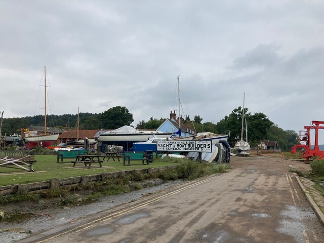
Pin Mill

Pin Mill is a hamlet on the south bank of the tidal River Orwell, on the outskirts of the village of Chelmondiston, on the Shotley peninsula in southern...

Woolverstone

Woolverstone is a small village and civil parish in Suffolk, England located on the Shotley peninsula. It is situated about 6.4 km (4.0 mi) south of Ipswich...

Nearby Amenities

Located within 500m of 52.00551,1.2052392
Source: PGS
Lat/Long: 52.0012847/1.2064948
Source: PGS
Lat/Long: 52.001866/1.205626
Source: PGS
Lat/Long: 52.0028476/1.20472
Source: PGS
Lat/Long: 52.0030725/1.2043842
Source: PGS
Lat/Long: 52.0041914/1.2038893
Source: PGS
Lat/Long: 52.0046609/1.203292
Source: PGS
Lat/Long: 52.0048716/1.2022828
Source: PGS
Lat/Long: 52.005157/1.2020869
Source: PGS
Lat/Long: 52.0058485/1.1999273
Source: PGS
Lat/Long: 52.0058261/1.199452
Source: PGS
Lat/Long: 52.0059385/1.1983629
Seamark Buoy Lateral Category: port
Seamark Buoy Lateral Colour: red
Seamark Buoy Lateral Shape: can
Seamark Buoy Lateral System: iala-a
Seamark Light Character: Q
Seamark Light Colour: red
Seamark Name: No. 6
Seamark Type: buoy_lateral
Lat/Long: 52.0062042/1.2062968
Seamark Buoy Lateral Category: starboard
Seamark Buoy Lateral Colour: green
Seamark Buoy Lateral Shape: conical
Seamark Buoy Lateral System: iala-a
Seamark Light Character: Q
Seamark Light Colour: green
Seamark Name: Park Bight
Seamark Type: buoy_lateral
Lat/Long: 52.0072477/1.2070049
Seamark Buoy Lateral Category: starboard
Seamark Buoy Lateral Colour: green
Seamark Buoy Lateral Shape: conical
Seamark Buoy Lateral System: iala-a
Seamark Light Character: Fl
Seamark Light Colour: green
Seamark Light Period: 2.5
Seamark Name: Cathouse
Seamark Type: buoy_lateral
Lat/Long: 52.0081523/1.1998491
The data included in this document is from www.openstreetmap.org. The data is made available under ODbL.

Have you been to Hall Point?

Leave your review of Hall Point below (or comments, questions and feedback).