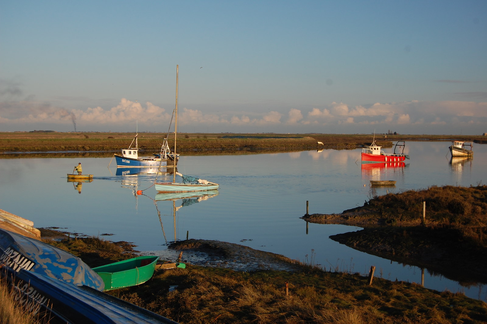
Barling Ness

Coastal Marsh, Saltings in Essex Rochford

England

Barling Ness

Shuttlewood's Boatyard, Paglesham Eastend The boatyard fronts Paglesham Reach of the River Roach and since 1895 has been engaged in boatbuilding and maintenance.
Shuttlewood's Boatyard, Paglesham Eastend Credit: David Kemp

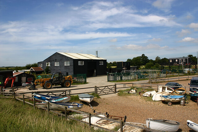
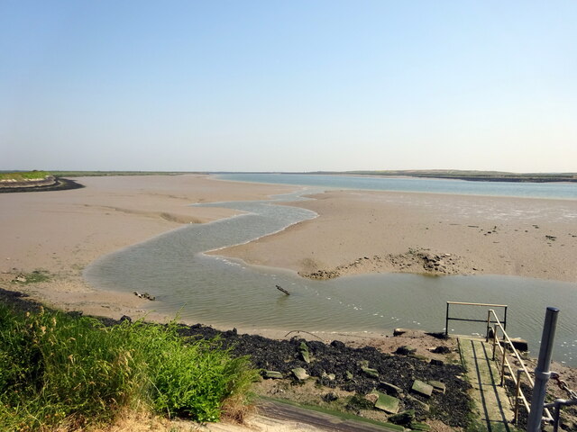
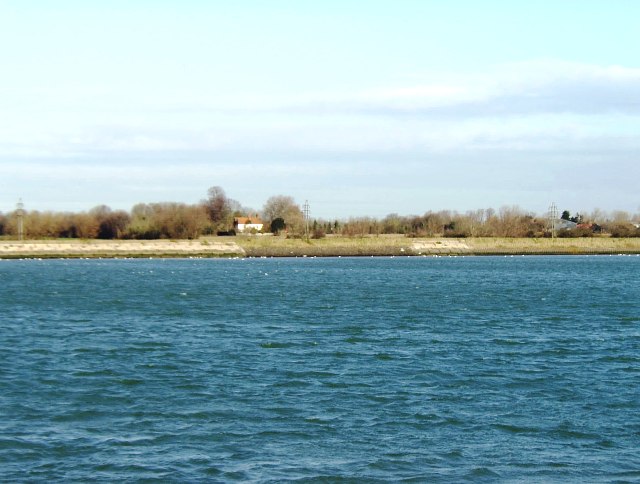
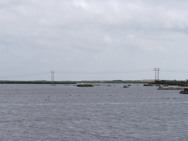
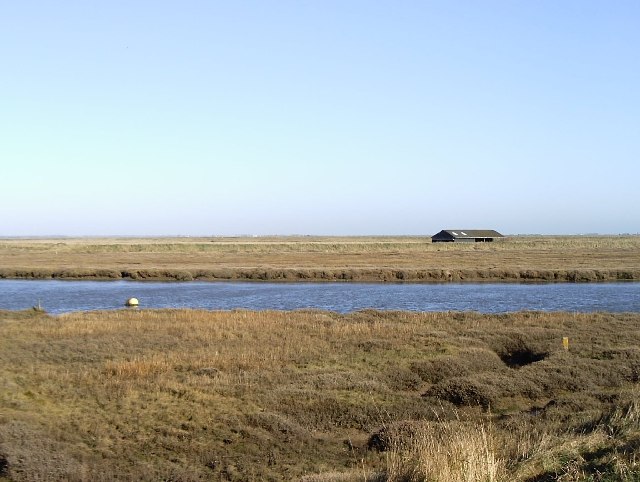
Barling Ness is a coastal marsh and saltings located in Essex, England. Situated on the estuary of the River Roach, it is a significant natural habitat and a designated Site of Special Scientific Interest (SSSI).

Covering an area of approximately 150 hectares, Barling Ness is characterized by its salt marshes, mudflats, and dunes. The marshland is vital for various bird species as it provides a rich feeding ground, especially during the winter months when migratory birds flock to the area. Some of the notable bird species found here include avocets, redshanks, curlews, and dunlins. The mudflats also support an abundance of invertebrates, which are a crucial food source for the birds.

The saltings, or salt marshes, are unique ecosystems that are formed by the deposition of sediment and the accumulation of salt-tolerant plants. These marshes are particularly important for wildlife as they act as a buffer against coastal erosion and provide shelter for various species. The vegetation found in the marshes includes samphire, sea lavender, and sea aster.

Barling Ness offers stunning views of the estuary and its diverse wildlife. It is a popular destination for birdwatchers, nature enthusiasts, and photographers. The area is also part of the Roach and Foulness Marine Conservation Zone, further highlighting its ecological significance.

Access to Barling Ness is limited to designated footpaths and public rights of way to protect the delicate habitats. Visitors are encouraged to respect the area's wildlife and adhere to any guidelines or restrictions in place to preserve this unique coastal environment.

If you have any feedback on the listing, please let us know in the comments section below.

Barling Ness Images

Images are sourced within 2km of 51.586291/0.80556926 or Grid Reference TQ9491. Thanks to Geograph Open Source API. All images are credited.

Shuttlewood's Boatyard, Paglesham Eastend The boatyard fronts Paglesham Reach of the River Roach and since 1895 has been engaged in boatbuilding and maintenance.
Shuttlewood's Boatyard, Paglesham Eastend
The boatyard fronts Paglesham Reach of the River Roach and since 1895 has been engaged in boatbuilding and maintenance.
Confluence of River Roach & Paglesham Pool (1) Paglesham Pool is the creek that can be seen top left. Taken from the mainland with Wallasea Island (left) and Potton Island (right).
Confluence of River Roach & Paglesham Pool (1)
Paglesham Pool is the creek that can be seen top left. Taken from the mainland with Wallasea Island (left) and Potton Island (right).
Confluence of River Roach & Paglesham Pool (2) Paglesham Pool is the creek nearest the camera while the Roach follows the horizon. Taken from the mainland with Wallsea Island (left) and Potton Island on the right of the horizon.
Confluence of River Roach & Paglesham Pool (2)
Paglesham Pool is the creek nearest the camera while the Roach follows the horizon. Taken from the mainland with Wallsea Island (left) and Potton Island on the right of the horizon.
Paglesham Pool Taken looking upstream from near Paglesham Point which is where Paglesham Pool joins Paglesham Reach of the River Roach. The land opposite is Wallasea Island.
Paglesham Pool
Taken looking upstream from near Paglesham Point which is where Paglesham Pool joins Paglesham Reach of the River Roach. The land opposite is Wallasea Island.
Borrowdyke at Paglesham Point
A view of River Roach; from top of pillbox
Paglesham Creek; looking north from the pillbox
River Roach, looking downstream from Stannets Creek
Barling Marsh Much of Barling Marsh has been given over to a landfill site and the extraction of sand and gravel. Vehicles reach the site by means of a dedicated road <a href="https://www.geograph.org.uk/gridref/TQ9288">TQ9288</a>. Taken from the berm beside Barlinghall Creek looking west.
Barling Marsh
Much of Barling Marsh has been given over to a landfill site and the extraction of sand and gravel. Vehicles reach the site by means of a dedicated road TQ9288. Taken from the berm beside Barlinghall Creek looking west.
River Roach This river is short, and in its lower reaches wide and tidal. Taken from Barling Marsh Sluice on the southern bank facing north.
River Roach
This river is short, and in its lower reaches wide and tidal. Taken from Barling Marsh Sluice on the southern bank facing north.
Looking towards Barling Ness Barling Ness is at the far end of the drainage channel. The water on the left is Paglesham Reach of the River Roach and the land just discernible on the horizon is Potton Island.
Looking towards Barling Ness
Barling Ness is at the far end of the drainage channel. The water on the left is Paglesham Reach of the River Roach and the land just discernible on the horizon is Potton Island.
Essex Creeks The land with the farm buildings (just outside the gridsquare in <a href="https://www.geograph.org.uk/gridref/TQ9590">TQ9590</a>) on it is Potton Island to which there is no public access. The part of the mainland across the water to the right of the island is separated from it by Potton Creek. The water on the left is known as The Violet and that on the right is Barlinghall Creek.
Essex Creeks
The land with the farm buildings (just outside the gridsquare in TQ9590) on it is Potton Island to which there is no public access. The part of the mainland across the water to the right of the island is separated from it by Potton Creek. The water on the left is known as The Violet and that on the right is Barlinghall Creek.
Great Potton farm buildings, Potton Island Although Potton Island is owned by the Ministry of Defence, much of the island has been used for farming. Taken from the mainland looking north across Potton Creek.
Great Potton farm buildings, Potton Island
Although Potton Island is owned by the Ministry of Defence, much of the island has been used for farming. Taken from the mainland looking north across Potton Creek.
Paglesham Eastend This row of cottages stands on an unmade road leading to a boatyard on the River Roach.
Paglesham Eastend
This row of cottages stands on an unmade road leading to a boatyard on the River Roach.
Flooded marshland, Stannets Creek, Paglesham Marshland such as this has been deliberately flooded to curb erosion elsewhere. Taken from the Roach Valley Way.
Flooded marshland, Stannets Creek, Paglesham
Marshland such as this has been deliberately flooded to curb erosion elsewhere. Taken from the Roach Valley Way.
Barns at East Hall, Paglesham Taken from the Roach Valley Way. Apart from agricultural buildings and a few cottages, most of the gridsquare comprises flat arable farmland.
Barns at East Hall, Paglesham
Taken from the Roach Valley Way. Apart from agricultural buildings and a few cottages, most of the gridsquare comprises flat arable farmland.
Boat on saltings River Roach just east of the head of Paglesham Creek.
Boat on saltings
River Roach just east of the head of Paglesham Creek.
The Plough and Sail, Paglesham East End Village pub.
The Plough and Sail, Paglesham East End
Village pub.
Show me another place!

Barling Ness is located at Grid Ref: TQ9491 (Lat: 51.586291, Lng: 0.80556926)

Administrative County: Essex

District: Rochford

Police Authority: Essex

What 3 Words

///trick.connected.fooling. Near Great Wakering, Essex

Related Wikis

Potton Island

Potton Island is a sparsely populated island west of Foulness in Essex, England. It is connected to the mainland by a swing bridge with a traffic light...

HMS Beagle

HMS Beagle was a Cherokee-class 10-gun brig-sloop of the Royal Navy, one of more than 100 ships of this class. The vessel, constructed at a cost of £7...
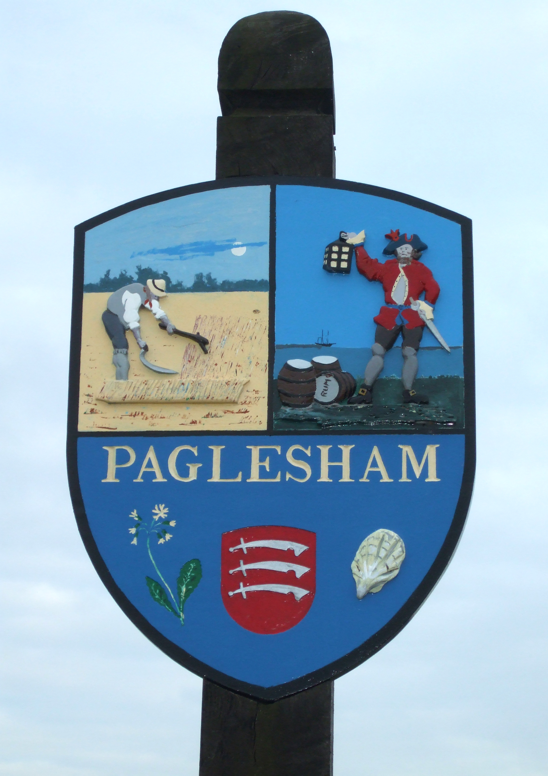
Paglesham

Paglesham ( PAG-əl-shəm) is a village and civil parish in the north east of the Rochford Rural District, Essex. The parish includes two hamlets of Eastend...

Barling, Essex

Barling is a village and former civil parish, now in the civil parish of Barling Magna in the Rochford district, in the county of Essex, England. It is...

Wallasea Island

Wallasea Island lies in Essex, England. It is bounded to the north by the River Crouch, to the south east by the River Roach, and to the west by Paglesham...

Rushley Island

Rushley Island is a small uninhabited island in Essex, England. It is the smallest of six islands comprising an archipelago in Essex, and is privately...

New England Island

New England Island is an uninhabited island in Essex, England. One road crosses the island, connecting it with bridges to Foulness and to the mainland...

White Ensign F.C.

White Ensign Football Club is a football club based in Southend-on-Sea, Essex, England. They are currently members of the Essex Senior League and play...

Nearby Amenities

Located within 500m of 51.586291,0.80556926
Source: PGS
Lat/Long: 51.587119/0.798888
Source: PGS
Lat/Long: 51.5873499/0.7998083
Source: PGS
Lat/Long: 51.587662/0.800508
Source: PGS
Lat/Long: 51.588197/0.801716
Source: PGS
Lat/Long: 51.588461/0.802115
Source: PGS
Lat/Long: 51.5886564/0.8028338
Source: PGS
Lat/Long: 51.5889364/0.8034132
Source: PGS
Lat/Long: 51.5891097/0.8037565
Source: PGS
Lat/Long: 51.5903028/0.8052907
Source: PGS
Lat/Long: 51.5830917/0.8091087
Source: PGS
Lat/Long: 51.5863583/0.8088512
Source: PGS
Lat/Long: 51.5867166/0.8087883
Source: PGS
Lat/Long: 51.5875699/0.8095286
Source: PGS
Lat/Long: 51.5884164/0.8103011
Source: PGS
Lat/Long: 51.5890497/0.8109019
Source: PGS
Lat/Long: 51.582268/0.806733
Source: PGS
Lat/Long: 51.582524/0.806721
Source: PGS
Lat/Long: 51.58278/0.806708
Source: PGS
Lat/Long: 51.5838701/0.8063422
Source: PGS
Lat/Long: 51.58505/0.8060418
Source: PGS
Lat/Long: 51.5860233/0.8059666
Source: PGS
Lat/Long: 51.5860233/0.8057092
Source: PGS
Lat/Long: 51.58551/0.8040891
Source: PGS
Lat/Long: 51.58521/0.8029733
Source: PGS
Lat/Long: 51.58491/0.8017288
Source: PGS
Lat/Long: 51.5845434/0.8002804
Source: PGS
Lat/Long: 51.5842434/0.8001945
Source: PGS
Lat/Long: 51.5841701/0.7996366
Source: PGS
Lat/Long: 51.5843634/0.7994328
Seamark Buoy Lateral Category: port
Seamark Buoy Lateral Colour: red
Seamark Buoy Lateral Shape: can
Seamark Buoy Lateral System: iala-a
Seamark Light Character: Q
Seamark Light Colour: red
Seamark Name: Barling Ness
Seamark Type: buoy_lateral
Lat/Long: 51.5874/0.8070833
The data included in this document is from www.openstreetmap.org. The data is made available under ODbL.

Have you been to Barling Ness?

Leave your review of Barling Ness below (or comments, questions and feedback).