Big Gap
Coastal Marsh, Saltings in Norfolk North Norfolk
England
Big Gap

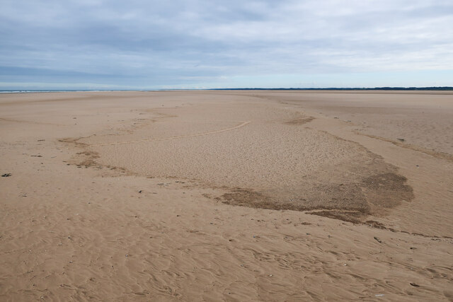
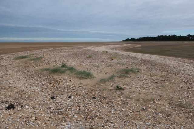
Big Gap is a coastal marsh located in Norfolk, England. It is situated along the Norfolk Coast Area of Outstanding Natural Beauty, between the villages of Cley-next-the-Sea and Salthouse. This unique marshland is known for its extensive saltings, which are areas of salt marshes that form at the edge of the coastline.
The marshland at Big Gap is characterized by large expanses of flat, open land, covered in a variety of salt-tolerant grasses and plants. These grasses help to stabilize the marshes and provide a habitat for numerous species of birds, insects, and small mammals. The area is particularly renowned as a haven for birdwatchers, as it is home to a diverse range of avian species.
Due to its proximity to the sea, Big Gap experiences tidal flooding, which creates a dynamic and ever-changing landscape. The tides bring in nutrient-rich sediments, which support the growth of unique salt-tolerant vegetation. During high tide, the marshes become inundated with water, providing a feeding ground for wading birds and waterfowl.
Big Gap is also part of the Norfolk Coast Path, a long-distance trail that stretches for 84 miles along the coast. This scenic trail allows visitors to explore the marshland and enjoy panoramic views of the North Sea. The area is also home to several nature reserves and wildlife sanctuaries, which contribute to its rich biodiversity.
Overall, Big Gap offers a fascinating glimpse into the unique coastal ecosystems found in Norfolk. Its extensive salt marshes, diverse birdlife, and stunning coastal views make it a popular destination for nature enthusiasts and those seeking a tranquil escape.
If you have any feedback on the listing, please let us know in the comments section below.
Big Gap Images
Images are sourced within 2km of 52.972626/0.86114577 or Grid Reference TF9245. Thanks to Geograph Open Source API. All images are credited.


Big Gap is located at Grid Ref: TF9245 (Lat: 52.972626, Lng: 0.86114577)
Administrative County: Norfolk
District: North Norfolk
Police Authority: Norfolk
What 3 Words
///useful.campsites.regaining. Near Wells-next-the-Sea, Norfolk
Nearby Locations
Related Wikis

Wells-next-the-Sea Lifeboat Station
Wells-next-the-Sea Lifeboat Station is a lifeboat station in the town of Wells-next-the-Sea in the English county of Norfolk. The station, run by the Royal...
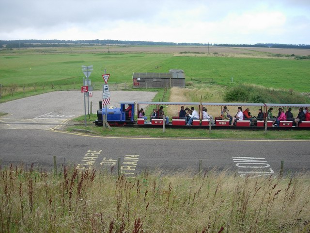
Wells Harbour Railway
The Wells Harbour Railway was a 10+1⁄4 in (260 mm) gauge railway that ran at Wells-next-the-Sea, Norfolk, England. It was 1,200 yards (1,100 m) long, running...

Eliza Adams Lifeboat Memorial
The Eliza Adams Lifeboat Memorial is a grade II listed memorial in Wells-next-the-Sea in Norfolk. It commemorates the death of 11 members of an RNLI lifeboat...

Wells Harbour
Wells Harbour is located in the town of Wells-next-the-Sea in the county of Norfolk, England. The harbour is 21 miles west of Cromer, 34.8 miles north...
Have you been to Big Gap?
Leave your review of Big Gap below (or comments, questions and feedback).