Barksore Marshes
Coastal Marsh, Saltings in Kent Swale
England
Barksore Marshes

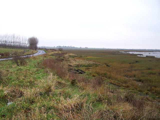
Barksore Marshes, located in Kent, England, is a coastal marshland and salting area of significant ecological importance. Stretching over a vast expanse of approximately 1,000 hectares, it is situated along the coast of the English Channel and forms part of the larger Walland Marshes.
The marshes are characterized by a diverse range of habitats, including saltmarshes, mudflats, reedbeds, and freshwater ditches. These habitats provide a haven for a wide array of plant and animal species, making it a haven for wildlife enthusiasts and nature lovers. The area is particularly renowned for its rich birdlife, with over 200 species recorded here, including migratory birds such as redshanks, oystercatchers, and curlews.
In addition to its ecological significance, Barksore Marshes have historical importance as well. The site has been used for centuries for grazing livestock, and evidence of Roman and medieval occupation can be found in the surrounding area. The marshes also played a role in coastal defense during World War II, with pillboxes and other fortifications still visible today.
The marshes are managed by various conservation organizations, such as the Royal Society for the Protection of Birds (RSPB), to ensure the preservation of its unique ecosystem. Visitors can explore the area through a network of footpaths and bird hides, allowing for close encounters with the diverse wildlife. Interpretive boards and guided tours are also available to educate visitors about the importance of this natural habitat and its conservation needs.
Overall, Barksore Marshes in Kent is a remarkable coastal marshland, teeming with biodiversity and offering a fascinating blend of natural and historical features.
If you have any feedback on the listing, please let us know in the comments section below.
Barksore Marshes Images
Images are sourced within 2km of 51.387111/0.69295921 or Grid Reference TQ8768. Thanks to Geograph Open Source API. All images are credited.


Barksore Marshes is located at Grid Ref: TQ8768 (Lat: 51.387111, Lng: 0.69295921)
Administrative County: Kent
District: Swale
Police Authority: Kent
What 3 Words
///changing.motored.estuaries. Near Lower Halstow, Kent
Nearby Locations
Related Wikis
Funton
Funton is a location in Kent, United Kingdom. It is a creek situated on the edge of the North Kent Marshes on the right bank of the River Medway about...

Chetney Hill
Chetney Hill was a planned lazaret on the banks of the River Medway estuary in Kent. Inspired by European ports such as Marseille and Venice, it was intended...
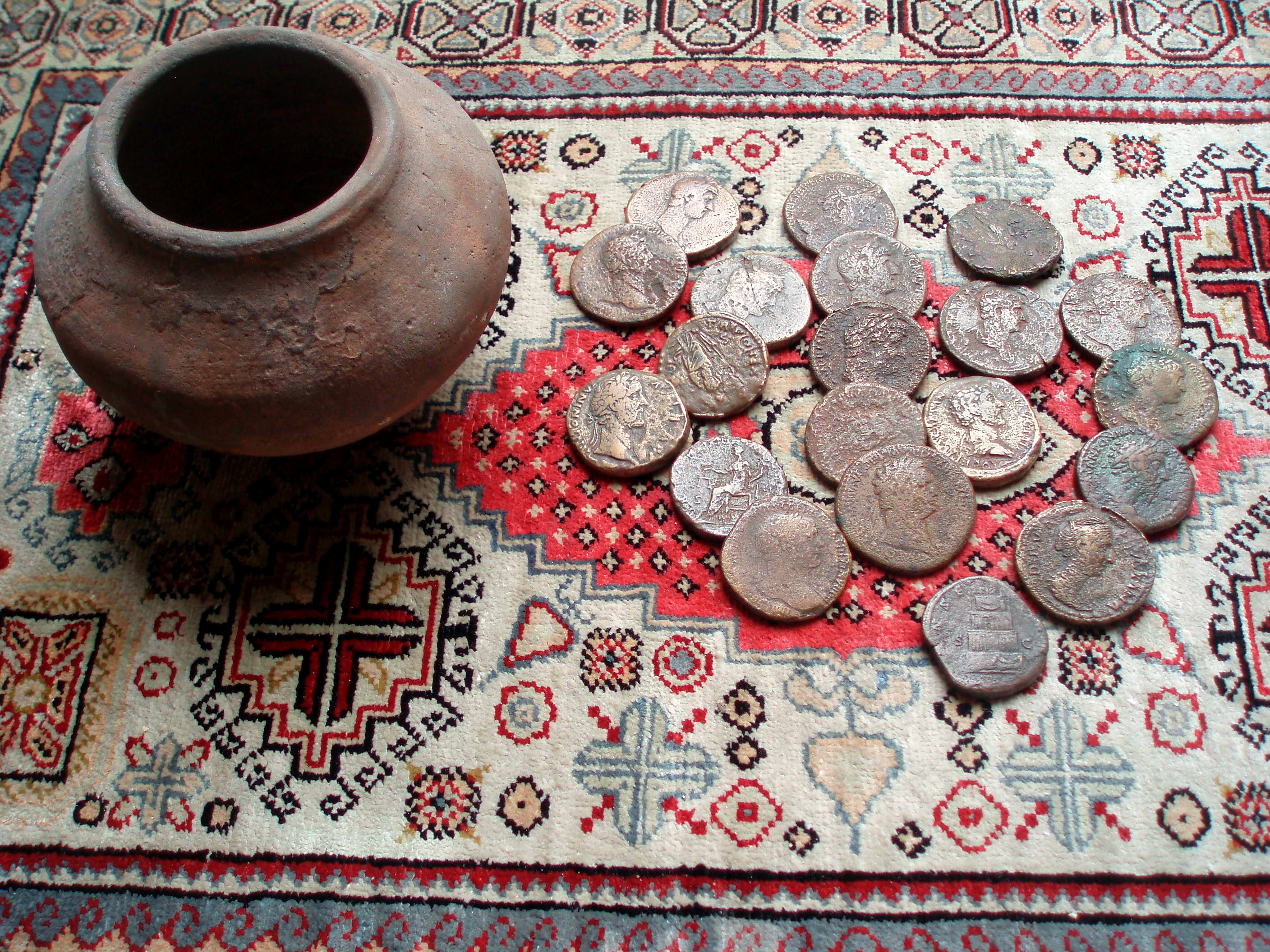
Upchurch Hoard
The Upchurch Hoard was a pot containing thirty-seven Roman sestertii dating from the late 1st century to the second half of the 2nd century AD found near...
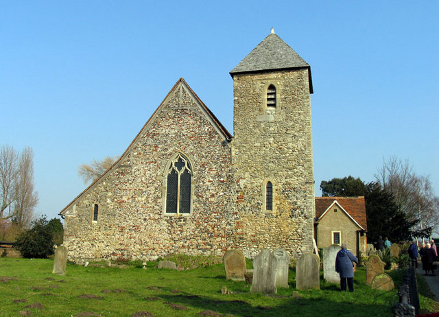
Lower Halstow
Lower Halstow is a village and civil parish in the Swale district of Kent, England. The village is northwest of Sittingbourne on the banks of the Medway...
Have you been to Barksore Marshes?
Leave your review of Barksore Marshes below (or comments, questions and feedback).