Ferrier Sand

Coastal Marsh, Saltings in Norfolk King's Lynn and West Norfolk

England

Ferrier Sand

Reflected cloudscape between Heacham and Shepherd's Port: aerial 2024
Reflected cloudscape between Heacham and Shepherd's Port: aerial 2024 Credit: Chris

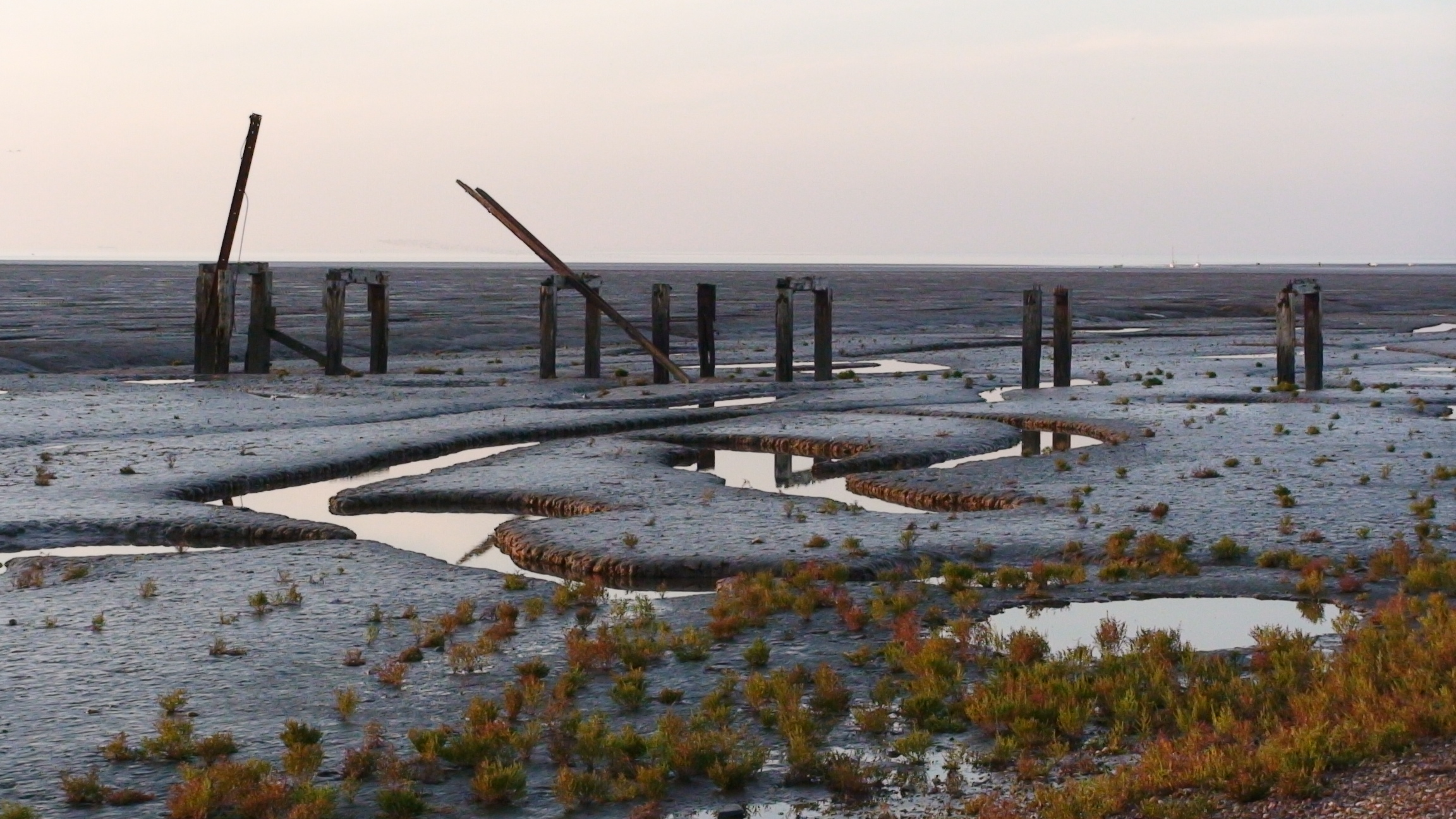
Ferrier Sand is a coastal marsh located in Norfolk, England. Situated along the eastern coast of the country, it is known for its unique and diverse ecosystem of salt marshes and saltings. The area is characterized by its vast expanse of sandy soil, which is a result of tidal processes and deposition of sediments.

The marsh is home to a wide variety of plants and wildlife, making it an important habitat for many species. The salt marshes provide a breeding ground for various bird species, including waders such as redshanks and curlews. These birds can often be spotted feeding on the rich food sources found in the marshes.

The vegetation in Ferrier Sand is adapted to tolerate the high salt content in the soil. Common species found in the area include samphire, sea lavender, and sea purslane. These plants not only provide food and shelter for the local wildlife but also help to stabilize the soil and prevent erosion.

The marshes of Ferrier Sand are influenced by the tides, which bring in a constant supply of nutrients and sediments. This dynamic environment is crucial for the survival and growth of the diverse array of flora and fauna found in the area.

Ferrier Sand attracts visitors who are interested in observing and studying the unique coastal ecosystem. The marshes offer opportunities for walking, birdwatching, and photography, allowing visitors to appreciate the natural beauty and ecological significance of this coastal landscape.

If you have any feedback on the listing, please let us know in the comments section below.

Ferrier Sand Images

Images are sourced within 2km of 52.875809/0.41423944 or Grid Reference TF6233. Thanks to Geograph Open Source API. All images are credited.

Reflected cloudscape between Heacham and Shepherd's Port: aerial 2024
Mud glorious mud - no boys on this beach only buoys ! Although there is a sandy beach at the mean high water mark at Snettisham once the tide goes out there is nothing but soggy mud for miles. The vessel in the distance is probably laying a power cable from the wind farm off the Lincolnshire coast to the saltmarsh near Sutton Bridge
Mud glorious mud - no boys on this beach only buoys !
Although there is a sandy beach at the mean high water mark at Snettisham once the tide goes out there is nothing but soggy mud for miles. The vessel in the distance is probably laying a power cable from the wind farm off the Lincolnshire coast to the saltmarsh near Sutton Bridge
Watching the sunset on Snettisham beach At high tide the sea breaks onto the shingle beach but at low tide there is a vast expanse of mud and creeks and it is difficult to see the sea, <a title="https://www.geograph.org.uk/photo/1916406" href="https://www.geograph.org.uk/photo/1916406">Link</a>
Watching the sunset on Snettisham beach
At high tide the sea breaks onto the shingle beach but at low tide there is a vast expanse of mud and creeks and it is difficult to see the sea, Link
Sunset and high tide at Snettisham beach The east coast of The Wash is one of the few places in eastern England where you can watch the sun set over the sea
Sunset and high tide at Snettisham beach
The east coast of The Wash is one of the few places in eastern England where you can watch the sun set over the sea
The sun sets over The Wash on Remembrance Sunday A peaceful end to this day of remembrance on Snettisham beach. Even the mud and trenches usually on view are hidden by the high tide, see <a title="https://www.geograph.org.uk/photo/1916406" href="https://www.geograph.org.uk/photo/1916406">Link</a>
The sun sets over The Wash on Remembrance Sunday
A peaceful end to this day of remembrance on Snettisham beach. Even the mud and trenches usually on view are hidden by the high tide, see Link
Ferrier Sand There’s not much to see out here.  Muddy sand, some clumps of weed, and a lot of cockle shells.
Ferrier Sand
There’s not much to see out here. Muddy sand, some clumps of weed, and a lot of cockle shells.
Hovercraft on Ferrier Sand Ferrier Sand is difficult to access on foot because it lies on the opposite side of Wolferton Creek from the beaches of Snettisham and Heacham.  Happily, I now have a means of crossing creeks and sandbanks alike.
Hovercraft on Ferrier Sand
Ferrier Sand is difficult to access on foot because it lies on the opposite side of Wolferton Creek from the beaches of Snettisham and Heacham. Happily, I now have a means of crossing creeks and sandbanks alike.
Snettisham Beach at High Tide Shingle beach with berms marking previous high tides. Currently having millions of pounds spent on it to repair erosion damage.
Snettisham Beach at High Tide
Shingle beach with berms marking previous high tides. Currently having millions of pounds spent on it to repair erosion damage.
Snettisham Beach, Sunset This view is across the sands bordering The Wash at Snettisham. As can be seen it is a vast expanse of tidal sand, much beloved by shorebirds. This stretch of coast from King's Lynn up to Hunstanton is of course rather unusual for the East Coast of England, in that it is west-facing, and is therefore one of the few places on this side of the country where a sunset can be seen over the sea.

This was my first contribution to the Geograph project, when most of the map was still green (not yet photographed for the project). However, when I took this photo I was unaware of the project, finding out about it just a couple of weeks later, I thought that this snap might be accepted. I was right and a new hobby was born for me - one I'm still pursuing actively over sixteen years later! 
My original comment for this photo was "Taken with a Fuji F401 digital camera : October 2005" - which is a little less informative than I try to be these days.
Snettisham Beach, Sunset
This view is across the sands bordering The Wash at Snettisham. As can be seen it is a vast expanse of tidal sand, much beloved by shorebirds. This stretch of coast from King's Lynn up to Hunstanton is of course rather unusual for the East Coast of England, in that it is west-facing, and is therefore one of the few places on this side of the country where a sunset can be seen over the sea. This was my first contribution to the Geograph project, when most of the map was still green (not yet photographed for the project). However, when I took this photo I was unaware of the project, finding out about it just a couple of weeks later, I thought that this snap might be accepted. I was right and a new hobby was born for me - one I'm still pursuing actively over sixteen years later! My original comment for this photo was "Taken with a Fuji F401 digital camera : October 2005" - which is a little less informative than I try to be these days.
Sunset over the Wash. Taken from Snettisham beach, Norfolk.
Sunset over the Wash.
Taken from Snettisham beach, Norfolk.
Sunset over the Wash. Taken from Snettisham beach, the calmness of the sea provides a mirror like image of the sky.
Sunset over the Wash.
Taken from Snettisham beach, the calmness of the sea provides a mirror like image of the sky.
Wolferton Creek buoy number 2 There seem to be numbered buoys marking the channel of Wolferton Creek.  This one, number 2, had fallen over as the tide went out.
Wolferton Creek buoy number 2
There seem to be numbered buoys marking the channel of Wolferton Creek. This one, number 2, had fallen over as the tide went out.
Mudflats of Snettisham Beach Sometimes, the mud seems to go on forever.
Mudflats of Snettisham Beach
Sometimes, the mud seems to go on forever.
Slightly rippled Unlike further north, the mud here has clearly been shaped by the movement of the sea.  Ahead, the clear water marks the mouth of Wolferton Creek.
Slightly rippled
Unlike further north, the mud here has clearly been shaped by the movement of the sea. Ahead, the clear water marks the mouth of Wolferton Creek.
Wolferton Creek This picture shows the confluence of Wolferton Creek with an unidentified watercourse from somewhere further west.  Also quite a lot of mud.
Wolferton Creek
This picture shows the confluence of Wolferton Creek with an unidentified watercourse from somewhere further west. Also quite a lot of mud.
Wolferton Creek Up here, Wolferton Creek has carved a noticeable valley in the mud, and some smaller tributary channels are visible too.  In the distance buoy number 5 stands upright on the mud, as do several small boats.
Wolferton Creek
Up here, Wolferton Creek has carved a noticeable valley in the mud, and some smaller tributary channels are visible too. In the distance buoy number 5 stands upright on the mud, as do several small boats.
Snettisham Scalp The Wash is the square-mouthed bay and estuary at the north-west corner of East Anglia on the East coast of England, where Norfolk meets Lincolnshire. It is among the largest estuaries in the United Kingdom. The Wash is fed by the rivers Witham, Welland, Nene and Great Ouse. The coastline runs from near Hunstanton to Gibraltar Point.
Owing to deposits of sediment and land reclamation, the coastline of the Wash has altered markedly within historical times; several towns once on the coast of the Wash (notably King's Lynn) are now some distance inland. Much of the Wash itself is very shallow, with several large sandbanks, such as Breast Sand, Bulldog Sand, Roger Sand and Old South Sand, which are exposed at low tide, especially along the south coast. For this reason, navigation in the Wash can be hazardous.
Snettisham Scalp
The Wash is the square-mouthed bay and estuary at the north-west corner of East Anglia on the East coast of England, where Norfolk meets Lincolnshire. It is among the largest estuaries in the United Kingdom. The Wash is fed by the rivers Witham, Welland, Nene and Great Ouse. The coastline runs from near Hunstanton to Gibraltar Point. Owing to deposits of sediment and land reclamation, the coastline of the Wash has altered markedly within historical times; several towns once on the coast of the Wash (notably King's Lynn) are now some distance inland. Much of the Wash itself is very shallow, with several large sandbanks, such as Breast Sand, Bulldog Sand, Roger Sand and Old South Sand, which are exposed at low tide, especially along the south coast. For this reason, navigation in the Wash can be hazardous.
Show me another place!

Ferrier Sand is located at Grid Ref: TF6233 (Lat: 52.875809, Lng: 0.41423944)

Administrative County: Norfolk

District: King's Lynn and West Norfolk

Police Authority: Norfolk

What 3 Words

///otters.lyrics.riots. Near Snettisham, Norfolk

Nearby Locations

Ferrier Sand

Related Wikis

Snettisham RSPB reserve

Snettisham RSPB reserve is a nature reserve in the care of the Royal Society for the Protection of Birds, situated near Snettisham in the county of Norfolk...
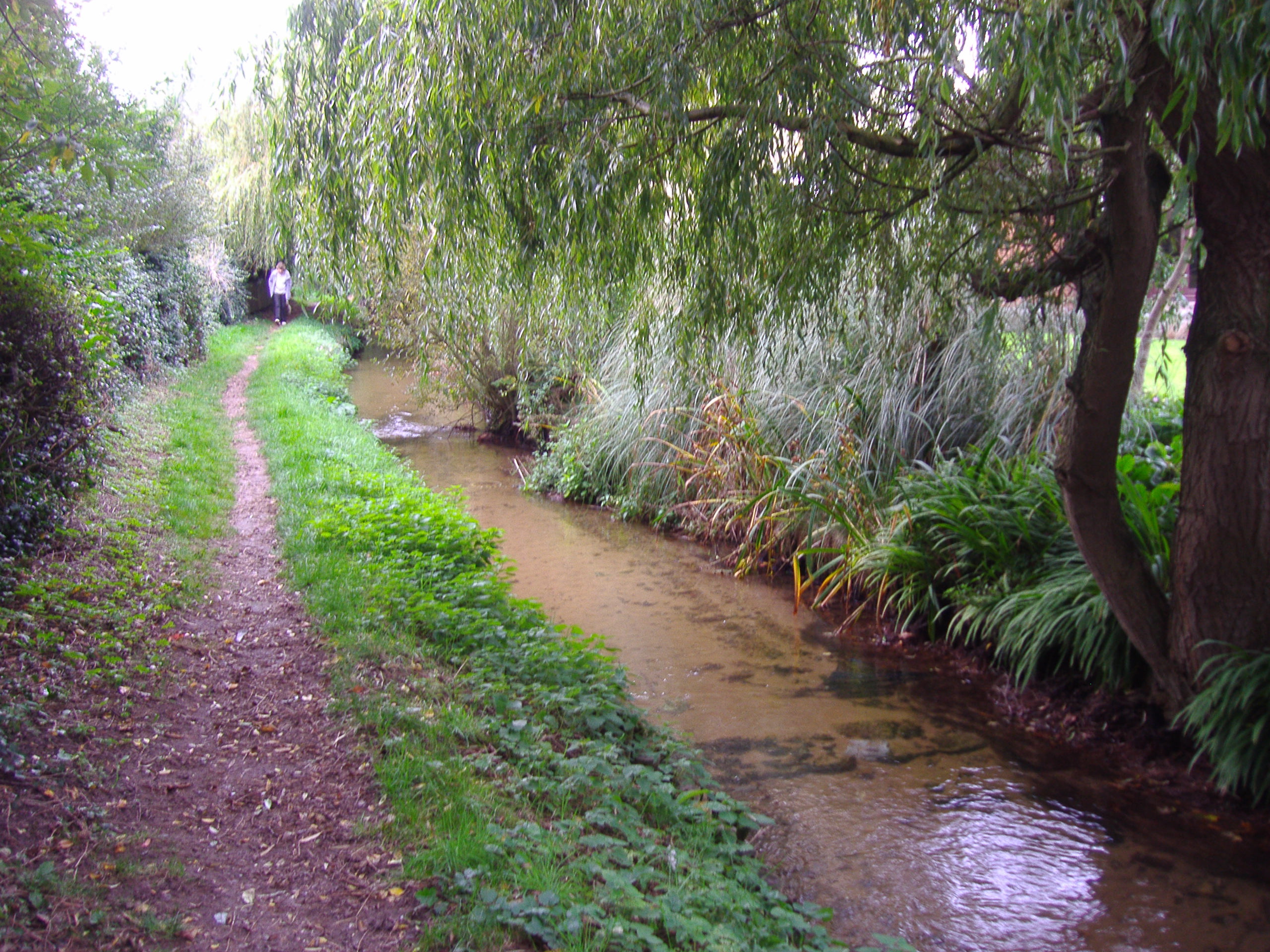
River Ingol

The River Ingol is a small river in the west of the English county of Norfolk. == Sources == The source of the river can be found a little to the west...
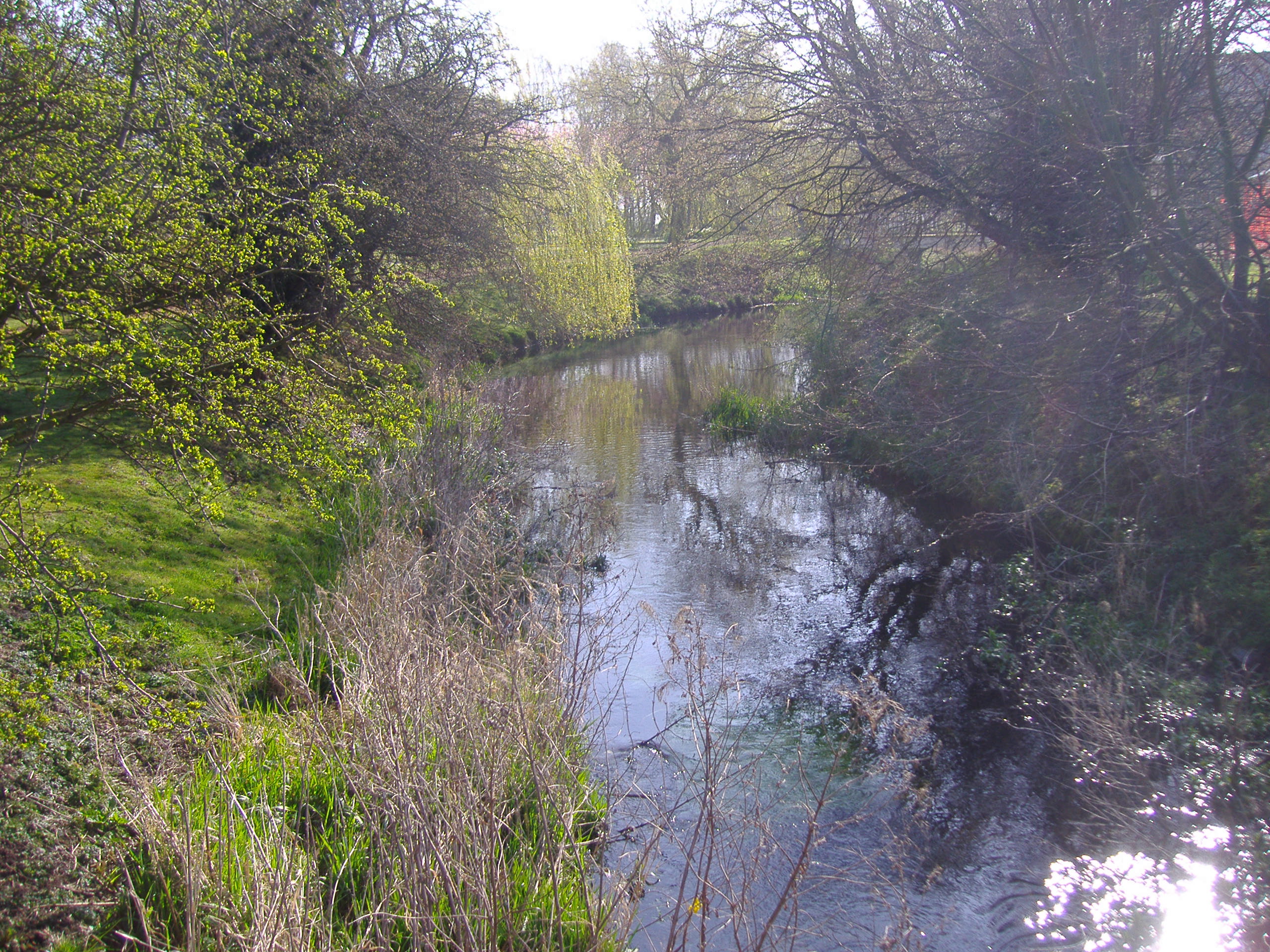
Heacham River

Heacham River is a small river in the King's Lynn and West Norfolk district of the English County of Norfolk. Its source is near the village of Bircham...

Snettisham railway station

Snettisham was a railway station on the King's Lynn to Hunstanton line which served the village of Snettisham, a few miles north of King's Lynn in North...

Have you been to Ferrier Sand?

Leave your review of Ferrier Sand below (or comments, questions and feedback).