Blackshelf

Coastal Marsh, Saltings in Essex

England

Blackshelf

Lion Pit Cutting A view towards the Thames just above the now wooded old cutting which led from Lion Pit (now Gorge) to the wharves by the Thames. This is now part of the Chafford Gorges nature reserve, managed by Essex Wildlife Trust. The tall pylon is on the Kent side of the river.
Lion Pit Cutting Credit: Adrian Benn

Blackshelf is a coastal marsh and saltings area located in Essex, England. Situated along the eastern coast of the county, it is known for its unique ecological features and diverse wildlife.

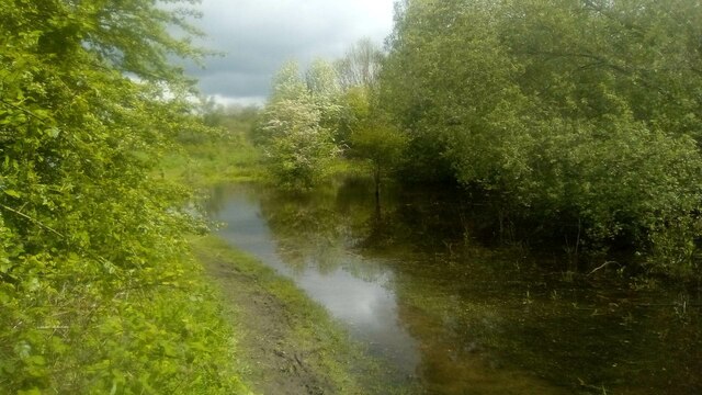
The area encompasses a stretch of land between the Blackwater and Colne estuaries, covering approximately 500 hectares. Blackshelf is characterized by its vast salt marshes, which are flooded by the tides twice a day. These marshes are predominantly covered with salt-tolerant plants, such as samphire and sea lavender, creating a stunning landscape of vibrant colors.

The saline environment of Blackshelf provides a habitat for a wide range of wildlife. The area is particularly renowned for its bird population, with numerous species of waders and waterfowl frequenting the marshes throughout the year. Visitors can observe birds like avocets, dunlins, and redshanks, which use the marshes as feeding grounds and nesting sites.

In addition to its avian inhabitants, Blackshelf is also home to various insects, reptiles, and mammals. The marshes attract butterflies and dragonflies, while common seals can often be spotted basking on the mudflats during low tide.

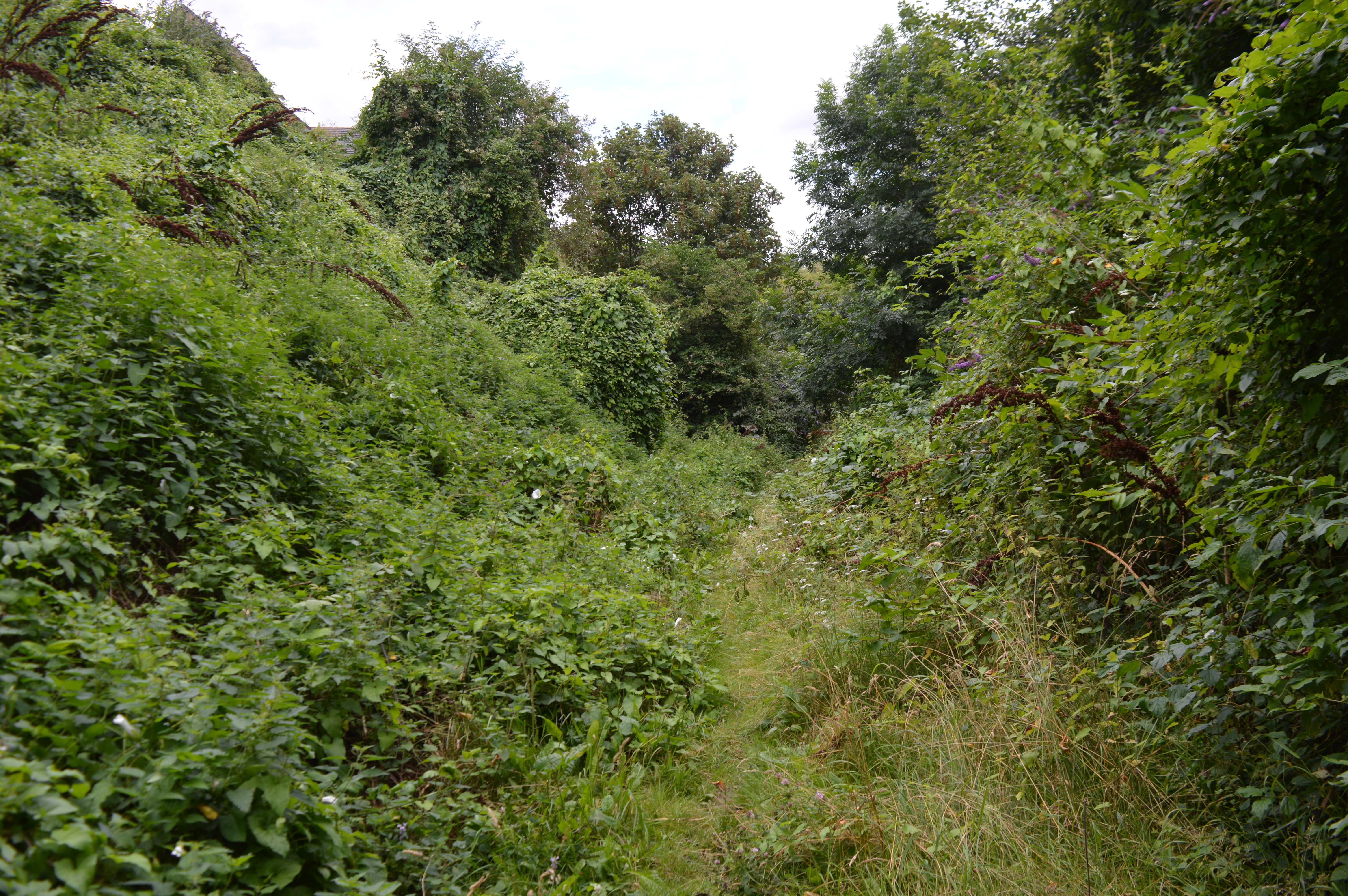
Blackshelf is a popular destination for nature enthusiasts and birdwatchers, who can explore the area via designated paths and trails. The marshes provide a serene location for peaceful walks, picnics, and wildlife photography. The site is managed by local conservation organizations, ensuring the preservation of this valuable coastal ecosystem for future generations to enjoy.

If you have any feedback on the listing, please let us know in the comments section below.
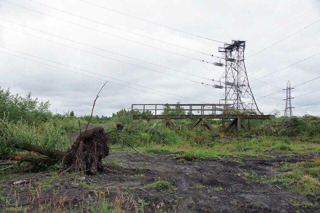
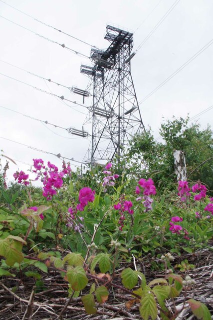
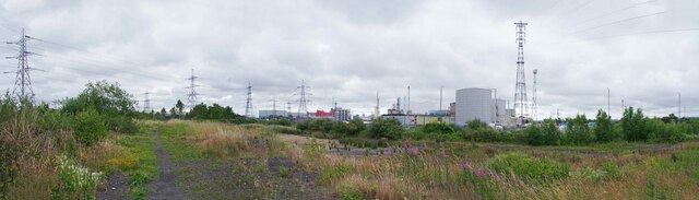
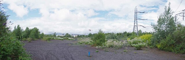
Blackshelf Images

Images are sourced within 2km of 51.472741/0.30807475 or Grid Reference TQ6077. Thanks to Geograph Open Source API. All images are credited.

Lion Pit Cutting A view towards the Thames just above the now wooded old cutting which led from Lion Pit (now Gorge) to the wharves by the Thames. This is now part of the Chafford Gorges nature reserve, managed by Essex Wildlife Trust. The tall pylon is on the Kent side of the river.
Lion Pit Cutting
A view towards the Thames just above the now wooded old cutting which led from Lion Pit (now Gorge) to the wharves by the Thames. This is now part of the Chafford Gorges nature reserve, managed by Essex Wildlife Trust. The tall pylon is on the Kent side of the river.
Low Tide on the Thames at Grays
Oliver Road Lagoons Nature Reserve Oliver Road Reserve is owned by The Land Trust <span class="nowrap"><a title="https://thelandtrust.org.uk/space/oliver-road-lagoons/" rel="nofollow ugc noopener" href="https://thelandtrust.org.uk/space/oliver-road-lagoons/">Link</a><img style="margin-left:2px;" alt="External link" title="External link - shift click to open in new window" src="https://s1.geograph.org.uk/img/external.png" width="10" height="10"/></span>  but since 2018 has been managed by 
Essex Wildlife Trust <span class="nowrap"><a title="https://www.essexwt.org.uk/" rel="nofollow ugc noopener" href="https://www.essexwt.org.uk/">Link</a><img style="margin-left:2px;" alt="External link" title="External link - shift click to open in new window" src="https://s1.geograph.org.uk/img/external.png" width="10" height="10"/></span>. The 40ha site is that of a former coal fired power station demolished around 1997. The land contaminated with fly ash became secondary birch woodland with little biodiversity. The clearance of many of the trees has led to significant improvement in this. 59 “Red List” species have been recorded on the site as well as a further 27 nationally scarce species. The reserve is particularly good for invertebrates and includes the largest intertidal mudflats in the inner Thames area. The reserve is closed to the public due to the contaminated nature of the soil. However you could join the Wednesday work party <span class="nowrap"><a title="https://www.essexwt.org.uk/volunteering-opportunities/work-party-volunteers-oliver-road-lagoons" rel="nofollow ugc noopener" href="https://www.essexwt.org.uk/volunteering-opportunities/work-party-volunteers-oliver-road-lagoons">Link</a><img style="margin-left:2px;" alt="External link" title="External link - shift click to open in new window" src="https://s1.geograph.org.uk/img/external.png" width="10" height="10"/></span> To continue on a tour of Wildlife Trust sites in Essex visit <a href="https://www.geograph.org.uk/photo/150006">TL9114 : Oxley Meadow</a>
Oliver Road Lagoons Nature Reserve
Oliver Road Reserve is owned by The Land Trust LinkExternal link but since 2018 has been managed by Essex Wildlife Trust LinkExternal link. The 40ha site is that of a former coal fired power station demolished around 1997. The land contaminated with fly ash became secondary birch woodland with little biodiversity. The clearance of many of the trees has led to significant improvement in this. 59 “Red List” species have been recorded on the site as well as a further 27 nationally scarce species. The reserve is particularly good for invertebrates and includes the largest intertidal mudflats in the inner Thames area. The reserve is closed to the public due to the contaminated nature of the soil. However you could join the Wednesday work party LinkExternal link To continue on a tour of Wildlife Trust sites in Essex visit TL9114 : Oxley Meadow
Waiting For A Bioblitz Essex Wildlife Trust staff are waiting at <a href="https://www.geograph.org.uk/photo/7215288">TQ5877 : Oliver Road Lagoons Nature Reserve</a> for a small army of volunteers to arrive to record as many species as they can during the day. Often common species go unrecorded. The technique of the Bioblitz <span class="nowrap"><a title="https://en.wikipedia.org/wiki/BioBlitz" rel="nofollow ugc noopener" href="https://en.wikipedia.org/wiki/BioBlitz">Link</a><img style="margin-left:2px;" alt="External link" title="External link - shift click to open in new window" src="https://s1.geograph.org.uk/img/external.png" width="10" height="10"/></span> uses citizen scientists to get as comprehensive picture of the habitat as possible.
Waiting For A Bioblitz
Essex Wildlife Trust staff are waiting at TQ5877 : Oliver Road Lagoons Nature Reserve for a small army of volunteers to arrive to record as many species as they can during the day. Often common species go unrecorded. The technique of the Bioblitz LinkExternal link uses citizen scientists to get as comprehensive picture of the habitat as possible.
Old Bridge at Oliver Road This decaying bridge is on <a href="https://www.geograph.org.uk/photo/7215288">TQ5877 : Oliver Road Lagoons Nature Reserve</a> a 40ha site managed by Essex Wildlife Trust  <span class="nowrap"><a title="https://www.essexwt.org.uk/" rel="nofollow ugc noopener" href="https://www.essexwt.org.uk/">Link</a><img style="margin-left:2px;" alt="External link" title="External link - shift click to open in new window" src="https://s1.geograph.org.uk/img/external.png" width="10" height="10"/></span> in the background you can see the birch woodland that once colonised this brownfield site. Clearance of the trees has created some nationally important habitat. 59 Red list species have been recorded on site.
Old Bridge at Oliver Road
This decaying bridge is on TQ5877 : Oliver Road Lagoons Nature Reserve a 40ha site managed by Essex Wildlife Trust LinkExternal link in the background you can see the birch woodland that once colonised this brownfield site. Clearance of the trees has created some nationally important habitat. 59 Red list species have been recorded on site.
A Dry Lagoon at Oliver Road Looking across a dried up lagoon on <a href="https://www.geograph.org.uk/photo/7215288">TQ5877 : Oliver Road Lagoons Nature Reserve</a> looking 
towards <a href="https://www.geograph.org.uk/photo/39699">TQ5876 : High Voltage?</a>
A Dry Lagoon at Oliver Road
Looking across a dried up lagoon on TQ5877 : Oliver Road Lagoons Nature Reserve looking towards TQ5876 : High Voltage?
Sweet Peas and Pylon Garden escapees on <a href="https://www.geograph.org.uk/photo/7215288">TQ5877 : Oliver Road Lagoons Nature Reserve</a>
Sweet Peas and Pylon
Oliver Rd Panorama Just a small part of <a href="https://www.geograph.org.uk/photo/7215288">TQ5877 : Oliver Road Lagoons Nature Reserve</a> a 40Ha site managed by 
Essex Wildlife Trust <span class="nowrap"><a title="https://www.essexwt.org.uk/" rel="nofollow ugc noopener" href="https://www.essexwt.org.uk/">Link</a><img style="margin-left:2px;" alt="External link" title="External link - shift click to open in new window" src="https://s1.geograph.org.uk/img/external.png" width="10" height="10"/></span>
Oliver Rd Panorama
Just a small part of TQ5877 : Oliver Road Lagoons Nature Reserve a 40Ha site managed by Essex Wildlife Trust LinkExternal link
Heading for the Bioblitz A couple of Bioblitzers on <a href="https://www.geograph.org.uk/photo/7215288">TQ5877 : Oliver Road Lagoons Nature Reserve</a>
Heading for the Bioblitz
A couple of Bioblitzers on TQ5877 : Oliver Road Lagoons Nature Reserve
Vetch at Oliver Rd Lagoons An attractive native plant on <a href="https://www.geograph.org.uk/photo/7215288">TQ5877 : Oliver Road Lagoons Nature Reserve</a>.
Vetch at Oliver Rd Lagoons
An attractive native plant on TQ5877 : Oliver Road Lagoons Nature Reserve.
Goat's Rue on Oliver Road Reserve Parts of the <a href="https://www.geograph.org.uk/photo/7215288">TQ5877 : Oliver Road Lagoons Nature Reserve</a> are infested with the invasive Goat's Rue (Galega officinalis). Although the bees love it Goat's Rue chokes out other plants. When strimming large areas of goat's rue I have felt sorry for surviving stinging nettles and worked around them!
Goat's Rue on Oliver Road Reserve
Parts of the TQ5877 : Oliver Road Lagoons Nature Reserve are infested with the invasive Goat's Rue (Galega officinalis). Although the bees love it Goat's Rue chokes out other plants. When strimming large areas of goat's rue I have felt sorry for surviving stinging nettles and worked around them!
A Path Through Oliver Rd Reserve The silver birches give a feel of what <a href="https://www.geograph.org.uk/photo/7215288">TQ5877 : Oliver Road Lagoons Nature Reserve</a> was like before the tree clearance campaign.
A Path Through Oliver Rd Reserve
The silver birches give a feel of what TQ5877 : Oliver Road Lagoons Nature Reserve was like before the tree clearance campaign.
Common Red Soldier Beetle This Rhagonycha fulva is a resident of <a href="https://www.geograph.org.uk/photo/7215288">TQ5877 : Oliver Road Lagoons Nature Reserve</a>
Common Red Soldier Beetle
This Rhagonycha fulva is a resident of TQ5877 : Oliver Road Lagoons Nature Reserve
Comma on Oliver Road A comma rests on the pulverised coal ash from the former power station at <a href="https://www.geograph.org.uk/photo/7215288">TQ5877 : Oliver Road Lagoons Nature Reserve</a>
Comma on Oliver Road
A comma rests on the pulverised coal ash from the former power station at TQ5877 : Oliver Road Lagoons Nature Reserve
317 304 on down train at West Thurrock, 1999 During the period when passenger operations on the London, Tilbury and Southend line were branded LTS Rail.
317 304 on down train at West Thurrock, 1999
During the period when passenger operations on the London, Tilbury and Southend line were branded LTS Rail.
High water in Warren Gorge Unusually high water in one of the lakes in Warren Gorge, part of the Chafford Gorges Nature Park.
High water in Warren Gorge
Unusually high water in one of the lakes in Warren Gorge, part of the Chafford Gorges Nature Park.
Flooded path in Warren Gorge Unusually high water in Warren Gorge, part of the Chafford Gorges Nature Park.
Flooded path in Warren Gorge
Unusually high water in Warren Gorge, part of the Chafford Gorges Nature Park.
Flooded area of Warren Gorge
Show me another place!

Blackshelf is located at Grid Ref: TQ6077 (Lat: 51.472741, Lng: 0.30807475)

Unitary Authority: Thurrock

Police Authority: Essex

What 3 Words

///link.hotel.orange. Near Grays, Essex

Nearby Locations

Blackshelf

Related Wikis

Nearby Amenities

Located within 500m of 51.472741,0.30807475
Crossing
Crossing: unmarked
Crossing Island: yes
Tactile Paving: yes
Lat/Long: 51.4771353/0.3074712
Direction: forward
Maxwidth: 6'6"
Traffic Calming: choker
Lat/Long: 51.4768271/0.3081531
Pub
The Wharf
Addr City: Grays
Addr Housename: The Wharf
Addr Postcode: RM17 6SZ
Addr Street: Wharf Road South
Contact Phone: +44 1375 372418
Contact Website: http://www.johnbarras.com/pub/wharf-hotel-grays/m3969/
Fhrs Id: 390656
Fhrs Local Authority Id: 12860/2000/2/000
Food: yes
Real Ale: yes
Source Addr: FHRS Open Data
Wikidata: Q26440890
Lat/Long: 51.4743431/0.3145286
Crossing
Crossing: unmarked
Crossing Island: yes
Tactile Paving: yes
Lat/Long: 51.477026/0.3076276
Traffic Signals
Traffic Signals: bus_priority
Traffic Signals Direction: forward
Lat/Long: 51.4766832/0.3084277
Crossing
Crossing: unmarked
Crossing Island: yes
Tactile Paving: yes
Lat/Long: 51.4769832/0.307994
Bus Stop
Roseberry Road
Bench: no
Bus: yes
Covered: no
Naptan AtcoCode: 1590015301
Naptan Bearing: W
Naptan CommonName: Roseberry Road
Naptan Indicator: Westbound
Naptan Landmark: Florence Road
Naptan NaptanCode: thuajpj
Naptan Street: London Road
Naptan Verified: no
Public Transport: platform
Shelter: no
Source: naptan_import
Lat/Long: 51.4764446/0.3086646
Bus Stop
Roseberry Road
Bus: yes
Naptan AtcoCode: 1590015401
Naptan Bearing: E
Naptan CommonName: Roseberry Road
Naptan Indicator: Eastbound
Naptan Landmark: Roseberry Road
Naptan NaptanCode: thuajpm
Naptan Street: London Road
Naptan Verified: no
Public Transport: platform
Source: naptan_import
Lat/Long: 51.4763054/0.3103236
Bus Stop
Meesons Lane
Bus: yes
Naptan AtcoCode: 1590015501
Naptan Bearing: W
Naptan CommonName: Meesons Lane
Naptan Indicator: Westbound
Naptan Landmark: Belmont Road
Naptan NaptanCode: thuajpt
Naptan Street: London Road
Naptan Verified: no
Public Transport: platform
Source: naptan_import
Lat/Long: 51.4762928/0.3112282
Railway: switch
Lat/Long: 51.4753828/0.3025343
Railway: switch
Lat/Long: 51.4754848/0.3033802
Railway: switch
Lat/Long: 51.4754193/0.3030638
Railway: switch
Lat/Long: 51.4754425/0.3039471
Communication Mobile Phone: yes
Man Made: mast
Tower Construction: lattice
Tower Type: communication
Lat/Long: 51.4758516/0.3041879
Give Way
Direction: forward
Lat/Long: 51.4771934/0.307087
Crossing
Crossing: unmarked
Crossing Island: yes
Tactile Paving: yes
Lat/Long: 51.4770083/0.3069809
Artwork Type: statue
Tourism: artwork
Lat/Long: 51.474185/0.3104168
Traffic Signals
Traffic Signals: bus_priority
Traffic Signals Direction: forward
Lat/Long: 51.4766557/0.3083885
Give Way
Direction: forward
Lat/Long: 51.4768391/0.307803
Give Way
Direction: forward
Lat/Long: 51.4771914/0.3072377
Give Way
Direction: backward
Lat/Long: 51.4770801/0.3070687
Give Way
Direction: forward
Lat/Long: 51.4771565/0.306926
Crossing
Crossing: unmarked
Crossing Island: yes
Tactile Paving: yes
Lat/Long: 51.4769771/0.3074452
Blackshelf
Place: locality
Source: OS _OpenData_StreetView
Lat/Long: 51.473219/0.3085207
Crossing
Crossing: unmarked
Crossing Island: yes
Tactile Paving: yes
Lat/Long: 51.4770531/0.307663
Crossing
Crossing: marked
Crossing Island: no
Tactile Paving: yes
Lat/Long: 51.4764061/0.311557
Direction: both
Surface: asphalt
Traffic Calming: cushion
Lat/Long: 51.4762995/0.3095431
Direction: both
Surface: asphalt
Traffic Calming: cushion
Lat/Long: 51.4763931/0.3090525
Direction: both
Surface: asphalt
Traffic Calming: cushion
Lat/Long: 51.476262/0.3099444
Direction: both
Surface: asphalt
Traffic Calming: cushion
Lat/Long: 51.4763086/0.3109707
Give Way
Direction: backward
Lat/Long: 51.476478/0.3117631
Give Way
Direction: backward
Lat/Long: 51.4763253/0.3107481
Give Way
Direction: backward
Lat/Long: 51.4763064/0.309774
Give Way
Direction: backward
Lat/Long: 51.4764348/0.3087992
Give Way
Direction: forward
Lat/Long: 51.4769522/0.3079559
Crossing
Crossing: unmarked
Crossing Island: yes
Tactile Paving: yes
Lat/Long: 51.4770094/0.3079319
Seamark Light Colour: green
Seamark Type: light_minor
Lat/Long: 51.4715065/0.3023922
Seamark Light Colour: green
Seamark Type: light_minor
Lat/Long: 51.4717203/0.3051066
Seamark Fog Signal Category: bell
Seamark Fog Signal Group: 1
Seamark Fog Signal Period: 55
Seamark Light Colour: green
Seamark Type: light_minor
Lat/Long: 51.4718072/0.3062868
Seamark Light Colour: green
Seamark Type: light_minor
Lat/Long: 51.4719943/0.3080249
Seamark Buoy Lateral Category: starboard
Seamark Buoy Lateral Colour: green
Seamark Buoy Lateral Shape: conical
Seamark Buoy Lateral System: iala-a
Seamark Light Character: Q
Seamark Light Colour: green
Seamark Name: Black Shelf
Seamark Type: buoy_lateral
Lat/Long: 51.4715867/0.3129387
The data included in this document is from www.openstreetmap.org. The data is made available under ODbL.

Have you been to Blackshelf?

Leave your review of Blackshelf below (or comments, questions and feedback).