Outer Knock

Coastal Marsh, Saltings in Lincolnshire

England

Outer Knock

Higher ground Looking towards Skegness, showing the flat and dry 'creek' to the left and the 'real' beach to the right.
Higher ground Credit: Ian Paterson

Outer Knock is a coastal marshland located in Lincolnshire, England. It is situated near the small village of Saltfleetby and is part of the larger Saltfleetby-Theddlethorpe Dunes and Salt Marshes Nature Reserve. This area is renowned for its unique and diverse ecosystem, making it a popular destination for nature enthusiasts and birdwatchers.

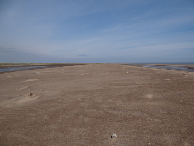
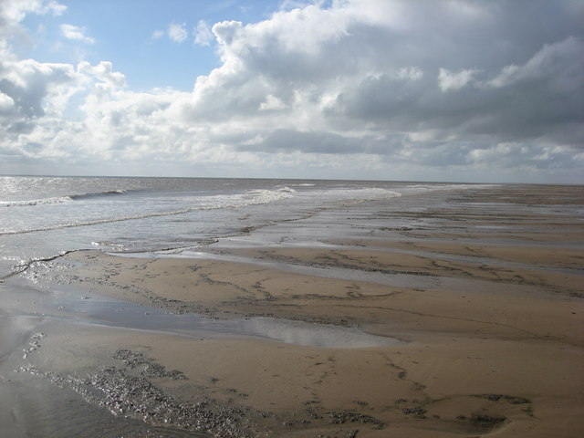
The marshland is characterized by its vast open space, consisting of salt marshes, mudflats, and tidal creeks. These marshes are formed by the deposition of sediment and salts brought in by the tides, creating a fertile habitat for a variety of plant and animal species. The vegetation here is predominantly salt-tolerant grasses and herbs, adapted to the saline conditions.

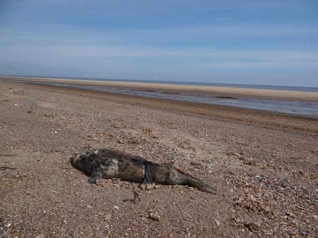
Outer Knock is home to a rich avian population, attracting numerous migratory birds throughout the year. Visitors can spot a wide range of species, including Brent geese, wading birds, and ducks. The marshes also provide nesting grounds for several rare and endangered species, such as the redshank and lapwing.

Aside from its ecological importance, Outer Knock offers a peaceful and serene environment for visitors to enjoy. The vast expanse of the marshland provides ample opportunities for walking, photography, and exploring the unique flora and fauna. The surrounding coastal area also offers stunning panoramic views of the sea and the Lincolnshire coastline.

Overall, Outer Knock in Lincolnshire is a captivating coastal marshland, brimming with biodiversity and natural beauty. Its serene atmosphere and diverse wildlife make it a must-visit destination for nature lovers and those seeking a tranquil escape.

If you have any feedback on the listing, please let us know in the comments section below.

Outer Knock Images

Images are sourced within 2km of 53.093914/0.36900477 or Grid Reference TF5857. Thanks to Geograph Open Source API. All images are credited.

Higher ground Looking towards Skegness, showing the flat and dry 'creek' to the left and the 'real' beach to the right.
Higher ground
Looking towards Skegness, showing the flat and dry 'creek' to the left and the 'real' beach to the right.
Casualty Carcass of a seal washed up on the beach near Gibraltar Point.
Casualty
Carcass of a seal washed up on the beach near Gibraltar Point.
Woof! It's Outer Dog's Head: aerial 2017 Despite the ever-changing nature of sandbanks, this one still looks like a dog!
A two-headed dog, for there is an Inner Dog's Head just to the south.
Woof! It's Outer Dog's Head: aerial 2017
Despite the ever-changing nature of sandbanks, this one still looks like a dog! A two-headed dog, for there is an Inner Dog's Head just to the south.
Across Inner Knock and Dog's Head sandbanks with Wainfleet Sand right and the Deeps between: aerial 2017 Beyond Wainfleet Sand are Friskney and Wrangle Flats.
Across Inner Knock and Dog's Head sandbanks with Wainfleet Sand right and the Deeps between: aerial 2017
Beyond Wainfleet Sand are Friskney and Wrangle Flats.
Wainfleet Sand and Wash sandbanks at low tide: aerial 2018 See <a href="https://www.geograph.org.uk/photo/4667766">TF5855 : Sandbanks and mudflats in the Wash at low tide: aerial 2015</a>. Top is Inner Knock, and to the right of it Outer Dog's Head.
Wainfleet Sand and Wash sandbanks at low tide: aerial 2018
See TF5855 : Sandbanks and mudflats in the Wash at low tide: aerial 2015. Top is Inner Knock, and to the right of it Outer Dog's Head.
Gibraltar Point Looking across the New Salt Marsh from the view point on the East Dunes.
Gibraltar Point
Looking across the New Salt Marsh from the view point on the East Dunes.
Gibraltar Point Beach A vast, untouched beach hidden beyond the dunes at Gibraltar Point gives a welcome , peaceful end to a busy day at Skegness.  Well worth a visit - but pack a jacket, it gets quite windy! Safety note: Check the tide tables as well.
Gibraltar Point Beach
A vast, untouched beach hidden beyond the dunes at Gibraltar Point gives a welcome , peaceful end to a busy day at Skegness. Well worth a visit - but pack a jacket, it gets quite windy! Safety note: Check the tide tables as well.
Skegness Offshore Wind Farm on the Horizon This view of the beach at Gibraltar Point takes in the work in progress on the Wind Farm off Skegness. <span class="nowrap"><a title="http://www.skegnessvideo.com/2007/06/16/windfarm/" rel="nofollow ugc noopener" href="http://www.skegnessvideo.com/2007/06/16/windfarm/">Link</a><img style="margin-left:2px;" alt="External link" title="External link - shift click to open in new window" src="https://s1.geograph.org.uk/img/external.png" width="10" height="10"/></span>
Skegness Offshore Wind Farm on the Horizon
This view of the beach at Gibraltar Point takes in the work in progress on the Wind Farm off Skegness. LinkExternal link
Mud Cliffs Every so often along this otherwise sandy part of the beach at Gibraltar Point are what appear at first glance to be rocky outcrops.  On closer inspection these are in fact mounds of sticky clay.  As you travel further south and west, the sand is gradually taken over by the mud.
Mud Cliffs
Every so often along this otherwise sandy part of the beach at Gibraltar Point are what appear at first glance to be rocky outcrops. On closer inspection these are in fact mounds of sticky clay. As you travel further south and west, the sand is gradually taken over by the mud.
Beaten by the Tide When the next Spring Tides come, this square will be up for grabs.  
Whether the other two further east are going to dry out remains to be seen.  Now there's a challenge for someone!
Beaten by the Tide
When the next Spring Tides come, this square will be up for grabs. Whether the other two further east are going to dry out remains to be seen. Now there's a challenge for someone!
Low tide at Gibraltar point The slope of the beach is so gentle that each small wave runs about 4 metres across the sand. Norfolk is just visible on the horizon.
Low tide at Gibraltar point
The slope of the beach is so gentle that each small wave runs about 4 metres across the sand. Norfolk is just visible on the horizon.
Gibraltar Point beach Two months earlier and ten degrees warmer the beach might have been rather busier.
Gibraltar Point beach
Two months earlier and ten degrees warmer the beach might have been rather busier.
Flintstones Geograph <a href="https://www.geograph.org.uk/photo/34585">NT1877 : Black and White</a> shows the black and white nature of a Forth estuary beach.  Here, near the Wash, there is no coal and fewer shells but the abundance of flint is obvious.
Flintstones
Geograph NT1877 : Black and White shows the black and white nature of a Forth estuary beach. Here, near the Wash, there is no coal and fewer shells but the abundance of flint is obvious.
Gibraltar Point nature reserve Looking south to the Wash.
Gibraltar Point nature reserve
Looking south to the Wash.
Lincolnshire beach Sand and flints at Gibraltar Point.  Compare geograph <a href="https://www.geograph.org.uk/photo/34585">NT1877 : Black and White</a> for different beach composition
Lincolnshire beach
Sand and flints at Gibraltar Point. Compare geograph NT1877 : Black and White for different beach composition
Gibraltar Point - Beach view at low tide
Gibraltar Point Nature Reserve and Skegness (aerial 2013) Skegness is sooo... bracing! Choppy seas and white horses in a brisk easterly wind. We rightly anticipated a challenging landing at Cromer - when the headwind finally allowed us to get there all of half an hour later. 
The white pointed constructions at Butlins can be seen at the top.
Gibraltar Point Nature Reserve and Skegness (aerial 2013)
Skegness is sooo... bracing! Choppy seas and white horses in a brisk easterly wind. We rightly anticipated a challenging landing at Cromer - when the headwind finally allowed us to get there all of half an hour later. The white pointed constructions at Butlins can be seen at the top.
Beach at the Gibraltar Point Nature Reserve
Show me another place!

Outer Knock is located at Grid Ref: TF5857 (Lat: 53.093914, Lng: 0.36900477)

Administrative County: Lincolnshire

Police Authority: Lincolnshire

What 3 Words

///hotspots.unlimited.submitted. Near Skegness, Lincolnshire

Nearby Locations

Outer Knock

Related Wikis

Gibraltar Point, Lincolnshire

Gibraltar Point national nature reserve is an area of about 4.3 km2 (1.7 sq mi) on the coast of Lincolnshire, England. The reserve is owned by Lincolnshire...

Skegness Lifeboat Station

Skegness Lifeboat Station is a lifeboat station located in the town of Skegness, Lincolnshire, England, operated by the Royal National Lifeboat Institution...

Seacroft railway station

Seacroft railway station was a station in Seacroft, Lincolnshire.The station was opened on 28 July 1873 and originally called Cow Bank, but was renamed...

Richmond Drive

Richmond Drive is a cricket ground in Skegness, Lincolnshire. The first recorded match on the ground was in 1879, when a Lincolnshire team played against...

Have you been to Outer Knock?

Leave your review of Outer Knock below (or comments, questions and feedback).