Breast Sand

Coastal Marsh, Saltings in Norfolk King's Lynn and West Norfolk

England

Breast Sand

Breast Sand and Inner Tidal Bank: aerial 2023 (1) See:<span class="nowrap"><a title="https://en.wikipedia.org/wiki/Outer_Trial_Bank" rel="nofollow ugc noopener" href="https://en.wikipedia.org/wiki/Outer_Trial_Bank">Link</a><img style="margin-left:2px;" alt="External link" title="External link - shift click to open in new window" src="https://s1.geograph.org.uk/img/external.png" width="10" height="10"/></span>

A smaller and cruder than the Outer Trial Bank, it is connected by a causeway on Terrington Marsh.
Breast Sand and Inner Tidal Bank: aerial 2023 (1) Credit: Chris

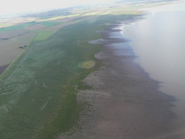
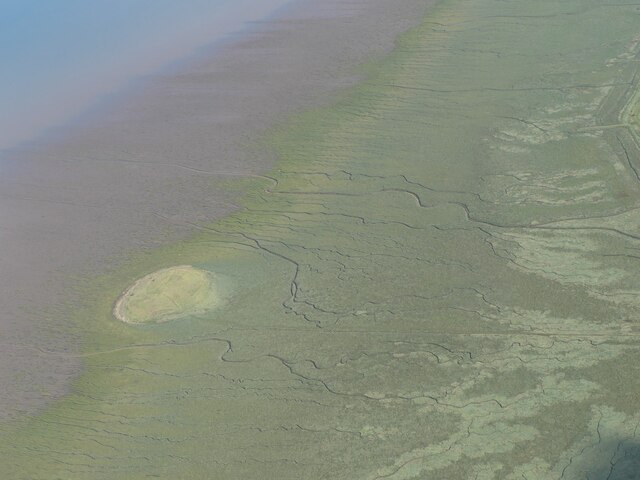
Breast Sand, located in Norfolk, is a coastal marsh area known for its unique ecosystem and stunning views. The marsh is situated along the coast, with salt marshes and saltings providing a diverse habitat for a variety of plant and animal species. The area is popular among birdwatchers, as it is a prime location for spotting a wide range of bird species, including waders, ducks, and geese.

Breast Sand is characterized by its vast expanse of open marshland, dotted with tidal creeks and channels that fill and drain with the ebb and flow of the tide. The marsh is home to a number of rare and endangered plant species, making it an important conservation area.

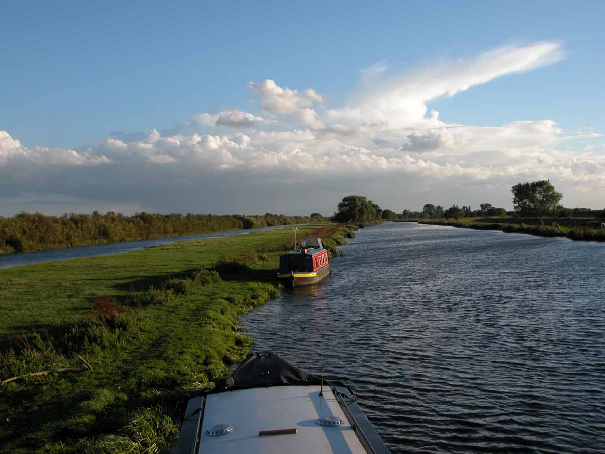
Visitors to Breast Sand can explore the marsh on foot, following designated paths and boardwalks that provide access to the various habitats within the area. The views from the marsh are spectacular, with panoramic vistas of the coastline and surrounding countryside.

Overall, Breast Sand offers a peaceful and serene environment for nature lovers to enjoy the beauty of Norfolk's coastal landscape.

If you have any feedback on the listing, please let us know in the comments section below.

Breast Sand Images

Images are sourced within 2km of 52.831818/0.27848048 or Grid Reference TF5328. Thanks to Geograph Open Source API. All images are credited.

Breast Sand and Inner Tidal Bank: aerial 2023 (1) See:<span class="nowrap"><a title="https://en.wikipedia.org/wiki/Outer_Trial_Bank" rel="nofollow ugc noopener" href="https://en.wikipedia.org/wiki/Outer_Trial_Bank">Link</a><img style="margin-left:2px;" alt="External link" title="External link - shift click to open in new window" src="https://s1.geograph.org.uk/img/external.png" width="10" height="10"/></span>

A smaller and cruder than the Outer Trial Bank, it is connected by a causeway on Terrington Marsh.
Breast Sand and Inner Tidal Bank: aerial 2023 (1)
See:LinkExternal link A smaller and cruder than the Outer Trial Bank, it is connected by a causeway on Terrington Marsh.
Inner Tidal Bank: aerial 2023 (1) See:<span class="nowrap"><a title="https://en.wikipedia.org/wiki/Outer_Trial_Bank" rel="nofollow ugc noopener" href="https://en.wikipedia.org/wiki/Outer_Trial_Bank">Link</a><img style="margin-left:2px;" alt="External link" title="External link - shift click to open in new window" src="https://s1.geograph.org.uk/img/external.png" width="10" height="10"/></span>

A smaller and cruder than the Outer Trial Bank, it is connected by a causeway on Terrington Marsh.
Inner Tidal Bank: aerial 2023 (1)
See:LinkExternal link A smaller and cruder than the Outer Trial Bank, it is connected by a causeway on Terrington Marsh.
Breast Sand and Inner Tidal Bank: aerial 2023 (2) See:<span class="nowrap"><a title="https://en.wikipedia.org/wiki/Outer_Trial_Bank" rel="nofollow ugc noopener" href="https://en.wikipedia.org/wiki/Outer_Trial_Bank">Link</a><img style="margin-left:2px;" alt="External link" title="External link - shift click to open in new window" src="https://s1.geograph.org.uk/img/external.png" width="10" height="10"/></span>

A smaller and cruder than the Outer Trial Bank, it is connected by a causeway on Terrington Marsh.
Breast Sand and Inner Tidal Bank: aerial 2023 (2)
See:LinkExternal link A smaller and cruder than the Outer Trial Bank, it is connected by a causeway on Terrington Marsh.
Old Lynn Roads, between Breast Sand and Terrington Marsh: aerial 2023 What roads would these be?

<span class="nowrap"><a title="https://britainfromabove.org.uk/en/image/EPW031704" rel="nofollow ugc noopener" href="https://britainfromabove.org.uk/en/image/EPW031704">Link</a><img style="margin-left:2px;" alt="External link" title="External link - shift click to open in new window" src="https://s1.geograph.org.uk/img/external.png" width="10" height="10"/></span>
Old Lynn Roads, between Breast Sand and Terrington Marsh: aerial 2023
What roads would these be? LinkExternal link
Inner Tidal Bank: aerial 2023 (1) See <span class="nowrap"><a title="https://en.wikipedia.org/wiki/Outer_Trial_Bank" rel="nofollow ugc noopener" href="https://en.wikipedia.org/wiki/Outer_Trial_Bank">Link</a><img style="margin-left:2px;" alt="External link" title="External link - shift click to open in new window" src="https://s1.geograph.org.uk/img/external.png" width="10" height="10"/></span>
Inner Tidal Bank: aerial 2023 (1)
See LinkExternal link
Inner Tidal Bank: aerial 2023 (2) See <span class="nowrap"><a title="https://en.wikipedia.org/wiki/Outer_Trial_Bank" rel="nofollow ugc noopener" href="https://en.wikipedia.org/wiki/Outer_Trial_Bank">Link</a><img style="margin-left:2px;" alt="External link" title="External link - shift click to open in new window" src="https://s1.geograph.org.uk/img/external.png" width="10" height="10"/></span>
Inner Tidal Bank: aerial 2023 (2)
See LinkExternal link
Inner Tidal Bank: aerial 2023 (3) See <span class="nowrap"><a title="https://en.wikipedia.org/wiki/Outer_Trial_Bank" rel="nofollow ugc noopener" href="https://en.wikipedia.org/wiki/Outer_Trial_Bank">Link</a><img style="margin-left:2px;" alt="External link" title="External link - shift click to open in new window" src="https://s1.geograph.org.uk/img/external.png" width="10" height="10"/></span>
Inner Tidal Bank: aerial 2023 (3)
See LinkExternal link
From Inner Tidal Bank to Outer Trial Bank ("Doughnut"): aerial 2023 (1) See <span class="nowrap"><a title="https://en.wikipedia.org/wiki/Outer_Trial_Bank" rel="nofollow ugc noopener" href="https://en.wikipedia.org/wiki/Outer_Trial_Bank">Link</a><img style="margin-left:2px;" alt="External link" title="External link - shift click to open in new window" src="https://s1.geograph.org.uk/img/external.png" width="10" height="10"/></span>

For "Doughnut" see <a href="https://www.geograph.org.uk/photo/7617320">TF5129 : "The Doughnut" aka Outer Trial Bank: aerial 2023</a>.
From Inner Tidal Bank to Outer Trial Bank ("Doughnut"): aerial 2023 (1)
From Inner Tidal Bank to Outer Trial Bank ("Doughnut"): aerial 2023 (2) See <span class="nowrap"><a title="https://en.wikipedia.org/wiki/Outer_Trial_Bank" rel="nofollow ugc noopener" href="https://en.wikipedia.org/wiki/Outer_Trial_Bank">Link</a><img style="margin-left:2px;" alt="External link" title="External link - shift click to open in new window" src="https://s1.geograph.org.uk/img/external.png" width="10" height="10"/></span>

For "Doughnut" see <a href="https://www.geograph.org.uk/photo/7617320">TF5129 : "The Doughnut" aka Outer Trial Bank: aerial 2023</a>.
From Inner Tidal Bank to Outer Trial Bank ("Doughnut"): aerial 2023 (2)
Inner Tidal Bank: aerial 2023 (4) See <span class="nowrap"><a title="https://en.wikipedia.org/wiki/Outer_Trial_Bank" rel="nofollow ugc noopener" href="https://en.wikipedia.org/wiki/Outer_Trial_Bank">Link</a><img style="margin-left:2px;" alt="External link" title="External link - shift click to open in new window" src="https://s1.geograph.org.uk/img/external.png" width="10" height="10"/></span>
Inner Tidal Bank: aerial 2023 (4)
See LinkExternal link
Inner Tidal Bank: aerial 2023 (5)
Off shore island A small island built as part of an experiment to create freshwater reservoirs in the Wash. A more complete island can be seen at <a href="https://www.geograph.org.uk/gridref/TF5129">TF5129</a>. Note the erosion on the left hand side.
Off shore island
A small island built as part of an experiment to create freshwater reservoirs in the Wash. A more complete island can be seen at TF5129. Note the erosion on the left hand side.
Salt marsh and offshore island in The Wash Midway between The River Nene and The River Great Ouse outlets into The Wash. For video see link <span class="nowrap"><a title="http://www.youtube.com/watch?v=O6tzusScYwo" rel="nofollow ugc noopener" href="http://www.youtube.com/watch?v=O6tzusScYwo">Link</a><img style="margin-left:2px;" alt="External link" title="External link - shift click to open in new window" src="https://s1.geograph.org.uk/img/external.png" width="10" height="10"/></span>
Salt marsh and offshore island in The Wash
Midway between The River Nene and The River Great Ouse outlets into The Wash. For video see link LinkExternal link
Track through the salt marsh to the island in The Wash At low tide it is possible to walk out to this island built on The Breast Sand. For video see link <span class="nowrap"><a title="http://www.youtube.com/watch?v=O6tzusScYwo" rel="nofollow ugc noopener" href="http://www.youtube.com/watch?v=O6tzusScYwo">Link</a><img style="margin-left:2px;" alt="External link" title="External link - shift click to open in new window" src="https://s1.geograph.org.uk/img/external.png" width="10" height="10"/></span>
Track through the salt marsh to the island in The Wash
At low tide it is possible to walk out to this island built on The Breast Sand. For video see link LinkExternal link
Island in The Wash on The Breast Sand The track through the salt-marsh to this island is still muddy even at very low tide on a dry and windy day and can be quickly covered by the incoming tide. For video see link <span class="nowrap"><a title="http://www.youtube.com/watch?v=O6tzusScYwo" rel="nofollow ugc noopener" href="http://www.youtube.com/watch?v=O6tzusScYwo">Link</a><img style="margin-left:2px;" alt="External link" title="External link - shift click to open in new window" src="https://s1.geograph.org.uk/img/external.png" width="10" height="10"/></span>
Island in The Wash on The Breast Sand
The track through the salt-marsh to this island is still muddy even at very low tide on a dry and windy day and can be quickly covered by the incoming tide. For video see link LinkExternal link
Creeks in The Breast Sand, The Wash A view north from the island in The Wash off the coast between the outfalls of The River Nene and The River Great Ouse
Creeks in The Breast Sand, The Wash
A view north from the island in The Wash off the coast between the outfalls of The River Nene and The River Great Ouse
Salt marsh on The Breast Sand, The Wash A north westerly view from the island just off the coast in The Wash. A second island further offshore can be seen in the far distance. This second island is not shown on all OS maps for some reason.
Salt marsh on The Breast Sand, The Wash
A north westerly view from the island just off the coast in The Wash. A second island further offshore can be seen in the far distance. This second island is not shown on all OS maps for some reason.
The Breast Sand, The Wash A north easterly view from the island in The Wash just off the sea bank between The River Nene and The River Great Ouse. The North Norfolk coast can be seen in the far distance. Perfect solitude - I did not see another person for 3 hours on this walk. A strange name for this area as there's no sand to be seen for miles.
The Breast Sand, The Wash
A north easterly view from the island in The Wash just off the sea bank between The River Nene and The River Great Ouse. The North Norfolk coast can be seen in the far distance. Perfect solitude - I did not see another person for 3 hours on this walk. A strange name for this area as there's no sand to be seen for miles.
Show me another place!

Breast Sand is located at Grid Ref: TF5328 (Lat: 52.831818, Lng: 0.27848048)

Administrative County: Norfolk

District: King's Lynn and West Norfolk

Police Authority: Norfolk

What 3 Words

///subplot.behaving.dwelled. Near Terrington St Clement, Norfolk

Nearby Locations

Breast Sand

Related Wikis

Outer Trial Bank

The Outer Trial Bank is a circular artificial island in the Wash, East Anglia, England. It is one of two artificial islands constructed during the 1970s...

River Nene

The River Nene ( or : see below) is a river in the east of England that rises from three sources in Northamptonshire. The river is about 105 miles (169...

River Great Ouse

The River Great Ouse () is a river in England, the longest of several British rivers called "Ouse". From Syresham in Northamptonshire, the Great Ouse flows...

Gedney Drove End

Gedney Drove End is a village in the civil parish of Gedney and the South Holland district of Lincolnshire, England. It is 40 miles (64 km) south-east...

Have you been to Breast Sand?

Leave your review of Breast Sand below (or comments, questions and feedback).