East Marsh
Lake, Pool, Pond, Freshwater Marsh in Cambridgeshire King's Lynn and West Norfolk
England
East Marsh

East Marsh is a freshwater marsh located in Cambridgeshire, England. Situated in a low-lying area, it is characterized by its abundant water bodies, including lakes, pools, and ponds. The marsh covers a vast area, providing a diverse habitat for numerous plant and animal species.
The lakes in East Marsh are large bodies of water formed by natural processes such as flooding and seasonal rainfall. They support a rich aquatic ecosystem, attracting various waterfowl and fish species. The pools, on the other hand, are smaller and shallower bodies of water. They often form as a result of rainfall or underground springs and contribute to the overall biodiversity of the marsh.
Ponds are another prominent feature of East Marsh. These small bodies of water are man-made and serve various purposes, such as providing habitats for amphibians, birds, and insects. They also play a crucial role in maintaining the water balance of the marsh, acting as natural reservoirs during periods of heavy rainfall.
The freshwater marsh itself is characterized by its waterlogged soil, resulting in an abundance of wetland vegetation. Species such as reeds, rushes, and sedges thrive in this environment, providing shelter and food for a wide array of wildlife. The marsh is home to numerous bird species, including herons, ducks, and geese, which rely on its resources for nesting and feeding.
Overall, East Marsh in Cambridgeshire is a biodiverse and ecologically significant area, with its lakes, pools, ponds, and freshwater marsh providing a vital habitat for a diverse range of plant and animal species.
If you have any feedback on the listing, please let us know in the comments section below.
East Marsh Images
Images are sourced within 2km of 52.735841/0.17914092 or Grid Reference TF4717. Thanks to Geograph Open Source API. All images are credited.


East Marsh is located at Grid Ref: TF4717 (Lat: 52.735841, Lng: 0.17914092)
Division: Isle of Ely
Administrative County: Norfolk
District: King's Lynn and West Norfolk
Police Authority: Norfolk
What 3 Words
///risky.extreme.backfired. Near Sutton Bridge, Lincolnshire
Nearby Locations
Related Wikis

Tydd railway station
Tydd railway station was a station, opened by the Peterborough, Wisbech and Sutton Bridge Railway on 1 August 1866, in Lincolnshire serving the villages...

Tydd Gote
Tydd Gote is an English village, partly, at the north, in the civil parish of Tydd St Mary of the South Holland District of Lincolnshire, and partly, at...
Four Gotes
Four Gotes is a hamlet in the civil parish of Tydd St Giles in Cambridgeshire, England. The population is included in the civil parish of Leverington....
Walpole, Norfolk
Walpole is a civil parish in Norfolk, England. The parish includes the conjoined villages of Walpole St Andrew and Walpole St Peter. Walpole Highway and...
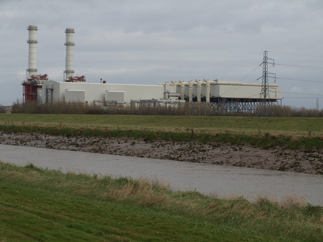
Sutton Bridge Power Station
Sutton Bridge Power Station is an 819 MW gas-fired power station in Sutton Bridge in the south-east of Lincolnshire in South Holland, England. It is situated...
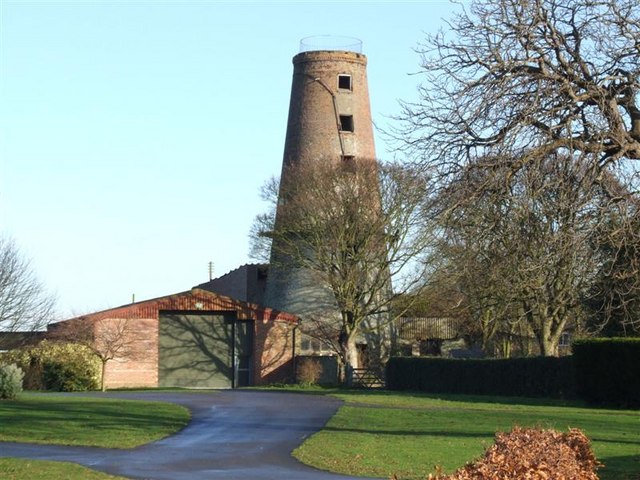
Ingleborough Tower Windmill, West Walton
Ingleborough Tower Windmill is one mile north of the village of West Walton in Norfolk, England. The windmill is in the yard of Hill House Farm alongside...
RAF Sutton Bridge
Royal Air Force Sutton Bridge or more simply RAF Sutton Bridge is a former Royal Air Force station found next to the village of Sutton Bridge in the south...

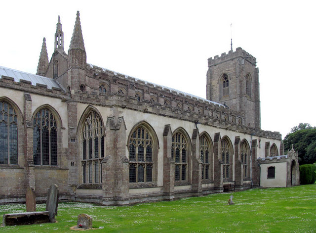
St Andrew's Church, Walpole
St Andrew's Church is a redundant Anglican church in the village of Walpole, Norfolk, England. It is recorded in the National Heritage List for England...
Nearby Amenities
Located within 500m of 52.735841,0.17914092Have you been to East Marsh?
Leave your review of East Marsh below (or comments, questions and feedback).