Herring Hill

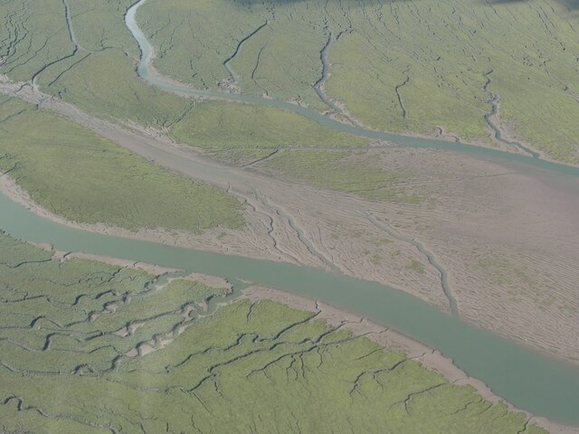
Coastal Marsh, Saltings in Lincolnshire South Holland

England

Herring Hill

Saltmarshes Looking across the mudflats from the Welland
Saltmarshes Credit: Ian Simons

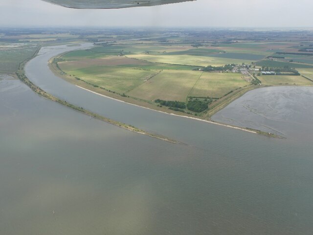
Herring Hill is a coastal marsh located in Lincolnshire, England. Situated on the eastern coast of the county, it is part of the larger Saltfleetby-Theddlethorpe Dunes and Gibraltar Point Nature Reserve.

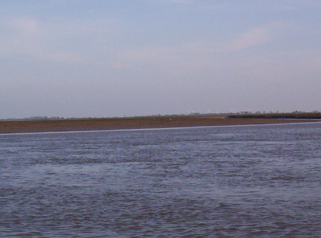
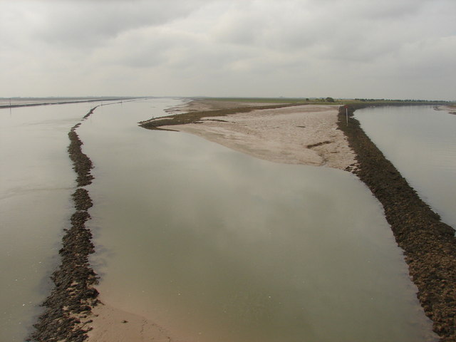
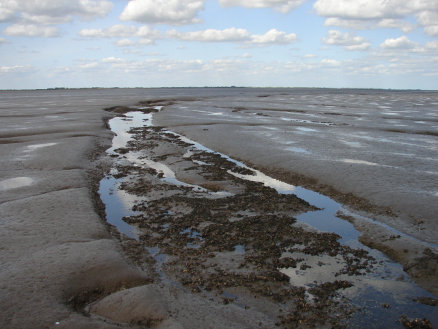
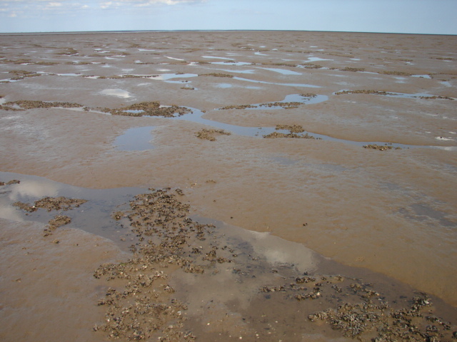
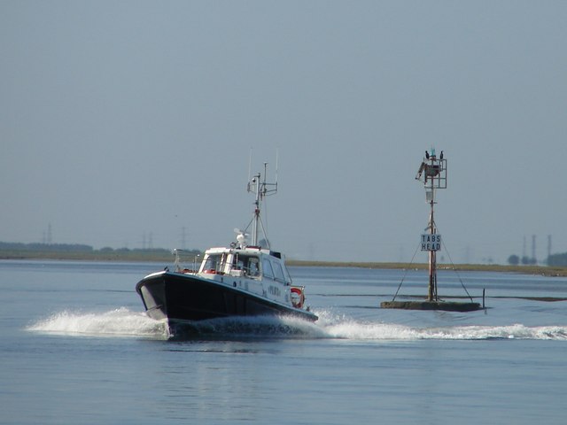
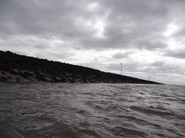
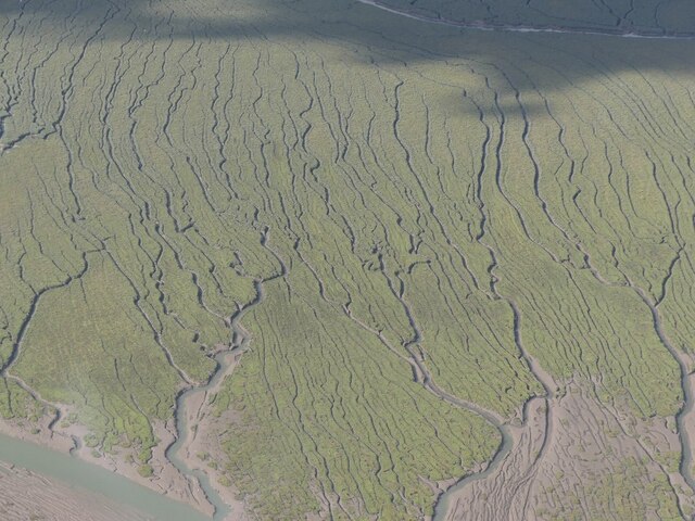
The main feature of Herring Hill is its vast expanse of salt marshes and saltings, which are interspersed with tidal creeks and channels. These habitats are formed as a result of the constant interaction between the sea and the land. As the tides ebb and flow, the marshes are periodically submerged and exposed, creating an ever-changing landscape.

The dominant vegetation in Herring Hill consists of salt-tolerant plants such as sea lavender, sea aster, and samphire. These plants have adapted to the harsh conditions of the saline environment and provide essential habitat and food sources for a variety of bird species.

The marshes are a haven for migratory birds, especially during the winter months when they provide crucial feeding and roosting grounds. Species such as dunlins, redshanks, and curlews can be observed in large numbers, making Herring Hill an important site for birdwatchers and ornithologists.

Aside from its ecological significance, Herring Hill also holds historical value. The area was once used for salt production, with evidence of salt pans and channels still visible today. The local salt industry thrived during the medieval period and played a significant role in the region's economy.

Herring Hill is accessible to visitors, with footpaths and bird hides providing opportunities for exploration and wildlife observation. Its unique combination of coastal marshes, saltings, and historical significance make it a fascinating destination for nature enthusiasts and those interested in the region's heritage.

If you have any feedback on the listing, please let us know in the comments section below.

Herring Hill Images

Images are sourced within 2km of 52.915445/0.086245448 or Grid Reference TF4037. Thanks to Geograph Open Source API. All images are credited.

Saltmarshes Looking across the mudflats from the Welland
Saltmarshes
Looking across the mudflats from the Welland
Where two rivers meet View of the mouth of the River Welland (to the left) and The Witham (The Haven at this point, to the right) from the navigation beacon at Tabs Head.  The lagoon in between and bounded by the banking is a handy spot for fishermen, as sea bass can be caught here.
Where two rivers meet
View of the mouth of the River Welland (to the left) and The Witham (The Haven at this point, to the right) from the navigation beacon at Tabs Head. The lagoon in between and bounded by the banking is a handy spot for fishermen, as sea bass can be caught here.
Silver mud Facing landwards, this view from the mudflats is typical of the area beyond the samphire beds.  As you approach the shoreline, tiny individual clumps of samphire appear randomly before they begin to knit together.
Silver mud
Facing landwards, this view from the mudflats is typical of the area beyond the samphire beds. As you approach the shoreline, tiny individual clumps of samphire appear randomly before they begin to knit together.
Towards Herring Hill View from the corner of the gridsquare towards Herring Hill.  I daren't go much further as I was exhausted by the sticky sucking mud.  It was supposed to be sand!
Towards Herring Hill
View from the corner of the gridsquare towards Herring Hill. I daren't go much further as I was exhausted by the sticky sucking mud. It was supposed to be sand!
Cockle beds on the mud The clumps of cockles begin to appear at this point on the mudflats.
Cockle beds on the mud
The clumps of cockles begin to appear at this point on the mudflats.
Out in the wilderness Not much in the way of vegetation or wildlife out here apart from a few cockles, but what a glorious sight!
Out in the wilderness
Not much in the way of vegetation or wildlife out here apart from a few cockles, but what a glorious sight!
There and back again Who needs satellite navigation when there's lots of sticky, sucking mud to guide your way back!
There and back again
Who needs satellite navigation when there's lots of sticky, sucking mud to guide your way back!
Pilot boat passing Tabs Head Speeding out into The Wash past Tabs Head.  Behind is the mouth of the River Welland.
Pilot boat passing Tabs Head
Speeding out into The Wash past Tabs Head. Behind is the mouth of the River Welland.
Cockling in the Wash Position is not certain, but this was taking place near "The Doughnut" island in the south part of the Wash.
Cockling in the Wash
Position is not certain, but this was taking place near "The Doughnut" island in the south part of the Wash.
Close up of the training wall The training wall runs either side of the River Welland, with occasional breaks to the drainage system and numerous creek inlets.  Navigation poles line the route as it is difficult to discern the wall when it is below sea level.  Behind the wall lies Herring Hill.  Compare with the photo referred to below.

Having previously attempted a geograph of this gridsquare almost 12 years ago from the Boston Belle <a href="https://www.geograph.org.uk/photo/1494200">TF3937 : Edge of the marsh</a>, I finally managed to photograph it at a much lower level of tide, from Bluey Due which being much smaller than the Boston Belle, could sail much closer to the wall itself.  See link for youTube excerpts of the trip <span class="nowrap"><a title="https://www.youtube.com/watch?v=GLveWvAEe-w" rel="nofollow ugc noopener" href="https://www.youtube.com/watch?v=GLveWvAEe-w">Link</a><img style="margin-left:2px;" alt="External link" title="External link - shift click to open in new window" src="https://s1.geograph.org.uk/img/external.png" width="10" height="10"/></span>.
Close up of the training wall
The training wall runs either side of the River Welland, with occasional breaks to the drainage system and numerous creek inlets. Navigation poles line the route as it is difficult to discern the wall when it is below sea level. Behind the wall lies Herring Hill. Compare with the photo referred to below. Having previously attempted a geograph of this gridsquare almost 12 years ago from the Boston Belle TF3937 : Edge of the marsh, I finally managed to photograph it at a much lower level of tide, from Bluey Due which being much smaller than the Boston Belle, could sail much closer to the wall itself. See link for youTube excerpts of the trip LinkExternal link.
River Witham outfall, the Haven, Boston: aerial 2023 (2) Welland Outfall to the left.
River Witham outfall, the Haven, Boston: aerial 2023 (2)
Welland Outfall to the left.
River Witham outfall, the Haven, Boston: aerial 2023 (4) Welland Outfall to the left.
River Witham outfall, the Haven, Boston: aerial 2023 (4)
Welland Outfall to the left.
River Witham outfall, the Haven, Boston: aerial 2023 (5)
Welland Outfall and the Scalp (marsh): aerial 2023 (1)
Haven and Welland Outfall, and the Scalp (marsh): aerial 2023 (1)
Haven and Welland Outfall, and the Scalp (marsh): aerial 2023 (2)
Saltmarsh south of Welland Outfall: aerial 2023 (1)
Saltmarsh south of Welland Outfall: aerial 2023 (2)
Show me another place!

Herring Hill is located at Grid Ref: TF4037 (Lat: 52.915445, Lng: 0.086245448)

Administrative County: Lincolnshire

District: South Holland

Police Authority: Lincolnshire

What 3 Words

///puzzles.stops.lengthen. Near Fishtoft, Lincolnshire

Nearby Locations

Herring Hill

Related Wikis

HM Prison North Sea Camp

HM Prison North Sea Camp is a men's open prison (Category D), located on the edge of the parish of Freiston (near Boston) in Lincolnshire, England. North...

RSPB Frampton Marsh

Frampton Marsh is a nature reserve in Lincolnshire, England. The reserve is situated on the coast of The Wash, some 4 miles from the town of Boston, between...

River Welland

The River Welland is a lowland river in the east of England, some 65 miles (105 km) long. It drains part of the Midlands eastwards to The Wash. The river...

Holbeach St Matthew

Holbeach St Matthew is a small fenland village in the South Holland district of southern Lincolnshire, England. It lies 6 miles (10 km) north-east from...

Have you been to Herring Hill?

Leave your review of Herring Hill below (or comments, questions and feedback).