Moulton Marsh

Coastal Marsh, Saltings in Lincolnshire South Holland

England

Moulton Marsh

View from the A17 near Fosdyke Not the most delightful photograph but a view typical from the A17.
View from the A17 near Fosdyke Credit: David Bremner

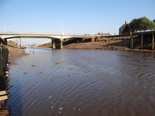
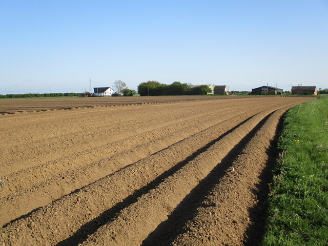
Moulton Marsh is a coastal marsh located in Lincolnshire, England. It is situated along the eastern coastline of the county, near the town of Spalding. Spanning an area of approximately 900 hectares, Moulton Marsh is a designated Site of Special Scientific Interest (SSSI) and forms part of the Wash and North Norfolk Coast Special Area of Conservation.

The marshland is characterized by its diverse range of habitats, including saltmarsh, mudflats, reedbeds, and open water channels. It is a prime example of a saltmarsh ecosystem, with its vegetation consisting mainly of salt-tolerant plants such as samphire, sea purslane, and sea aster. These plants provide vital habitats and feeding grounds for a variety of bird species, including avocets, redshanks, and lapwings.

Moulton Marsh is also home to several rare and protected species, such as the marsh harrier and bittern, which are known to breed in the area. The marshland provides an important stopover site for migrating birds, particularly during the winter months when large numbers of waders and wildfowl visit the area.

Visitors to Moulton Marsh can enjoy a network of footpaths and bird hides, allowing them to observe the rich wildlife without disturbing the sensitive habitats. The marshland is managed by a combination of local conservation organizations and government agencies, who work towards preserving its unique biodiversity and promoting sustainable use of the area.

Overall, Moulton Marsh is a valuable and ecologically significant coastal marsh, offering a haven for numerous bird species and providing an opportunity for nature enthusiasts to appreciate the beauty and diversity of this unique habitat.

If you have any feedback on the listing, please let us know in the comments section below.

Moulton Marsh Images

Images are sourced within 2km of 52.869615/-0.0218192 or Grid Reference TF3332. Thanks to Geograph Open Source API. All images are credited.

View from the A17 near Fosdyke Not the most delightful photograph but a view typical from the A17.
View from the A17 near Fosdyke
Not the most delightful photograph but a view typical from the A17.
Short back and sides Expertly trimmed specimen tree.
Short back and sides
Expertly trimmed specimen tree.
Spring low Low spring tide two days after the full moon.  Note the submerged rocks and piles which could make beaching here a bit of a challenge.  
The tide level measured here by the station nearby read -0.821 around this time (17:30).  This was a drop of 5.807 metres from the high tide level at 09:00 earlier in the day.  

See <span class="nowrap"><a title="https://check-for-flooding.service.gov.uk/station/6006" rel="nofollow ugc noopener" href="https://check-for-flooding.service.gov.uk/station/6006">Link</a><img style="margin-left:2px;" alt="External link" title="External link - shift click to open in new window" src="https://s1.geograph.org.uk/img/external.png" width="10" height="10"/></span>
Spring low
Low spring tide two days after the full moon. Note the submerged rocks and piles which could make beaching here a bit of a challenge. The tide level measured here by the station nearby read -0.821 around this time (17:30). This was a drop of 5.807 metres from the high tide level at 09:00 earlier in the day. See LinkExternal link
Normally under water View upstream of the outlow from the sluices.  The water level earlier in the day would have been over 5 metres higher than it was when the photo was taken.
Normally under water
View upstream of the outlow from the sluices. The water level earlier in the day would have been over 5 metres higher than it was when the photo was taken.
Quiz time! The local weather report often talks about mist and 'murk'.  I'm not sure how to distinguish between the two. Is this a photo of mist or is it a photo of murk?  Or is this just fog!

Whatever the answer, here the tree in a better light: <a href="https://www.geograph.org.uk/photo/6967142">TF3132 : Short back and sides</a>.
Quiz time!
The local weather report often talks about mist and 'murk'. I'm not sure how to distinguish between the two. Is this a photo of mist or is it a photo of murk? Or is this just fog! Whatever the answer, here the tree in a better light: TF3132 : Short back and sides.
Early spring High spring tide due at 09:15 meaning there is a good half metre still to rise (see later <a href="https://www.geograph.org.uk/photo/6986735">TF3132 : Almost there</a>). The early morning misty sun casts some great shadows and reflections on this River Welland scene near the slipway at Fosdyke Bridge.
Early spring
High spring tide due at 09:15 meaning there is a good half metre still to rise (see later TF3132 : Almost there). The early morning misty sun casts some great shadows and reflections on this River Welland scene near the slipway at Fosdyke Bridge.
Almost there High spring tide in fifteen minutes.  
Compare with the photo taken half an hour earlier <a href="https://www.geograph.org.uk/photo/6986725">TF3132 : Early spring</a>.  The water surface is so mirror-like it creates an optical illusion effect as if the steel beams are floating in mid-air.
Almost there
High spring tide in fifteen minutes. Compare with the photo taken half an hour earlier TF3132 : Early spring. The water surface is so mirror-like it creates an optical illusion effect as if the steel beams are floating in mid-air.
Not quite a record This is what the high spring tide looked like at 09:15. Clearly not the highest in recent times as evidenced by the tide line a few metres further up.
Not quite a record
This is what the high spring tide looked like at 09:15. Clearly not the highest in recent times as evidenced by the tide line a few metres further up.
Bend in the sea bank The footpath beside the River Welland makes a bit of a bend at this point.
Bend in the sea bank
The footpath beside the River Welland makes a bit of a bend at this point.
Green track Shown on the map and easily spotted from the bank of the footpath  between the stubbly fields either side.
Green track
Shown on the map and easily spotted from the bank of the footpath between the stubbly fields either side.
Accident averted Barely visible in the distance slightly higher than the point where the distant trees converge with the river, flies a lone paraglider heading towards the overhead high tension cables.  Thankfully, the pilot powered up to take his aircraft to a safe altitude and thus avoid a tricky rescue operation <a href="https://www.geograph.org.uk/photo/6986786">TF3333 : High wire antics</a>!
Accident averted
Barely visible in the distance slightly higher than the point where the distant trees converge with the river, flies a lone paraglider heading towards the overhead high tension cables. Thankfully, the pilot powered up to take his aircraft to a safe altitude and thus avoid a tricky rescue operation TF3333 : High wire antics!
High wire antics The paraglider shown approaching the high-tension cables towering above my head here <a href="https://www.geograph.org.uk/photo/6986781">TF3333 : Accident averted</a> has successfully risen to a safe height!
High wire antics
The paraglider shown approaching the high-tension cables towering above my head here TF3333 : Accident averted has successfully risen to a safe height!
Downstream, upstream With the outgoing tide on the River Welland heading north-easterly, this drain flows in a south-westerly direction in order to meet it.
Downstream, upstream
With the outgoing tide on the River Welland heading north-easterly, this drain flows in a south-westerly direction in order to meet it.
Potato ridges near Hodgman's Farm
Cottages on Craven's Lane, Fosdyke
Very tall pylon Raised high above the estuary of the River Welland is this very tall pylon.
Very tall pylon
Raised high above the estuary of the River Welland is this very tall pylon.
Fish landing regulations A sticker on an electrical junction box above the sea-berths in the Welland at Fosdyke Bridge, giving information about minimum catch sizes.  I am still puzzling over why it is there.
Fish landing regulations
A sticker on an electrical junction box above the sea-berths in the Welland at Fosdyke Bridge, giving information about minimum catch sizes. I am still puzzling over why it is there.
Fosdyke Bridge Fosdyke Bridge is both the name of a bridge and of the small community that grew up around it.  It is the lowest bridging point on the Welland, which is tidal not only here but all the way to Spalding.

There have been many bridges here. This one, opened in 1990, is the first not to be capable of opening so ocean going vessels can go no further upstream than here.   The previous bridge was a swing bridge built in 1911, with some similarities to the bridge on the Nene at Sutton Bridge (<a href="https://www.geograph.org.uk/photo/5157017">TF4821 : Crosskeys Bridge</a>).  

See also <a href="https://www.geograph.org.uk/photo/7201071">TF3132 : Interpretation board</a>.
Fosdyke Bridge
Fosdyke Bridge is both the name of a bridge and of the small community that grew up around it. It is the lowest bridging point on the Welland, which is tidal not only here but all the way to Spalding. There have been many bridges here. This one, opened in 1990, is the first not to be capable of opening so ocean going vessels can go no further upstream than here. The previous bridge was a swing bridge built in 1911, with some similarities to the bridge on the Nene at Sutton Bridge (TF4821 : Crosskeys Bridge). See also TF3132 : Interpretation board.
Show me another place!

Moulton Marsh is located at Grid Ref: TF3332 (Lat: 52.869615, Lng: -0.0218192)

Administrative County: Lincolnshire

District: South Holland

Police Authority: Lincolnshire

What 3 Words

///reminder.flick.racing. Near Sutterton, Lincolnshire

Nearby Locations

Moulton Marsh

Related Wikis

Fosdyke

Fosdyke is a village and civil parish in the Borough of Boston, Lincolnshire, England. The population of the civil parish at the 2011 census was 480. It...

Parts of Holland

The Parts of Holland is a historical division of Lincolnshire, England, encompassing the south-east of the county. The name is still recognised locally...

Algarkirk

Algarkirk ( AL-jər-kurk) is a village and civil parish in the Borough of Boston in Lincolnshire, England. It is situated 6 miles (9.7 km) south-south-west...

Holbeach St Marks

Holbeach St Marks is a fenland village in the South Holland district of southern Lincolnshire, England. It is 5 miles (8 km) north from Holbeach, 3 miles...

Algarkirk and Sutterton railway station

Algarkirk and Sutterton railway station was a station which served the villages of Algarkirk and Sutterton in the English county of Lincolnshire. It was...
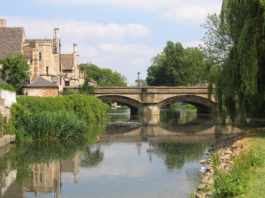
River Welland

The River Welland is a lowland river in the east of England, some 65 miles (105 km) long. It drains part of the Midlands eastwards to The Wash. The river...

Sutterton

Sutterton is a village and civil parish in the Borough of Boston in Lincolnshire, England. The population of the parish at the 2011 census was 1,585....

Moulton Seas End

Moulton Seas End is a village in the civil parish of The Moultons and the South Holland district of Lincolnshire, England. It is 5 miles (8 km) north...

Nearby Amenities

Located within 500m of 52.869615,-0.0218192
Bus Stop
Coneygarth
Naptan AtcoCode: 270002700624
Naptan Bearing: NE
Naptan CommonName: Coneygarth
Naptan Indicator: opp
Naptan Landmark: Coneygarth
Naptan Street: Middlemarsh Road
Naptan Verified: no
Source: naptan_import
Lat/Long: 52.8719351/-0.0266922
Bus Stop
Coneygarth
Naptan AtcoCode: 2700LMMM6727
Naptan Bearing: SW
Naptan CommonName: Coneygarth
Naptan Indicator: o/s
Naptan Landmark: Coneygarth
Naptan NaptanCode: lingdwmp
Naptan Street: Middlemarsh Road
Naptan Verified: no
Source: naptan_import
Lat/Long: 52.8718347/-0.0266076
Power: tower
Lat/Long: 52.8734686/-0.0237749
Power: tower
Lat/Long: 52.8700558/-0.0186465
Power: tower
Lat/Long: 52.8684238/-0.0151382
Power: tower
Lat/Long: 52.8718497/-0.0213502
The data included in this document is from www.openstreetmap.org. The data is made available under ODbL.

Have you been to Moulton Marsh?

Leave your review of Moulton Marsh below (or comments, questions and feedback).