Booth of Copister

Coastal Marsh, Saltings in Shetland

Scotland

Booth of Copister

Loch of Galtagarth Arm of the sea cut off at low tide by tidal flats at this end, and by a causeway at the far end. Fish farms out in the bay.
Loch of Galtagarth Credit: Oliver Dixon

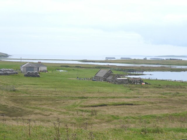
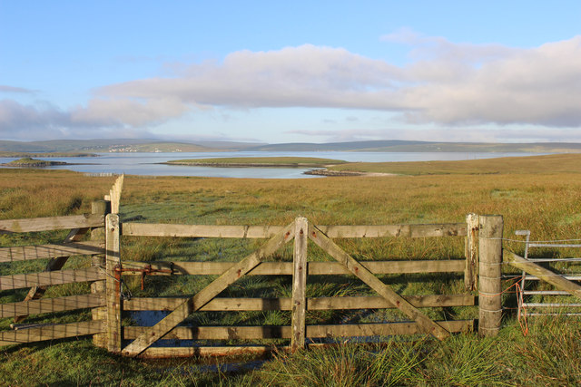
Booth of Copister is a coastal marsh located in the Shetland Islands, Scotland. It is situated on the eastern coast of the Mainland, the largest of the Shetland Islands. The marsh is specifically found within the area known as the Saltings.

The Booth of Copister marsh is characterized by its low-lying and marshy landscape. It is primarily composed of salt marsh vegetation, which thrives in the brackish water environment. The marsh is periodically flooded with the rise and fall of the tides, creating a dynamic and ever-changing ecosystem.

The vegetation in Booth of Copister consists of various salt-tolerant plants, such as cordgrasses, samphires, and sea purslane. These plants have adapted to the saline conditions and play a crucial role in stabilizing the marshland, preventing erosion, and providing habitat for numerous bird species.

The coastal marsh is an important breeding ground and stopover point for a wide variety of birds. Species such as redshanks, oystercatchers, curlews, and dunlins can be observed in the area, making it a popular spot for birdwatchers and nature enthusiasts.

Booth of Copister is also recognized for its scenic beauty and tranquil atmosphere. The marsh offers stunning views of the surrounding coastline, with its rugged cliffs and sandy beaches. Visitors can enjoy walks along the marshland, taking in the sights and sounds of this unique coastal habitat.

Overall, Booth of Copister is a remarkable coastal marsh in the Shetland Islands, boasting diverse salt marsh vegetation, a rich bird population, and breathtaking scenery.

If you have any feedback on the listing, please let us know in the comments section below.

Booth of Copister Images

Images are sourced within 2km of 60.488041/-1.1261591 or Grid Reference HU4878. Thanks to Geograph Open Source API. All images are credited.

Loch of Galtagarth Arm of the sea cut off at low tide by tidal flats at this end, and by a causeway at the far end. Fish farms out in the bay.
Loch of Galtagarth
Arm of the sea cut off at low tide by tidal flats at this end, and by a causeway at the far end. Fish farms out in the bay.
Tangi Loch and Holm of Copister Headland connected to the Isle of Yell by a strip of beach. Tangi Loch is the inlet this side of the headland and to the left.
Tangi Loch and Holm of Copister
Headland connected to the Isle of Yell by a strip of beach. Tangi Loch is the inlet this side of the headland and to the left.
Ulsta Ferry terminal At the northern end of the Yell to Mainland crossing.
Ulsta Ferry terminal
At the northern end of the Yell to Mainland crossing.
Corrugated iron and stone Presumably a shelter for sheep near Easter Knowes.
Corrugated iron and stone
Presumably a shelter for sheep near Easter Knowes.
Ferry at Ulsta
Ferry at Ulsta
Ulsta Ferry Yell
Ulsta Ferry Yell
Holm of Copister View from the Yell Sound ferry. The Holm of Copister is connected to Yell by a double tombolo.
Holm of Copister
View from the Yell Sound ferry. The Holm of Copister is connected to Yell by a double tombolo.
Ulsta: the ferry in dock A view of the ferry as it accepts cars for one of its frequent sailings to the Shetland mainland, from the parallel pier alongside.
Ulsta: the ferry in dock
A view of the ferry as it accepts cars for one of its frequent sailings to the Shetland mainland, from the parallel pier alongside.
Holm of Copister Seen from the ferry between Toft and Ulsta.
Holm of Copister
Seen from the ferry between Toft and Ulsta.
Brough of Copister A zoom shot onto this small flying saucer shaped island with its ancient broch.
Brough of Copister
A zoom shot onto this small flying saucer shaped island with its ancient broch.
Bags in the Bog Peat cutting and bagging along the road to Copister.
Mussel Loch in the distance.
Bags in the Bog
Peat cutting and bagging along the road to Copister. Mussel Loch in the distance.
Old Tractor Rusting by the road at Copister.
Old Tractor
Rusting by the road at Copister.
Empty House, Copister
Road into Ulsta The southern Part of Yell has two roads which run in an oval around the inaccessible central area.
These roads converge here at Ulsta by the ferry.
Road into Ulsta
The southern Part of Yell has two roads which run in an oval around the inaccessible central area. These roads converge here at Ulsta by the ferry.
First Ferry of the Day Morning sunlight gives a warm tint to the 6:15 boat out of Ulsta.
By way of an aside, the official ferry company website includes a link to a timetable compiled by a local primary school which the ferry people admit is easier to understand than their own.
First Ferry of the Day
Morning sunlight gives a warm tint to the 6:15 boat out of Ulsta. By way of an aside, the official ferry company website includes a link to a timetable compiled by a local primary school which the ferry people admit is easier to understand than their own.
Peat Stacks and Bags Beside the road to Copister. Houses at Ulsta in the distance.
Peat Stacks and Bags
Beside the road to Copister. Houses at Ulsta in the distance.
View from Copister Looking over the Wester Wick and the Holm of Copister towards the houses at Mossbank on the Mainland.
View from Copister
Looking over the Wester Wick and the Holm of Copister towards the houses at Mossbank on the Mainland.
Morning Sun at Copister About 7am, the mist has just cleared and a fine day is on the way.
Morning Sun at Copister
About 7am, the mist has just cleared and a fine day is on the way.
Show me another place!

Booth of Copister is located at Grid Ref: HU4878 (Lat: 60.488041, Lng: -1.1261591)

Unitary Authority: Shetland Islands

Police Authority: Highlands and Islands

What 3 Words

///doses.forecast.loans. Near Ulsta, Shetland Islands

Related Wikis

Copister

Copister is a village in Yell. It is a former centre for haaf fishing, and has a shingle beach. == References == Blackadder, Jill Slee (2003). Shetland...
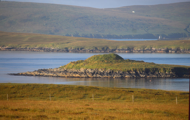
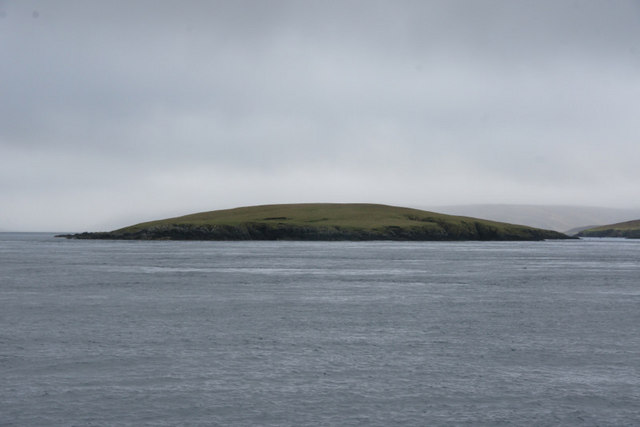
Orfasay

Orfasay (Old Norse: Orfyrisey, meaning "tidal island") is one of the Shetland Islands. == Geography == Orfasay is a tidal island in Yell Sound, connected...

Ulsta

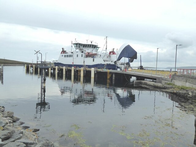
Ulsta is a village in the south-west of the island of Yell, Shetland, Scotland. North Ness Hall is the local community facility. The car ferry to Toft...

Samphrey

Samphrey (Scots: Samphrey; Old Norse: SandfriĆ°arey) is an uninhabited island in the Shetland Islands, Scotland. One of Fair Isle's old names is "FriĆ°arey...

Bigga, Shetland

Bigga is an uninhabited island in the Yell Sound between the Mainland and Yell in Shetland, Scotland. == Geography and geology == Just over 1,000 metres...

Old Haa Museum

The Old Haa of Brough in located in Burravoe, Yell, Shetland, Scotland. Built for Robert Tyrie, a merchant, in 1672, houses the local museum for Burravoe...

Burravoe

Burravoe is a community on the north shore of Burra Voe, in the south-east part of the island of Yell in the Shetland Islands, Scotland. The name Burravoe...

Fish Holm

Fish Holm is a small island, 1.5 miles (2.4 km) east of Mainland, Shetland. It is near the village of Mossbank. It is 20 metres (66 ft) at its highest...

Related Videos

FERRY FROM YELL(ULSTA) TO TOFT(MAINLAND),SHETLAND-2017

Ferry #Yell #Toft #Shetland Traveling Shetland The ferry is crossing from Ulsta to Toft takes around 20 minutes and the services ...

Nearby Amenities

Located within 500m of 60.488041,-1.1261591
Wick of Copister
Natural: bay
Lat/Long: 60.4871988/-1.1233306
Power: pole
Lat/Long: 60.4922047/-1.1270093
Passing Place
Lat/Long: 60.4917487/-1.1268323
Power: pole
Lat/Long: 60.4916716/-1.1261537
Power: pole
Lat/Long: 60.4912039/-1.1253531
Barrier: cattle_grid
Lat/Long: 60.4910536/-1.123744
Power: pole
Lat/Long: 60.4906448/-1.1230598
Power: pole
Lat/Long: 60.4888845/-1.1288554
Power: pole
Lat/Long: 60.4890423/-1.1279609
Power: pole
Lat/Long: 60.4887107/-1.1297032
Power: pole
Lat/Long: 60.4885396/-1.1306192
Power: pole
Lat/Long: 60.4903715/-1.1239236
Power: pole
Lat/Long: 60.4903075/-1.1241167
Barrier: cattle_grid
Lat/Long: 60.489115/-1.1300573
Copister
Place: hamlet
Wikidata: Q5168600
Wikipedia: en:Copister
Lat/Long: 60.4907276/-1.1278873
Power: pole
Lat/Long: 60.4883761/-1.131509
Power: pole
Lat/Long: 60.4897952/-1.1274322
Power: pole
Lat/Long: 60.4904066/-1.1270235
Power: pole
Lat/Long: 60.4910623/-1.1265747
Power: pole
Lat/Long: 60.490929/-1.1221029
Power: pole
Lat/Long: 60.4906647/-1.1244247
The data included in this document is from www.openstreetmap.org. The data is made available under ODbL.

Have you been to Booth of Copister?

Leave your review of Booth of Copister below (or comments, questions and feedback).