Beilla Water

Coastal Marsh, Saltings in Shetland

Scotland

Beilla Water

Cunnigill Hill Final TuMP of the day after tramp over tussocks and peat haggs with Tricky Speirs.
Name:Cunnigill Hill
Hill number:1543
Height:176m / 577ft
Area:22: Shetland Islands
Class:Hu
Grid ref: HU432675 (est)
Drop:127m
Col:49m HU410660
Cunnigill Hill Credit: Rude Health

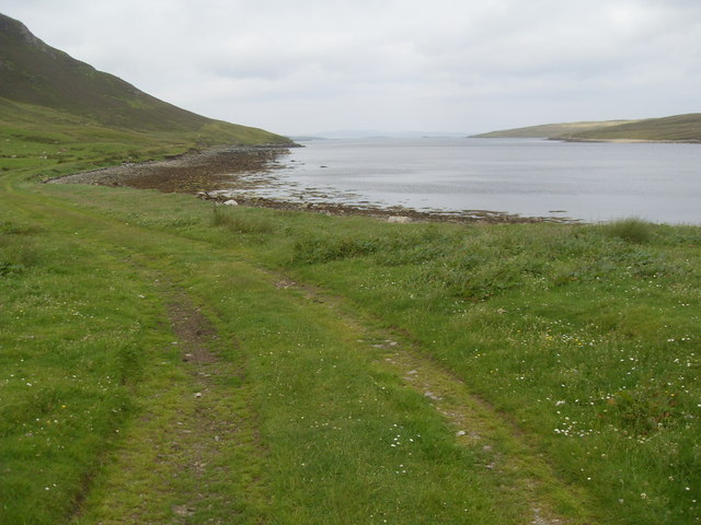
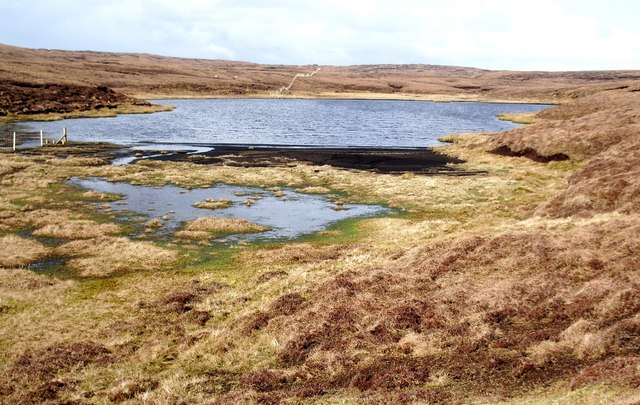
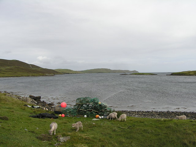
Beilla Water is a picturesque coastal marsh located in Shetland, an archipelago in Scotland. It is situated in the area known as the Saltings, which refers to the marshy land near the coast that is regularly flooded by the tides. This unique ecosystem is characterized by a diverse range of plant and animal life, making it an important habitat for both resident and migratory species.

The marsh is primarily made up of salt-tolerant grasses and sedges, which have adapted to the brackish water and high salt content of the soil. These plants provide essential forage and nesting grounds for a variety of bird species, including waders such as curlews, redshanks, and oystercatchers. The marshes also attract other bird species like lapwings, snipes, and dunlins.

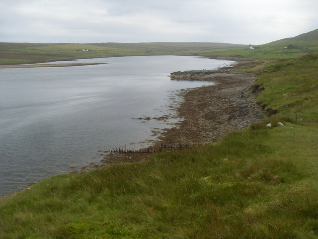
Beilla Water is known for its beautiful and ever-changing landscape, with the tides creating a dynamic environment. During high tide, the marshes are flooded, creating shallow pools and channels that attract waterfowl and shorebirds. At low tide, the water recedes, revealing vast mudflats where waders can easily forage for food.

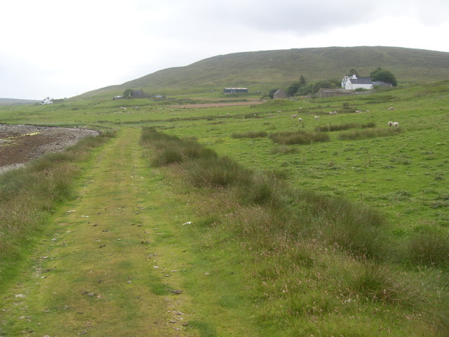
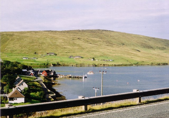
The marshes are not only of ecological importance but also provide a scenic backdrop for visitors. The surrounding coastal area offers breathtaking views of the North Sea, with rugged cliffs and rocky outcrops. The marshes themselves are a haven for nature enthusiasts and birdwatchers, who can observe the diverse birdlife from designated viewing points or explore the area on foot along the many trails in the vicinity.

Overall, Beilla Water in Shetland is a vital coastal marshland that supports a rich array of plant and animal species. With its stunning landscapes and abundant wildlife, it is a must-visit destination for anyone with an interest in nature and conservation.

If you have any feedback on the listing, please let us know in the comments section below.

Beilla Water Images

Images are sourced within 2km of 60.379235/-1.2006778 or Grid Reference HU4466. Thanks to Geograph Open Source API. All images are credited.

Cunnigill Hill Final TuMP of the day after tramp over tussocks and peat haggs with Tricky Speirs.
Name:Cunnigill Hill
Hill number:1543
Height:176m / 577ft
Area:22: Shetland Islands
Class:Hu
Grid ref: HU432675 (est)
Drop:127m
Col:49m HU410660
Cunnigill Hill
Final TuMP of the day after tramp over tussocks and peat haggs with Tricky Speirs. Name:Cunnigill Hill Hill number:1543 Height:176m / 577ft Area:22: Shetland Islands Class:Hu Grid ref: HU432675 (est) Drop:127m Col:49m HU410660
En-route To Cunnigill Hill We followed the fence line from Gardie Hill to the fence junction in the picture then followed the fence at 90 degree over wetter going.  This moorland was surprisingly dry underfoot.  At other times of year this could be a time consuming bog trot.  You have been warned.
En-route To Cunnigill Hill
We followed the fence line from Gardie Hill to the fence junction in the picture then followed the fence at 90 degree over wetter going. This moorland was surprisingly dry underfoot. At other times of year this could be a time consuming bog trot. You have been warned.
Still En-route To Cunnigill Hill Another fence to cross on our way across this moorland between Gardie Hill and Cunnigill Hill.  We had to cross another fence before the summit but managed to detour round them on our return journey back to the car.
Still En-route To Cunnigill Hill
Another fence to cross on our way across this moorland between Gardie Hill and Cunnigill Hill. We had to cross another fence before the summit but managed to detour round them on our return journey back to the car.
Shore track at Swining The first part of the walk to Sandwick.
Shore track at Swining
The first part of the walk to Sandwick.
Swining from the north
Head of Swining Voe from south
Clubb of Swining, Shetland Photo taken looking north to the craggy face of the Clubb of Swining with Swining Voe to the right.
Clubb of Swining, Shetland
Photo taken looking north to the craggy face of the Clubb of Swining with Swining Voe to the right.
Eroded peat on Clubb of Tronister, Shetland Photo shows that the original intact peat would have been 2-3m deep, but now some 80% of the area has been eroded.  There are patches of black outwashed peat on top of the stony surface and some zones of re-established vegetation.
Eroded peat on Clubb of Tronister, Shetland
Photo shows that the original intact peat would have been 2-3m deep, but now some 80% of the area has been eroded. There are patches of black outwashed peat on top of the stony surface and some zones of re-established vegetation.
Kingshouse (Ruin), Shetland The ruins of Kingshouse lie near the confluence of the Burn of Brecklee and the Seggie Burn.
Kingshouse (Ruin), Shetland
The ruins of Kingshouse lie near the confluence of the Burn of Brecklee and the Seggie Burn.
Sand Water, Shetland Looking north across the 'beach' which is not actually composed of sand, but the fines from outwashed peat.
Sand Water, Shetland
Looking north across the 'beach' which is not actually composed of sand, but the fines from outwashed peat.
Trees at Swining
Trees at Swining
Swining, Vidlin
Swining, Vidlin
Swining Voe
Swining Voe
Head of Swining Voe A Shetland ram beside the Burn of Tronister as it flows into Swining Voe.
Head of Swining Voe
A Shetland ram beside the Burn of Tronister as it flows into Swining Voe.
Swining The maps say Swining, but the roadsigns say Sweening.
Swining
The maps say Swining, but the roadsigns say Sweening.
Trees, bushes and flowers at Swining Flowering Currant (Ribes sp.) and Lesser Celandine (Ranunculus filicaria) growing beneath the trees at Swining.
Trees, bushes and flowers at Swining
Flowering Currant (Ribes sp.) and Lesser Celandine (Ranunculus filicaria) growing beneath the trees at Swining.
Swining One of the houses at the end of the road in Swining, nestling among the trees.
Swining
One of the houses at the end of the road in Swining, nestling among the trees.
Peaty beach on Laxo Water A beach in the bight on the west side of Laxo Water made of fine peat washed down into the loch.
Peaty beach on Laxo Water
A beach in the bight on the west side of Laxo Water made of fine peat washed down into the loch.
Show me another place!

Beilla Water is located at Grid Ref: HU4466 (Lat: 60.379235, Lng: -1.2006778)

Unitary Authority: Shetland Islands

Police Authority: Highlands and Islands

What 3 Words

///geologist.myself.done. Near Vidlin, Shetland Islands

Nearby Locations

Beilla Water Yella Moor

Related Wikis

Laxo

Laxo is a small settlement at the end of Laxo Voe in Vidlin, Shetland, Scotland. A ferry from the Mainland to Symbister in Whalsay operates from the nearby...

Vidlin

Vidlin (from Old Norse: Vaðill meaning a ford) is a small village located on Mainland, Shetland, Scotland. The settlement is within the parish of Nesting...

Voe, Delting

Voe is a village in Delting parish on Mainland, Shetland, Scotland. It is one of the three main settlements in Delting. It is at the junction of the A968...

North Mainland

The North Mainland of the Shetland Islands, Scotland is the part of the Mainland lying north of Voe (60° 21′N). == Geography == Notable places in North...

Lunna House

Lunna House is a 17th-century laird's house on Lunna Ness in the Shetland Islands. Lunna House is noted for having "the best historic designed landscape...

Delting

Delting is a civil parish and community council area on Mainland, Shetland, Scotland. It includes the Sullom Voe oil terminal and its main settlements...

Firth, Shetland

Note: "Firth" is a common name for sounds in ShetlandFirth is a village in the north east of Mainland, Shetland, Scotland, in the parish of Delting, not...

Linga, Yell Sound

Linga is one of the Shetland Islands, in Yell Sound. == Geography and geology == Linga is an extremely common name in Shetland, meaning heather island...

Have you been to Beilla Water?

Leave your review of Beilla Water below (or comments, questions and feedback).