Tonga

Coastal Marsh, Saltings in Shetland

Scotland

Tonga

To Sumburgh Head Taken at Jarlshof, settlement site on Shetland dating back 4,000 years and still in use in the 17th century, I am looking across the West Voe of Sumburgh towards Sumburgh Head, the most southerly point of mainland Shetland.
To Sumburgh Head Credit: Carroll Pierce

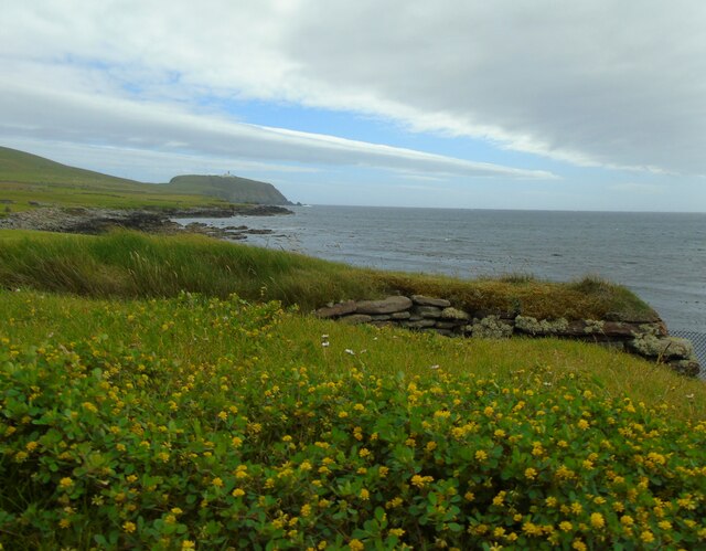
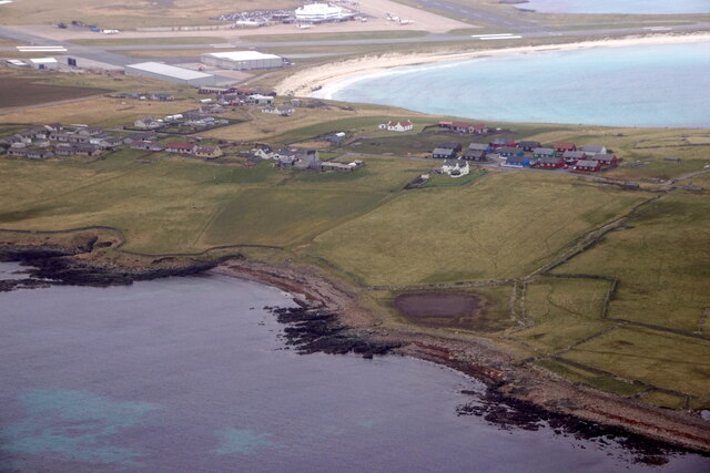
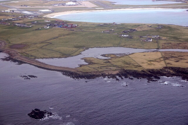
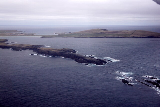
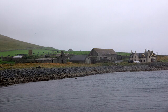
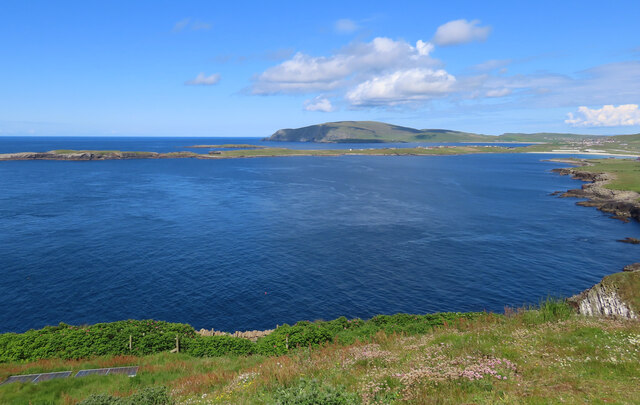
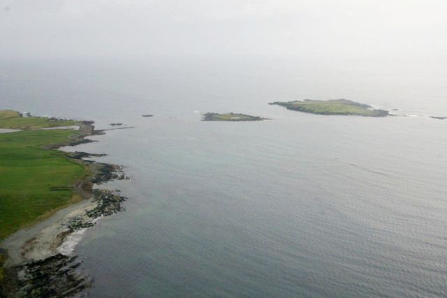
Tonga, Shetland is a coastal marsh and saltings located in the Shetland Islands, Scotland. It is situated on the eastern coast of the mainland, specifically in the parish of Dunrossness. This area is known for its diverse and unique ecosystem, making it an important ecological site.

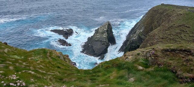
The marsh and saltings of Tonga are characterized by a combination of mudflats, salt marshes, and sand dunes. These habitats are home to a wide variety of plant and animal species. The salt marshes, in particular, support a range of halophytic plants such as sea aster, sea purslane, and sea lavender. These plants are adapted to the high salt concentrations found in the area.

The coastal marsh is also an important breeding ground and feeding area for many bird species. It serves as a vital stopover site for migratory birds, including waders and waterfowl. Some of the bird species that can be observed here include redshanks, curlews, oystercatchers, and various species of gulls.

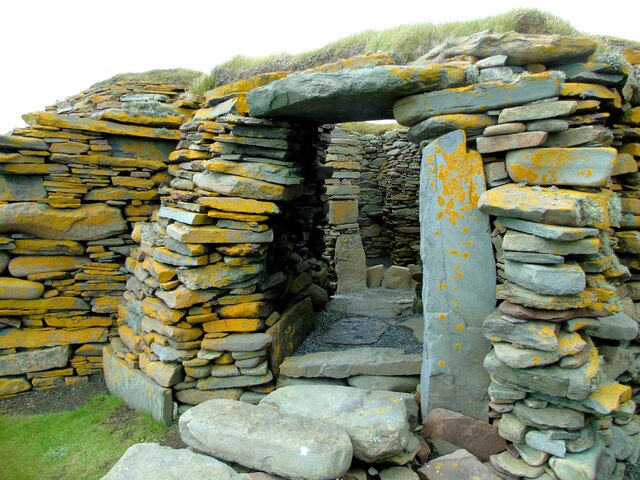
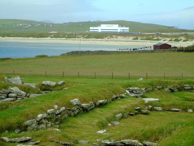
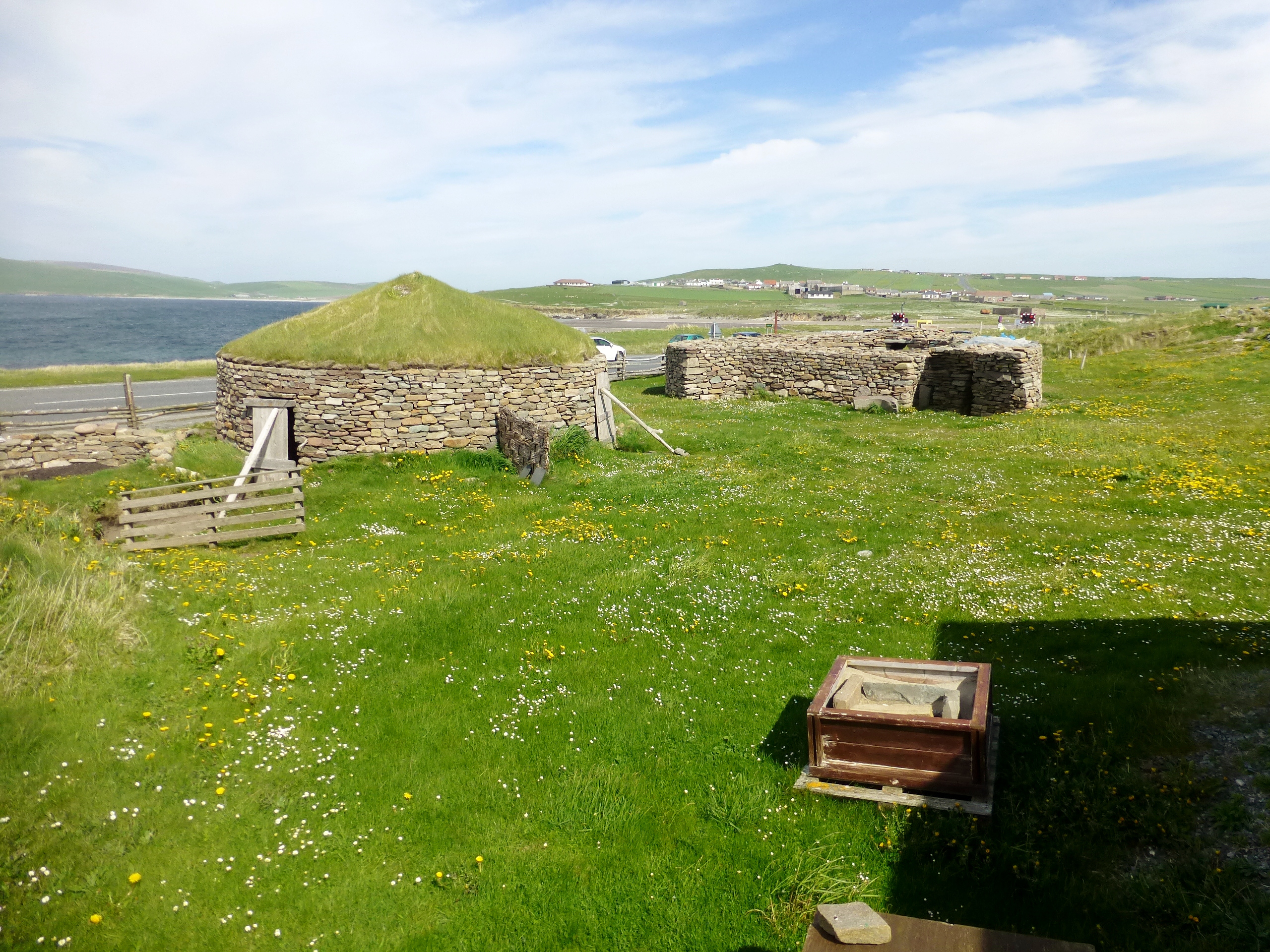
Tonga, Shetland is not only significant for its ecological value but also for its cultural and historical importance. The area has a rich archaeological heritage, with evidence of human settlement dating back thousands of years. The remains of ancient settlements, including prehistoric houses and field systems, have been discovered in the vicinity.

Overall, Tonga, Shetland's coastal marsh and saltings are a unique and valuable natural resource. It provides essential habitats for plant and animal species, serves as a haven for migratory birds, and preserves the historical legacy of human occupation in the area.

If you have any feedback on the listing, please let us know in the comments section below.

Tonga Images

Images are sourced within 2km of 59.862691/-1.3063894 or Grid Reference HU3808. Thanks to Geograph Open Source API. All images are credited.

To Sumburgh Head Taken at Jarlshof, settlement site on Shetland dating back 4,000 years and still in use in the 17th century, I am looking across the West Voe of Sumburgh towards Sumburgh Head, the most southerly point of mainland Shetland.
To Sumburgh Head
Taken at Jarlshof, settlement site on Shetland dating back 4,000 years and still in use in the 17th century, I am looking across the West Voe of Sumburgh towards Sumburgh Head, the most southerly point of mainland Shetland.
Wheelhouse entrance This is a section of the extensive remains located at Jarlshof, Sumburgh, Shetland. The site was first settled around 4,000 years ago and had a succession of inhabitants through the Bronze and Iron Ages to Norse settlement and medieval farming following on until the 17th century. I am looking at an entrance to the wheelhouse complex on the site.
Wheelhouse entrance
This is a section of the extensive remains located at Jarlshof, Sumburgh, Shetland. The site was first settled around 4,000 years ago and had a succession of inhabitants through the Bronze and Iron Ages to Norse settlement and medieval farming following on until the 17th century. I am looking at an entrance to the wheelhouse complex on the site.
Sumburgh Airport from Jarlshof Taken on the inner path running between the wheelhouse complex and the Norse settlement at Jarlshof, Sumburgh, I am looking across the eastern edge of West Voe to Sumburgh Airport, Shetland's main airport.
Sumburgh Airport from Jarlshof
Taken on the inner path running between the wheelhouse complex and the Norse settlement at Jarlshof, Sumburgh, I am looking across the eastern edge of West Voe to Sumburgh Airport, Shetland's main airport.
Sumburgh Hotel I am near the visitor centre at Jarlshof, Shetland, and looking past the Shetland pony towards the Sumburgh Hotel which is flying the Shetland flag. The hill beyond crowned with radar installation is the landward side of Compass Head.
Sumburgh Hotel
I am near the visitor centre at Jarlshof, Shetland, and looking past the Shetland pony towards the Sumburgh Hotel which is flying the Shetland flag. The hill beyond crowned with radar installation is the landward side of Compass Head.
Scatness from the air
Loch of Gards, Scatness, from the air
Ness of Burgi, Scatness, from the air
Horse Island, Scatness, from the air
Grutness House from the pier
Guillemots on a stack at Sumburgh Head
Sumburgh Head Lighthouse At the summit of this path lie the lighthouse and visitor centre at Sumburgh Head, the southernmost point of mainland Shetland. This is also a nature reserve teeming with birdlife on the cliffs and the rocks below.
Sumburgh Head Lighthouse
At the summit of this path lie the lighthouse and visitor centre at Sumburgh Head, the southernmost point of mainland Shetland. This is also a nature reserve teeming with birdlife on the cliffs and the rocks below.
Sumburgh Lighthouse from the air
Compass Head from the air
View across Sumburgh from the Head With the airport further on.
View across Sumburgh from the Head
With the airport further on.
Communication masts, Sumburgh Viewed from Grutness.
Communication masts, Sumburgh
Viewed from Grutness.
Ness of Burgi and Fitful Head Taken on the western side of Sumburgh Head, beside its lighthouse and visitor centre, I am looking across the West Voe of Sumburgh to the Ness of Burgi. The Bay of Quendale and Fitful lie beyond. Main island, Shetland.
Ness of Burgi and Fitful Head
Taken on the western side of Sumburgh Head, beside its lighthouse and visitor centre, I am looking across the West Voe of Sumburgh to the Ness of Burgi. The Bay of Quendale and Fitful lie beyond. Main island, Shetland.
Compass Head from the approach road to Sumburgh Airport
Sumburgh Airport (2) This is Sumburgh Airport, the main airport serving Shetland, taken from the road as it passes its south western side.
Sumburgh Airport (2)
This is Sumburgh Airport, the main airport serving Shetland, taken from the road as it passes its south western side.
Show me another place!

Tonga is located at Grid Ref: HU3808 (Lat: 59.862691, Lng: -1.3063894)

Unitary Authority: Shetland Islands

Police Authority: Highlands and Islands

What 3 Words

///barbarian.ribs.bongo. Near Sumburgh, Shetland Islands

Related Wikis

Ness of Burgi

The Ness of Burgi is a narrow peninsula that stretches to the south from the Scat Ness headland of Mainland, Shetland, a Scottish island. It is in the...

West Voe of Sumburgh

The West Voe of Sumburgh, (grid reference: HU 395 088), is the most southerly bay on the Shetland Mainland, located between Sumburgh Head, and the point...

Jarlshof

Jarlshof ( YARLZ-hof) is the best-known prehistoric archaeological site in Shetland, Scotland. It lies in Sumburgh, Mainland, Shetland and has been described...

Scatness

Scatness is a settlement on the headland of Scat Ness at the southern tip of Mainland, Shetland, Scotland, across the West Voe of Sumburgh from Sumburgh...

Little Holm, Dunrossness

Little Holm is a small island to the west of South Mainland in Shetland. It is near Scatness and Lady's Holm. A trawler was wrecked there in 1916. ��2...

Sumburgh

Sumburgh is a small settlement in the Shetland Islands, Scotland. Sumburgh is located at the south end of the Mainland on Sumburgh Head. Sumburgh Airport...

Horse Holm

Horse Island or Horse Holm, known locally as Da Holm, is one of the Shetland Islands. It lies about 2.3 km west of Sumburgh Head at the south tip of the...

Lady's Holm

Lady's Holm is an island off southern Mainland in the Shetland Islands. It is not to be confused with the Maiden Stack, which is also known as "Frau Stack...

Nearby Amenities

Located within 500m of 59.862691,-1.3063894
Man Made: cairn
Lat/Long: 59.8653471/-1.3121367
Man Made: cairn
Lat/Long: 59.8653188/-1.311733
Man Made: cairn
Lat/Long: 59.8655922/-1.3072604
The data included in this document is from www.openstreetmap.org. The data is made available under ODbL.

Have you been to Tonga?

Leave your review of Tonga below (or comments, questions and feedback).