Beal Point
Coastal Marsh, Saltings in Northumberland
England
Beal Point

Beal Point is a coastal marshland located in Northumberland, England. Situated along the North Sea, it is renowned for its scenic beauty and ecological significance. The marshland is characterized by its vast expanse of saltmarshes and saltings, making it a unique and diverse ecosystem.
Covering an area of approximately 180 hectares, Beal Point offers a haven for a wide range of flora and fauna. The marshes are home to various species of grasses, sedges, and herbs that have adapted to the saline conditions of the area. These plants provide crucial habitat and sustenance for numerous bird species, including wading birds, ducks, and geese, which can be observed throughout the year.
In addition to its ecological importance, Beal Point also holds historical significance. The area has evidence of human settlement dating back thousands of years, with archaeological finds including tools, pottery, and ancient structures. These remnants serve as a reminder of the rich cultural heritage of the region.
Beal Point is a popular destination for nature enthusiasts and birdwatchers, who can explore the marshes via well-maintained footpaths and trails. The site offers breathtaking views of the coastline, with the iconic Lindisfarne Castle visible in the distance.
Visitors to Beal Point are encouraged to respect the delicate ecosystem and adhere to conservation guidelines in order to preserve the natural beauty and biodiversity of this stunning coastal marshland.
If you have any feedback on the listing, please let us know in the comments section below.
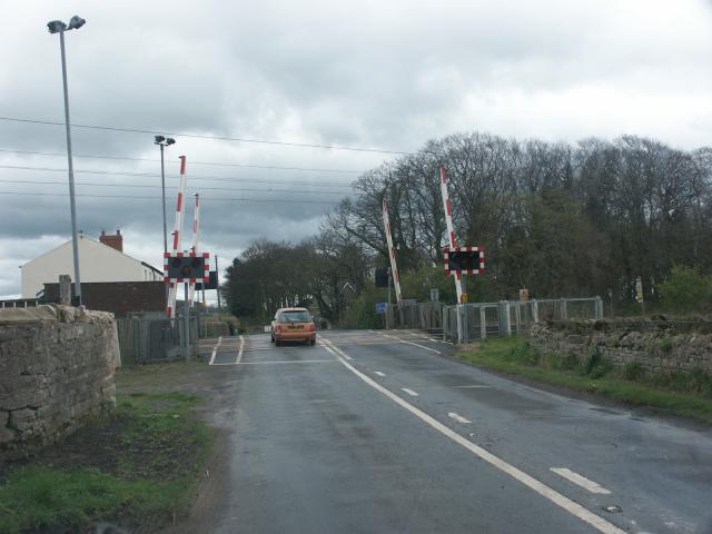
Beal Point Images
Images are sourced within 2km of 55.682254/-1.8723664 or Grid Reference NU0843. Thanks to Geograph Open Source API. All images are credited.


Beal Point is located at Grid Ref: NU0843 (Lat: 55.682254, Lng: -1.8723664)
Unitary Authority: Northumberland
Police Authority: Northumbria
What 3 Words
///yesterday.cars.onto. Near Lowick, Northumberland
Nearby Locations
Related Wikis

Islandshire
Islandshire was an area of Northumberland, England, comprising Lindisfarne or Holy Island, plus five parishes on the mainland. It is historically associated...

Beal, Northumberland
Beal is a village in Northumberland, in England. It is situated a short distance inland from the North Sea coast, and lies on the link road between the...
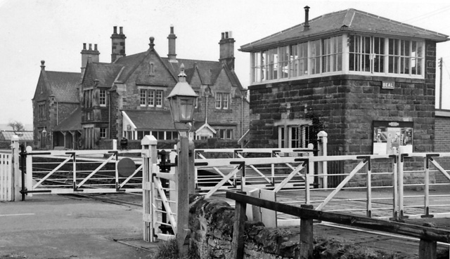
Beal railway station
Beal railway station, also known as Beal for Holy Island railway station, was a railway station that served the village of Beal, Northumberland, England...
Goswick
Goswick () is a hamlet in Northumberland, England, situated approximately south-east of Berwick-upon-Tweed, England, between the A1 and the North Sea coast...
Nearby Amenities
Located within 500m of 55.682254,-1.8723664Have you been to Beal Point?
Leave your review of Beal Point below (or comments, questions and feedback).