Black Stones
Coastal Marsh, Saltings in Aberdeenshire
Scotland
Black Stones
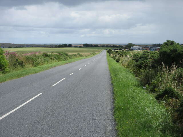
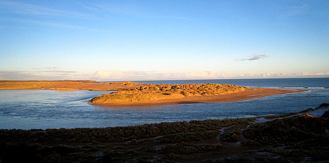
Black Stones is a coastal marsh located in Aberdeenshire, Scotland. It is renowned for its stunning natural beauty and diverse ecosystem. The marsh is situated adjacent to the North Sea, providing breathtaking views of the ocean and creating a unique environment for flora and fauna.
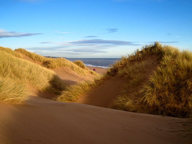
The landscape of Black Stones is characterized by a combination of sandy dunes, salt marshes, and saltings. These saltings are areas of land that are periodically flooded by the tides, creating a brackish environment that supports a wide range of plant and animal species. The marshes are home to various types of grasses, sedges, and rushes, which have adapted to the saltwater conditions.
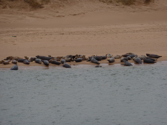
This area is a haven for birdwatchers and nature enthusiasts, as it provides important feeding and breeding grounds for numerous bird species. Visitors may have the opportunity to spot wading birds such as curlews, oystercatchers, and redshanks, among others. The marshes also attract migratory birds, including geese, ducks, and terns.
In addition to its ecological significance, Black Stones offers recreational activities for visitors. The sandy dunes are perfect for leisurely walks and picnics, while the nearby beach provides an ideal spot for sunbathing and swimming during the warmer months. The area is also popular among anglers, who can try their luck at catching sea trout or sea bass.
Overall, Black Stones in Aberdeenshire is a stunning coastal marsh that boasts a rich biodiversity and provides a tranquil escape for nature enthusiasts and outdoor lovers alike.
If you have any feedback on the listing, please let us know in the comments section below.
Black Stones Images
Images are sourced within 2km of 57.31068/-1.9932611 or Grid Reference NK0024. Thanks to Geograph Open Source API. All images are credited.


Black Stones is located at Grid Ref: NK0024 (Lat: 57.31068, Lng: -1.9932611)
Unitary Authority: Aberdeenshire
Police Authority: North East
What 3 Words
///receive.crashing.intestine. Near Newburgh, Aberdeenshire
Nearby Locations
Related Wikis
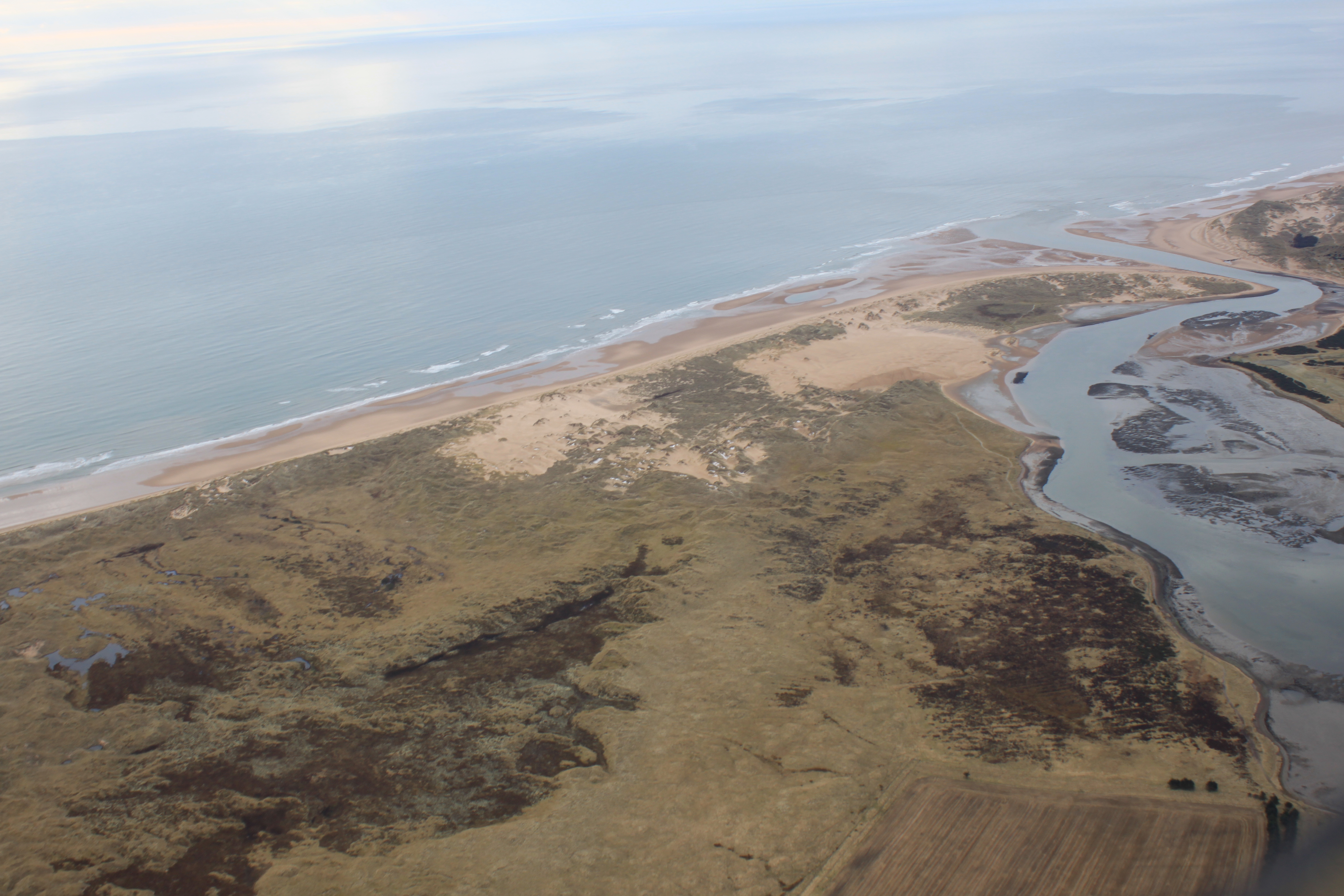
Forvie National Nature Reserve
The Forvie National Nature Reserve is a national nature reserve owned and managed by NatureScot. It is located north of Newburgh in Aberdeenshire, in the...

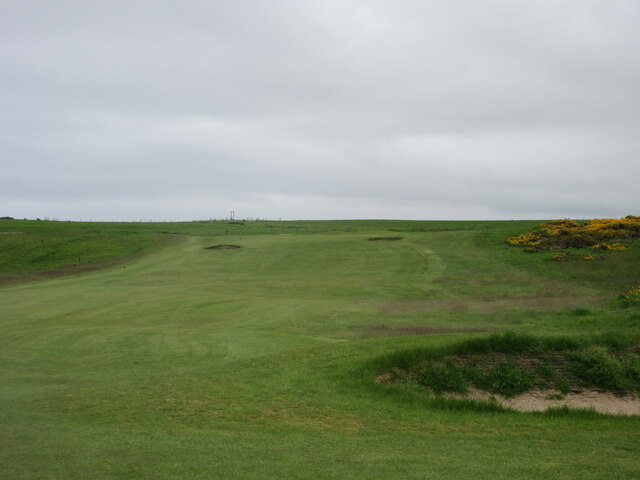
Newburgh On Ythan Golf Club
Newburgh On Ythan Golf Club was founded in 1888 by John Udny of Udny and a band of "founding fathers" and is one of the oldest golf courses in Scotland...

Newburgh, Aberdeenshire
Newburgh is a coastal village in Aberdeenshire, Scotland. The village dates to 1261 AD, when Lord Sinclair wanted to establish a chapel in the area. Originally...
River Ythan
The Ythan is a river in the north-east of Scotland rising at Wells of Ythan near the village of Ythanwells and flowing south-eastwards through the towns...
Foveran Castle
Foveran Castle was a 12th- or 13th-century castle, about 4.5 miles (7.2 km) south -ast of Ellon, Aberdeenshire, Scotland, at Foveran, 1 mile (1.6 km) west...
Foveran Links
Foveran Links is a Site of Special Scientific Interest (SSSI) in the parish of Foveran, in Aberdeenshire, Scotland. It consists of a mobile dune system...
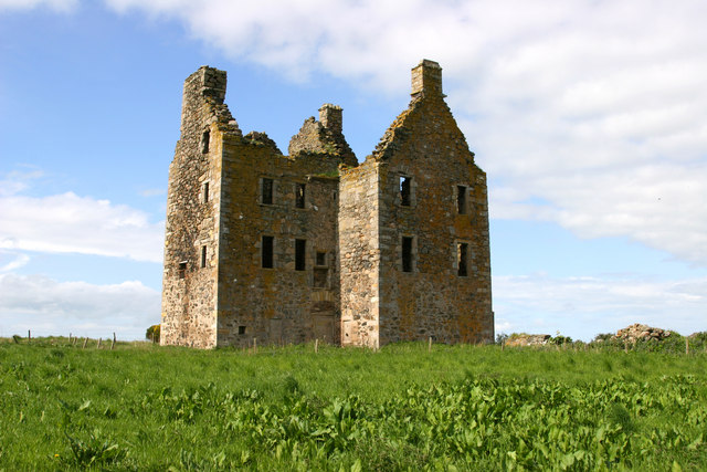
Knockhall Castle
Knockhall Castle is a historic Scottish castle near to Newburgh, Aberdeenshire. It was built by William Sinclair, 5th Lord Sinclair of Newburgh in 1565...
Forvie
Forvie was a village in what is now the Forvie National Nature Reserve, located at the modern location of Rockend some fourteen miles north of Aberdeen...
Nearby Amenities
Located within 500m of 57.31068,-1.9932611Have you been to Black Stones?
Leave your review of Black Stones below (or comments, questions and feedback).