Nyland, Lower

Settlement in Dorset

England

Nyland, Lower

Bow Bridge Cottage, A30 Shaftesbury Road Possibly a former Toll House, or modern restoration attempt on the foundations.
This location was the Bow TP as labelled in the OS drawing of 1808 ( <span class="nowrap"><a title="https://britishlibrary.oldmapsonline.org/compare#666931988205" rel="nofollow ugc noopener" href="https://britishlibrary.oldmapsonline.org/compare#666931988205">Link</a><img style="margin-left:2px;" alt="External link" title="External link - shift click to open in new window" src="https://s1.geograph.org.uk/img/external.png" width="10" height="10"/></span> ) when there was a bridge across Bow Brook.
It would have served the Crewkerne Turnpike Trust in the 19ᵗʰ C.

Milestone Society National ID: SO.HEN
Bow Bridge Cottage, A30 Shaftesbury Road Credit: Mr Red

Nyland is a small village located in the Lower district of Dorset, England. Situated in the southwestern part of the country, it is known for its picturesque countryside and charming rural atmosphere. With a population of around 500 residents, Nyland offers a close-knit community environment.

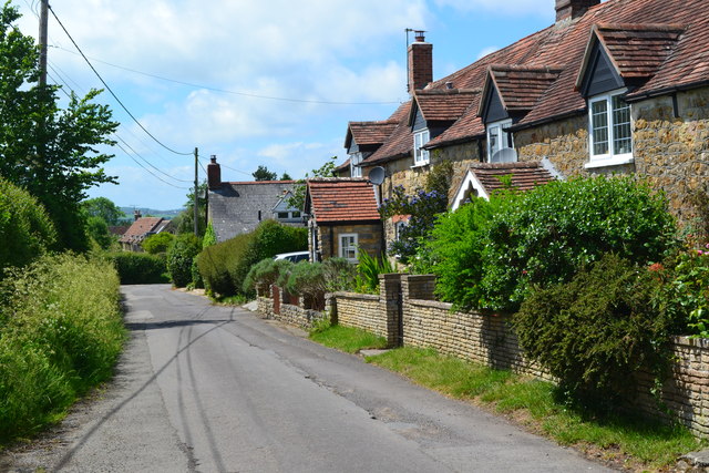
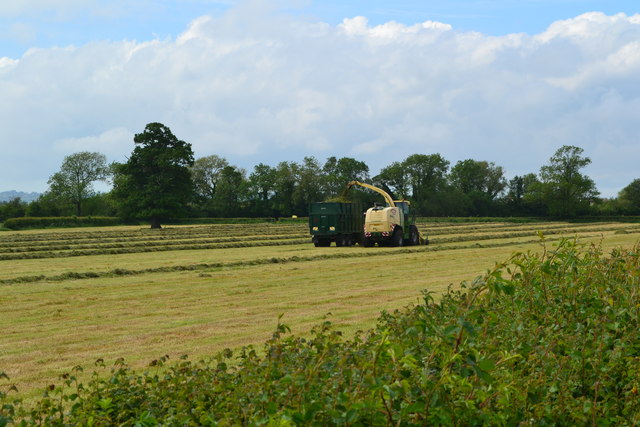
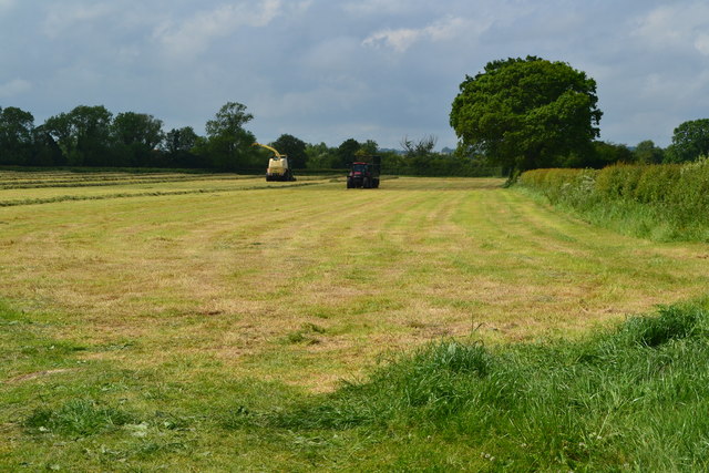
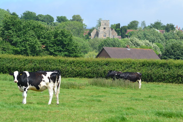
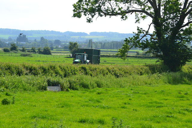
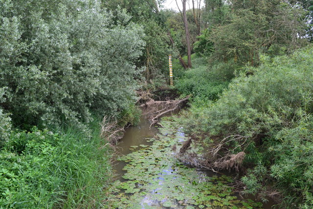
The village is surrounded by rolling hills and lush green fields, providing a tranquil setting for its inhabitants. The landscape is dotted with traditional English cottages, many of which date back several centuries, adding to the village's historic charm. Nyland is also home to a quaint parish church, which serves as a focal point for religious and community gatherings.

Despite its small size, Nyland boasts a few amenities to serve its residents. The village has a local pub, which serves as a social hub and gathering place for locals and visitors alike. There is also a small convenience store that provides essential groceries and daily necessities. However, for more extensive shopping and entertainment options, residents typically travel to nearby towns and cities.

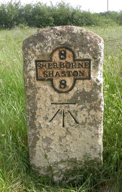
Nyland is surrounded by natural beauty, making it a popular destination for outdoor enthusiasts. The village is located near several walking trails and scenic viewpoints, attracting hikers and nature lovers. Additionally, the nearby coastline offers opportunities for beach walks and water activities.

Overall, Nyland offers a peaceful and idyllic lifestyle for its residents, with its charming village setting and access to the beautiful Dorset countryside.

If you have any feedback on the listing, please let us know in the comments section below.

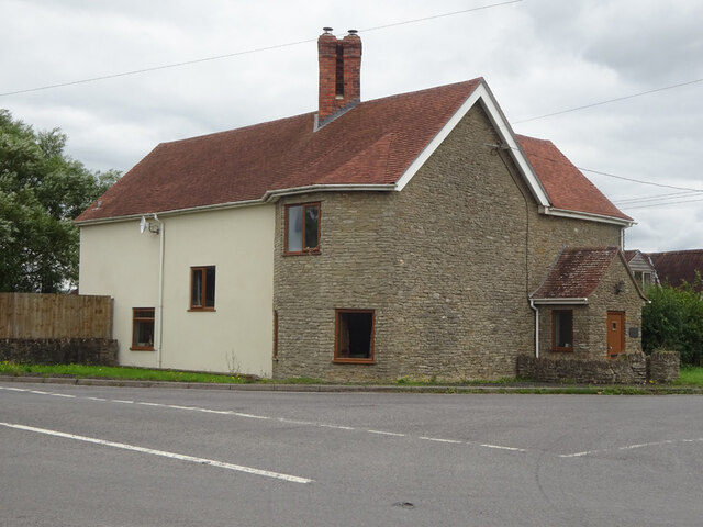
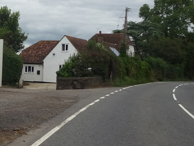
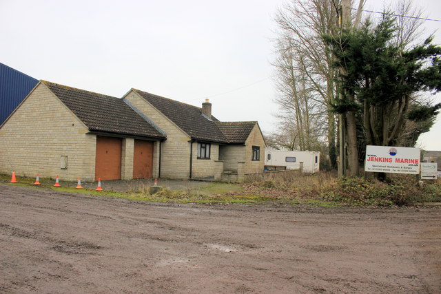
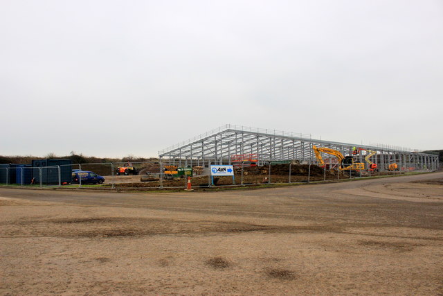
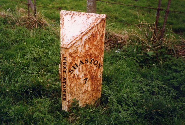
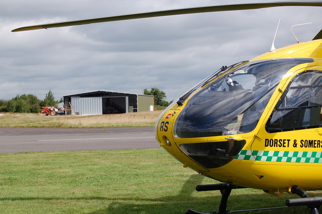
Nyland, Lower Images

Images are sourced within 2km of 50.994635/-2.3571181 or Grid Reference ST7521. Thanks to Geograph Open Source API. All images are credited.

Bow Bridge Cottage, A30 Shaftesbury Road Possibly a former Toll House, or modern restoration attempt on the foundations.
This location was the Bow TP as labelled in the OS drawing of 1808 ( <span class="nowrap"><a title="https://britishlibrary.oldmapsonline.org/compare#666931988205" rel="nofollow ugc noopener" href="https://britishlibrary.oldmapsonline.org/compare#666931988205">Link</a><img style="margin-left:2px;" alt="External link" title="External link - shift click to open in new window" src="https://s1.geograph.org.uk/img/external.png" width="10" height="10"/></span> ) when there was a bridge across Bow Brook.
It would have served the Crewkerne Turnpike Trust in the 19ᵗʰ C.

Milestone Society National ID: SO.HEN
Bow Bridge Cottage, A30 Shaftesbury Road
Possibly a former Toll House, or modern restoration attempt on the foundations. This location was the Bow TP as labelled in the OS drawing of 1808 ( LinkExternal link ) when there was a bridge across Bow Brook. It would have served the Crewkerne Turnpike Trust in the 19ᵗʰ C. Milestone Society National ID: SO.HEN
The White House, A30 Shaftesbury Road Possibly a former Toll House serving the Sherborne Turnpike Trust in the 19ᵗʰ C.
There is a former Toll House nearby to the West <a href="https://www.geograph.org.uk/photo/7572236">ST7421 : Bow Bridge Cottage, A30 Shaftesbury Road</a> that served a different Turnpike Trust.

Milestone Society National ID: DO.KIN
The White House, A30 Shaftesbury Road
Possibly a former Toll House serving the Sherborne Turnpike Trust in the 19ᵗʰ C. There is a former Toll House nearby to the West ST7421 : Bow Bridge Cottage, A30 Shaftesbury Road that served a different Turnpike Trust. Milestone Society National ID: DO.KIN
House at Jenkins Marine This house occupies the front of a plot on the industrial estate of which the main industrial building belongs to Jenkins Marine a specialised Workboats, Barges and Dredging Contractor whose headquarters are in Poole
House at Jenkins Marine
This house occupies the front of a plot on the industrial estate of which the main industrial building belongs to Jenkins Marine a specialised Workboats, Barges and Dredging Contractor whose headquarters are in Poole
New Industrial Building Hestridge Airfield This large steel framed industrial building is being erected on the site of what used to be the old Henstridge Airfield.
New Industrial Building Hestridge Airfield
This large steel framed industrial building is being erected on the site of what used to be the old Henstridge Airfield.
Chapel Hill, Kington Magna
Mowing the grass, near Kington Magna
Newly mown meadow
Newly mown meadow
Cows in field, looking towards Kington Magna church Post submission note: it's the photographer, not the cows that are looking towards the church, obviously!
Cows in field, looking towards Kington Magna church
Post submission note: it's the photographer, not the cows that are looking towards the church, obviously!
Tractor and trailer at Lower Farm Returning for another load of mown grass.
Tractor and trailer at Lower Farm
Returning for another load of mown grass.
Very overgrown River Cale at Five Bridges
Old Milestone by the A30, east of Bow Bridge Metal plate attached to stone post by the A30, in parish of KINGTON MAGNA (NORTH DORSET District), East of Bow Bridge; 2m back from road, opposite Bow Bridge Cottage (tollhouse?), by the road, on South side of road. Dorset 3 and 4 (iron plated), erected by the Sherborne turnpike trust in the 19th century. 

Inscription reads:-
8
SHERBORNE
SHASTON
8  
Carved benchmark centre front.

Milestone Society National ID: DO_SBSH08.
Old Milestone by the A30, east of Bow Bridge
Metal plate attached to stone post by the A30, in parish of KINGTON MAGNA (NORTH DORSET District), East of Bow Bridge; 2m back from road, opposite Bow Bridge Cottage (tollhouse?), by the road, on South side of road. Dorset 3 and 4 (iron plated), erected by the Sherborne turnpike trust in the 19th century. Inscription reads:- 8 SHERBORNE SHASTON 8 Carved benchmark centre front. Milestone Society National ID: DO_SBSH08.
Old Boundary Marker by the A30, Bow Bridge, Henstridge parish County Boundary Marker by the A30, in parish of Henstridge (South Somerset District), East end of Bow Bridge, by North side of road.

Inscription reads:-
: SOMERSET : : BOUNDARY / 1909 : : DORSET :

Surveyed

Milestone Society National ID: SO_SSDO01cb
Old Boundary Marker by the A30, Bow Bridge, Henstridge parish
County Boundary Marker by the A30, in parish of Henstridge (South Somerset District), East end of Bow Bridge, by North side of road. Inscription reads:- : SOMERSET : : BOUNDARY / 1909 : : DORSET : Surveyed Milestone Society National ID: SO_SSDO01cb
Old Milepost, A30, Coking Farm, Kington Magna Parish The milestone was located opposite the farm entrance on the north side of the road. Parish of Kington Magna (North Dorset district). Cast iron post, Shaston casting design, erected by the Shaftesbury and New Road to Blandford turnpike trust in the 19th century. The milestone is now in a private garden barely visible from the roadside.

Inscription reads:-
SHERBORNE / 9 : : WEST STOWER : : SHASTON / 7

Milestone Society National ID: DO_SBSH09L
Old Milepost, A30, Coking Farm, Kington Magna Parish
The milestone was located opposite the farm entrance on the north side of the road. Parish of Kington Magna (North Dorset district). Cast iron post, Shaston casting design, erected by the Shaftesbury and New Road to Blandford turnpike trust in the 19th century. The milestone is now in a private garden barely visible from the roadside. Inscription reads:- SHERBORNE / 9 : : WEST STOWER : : SHASTON / 7 Milestone Society National ID: DO_SBSH09L
Buckhorn Weston to Kington Magna Road
War Memorial, Kington Magna We will remember them.
War Memorial, Kington Magna
We will remember them.
Towards Fifehead Magdalen
Show me another place!

Nyland, Lower is located at Grid Ref: ST7521 (Lat: 50.994635, Lng: -2.3571181)

Unitary Authority: Dorset

Police Authority: Dorset

What 3 Words

///torso.mascot.classed. Near Henstridge, Somerset

Nearby Locations

Lower Nyland Nyland, Lower

Related Wikis

Dorset and Somerset Air Ambulance

The Dorset and Somerset Air Ambulance is a registered charity, which uses a helicopter to provide an air ambulance service to the English counties of Dorset...

RNAS Henstridge (HMS Dipper)

Royal Naval Air Station Henstridge (RNAS Henstridge; or HMS Dipper) is a former Royal Navy Fleet Air Arm airbase, located 7 miles (11 km) west of Shaftesbury...

Kington Magna

Kington Magna is a village and civil parish in the Blackmore Vale area of Dorset, England, about 3+1⁄2 miles (5.5 kilometres) southwest of Gillingham....

Fifehead Wood

Fifehead Wood is a woodland in Dorset, England, near the village of Fifehead Magdalen. Owned and maintained by the Woodland Trust, Fifehead Wood covers...

Nearby Amenities

Located within 500m of 50.994635,-2.3571181
Barrier: stile
Lat/Long: 50.9950425/-2.3520472
Barrier: stile
Lat/Long: 50.9951509/-2.3520759
Lower Nyland
Is In: Dorset, UK
Place: hamlet
Lat/Long: 50.9944938/-2.3541914
Barrier: stile
Stile: stepover
Lat/Long: 50.9928256/-2.3562237
Barrier: stile
Stile: stepover
Lat/Long: 50.9915371/-2.3565311
Material: wood
Power: pole
Source: bing
Lat/Long: 50.9910147/-2.3602214
Material: wood
Power: pole
Source: bing
Lat/Long: 50.991083/-2.3583047
Material: wood
Power: pole
Source: bing
Lat/Long: 50.9911802/-2.3558564
Material: wood
Power: pole
Source: bing
Lat/Long: 50.9912692/-2.353717
Historic: milestone
Note: Looks relatively new.
Lat/Long: 50.9915484/-2.3619898
Barrier: stile
Lat/Long: 50.9953315/-2.3640897
The data included in this document is from www.openstreetmap.org. The data is made available under ODbL.

Have you been to Nyland, Lower?

Leave your review of Nyland, Lower below (or comments, questions and feedback).