Little Marsh

Lake, Pool, Pond, Freshwater Marsh in Staffordshire South Staffordshire

England

Little Marsh

Filance Lock near Penkridge in Staffordshire Filance Lock is No 37 on the Staffordshire and Worcestershire Canal near Penkridge, by Templars Way. It proviseds a fall (or rise) of 10ft 3in (about 3·1 metres).
Filance Lock near Penkridge in Staffordshire Credit: Roger D Kidd

Little Marsh is a small, picturesque freshwater marsh located in the county of Staffordshire, England. Situated on the outskirts of the charming village of Little Marsh, the area is renowned for its stunning natural beauty and abundant wildlife.

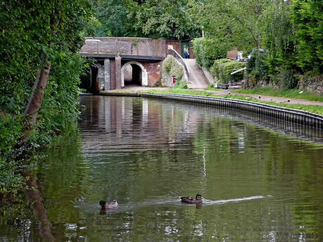
The marsh is primarily formed by the convergence of several small streams, creating a tranquil pool of freshwater. Surrounded by lush vegetation and framed by tall reeds, it offers a peaceful oasis for both residents and visitors alike. The water is crystal clear and teeming with various species of fish, making it a popular spot for anglers.

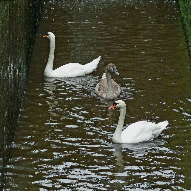
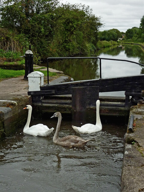
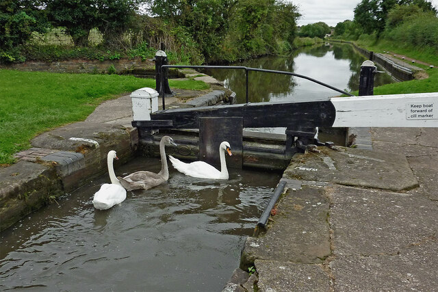
The marsh serves as a crucial habitat for a diverse range of wildlife. It is home to a variety of water birds, including ducks, herons, and swans, which can be observed gracefully gliding across the surface of the water. The surrounding vegetation provides shelter for numerous small mammals, such as voles and water shrews, as well as a wide array of insects and amphibians.

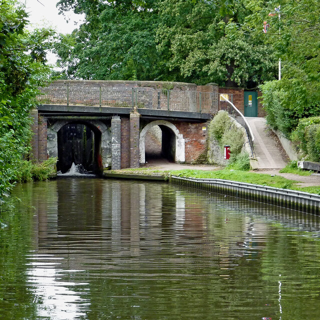
Nature enthusiasts are drawn to Little Marsh for its scenic beauty and the opportunity to explore its unique ecosystem. The marsh is accessible via well-maintained footpaths that wind their way through the surrounding countryside. These paths offer visitors the chance to observe the marsh's inhabitants up close and enjoy the tranquil ambiance of the area.

Overall, Little Marsh is a hidden gem in Staffordshire, offering visitors a chance to connect with nature and experience the beauty of a freshwater marsh. Whether it's for fishing, birdwatching, or simply enjoying a peaceful stroll, this enchanting location is sure to captivate all who venture there.

If you have any feedback on the listing, please let us know in the comments section below.
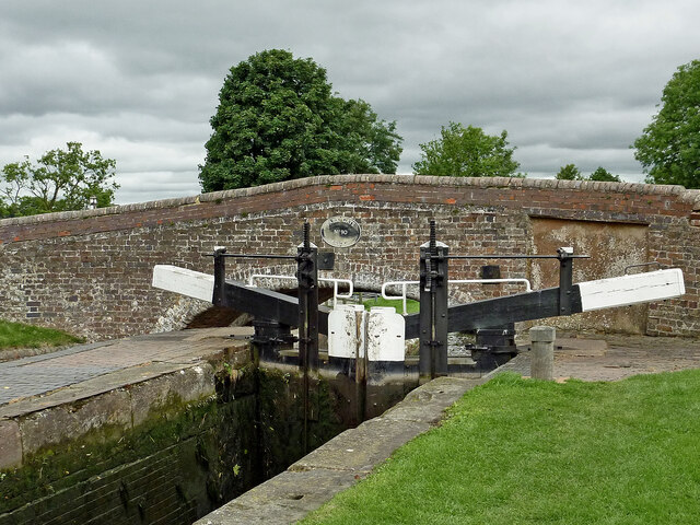
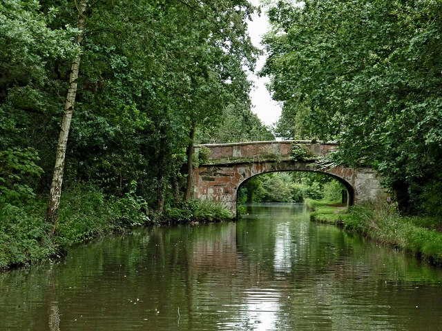
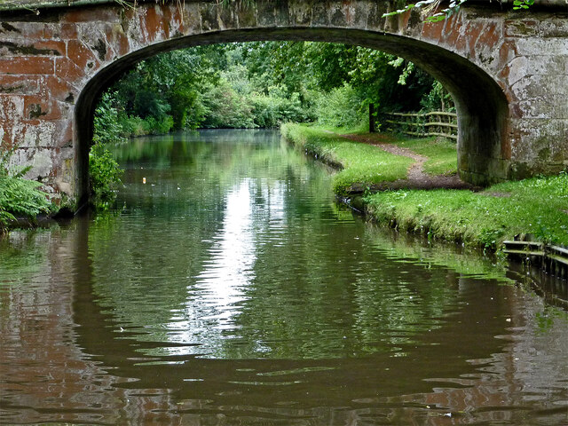
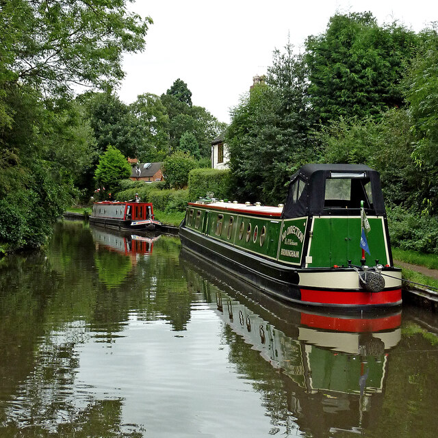
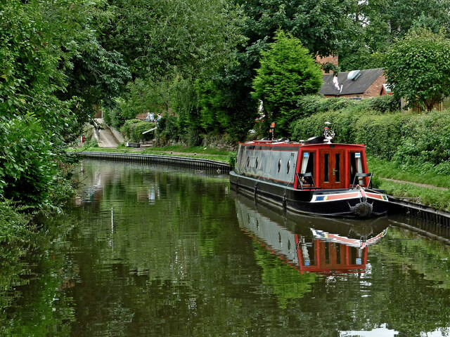
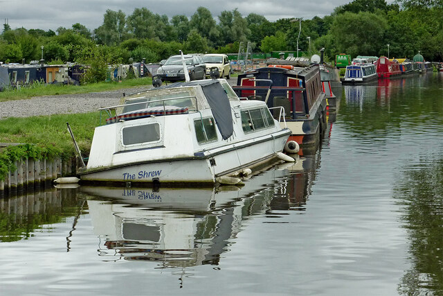
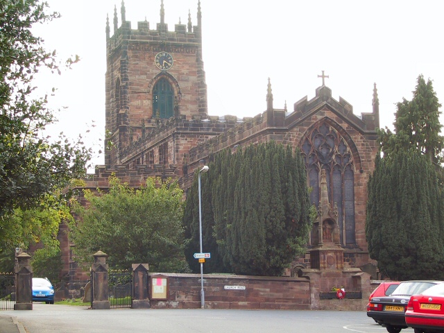
Little Marsh Images

Images are sourced within 2km of 52.725176/-2.1035884 or Grid Reference SJ9314. Thanks to Geograph Open Source API. All images are credited.

Filance Lock near Penkridge in Staffordshire Filance Lock is No 37 on the Staffordshire and Worcestershire Canal near Penkridge, by Templars Way. It proviseds a fall (or rise) of 10ft 3in (about 3·1 metres).
Filance Lock near Penkridge in Staffordshire
Filance Lock is No 37 on the Staffordshire and Worcestershire Canal near Penkridge, by Templars Way. It proviseds a fall (or rise) of 10ft 3in (about 3·1 metres).
Park Gate Lock and Bridge near Penkridge, Staffordshire Park Gate Bridge is No 90 across the Staffordshire and Worcestershire Canal, and now allows access to the Midland Chandlers warehouse, Park Gate Lockhouse and the (now former) Teddesley Boat Compaany wharf.

Note the two gate paddle ratchets (between the bridge plate) are both up so the lock is being drained to allow a south bound boat to enter.
Park Gate Lock and Bridge near Penkridge, Staffordshire
Park Gate Bridge is No 90 across the Staffordshire and Worcestershire Canal, and now allows access to the Midland Chandlers warehouse, Park Gate Lockhouse and the (now former) Teddesley Boat Compaany wharf. Note the two gate paddle ratchets (between the bridge plate) are both up so the lock is being drained to allow a south bound boat to enter.
Canal cruising near Penkridge in Staffordshire This is the Staffordshire and Worcestershire Canal meandering southwards towards Penkridge and Wolverhampton. The narrowboat is called "Beeston Castle".
Canal cruising near Penkridge in Staffordshire
This is the Staffordshire and Worcestershire Canal meandering southwards towards Penkridge and Wolverhampton. The narrowboat is called "Beeston Castle".
Teddesley Park Bridge near Penkridge in Staffordshire Looking south-south-east towards Penkridge and Wolverhampton.
Teddesley Park Bridge is No 89 across the Staffordshire and Worcestershire Canal. The accommodation bridge carries a farm track and public footpath.
Teddesley Park Bridge near Penkridge in Staffordshire
Looking south-south-east towards Penkridge and Wolverhampton. Teddesley Park Bridge is No 89 across the Staffordshire and Worcestershire Canal. The accommodation bridge carries a farm track and public footpath.
Swans in Longford Lock near Penkridge, Staffordshire These three wanted a free lift up to the next water level.

<a href="https://www.geograph.org.uk/photo/7049547">SJ9314 : Swans using Longford Lock near Penkridge, Staffordshire</a>
Swans in Longford Lock near Penkridge, Staffordshire
These three wanted a free lift up to the next water level. SJ9314 : Swans using Longford Lock near Penkridge, Staffordshire
Mixed usage of Longord Lock near Penkridge The three swans swam into the lock chamber in front of the narrowboat. Despite the turbulence of the water entering the lock through the gate paddles, they showed little sign of distress or concern.

Longford Lock is No 39 on the Staffordshire and Worcestershire Canal, providing a rise (or fall) of ten feet (three metres).


<a href="https://www.geograph.org.uk/photo/7049572">SJ9314 : Longford Lock with swans, north of Penkridge</a>
Mixed usage of Longord Lock near Penkridge
The three swans swam into the lock chamber in front of the narrowboat. Despite the turbulence of the water entering the lock through the gate paddles, they showed little sign of distress or concern. Longford Lock is No 39 on the Staffordshire and Worcestershire Canal, providing a rise (or fall) of ten feet (three metres). SJ9314 : Longford Lock with swans, north of Penkridge
Swans using Longford Lock near Penkridge, Staffordshire Looking south towards Penkridge and Wolverhampton.
The three swans swam into the lock chamber in front of a narrowboat. Despite the turbulence of the water entering the lock through the gate paddles, they showed little sign of distress or concern, and waited patiently for me to open the gate.

Longford Lock is No 39 on the Staffordshire and Worcestershire Canal, providing a rise (or fall) of ten feet (three metres).
Swans using Longford Lock near Penkridge, Staffordshire
Looking south towards Penkridge and Wolverhampton. The three swans swam into the lock chamber in front of a narrowboat. Despite the turbulence of the water entering the lock through the gate paddles, they showed little sign of distress or concern, and waited patiently for me to open the gate. Longford Lock is No 39 on the Staffordshire and Worcestershire Canal, providing a rise (or fall) of ten feet (three metres).
Longford Lock with swans, north of Penkridge Looking south towards Penkridge and Wolverhampton.
The three swans swam into the lock chamber in front of a narrowboat. Despite the initial turbulence of the water entering the lock through the gate paddles, they showed little sign of distress or concern, and are waiting patiently for me to open the gate.

<a href="https://www.geograph.org.uk/photo/7049535">SJ9314 : Mixed usage of Longord Lock near Penkridge</a>

Longford Lock is No 39 on the Staffordshire and Worcestershire Canal, providing a rise (or fall) of ten feet (three metres).
Longford Lock with swans, north of Penkridge
Looking south towards Penkridge and Wolverhampton. The three swans swam into the lock chamber in front of a narrowboat. Despite the initial turbulence of the water entering the lock through the gate paddles, they showed little sign of distress or concern, and are waiting patiently for me to open the gate. SJ9314 : Mixed usage of Longord Lock near Penkridge Longford Lock is No 39 on the Staffordshire and Worcestershire Canal, providing a rise (or fall) of ten feet (three metres).
Housing by the canal near Penkridge in Staffordshire This is the Staffordshire and Worcestershire Canal, looking south-west towards Penkridge Lock. The mobile homes are in Little Marsh Grove.
Housing by the canal near Penkridge in Staffordshire
This is the Staffordshire and Worcestershire Canal, looking south-west towards Penkridge Lock. The mobile homes are in Little Marsh Grove.
Moored narrowboats near Penkridge in Staffordshire This is the Staffordshire and Worcestershire Canal, looking south-west towards Penkridge Lock (just past the bend). There are plenty of visitor moorings here north of Penkridge Lock.
Moored narrowboats near Penkridge in Staffordshire
This is the Staffordshire and Worcestershire Canal, looking south-west towards Penkridge Lock (just past the bend). There are plenty of visitor moorings here north of Penkridge Lock.
Staffordshire and Worcestershire Canal at Penkridge in Staffordshire This is the Staffordshire and Worcestershire Canal, looking south-west towards Penkridge Lock (just past the bend). There are plenty of visitor moorings here north of Penkridge Bridge and Lock.
Staffordshire and Worcestershire Canal at Penkridge in Staffordshire
This is the Staffordshire and Worcestershire Canal, looking south-west towards Penkridge Lock (just past the bend). There are plenty of visitor moorings here north of Penkridge Bridge and Lock.
Canal by Penkridge Bridge, Staffordshire This is the Staffordshire and Worcestershire Canal at Penkridge Bridge (No 86) and Lock (No 38 (just visible). There are plenty of visitor moorings behind the camera. The popular Boat Inn is off to the right.
Canal by Penkridge Bridge, Staffordshire
This is the Staffordshire and Worcestershire Canal at Penkridge Bridge (No 86) and Lock (No 38 (just visible). There are plenty of visitor moorings behind the camera. The popular Boat Inn is off to the right.
Penkridge Bridge and Lock in Staffordshire This is the Staffordshire and Worcestershire Canal at Penkridge Bridge (No 86) and Lock (No 38). There are plenty of visitor moorings behind the camera. The bridge carries Cannock Road. The lock provides a rise of 9ft 3in (2·8 metres), and its tail gates are leaking badly. The popular Boat Inn is off to the right.
Penkridge Bridge and Lock in Staffordshire
This is the Staffordshire and Worcestershire Canal at Penkridge Bridge (No 86) and Lock (No 38). There are plenty of visitor moorings behind the camera. The bridge carries Cannock Road. The lock provides a rise of 9ft 3in (2·8 metres), and its tail gates are leaking badly. The popular Boat Inn is off to the right.
Penkridge Lock in Staffordshire Looking south towards Wolverhampton and Stourport.
Penkridge Lock is No 38 on the Staffordshire and Worcestershire Canal. The lock provides a rise of 9ft 3in (2·8 metres), and has been drained in this image in anticipation of a narrowboat approaching from behind the camera. Contrasting with the bottom gates, the top gate is leaking minimally.
Penkridge Lock in Staffordshire
Looking south towards Wolverhampton and Stourport. Penkridge Lock is No 38 on the Staffordshire and Worcestershire Canal. The lock provides a rise of 9ft 3in (2·8 metres), and has been drained in this image in anticipation of a narrowboat approaching from behind the camera. Contrasting with the bottom gates, the top gate is leaking minimally.
Wading heron south of Penkridge, Staffordshire Unusually this bird decided not to fly off as we passed it on the Staffordshire and Worcestershire Canal. Teveray Drive housing is by the canal, above.
Wading heron south of Penkridge, Staffordshire
Unusually this bird decided not to fly off as we passed it on the Staffordshire and Worcestershire Canal. Teveray Drive housing is by the canal, above.
Canal cruising south of Penkridge in Staffordshire This is the Staffordshire and Worcestershire Canal at the southern edge of Penkridge, looking south-east as the canal meanders towards Wolverhampton and Stourport.
Canal cruising south of Penkridge in Staffordshire
This is the Staffordshire and Worcestershire Canal at the southern edge of Penkridge, looking south-east as the canal meanders towards Wolverhampton and Stourport.
Sunken boat by Otherton Marina near Penkridge A notice on the boat stated that it had been hit by a passing hire boat. Staffordshire and Worcestershire Canal.
Sunken boat by Otherton Marina near Penkridge
A notice on the boat stated that it had been hit by a passing hire boat. Staffordshire and Worcestershire Canal.
Show me another place!

Little Marsh is located at Grid Ref: SJ9314 (Lat: 52.725176, Lng: -2.1035884)

Administrative County: Staffordshire

District: South Staffordshire

Police Authority: Staffordshire

What 3 Words

///ignore.basket.knee. Near Penkridge, Staffordshire

Nearby Locations

Little Marsh

Related Wikis

Wolgarston High School

Wolgarston High School is a coeducational upper school and sixth form located in Penkridge, Staffordshire, England. Wolgarston High School is an age 13...

History of Penkridge

Penkridge is a village and parish in Staffordshire with a history stretching back to the Anglo-Saxon period. A religious as well as a commercial centre...

Penkridge

Penkridge ( PENG-krij) is a large village and civil parish in South Staffordshire District in Staffordshire, England. It is to the south of Stafford, north...

Penkridge railway station

Penkridge railway station is a railway station serving the village of Penkridge in Staffordshire, England. It is situated on the Birmingham loop of the...

Penkridge Viaduct

Penkridge Viaduct is a railway viaduct on the West Coast Main Line where it crosses the River Penk and Levedale Road near the village of Penkridge, Staffordshire...

Pillaton, Staffordshire

Pillaton is a small village in Staffordshire, England, nearby to Penkridge and lying on the B5012 road between Cannock and Penkridge. It falls under the...
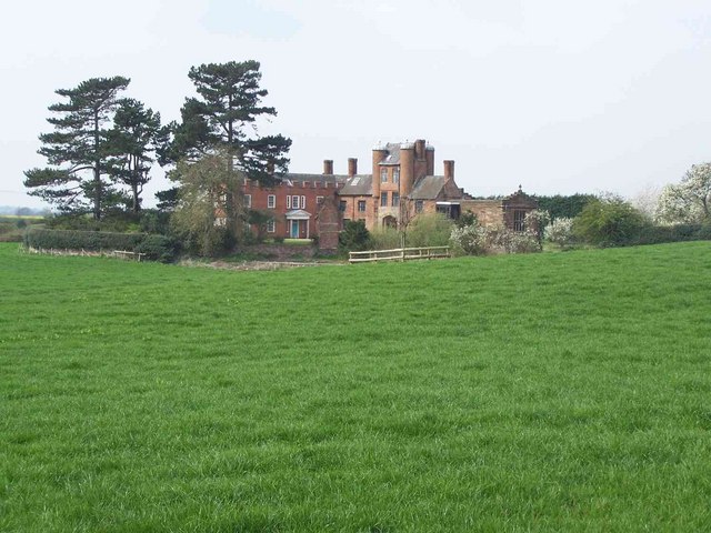
Pillaton Hall

Pillaton Hall was an historic house located in Pillaton, Staffordshire, near Penkridge, England. For more than two centuries it was the seat of the Littleton...

Rodbaston

Rodbaston is a village in Staffordshire, England. The population as taken at the 2011 census can be found under Penkridge. It is the location of a campus...

Nearby Amenities

Located within 500m of 52.725176,-2.1035884
Seamark Type: gate
Waterway: lock_gate
Lat/Long: 52.7238768/-2.1075813
Mini Roundabout
Direction: clockwise
Lat/Long: 52.7234165/-2.1032552
Bus Stop
Wolgarston School
Bus: yes
Naptan AtcoCode: 3800C604801
Naptan Bearing: W
Naptan BusStopType: CUS
Naptan CommonName: Wolgarston School
Naptan Indicator: Adj
Naptan Landmark: Wolgarston School
Naptan Street: Cannock Rd
Naptan Verified: no
Public Transport: platform
Source: naptan_import
Lat/Long: 52.7228163/-2.0976318
Bus Stop
Sapling Close
Bus: yes
Naptan AtcoCode: 3800C607800
Naptan Bearing: SW
Naptan Indicator: Adj
Naptan Landmark: Cannock Road (E)
Naptan Street: Haling Road
Naptan Verified: no
Public Transport: platform
Source: naptan_import
Lat/Long: 52.7244704/-2.1080595
Bus Stop
Sapling Close
Bus: yes
Naptan AtcoCode: 3800C607801
Naptan Bearing: NE
Naptan CommonName: Sapling Close
Naptan Indicator: Adj
Naptan Landmark: Sapling Close
Naptan Street: Haling Road
Naptan Verified: no
Public Transport: platform
Source: naptan_import
Lat/Long: 52.7245062/-2.1082668
Bus Stop
Little Marsh Grove
Bus: yes
Naptan AtcoCode: 3800C617701
Naptan Bearing: E
Naptan CommonName: Little Marsh Grove
Naptan Indicator: Adj
Naptan Landmark: Little Marsh Grove
Naptan Street: Cannock Road
Naptan Verified: no
Public Transport: platform
Source: naptan_import
Lat/Long: 52.7238964/-2.1065922
Bus Stop
Littleton Crescent
Bus: yes
Naptan AtcoCode: 3800C617901
Naptan Bearing: NW
Naptan CommonName: Littleton Crescent
Naptan Indicator: Adj
Naptan Landmark: Littleton Crescent
Naptan Street: Marsh Lane
Naptan Verified: no
Public Transport: platform
Source: naptan_import
Lat/Long: 52.7290611/-2.1067375
Bus Stop
Leacroft Road
Bus: yes
Naptan AtcoCode: 3800C618001
Naptan Bearing: SW
Naptan CommonName: Leacroft Road
Naptan Indicator: Adj
Naptan Landmark: Leacroft Road
Naptan Street: Marsh Lane
Naptan Verified: no
Public Transport: platform
Source: naptan_import
Lat/Long: 52.7275106/-2.1062308
Bus Stop
Saxon Road
Bus: yes
Naptan AtcoCode: 3800C619201
Naptan Bearing: S
Naptan CommonName: Saxon Road
Naptan Indicator: Opp
Naptan Landmark: Saxon Road
Naptan Street: Wolgarston Way
Naptan Verified: no
Public Transport: platform
Source: naptan_import
Lat/Long: 52.7215358/-2.1023964
Bus Stop
Saxon Road
Bus: yes
Naptan AtcoCode: 3800C619202
Naptan Bearing: N
Naptan CommonName: Saxon Road
Naptan Indicator: Adj
Naptan Landmark: Saxon Road
Naptan Street: Wolgaston Way
Naptan Verified: no
Public Transport: platform
Source: naptan_import
Lat/Long: 52.7219852/-2.1024567
Bus Stop
Wolgarston Way
Bus: yes
Naptan AtcoCode: 3800C619801
Naptan Bearing: W
Naptan BusStopType: CUS
Naptan CommonName: Wolgarston Way
Naptan Indicator: Adj
Naptan Landmark: Wolgarston Way
Naptan Street: Cannock Road
Naptan Verified: no
Public Transport: platform
Source: naptan_import
Lat/Long: 52.7233963/-2.1028005
Bus Stop
Wolgarston Way
Bus: yes
Naptan AtcoCode: 3800C619802
Naptan Bearing: N
Naptan BusStopType: CUS
Naptan Indicator: Adj
Naptan Landmark: Cannock Road
Naptan Street: Wolgarston Way
Naptan Verified: no
Public Transport: platform
Source: naptan_import
Lat/Long: 52.7229074/-2.1034921
Bus Stop
Greenways
Bus: yes
Naptan AtcoCode: 3800C690201
Naptan Bearing: W
Naptan CommonName: Greenways
Naptan Indicator: Adj
Naptan Landmark: Greenways
Naptan Street: Cannock Road
Naptan Verified: no
Public Transport: platform
Source: naptan_import
Lat/Long: 52.7235907/-2.1044306
Veterinary
The Veterinary Hospital
Lat/Long: 52.7238503/-2.1021383
Turning Circle
Lat/Long: 52.7251509/-2.1083224
Halingdene
Power: substation
Ref: 8439
Lat/Long: 52.7239267/-2.1077485
Orchard Crescent
Power: substation
Ref: 8590
Lat/Long: 52.7268921/-2.1054514
Post Box
Ref: ST19 152
Lat/Long: 52.7272928/-2.1087654
Seamark Type: gate
Waterway: lock_gate
Lat/Long: 52.7236706/-2.10761
Wiscombe Avenue
Power: substation
Ref: 8801
Lat/Long: 52.724805/-2.1050508
Mooring: yes
Lat/Long: 52.7225703/-2.1077941
Police
Opening Hours: restricted
Lat/Long: 52.7240832/-2.1097491
Barrier: bollard
Lat/Long: 52.7218038/-2.1085009
Post Box
Ref: ST19 330
Lat/Long: 52.7242776/-2.1088393
Barrier: cycle_barrier
Lat/Long: 52.7217027/-2.1082674
Wolgarston Way
Power: substation
Ref: 8782
Lat/Long: 52.7227266/-2.1032247
Man Made: surveillance
Source: survey
Lat/Long: 52.7280785/-2.0989792
Man Made: surveillance
Source: survey
Lat/Long: 52.7278833/-2.0996918
Orange
Man Made: tower
Lat/Long: 52.7237839/-2.1015013
Waste Disposal
Penkridge Rubbish Disposal
Access: permissive
Centralkey: crt_watermate
Operator: Canal and River Trust
Waste: trash
Waterway: waste_disposal
Lat/Long: 52.7236016/-2.1075153
Toilets
Penkridge Services Toilets
Access: permissive
Centralkey: crt_watermate
Operator: Canal and River Trust
Lat/Long: 52.7235683/-2.1075162
Sanitary Dump Station
Penkridge Elsan Point
Access: customers
Operator: Canal and River Trust
Sanitary Dump Station: yes
Sanitary Dump Station Accepted: black_water
Sanitary Dump Station Basin: yes
Sanitary Dump Station Pump-out: no
Waste: toilet
Waterway: sanitary_dump_station
Lat/Long: 52.7235838/-2.1075158
Waste Basket
Lat/Long: 52.7240147/-2.1076745
Entrance: main
Lat/Long: 52.7240043/-2.1079246
Entrance: yes
Lat/Long: 52.7241205/-2.1079072
Entrance: yes
Lat/Long: 52.7240754/-2.1078025
Winding Hole
Description: 70 Ft Boat Turning Point
Lat/Long: 52.722762/-2.1075128
Water Point
Penkridge Water Point
Access: permissive
Centralkey: crt_watermate
Description: Canal Services. Water Filling Point
Drinking Water: yes
Man Made: water_tap
Operator: Canal and River Trust
Waterway: water_point
Lat/Long: 52.7235509/-2.107519
Generator Method: photovoltaic
Generator Output Electricity: yes
Generator Source: solar
Generator Type: solar_photovoltaic_panel
Location: roof
Power: generator
Lat/Long: 52.7267462/-2.1097653
Generator Method: photovoltaic
Generator Output Electricity: yes
Generator Source: solar
Generator Type: solar_photovoltaic_panel
Location: roof
Power: generator
Lat/Long: 52.7263539/-2.1034715
Generator Method: photovoltaic
Generator Output Electricity: yes
Generator Source: solar
Generator Type: solar_photovoltaic_panel
Location: roof
Power: generator
Lat/Long: 52.7250397/-2.1043593
Generator Method: photovoltaic
Generator Output Electricity: yes
Generator Source: solar
Generator Type: solar_photovoltaic_panel
Location: roof
Power: generator
Lat/Long: 52.7250641/-2.1044076
Generator Method: photovoltaic
Generator Output Electricity: yes
Generator Source: solar
Generator Type: solar_photovoltaic_panel
Location: roof
Power: generator
Lat/Long: 52.7258519/-2.1042171
Generator Method: photovoltaic
Generator Output Electricity: yes
Generator Source: solar
Generator Type: solar_photovoltaic_panel
Location: roof
Power: generator
Lat/Long: 52.7257455/-2.1046892
Generator Method: photovoltaic
Generator Output Electricity: yes
Generator Source: solar
Generator Type: solar_photovoltaic_panel
Location: roof
Power: generator
Lat/Long: 52.7257926/-2.1046315
Generator Method: photovoltaic
Generator Output Electricity: yes
Generator Source: solar
Generator Type: solar_photovoltaic_panel
Location: roof
Power: generator
Lat/Long: 52.7255636/-2.1050808
Generator Method: photovoltaic
Generator Output Electricity: yes
Generator Source: solar
Generator Type: solar_photovoltaic_panel
Location: roof
Power: generator
Lat/Long: 52.724459/-2.1070777
Generator Method: photovoltaic
Generator Output Electricity: yes
Generator Source: solar
Generator Type: solar_photovoltaic_panel
Location: roof
Power: generator
Lat/Long: 52.7239923/-2.1067223
Generator Method: photovoltaic
Generator Output Electricity: yes
Generator Source: solar
Generator Type: solar_photovoltaic_panel
Location: roof
Power: generator
Lat/Long: 52.7217752/-2.1064514
Generator Method: photovoltaic
Generator Output Electricity: yes
Generator Source: solar
Generator Type: solar_photovoltaic_panel
Location: roof
Power: generator
Lat/Long: 52.7217371/-2.1065131
Generator Method: photovoltaic
Generator Output Electricity: yes
Generator Source: solar
Generator Type: solar_photovoltaic_panel
Location: roof
Power: generator
Lat/Long: 52.720876/-2.1036485
Generator Method: photovoltaic
Generator Output Electricity: yes
Generator Source: solar
Generator Type: solar_photovoltaic_panel
Location: roof
Power: generator
Lat/Long: 52.7209069/-2.1035962
Generator Method: photovoltaic
Generator Output Electricity: yes
Generator Source: solar
Generator Type: solar_photovoltaic_panel
Location: roof
Power: generator
Lat/Long: 52.7223032/-2.1028371
Generator Method: photovoltaic
Generator Output Electricity: yes
Generator Source: solar
Generator Type: solar_photovoltaic_panel
Location: roof
Power: generator
Lat/Long: 52.7226062/-2.1037048
Generator Method: photovoltaic
Generator Output Electricity: yes
Generator Source: solar
Generator Type: solar_photovoltaic_panel
Location: roof
Power: generator
Lat/Long: 52.7228223/-2.1039931
Generator Method: photovoltaic
Generator Output Electricity: yes
Generator Source: solar
Generator Type: solar_photovoltaic_panel
Location: roof
Power: generator
Lat/Long: 52.7252403/-2.1089646
Generator Method: photovoltaic
Generator Output Electricity: yes
Generator Source: solar
Generator Type: solar_photovoltaic_panel
Location: roof
Power: generator
Lat/Long: 52.7257057/-2.1093294
Generator Method: photovoltaic
Generator Output Electricity: yes
Generator Source: solar
Generator Type: solar_photovoltaic_panel
Location: roof
Power: generator
Lat/Long: 52.7256399/-2.1077067
Generator Method: photovoltaic
Generator Output Electricity: yes
Generator Source: solar
Generator Type: solar_photovoltaic_panel
Location: roof
Power: generator
Lat/Long: 52.7253167/-2.1075122
Generator Method: photovoltaic
Generator Output Electricity: yes
Generator Source: solar
Generator Type: solar_photovoltaic_panel
Location: roof
Power: generator
Lat/Long: 52.7262198/-2.1068269
Generator Method: photovoltaic
Generator Output Electricity: yes
Generator Source: solar
Generator Type: solar_photovoltaic_panel
Location: roof
Power: generator
Lat/Long: 52.7264578/-2.107299
Generator Method: photovoltaic
Generator Output Electricity: yes
Generator Source: solar
Generator Type: solar_photovoltaic_panel
Location: roof
Power: generator
Lat/Long: 52.7272164/-2.1061148
Generator Method: photovoltaic
Generator Output Electricity: yes
Generator Source: solar
Generator Type: solar_photovoltaic_panel
Location: roof
Power: generator
Lat/Long: 52.7263108/-2.1053624
Generator Method: photovoltaic
Generator Output Electricity: yes
Generator Source: solar
Generator Type: solar_photovoltaic_panel
Location: roof
Power: generator
Lat/Long: 52.7278134/-2.1051103
Generator Method: photovoltaic
Generator Output Electricity: yes
Generator Source: solar
Generator Type: solar_photovoltaic_panel
Location: roof
Power: generator
Lat/Long: 52.7272343/-2.1048957
Bus Stop
Wolgarston High School
Bus: yes
Naptan AtcoCode: 3800C627400
Naptan BusStopType: CUS
Naptan Verified: no
Public Transport: platform
Source: naptan
Lat/Long: 52.7225965/-2.0979159
The data included in this document is from www.openstreetmap.org. The data is made available under ODbL.

Have you been to Little Marsh?

Leave your review of Little Marsh below (or comments, questions and feedback).