Beck Head

Settlement in Westmorland South Lakeland

England

Beck Head

Stall by the car park Walk over Whitbarrow and purchase a postcard or a local walks booklet.
Stall by the car park Credit: Karl and Ali

Beck Head is a small village located in the county of Westmorland, England. Situated in the picturesque Lake District National Park, it is surrounded by stunning natural beauty and offers a tranquil and idyllic setting for residents and visitors alike.

The village is nestled in a valley, with rolling hills and lush green meadows as far as the eye can see. The beck, from which the village takes its name, flows gently through the village, adding to its charm. The sound of running water provides a soothing backdrop to daily life in Beck Head.

The architecture of the village is predominantly traditional, with many stone cottages and farmhouses dating back several centuries. These historic buildings are well-preserved and give the village a timeless feel. The community takes great pride in maintaining the village's character and heritage.

Despite its small size, Beck Head has a strong sense of community. The residents are friendly and welcoming, and there is a close-knit atmosphere. The village has a local pub where locals and tourists can gather, share stories, and enjoy a pint or a traditional meal.

The surrounding countryside offers a plethora of outdoor activities for nature enthusiasts. Hiking, cycling, and fishing are popular pastimes, with numerous trails and paths to explore. The nearby lakes provide opportunities for boating and water sports, attracting visitors from far and wide.

Overall, Beck Head is a charming and picturesque village, perfect for those seeking a peaceful escape amidst the beauty of the Lake District.

If you have any feedback on the listing, please let us know in the comments section below.

Beck Head Images

Images are sourced within 2km of 54.254779/-2.853402 or Grid Reference SD4484. Thanks to Geograph Open Source API. All images are credited.

Stall by the car park Walk over Whitbarrow and purchase a postcard or a local walks booklet.
Stall by the car park
Walk over Whitbarrow and purchase a postcard or a local walks booklet.
Anastice, Whitbarrow Most of the eastern side of Whitbarrow is heavily wooded. There are a few tracks which penetrate the broken limestone upland but they are overgrown, particularly in the summer. The curiously named Anastice area overlooks a structural valley created by the dipping limestone strata. The place has a very 'Lost World' feel about it and a fly-by of pterodactyls wouldn't seem out of place here.
Anastice, Whitbarrow
Most of the eastern side of Whitbarrow is heavily wooded. There are a few tracks which penetrate the broken limestone upland but they are overgrown, particularly in the summer. The curiously named Anastice area overlooks a structural valley created by the dipping limestone strata. The place has a very 'Lost World' feel about it and a fly-by of pterodactyls wouldn't seem out of place here.
Cattle grazing at Low Fell End Cattle graze the low-lying pastures below the abrupt <a href="https://www.geograph.org.uk/photo/2475255">SD4584 : Millside Scar, Whitbarrow</a>
Cattle grazing at Low Fell End
Cattle graze the low-lying pastures below the abrupt SD4584 : Millside Scar, Whitbarrow
Interior of derelict building below White Scar The building was probably part of the quarrying operation which removed talus from the flank of White Scar.
Interior of derelict building below White Scar
The building was probably part of the quarrying operation which removed talus from the flank of White Scar.
Looking south from Whitbarrow The very southern end of Whitbarrow forms a prow of limestone looming abruptly over the flat pastures and wetlands (Bellart and Foulshaw Mosses, recently colonised by nesting ospreys) bordering the Kent estuary. Immediately below is the farm of Low Fell End. Across the estuary is Arnside Knott (right), with Warton Crag further left and the Bowland moors rising beyond. There is a considerable crag below known to rock climbers as <a href="https://www.geograph.org.uk/photo/2475255">SD4584 : Millside Scar, Whitbarrow</a>
Looking south from Whitbarrow
The very southern end of Whitbarrow forms a prow of limestone looming abruptly over the flat pastures and wetlands (Bellart and Foulshaw Mosses, recently colonised by nesting ospreys) bordering the Kent estuary. Immediately below is the farm of Low Fell End. Across the estuary is Arnside Knott (right), with Warton Crag further left and the Bowland moors rising beyond. There is a considerable crag below known to rock climbers as SD4584 : Millside Scar, Whitbarrow
Limestone outcrop, Whitbarrow 'Whitbarrow' means 'white hill' and when the sun shines on outcrops on the open ridge, it's easy to see why. Dark mats of low-growing juniper reflect the exposed location.
Limestone outcrop, Whitbarrow
'Whitbarrow' means 'white hill' and when the sun shines on outcrops on the open ridge, it's easy to see why. Dark mats of low-growing juniper reflect the exposed location.
Wind-pruned yew, Whitbarrow The upper part of this yew tree growing in a corner of the limestone scar has been pruned by the prevailing wind.
Wind-pruned yew, Whitbarrow
The upper part of this yew tree growing in a corner of the limestone scar has been pruned by the prevailing wind.
Overhangs on Slape Scar The overhangs of this limestone scar resemble a frozen breaking wave about 10m high. There are about 50 rock climbs of all grades spread along the cliff.
Overhangs on Slape Scar
The overhangs of this limestone scar resemble a frozen breaking wave about 10m high. There are about 50 rock climbs of all grades spread along the cliff.
Immortalised in a flash they forever seek the fox... Hanging on the wall in the Derby Arms at Witherslack we have this picture depicting the Peel tradition; fell boots, fox hounds and a red coat.It was years since I visited this public house and this was the picture I came to see. Here we have "Chappie", an iconic hunt leader who was known the length and breadth of the Lake District for his prowess and unique mastery of the hounds and fox hunting. I followed this hunt in 1974 and 1977 and felt privileged to do so. Things have moved on and in a packed Derby Arms it felt strange to be part of an historic photograph amidst a throng of locals, the majority of whom would not even notice the picture or have a clue that such occasions represented the essence of Lakeland life.
Immortalised in a flash they forever seek the fox...
Hanging on the wall in the Derby Arms at Witherslack we have this picture depicting the Peel tradition; fell boots, fox hounds and a red coat.It was years since I visited this public house and this was the picture I came to see. Here we have "Chappie", an iconic hunt leader who was known the length and breadth of the Lake District for his prowess and unique mastery of the hounds and fox hunting. I followed this hunt in 1974 and 1977 and felt privileged to do so. Things have moved on and in a packed Derby Arms it felt strange to be part of an historic photograph amidst a throng of locals, the majority of whom would not even notice the picture or have a clue that such occasions represented the essence of Lakeland life.
Beck Head rising A charming stream rising which gives the scatter of cottages at Beck Head its name. It was explored in 1994 by the Cave Diving Group 'at right end of cliff low passage leads to 0.6m high and 1m wide submerged bedding. Upstream is a squeeze at 90m and a partial choke at 130m' ('Northern Caves 3', Dalesman Pub Co Ltd, 1994). The water probably drains from Whitbarrow, the big limestone hill above to the north. One possible feeder may be <a href="https://www.geograph.org.uk/photo/4620789">SD4487 : Wakebarrow Pot entrance, Whitbarrow</a> which, if connected, would yield a cave system of around 125m in depth.
Beck Head rising
A charming stream rising which gives the scatter of cottages at Beck Head its name. It was explored in 1994 by the Cave Diving Group 'at right end of cliff low passage leads to 0.6m high and 1m wide submerged bedding. Upstream is a squeeze at 90m and a partial choke at 130m' ('Northern Caves 3', Dalesman Pub Co Ltd, 1994). The water probably drains from Whitbarrow, the big limestone hill above to the north. One possible feeder may be SD4487 : Wakebarrow Pot entrance, Whitbarrow which, if connected, would yield a cave system of around 125m in depth.
Witherslack Hall This imposing Victorian house was built for Lord Derby in 1874 and is Grade II listed <span class="nowrap"><a title="http://www.britishlistedbuildings.co.uk/en-77132-witherslack-hall-and-attached-outbuilding#.VsNKY0CHNI4" rel="nofollow ugc noopener" href="http://www.britishlistedbuildings.co.uk/en-77132-witherslack-hall-and-attached-outbuilding#.VsNKY0CHNI4">Link</a><img style="margin-left:2px;" alt="External link" title="External link - shift click to open in new window" src="https://s1.geograph.org.uk/img/external.png" width="10" height="10"/></span> It is currently run as a school.
Witherslack Hall
This imposing Victorian house was built for Lord Derby in 1874 and is Grade II listed LinkExternal link It is currently run as a school.
White Scar, Whitbarrow The great buttress of White Scar forms the southern escarpment of Whitbarrow. It is one of the most impressive limestone crags in the UK and home to several high standard rock climbs. Since access is currently banned and actually reaching the foot of the climbs is fraught with danger, these have never become popular.
White Scar, Whitbarrow
The great buttress of White Scar forms the southern escarpment of Whitbarrow. It is one of the most impressive limestone crags in the UK and home to several high standard rock climbs. Since access is currently banned and actually reaching the foot of the climbs is fraught with danger, these have never become popular.
Beck Head rising (2) A charming stream rising which gives the scatter of cottages at Beck Head its name. It was explored in 1994 by the Cave Diving Group 'at right end of cliff low passage leads to 0.6m high and 1m wide submerged bedding. Upstream is a squeeze at 90m and a partial choke at 130m' ('Northern Caves 3', Dalesman Pub Co Ltd, 1994). The water probably drains from Whitbarrow, the big limestone hill above to the north. One possible feeder may be <a href="https://www.geograph.org.uk/photo/4620789">SD4487 : Wakebarrow Pot entrance, Whitbarrow</a> which, if connected, would yield a cave system of around 125m in depth.
Beck Head rising (2)
A charming stream rising which gives the scatter of cottages at Beck Head its name. It was explored in 1994 by the Cave Diving Group 'at right end of cliff low passage leads to 0.6m high and 1m wide submerged bedding. Upstream is a squeeze at 90m and a partial choke at 130m' ('Northern Caves 3', Dalesman Pub Co Ltd, 1994). The water probably drains from Whitbarrow, the big limestone hill above to the north. One possible feeder may be SD4487 : Wakebarrow Pot entrance, Whitbarrow which, if connected, would yield a cave system of around 125m in depth.
Limestone grassland on Yewbarrow The low limestone spur of Yewbarrow is mainly wooded but, on the highest part, is open grassland with a scattering of outcrops. It's a fine viewpoint, here looking beyond the neighbouring ridge of Whitbarrow to the distant fells of the Yorkshire Dales. In early summer it's alive with wild flowers and herbs.
Limestone grassland on Yewbarrow
The low limestone spur of Yewbarrow is mainly wooded but, on the highest part, is open grassland with a scattering of outcrops. It's a fine viewpoint, here looking beyond the neighbouring ridge of Whitbarrow to the distant fells of the Yorkshire Dales. In early summer it's alive with wild flowers and herbs.
Wind-bent tree, Whitbarrow One of a number of remarkable yew trees shaped by the prevailing wind on the escarpment on top of Whitbarrow. In the distance is the dark ridge of Gummer's How which overlooks the foot of Windermere.
Wind-bent tree, Whitbarrow
One of a number of remarkable yew trees shaped by the prevailing wind on the escarpment on top of Whitbarrow. In the distance is the dark ridge of Gummer's How which overlooks the foot of Windermere.
Track on Farrer's Allotment, Whitbarrow The track descends through light woodland into one of the dry valleys that are incised into the 'lost world' of the Whitbarrow limestone massif.
Track on Farrer's Allotment, Whitbarrow
The track descends through light woodland into one of the dry valleys that are incised into the 'lost world' of the Whitbarrow limestone massif.
The bedding plane slab below White Scar Heading up the tilted slab exposed by quarrying of the scree slope that once formed the slope below the limestone scar. It might be a skateboarders heaven?
The bedding plane slab below White Scar
Heading up the tilted slab exposed by quarrying of the scree slope that once formed the slope below the limestone scar. It might be a skateboarders heaven?
Cottages at Beck Head A pretty terrace of cottages overlooking the rising which gives the hamlet its name. Beyond, is the very steep, wooded flank of Whitbarrow.
Cottages at Beck Head
A pretty terrace of cottages overlooking the rising which gives the hamlet its name. Beyond, is the very steep, wooded flank of Whitbarrow.
Show me another place!

Beck Head is located at Grid Ref: SD4484 (Lat: 54.254779, Lng: -2.853402)

Administrative County: Cumbria

District: South Lakeland

Police Authority: Cumbria

What 3 Words

///approvals.skillet.trucks. Near Arnside, Cumbria

Nearby Locations

Mill Side Beck Head

Related Wikis

Witherslack

Witherslack is a small village and former civil parish, now in the parish of Witherslack, Meathop and Ulpha, in the Westmorland and Furness district, in...

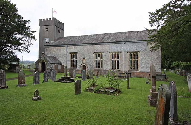
St Paul's Church, Witherslack

St Paul's Church is in the village of Witherslack, Cumbria, England. It is an active Anglican parish church in the deanery of Kendal, the archdeaconry...

Beck Head

Beck Head is a village in Cumbria, England. == References ==

Oversands School

Oversands School (formerly Witherslack Hall School) is a private special school with specialist SEN status situated in the village of Witherslack near...
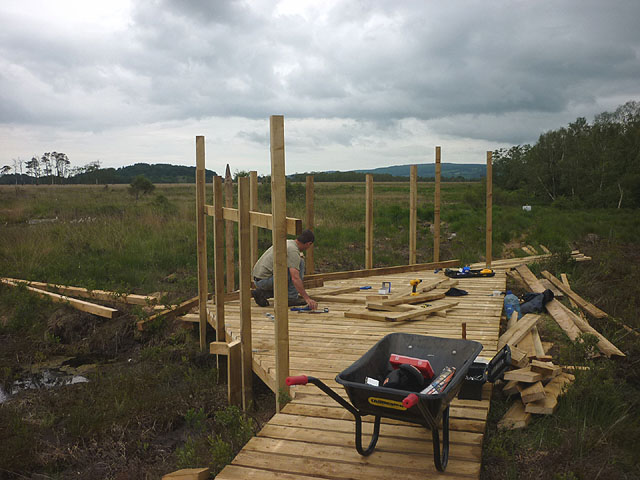
Foulshaw Moss

Foulshaw Moss is a raised bog in Cumbria, England. In 1998 it was bought by Cumbria Wildlife Trust, which has worked to reverse damage caused to the bog...

Witherslack Mosses

Witherslack Mosses are a fragmented wetland west of the Kent estuary in Cumbria, England, within the Lake District National Park. They consist of three...
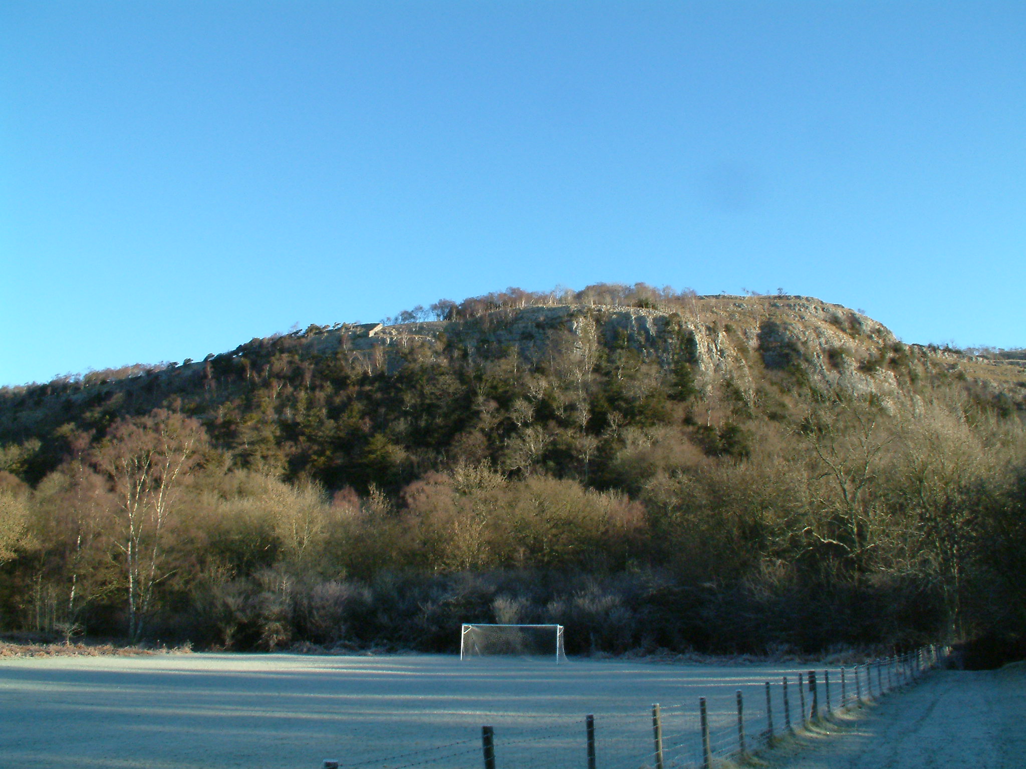
Whitbarrow

Whitbarrow is a hill in Cumbria, England. Designated a biological Site of Special Scientific Interest and national nature reserve, it forms part of the...

Meathop Moss

Meathop Moss is a raised bog located north of Meathop in Cumbria, England. Protected as a nature reserve by the Cumbria Wildlife Trust, Meathop Moss is...

Nearby Amenities

Located within 500m of 54.254779,-2.853402
Barrier: stile
Lat/Long: 54.2547222/-2.8597199
Barrier: kissing_gate
Lat/Long: 54.2541301/-2.8524006
Barrier: stile
Lat/Long: 54.2552182/-2.8496902
Barrier: kissing_gate
Lat/Long: 54.2516544/-2.8537023
Cafe
Hiker's Rest Self-service Cafe
Lat/Long: 54.2559251/-2.8543638
Beck Head
Place: hamlet
Wikidata: Q4878602
Lat/Long: 54.2549051/-2.8515877
Barrier: stile
Lat/Long: 54.2560426/-2.8548148
Barrier: stile
Lat/Long: 54.2557267/-2.856526
Barrier: stile
Lat/Long: 54.2552577/-2.8583442
Bicycle Rental
Capacity: 4
Fee: yes
Network: Morecambe Bay eBike Network
Operator: Witherslack Cycle Barn Bunk House
Operator Type: community
Lat/Long: 54.2542982/-2.8524282
Power: pole
Lat/Long: 54.2564229/-2.8520299
Power: pole
Lat/Long: 54.2562517/-2.8534757
Power: pole
Lat/Long: 54.256338/-2.8549165
Power: pole
Lat/Long: 54.2564229/-2.8563623
Power: pole
Lat/Long: 54.2564859/-2.8574799
Power: pole
Lat/Long: 54.2575339/-2.8580938
The data included in this document is from www.openstreetmap.org. The data is made available under ODbL.

Have you been to Beck Head?

Leave your review of Beck Head below (or comments, questions and feedback).