Charston Sands

Coastal Marsh, Saltings in Monmouthshire

Wales

Charston Sands

Charston Rock Light Charston Rock Light was built in 1868 and is still operational.Picture taken from Black Rock Picnic Site.
Charston Rock Light Credit: John Whiteside

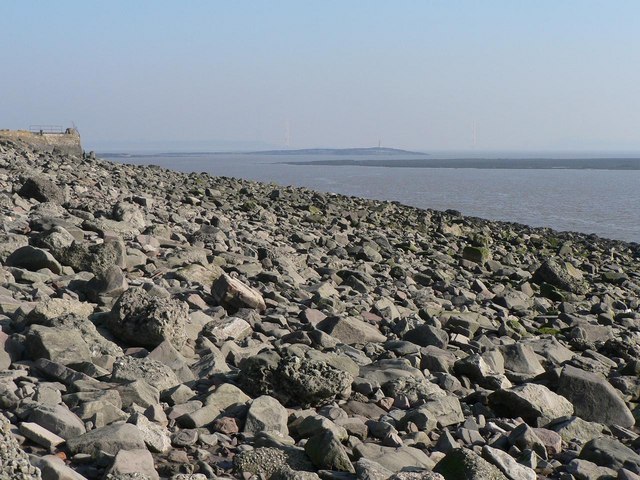
Charston Sands is a stunning coastal marsh located in Monmouthshire, Wales. Situated along the River Severn estuary, it offers breathtaking views and a unique ecosystem. The area is primarily known for its saltings, which are low-lying salt marshes that are periodically flooded by the tides.

The landscape at Charston Sands is a combination of mudflats, marshes, and sand dunes. It is a haven for a wide variety of plant and animal species, including samphire, sea lavender, and various species of wading birds. The marshes provide an important feeding ground for migratory birds, making it a popular spot for birdwatchers.

The tides play a crucial role in shaping the landscape at Charston Sands. Twice a day, the marshes are submerged in saltwater during high tide, creating a dynamic and ever-changing environment. During low tide, the mudflats are exposed, revealing a rich food source for birds and other creatures.

Visitors to Charston Sands can enjoy a peaceful walk along the coastline, immersing themselves in the natural beauty of the area. The marshes are teeming with wildlife, and it is not uncommon to spot herons, egrets, and even seals basking on the sandbanks. The sand dunes also provide a serene backdrop for picnics or simply enjoying the coastal views.

Charston Sands is a protected area, and it is important for visitors to respect the delicate ecosystem. The site offers educational opportunities for those interested in learning about coastal ecology and conservation. Overall, Charston Sands is a hidden gem in Monmouthshire, offering a tranquil escape and a chance to connect with nature.

If you have any feedback on the listing, please let us know in the comments section below.

Charston Sands Images

Images are sourced within 2km of 51.593461/-2.6900399 or Grid Reference ST5288. Thanks to Geograph Open Source API. All images are credited.

Charston Rock Light Charston Rock Light was built in 1868 and is still operational.Picture taken from Black Rock Picnic Site.
Charston Rock Light
Charston Rock Light was built in 1868 and is still operational.Picture taken from Black Rock Picnic Site.
Radar Station Small operational radar station near Black Rock Picnic Site
Radar Station
Small operational radar station near Black Rock Picnic Site
Junction of road between Leechpool & Portskewett Not much to add really, except that behind the trees there is a railway cutting and a sea of electricity pylons, the top of one of which you can just make out.
Junction of road between Leechpool & Portskewett
Not much to add really, except that behind the trees there is a railway cutting and a sea of electricity pylons, the top of one of which you can just make out.
Old railway and pumping station, Sudbrook The Severn Railway Tunnel runs beneath this village.  There is the constant need to pump water from it, and this is done here.  This old railway, relic of the building of the tunnel, runs parallel to the main street of the village. It is crossed a couple of times by link roads, for example to the Post Office just out of view on the right. They were hand-operated gates - hence this sign.
Old railway and pumping station, Sudbrook
The Severn Railway Tunnel runs beneath this village. There is the constant need to pump water from it, and this is done here. This old railway, relic of the building of the tunnel, runs parallel to the main street of the village. It is crossed a couple of times by link roads, for example to the Post Office just out of view on the right. They were hand-operated gates - hence this sign.
Black Rock Lave Net Heritage Fishery This sign (bi-lingual, as we're in Wales!) marks the area of the historic lave net fishery.  At particular times and tides, fishermen waded into the water with large hand-held triangular nets to catch salmon.  There are a few individuals locally who have maintained the skill, though no-one makes a living from it any more - it's for our education and heritage.  

Check out the website:  <span class="nowrap"><a title="http://www.blackrocklavenets.co.uk/" rel="nofollow ugc noopener" href="http://www.blackrocklavenets.co.uk/">Link</a><img style="margin-left:2px;" alt="External link" title="External link - shift click to open in new window" src="https://s1.geograph.org.uk/img/external.png" width="10" height="10"/></span>
Black Rock Lave Net Heritage Fishery
This sign (bi-lingual, as we're in Wales!) marks the area of the historic lave net fishery. At particular times and tides, fishermen waded into the water with large hand-held triangular nets to catch salmon. There are a few individuals locally who have maintained the skill, though no-one makes a living from it any more - it's for our education and heritage. Check out the website: LinkExternal link
Train on the Gloucester to Cardiff line, at Portskewett Picture taken from stone railway bridge (no built up sides here - so a really good place to see trains!) Landscape notable for the density of electrical pylons.
Train on the Gloucester to Cardiff line, at Portskewett
Picture taken from stone railway bridge (no built up sides here - so a really good place to see trains!) Landscape notable for the density of electrical pylons.
St. Pierre Pill This small inlet is used as inexpensive moorings for boat owners on a low budget!  The photo shows the new Severn Crossing to the south west
St. Pierre Pill
This small inlet is used as inexpensive moorings for boat owners on a low budget! The photo shows the new Severn Crossing to the south west
Northwick Warth, New Severn Bridge The end of the Second Severn Crossing with Avonmouth beyond.
Northwick Warth, New Severn Bridge
The end of the Second Severn Crossing with Avonmouth beyond.
Wallstone Farm, with M48 Severn bridge in background
Sudbrook: boulders on Severn foreshore Looking upstream along the Severn from Sudbrook.
Sudbrook: boulders on Severn foreshore
Looking upstream along the Severn from Sudbrook.
Charston Rock: view from Sudbrook Looking upstream along the Severn towards the light on Charston Rock, with the (older) Severn Bridge in the background.
Charston Rock: view from Sudbrook
Looking upstream along the Severn towards the light on Charston Rock, with the (older) Severn Bridge in the background.
Sudbrook: pipe outflow An old pipe emerges at the Severn estuary, with the new bridge beyond.
Sudbrook: pipe outflow
An old pipe emerges at the Severn estuary, with the new bridge beyond.
Sudbrook: old railway This was never a passenger line but was a goods line to nearby works. It splits the village of Sudbrook in two, separating its two parallel streets.
Sudbrook: old railway
This was never a passenger line but was a goods line to nearby works. It splits the village of Sudbrook in two, separating its two parallel streets.
Sudbrook: level crossing and Church Road Looking west along one of the two parallel streets in Sudbrook that are separated by this disused railway line.
Sudbrook: level crossing and Church Road
Looking west along one of the two parallel streets in Sudbrook that are separated by this disused railway line.
Charston Rock lighthouse Built 1868 and still operational, maintained by The Gloucester Harbour Trustees. Photo taken from near the car park and picnic area on Black Rock Road.
Charston Rock lighthouse
Built 1868 and still operational, maintained by The Gloucester Harbour Trustees. Photo taken from near the car park and picnic area on Black Rock Road.
The Severn Estuary foreshore at Lady Bench With the second Severn crossing in the background.
The Severn Estuary foreshore at Lady Bench
With the second Severn crossing in the background.
The Severn Estuary foreshore and cliffs at Lady Bench Accessed from the Black Rock car park.
The Severn Estuary foreshore and cliffs at Lady Bench
Accessed from the Black Rock car park.
Gate on the track from Black Rock to Sudbrook
Show me another place!

Charston Sands is located at Grid Ref: ST5288 (Lat: 51.593461, Lng: -2.6900399)

Unitary Authority: Monmouthshire

Police Authority: Gwent

What 3 Words

///musically.bitters.fatherly. Near Severn Beach, Gloucestershire

Nearby Locations

Charston Sands

Related Wikis

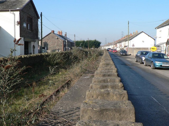
Portskewett Pier railway station

Portskewett Pier was a station on the Bristol & South Wales Union Railway. The pier at Black Rock, near Portskewett, was the Welsh side of the New Passage...

Portskewett railway station

Portskewett railway station is a former station serving Portskewett, Wales, four miles south west of Chepstow and one mile east of Caldicot. It was opened...
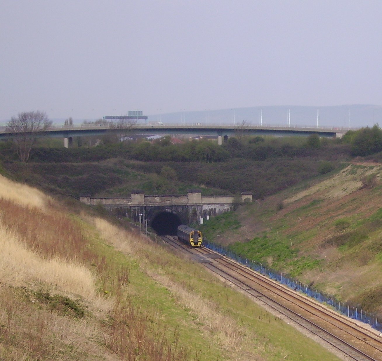
Severn Tunnel

The Severn Tunnel (Welsh: Twnnel Hafren) is a railway tunnel in the United Kingdom, linking South Gloucestershire in the west of England to Monmouthshire...

St Pierre, Monmouthshire

St Pierre is a former parish and hamlet in Monmouthshire, south east Wales, 3 miles (4.8 km) south west of Chepstow and adjacent to the Severn Estuary...

Sudbrook, Monmouthshire

Sudbrook is a village in Monmouthshire, south east Wales. It is located 4 miles south west of Chepstow and 1 mile east of Caldicot. It lies close to the...

St Pierre Hotel Gatehouse

The Gatehouse and attached range, at the St Pierre Hotel, St Pierre, Mathern, Monmouthshire are the most significant remains of the mansion built by the...

Second Severn Crossing

The Second Severn Crossing (Welsh: Ail Groesfan Hafren), officially named the Prince of Wales Bridge (Welsh: Pont Tywysog Cymru) since July 2018, is the...

Mathern Palace

Mathern Palace is a Grade I listed building in the village of Mathern, Monmouthshire, Wales, located some 3 miles (4.8 km) south-west of Chepstow close...

Related Videos

Walking Around The Prince of Wales Bridge - Quik Storys #3

A video automatically generated by the Go Pro Quik app using some of the images I took on of my Walk Around The Prince of ...

Have you been to Charston Sands?

Leave your review of Charston Sands below (or comments, questions and feedback).