Lower Moor

Settlement in Worcestershire Wychavon

England

Lower Moor

A44 at the entrance to Craycombe House
A44 at the entrance to Craycombe House Credit: Peter Whatley

Lower Moor is a small village located in the county of Worcestershire, England. Situated about 4 miles northeast of the town of Pershore, it falls within the Wychavon district. The village is surrounded by picturesque countryside, with the River Avon flowing nearby.

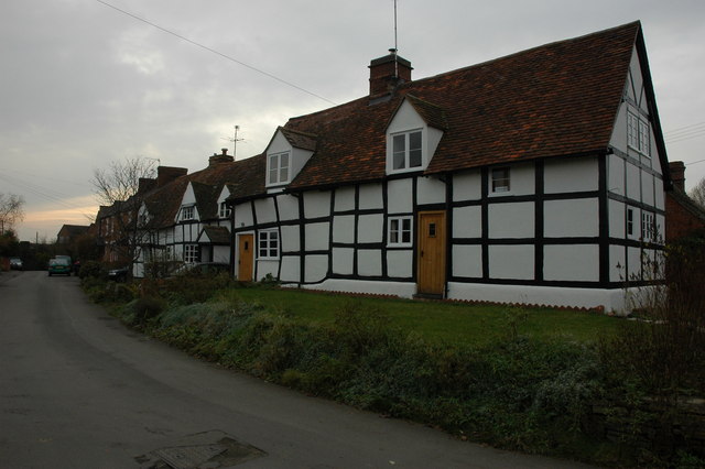
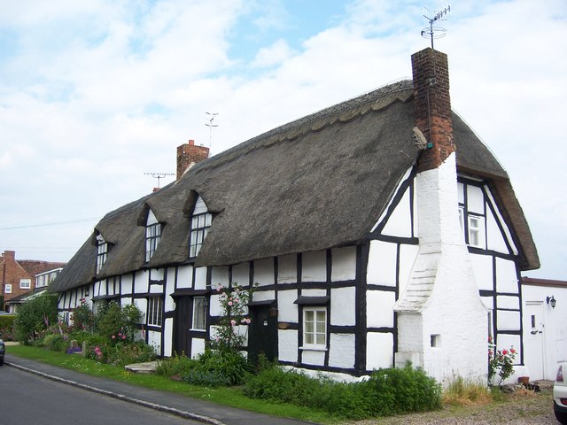
Lower Moor is a predominantly residential area, with a population of around 500 people. The village is characterized by its charming cottages and traditional architecture, giving it a quaint and peaceful atmosphere. The community is close-knit, with a strong sense of local pride and a friendly atmosphere.

The village is served by St. Nicholas Church, a beautiful medieval building that dates back to the 12th century. The church is an important focal point for the community, hosting regular services and events.

Lower Moor offers a range of amenities for its residents. These include a primary school, providing education for children aged 4 to 11, and a village hall that serves as a venue for various social gatherings and activities. The village also has a small convenience store, ensuring that residents have easy access to essential supplies.

The surrounding countryside provides ample opportunities for outdoor activities, such as walking, cycling, and fishing. Lower Moor is also conveniently located for exploring the wider Worcestershire area, with attractions such as Pershore Abbey and the historic city of Worcester within easy reach.

Overall, Lower Moor is a charming village that offers a peaceful and idyllic setting for its residents, with a strong community spirit and access to beautiful countryside.

If you have any feedback on the listing, please let us know in the comments section below.

Lower Moor Images

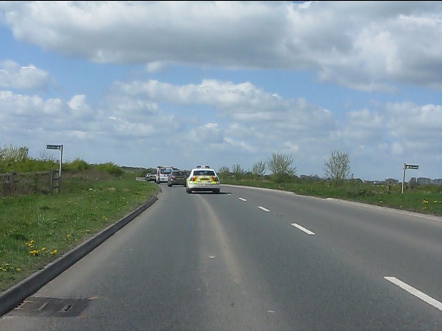
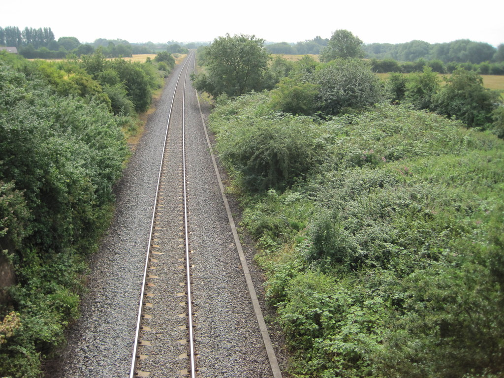
Images are sourced within 2km of 52.121723/-2.032832 or Grid Reference SO9747. Thanks to Geograph Open Source API. All images are credited.

A44 at the entrance to Craycombe House
A44 at Fladbury Cross
Lay-by and snack bar on the A44 near Lower Moor
A44 in Lower Moor We've caught up with that speedy police car again. See: <a title="https://www.geograph.org.uk/photo/2381843" href="https://www.geograph.org.uk/photo/2381843">Link</a>
A44 in Lower Moor
We've caught up with that speedy police car again. See: Link
The road to Upper Moor
A44 - Wyre Piddle bypass crosses a bridleway
A44 - lay-by near Upper Moor That police car's itching to overtake...
A44 - lay-by near Upper Moor
That police car's itching to overtake...
Speeding across the Piddle Brook Off goes the police car once more (see: <a title="https://www.geograph.org.uk/photo/2381843" href="https://www.geograph.org.uk/photo/2381843">Link</a> too). He won't gain much: we'll catch up yet again before Pinvin.
Speeding across the Piddle Brook
Off goes the police car once more (see: Link too). He won't gain much: we'll catch up yet again before Pinvin.
Arable land at Wick View across arable land near Wick to Bredon Hill.
Arable land at Wick
View across arable land near Wick to Bredon Hill.
Lane at Wick Lane giving access to farm land at Wick.  Bredon Hill is just visible on the horizon.
Lane at Wick
Lane giving access to farm land at Wick. Bredon Hill is just visible on the horizon.
Remains of RAF Comberton The remains of RAF Comberton (even though this is Wick) which served as a GCI (Ground Controlled Interception) RADAR station. One of five inland stations which date from the spring of 1941 in response to the night blitz by the Luftwaffe. Information gained from (p79, '20th Century Defences in Britain, The West Midlands area', Logaston Press, ISBN 978 1904396 99 4)
Remains of RAF Comberton
The remains of RAF Comberton (even though this is Wick) which served as a GCI (Ground Controlled Interception) RADAR station. One of five inland stations which date from the spring of 1941 in response to the night blitz by the Luftwaffe. Information gained from (p79, '20th Century Defences in Britain, The West Midlands area', Logaston Press, ISBN 978 1904396 99 4)
Lane at Wick Lane giving access to farm land to the north of Wick.
Lane at Wick
Lane giving access to farm land to the north of Wick.
RAF Comberton The remains of RAF Comberton (even though this is Wick) which served as a GCI (Ground Controlled Interception) RADAR station. One of five inland stations which date from the spring of 1941 in response to the night blitz by the Luftwaffe. Information gained from (p79, '20th Century Defences in Britain, The West Midlands area', Logaston Press, ISBN 978 1904396 99 4)
RAF Comberton
The remains of RAF Comberton (even though this is Wick) which served as a GCI (Ground Controlled Interception) RADAR station. One of five inland stations which date from the spring of 1941 in response to the night blitz by the Luftwaffe. Information gained from (p79, '20th Century Defences in Britain, The West Midlands area', Logaston Press, ISBN 978 1904396 99 4)
Road into Wick
Road into Wick
Church Street, Wyre Piddle
Pile driver being delivered Along a track (footpath) to a development site near the new glasshouses, Lower Moor.
Pile driver being delivered
Along a track (footpath) to a development site near the new glasshouses, Lower Moor.
Bridleway gateway between fields Bridleway is between the A44 and Hill and forms the constituency boundary here.
Bridleway gateway between fields
Bridleway is between the A44 and Hill and forms the constituency boundary here.
Show me another place!

Lower Moor is located at Grid Ref: SO9747 (Lat: 52.121723, Lng: -2.032832)

Administrative County: Worcestershire

District: Wychavon

Police Authority: West Mercia

What 3 Words

///catapult.reported.trainer. Near Pershore, Worcestershire

Related Wikis

Lower Moor

Lower Moor is a village between Wyre Piddle and Fladbury in the district of Wychavon in Worcestershire, England.

Hill and Moor

Hill and Moor is a civil parish in the Wychavon district of Worcestershire, England. It includes the village Lower Moor and the hamlets of Upper Moor...

Wyre Halt railway station

Wyre Halt railway station was a station in Wyre Piddle, Worcestershire, England. The station was opened in 1934 and closed in 1966. == References... ==

Wyre Piddle

Wyre Piddle is a village and civil parish in the Wychavon district of Worcestershire, England. It is on the River Avon, near where that river is joined...

Nearby Amenities

Located within 500m of 52.121723,-2.032832
Bus Stop
Lower Moor, adj Cherry Orchard Road
Bus: yes
Naptan AtcoCode: 2000G203500
Naptan Bearing: E
Naptan CommonName: Cherry Orchard Road
Naptan Indicator: Opp
Naptan Landmark: near Traffic Lights
Naptan NaptanCode: wocdgtpa
Naptan Street: Evesham Road
Naptan Verified: no
Public Transport: platform
Shelter: yes
Source: naptan_import
Lat/Long: 52.1257905/-2.0304732
Bus Stop
Lower Moor Shelter
Bench: no
Bin: yes
Bus: yes
Lit: yes
Naptan AtcoCode: 2000G203501
Naptan Bearing: W
Naptan CommonName: Cherry Orchard Road
Naptan Indicator: Adj
Naptan Landmark: by Traffic Lights
Naptan NaptanCode: wocdgtpd
Naptan Street: Evesham Road
Naptan Verified: no
Public Transport: platform
Shelter: yes
Source: naptan_import
Tactile Paving: no
Lat/Long: 52.125774/-2.0320237
Bus Stop
Lower Moor- Chestnut Tree
Bus: yes
Naptan AtcoCode: 2000G678001
Naptan Bearing: E
Naptan CommonName: Lower Moor- Chestnut Tree
Naptan Indicator: Adj
Naptan Landmark: Cherry Orchard Road
Naptan NaptanCode: wocdgwga
Naptan Street: Manor Road
Naptan Verified: no
Public Transport: platform
Source: naptan_import
Lat/Long: 52.1238215/-2.0318916
Crossing
Crossing: uncontrolled
Lat/Long: 52.125376/-2.0305752
Crossing
Button Operated: yes
Crossing: traffic_signals
Crossing Island: no
Tactile Paving: no
Traffic Signals Vibration: no
Lat/Long: 52.1257988/-2.0312005
Post Box
Post Box Type: lamp
Ref: WR10 313
Royal Cypher: EIIR
Royal Cypher Wikidata: Q33102113
Lat/Long: 52.1238908/-2.0318618
Public Bookcase
Booth: K6
Disused Amenity: telephone
Man Made: telephone_box
Public Bookcase Type: phone_box
Lat/Long: 52.1239292/-2.0318424
Lower Moor
Place: village
Wikidata: Q14955821
Lat/Long: 52.1228095/-2.0329702
Bench
Lat/Long: 52.1237864/-2.031531
Post Office
Lower Moor Post Office
Addr City: Pershore
Addr Housename: Lower Moor Village Hall
Addr Postcode: WR10 2PN
Addr Street: Cherry Orchard Road
Addr Village: Lower Moor
Brand: Post Office
Brand Wikidata: Q1783168
Opening Hours: Tu,Th 09:00-12:30
Ref Pol Id: 128488
Source: pol_branch_list_2018-02
Website: https://www.postoffice.co.uk/branch-finder/2734710/lower-moor
Lat/Long: 52.1244418/-2.0315723
Generator Method: photovoltaic
Generator Output Electricity: yes
Generator Source: solar
Generator Type: solar_photovoltaic_panel
Location: roof
Power: generator
Lat/Long: 52.122548/-2.0277473
Generator Method: photovoltaic
Generator Output Electricity: yes
Generator Source: solar
Generator Type: solar_photovoltaic_panel
Location: roof
Power: generator
Lat/Long: 52.1240037/-2.0328918
Generator Method: photovoltaic
Generator Output Electricity: yes
Generator Source: solar
Generator Type: solar_photovoltaic_panel
Location: roof
Power: generator
Lat/Long: 52.1236431/-2.0325968
Generator Method: photovoltaic
Generator Output Electricity: yes
Generator Source: solar
Generator Type: solar_photovoltaic_panel
Location: roof
Power: generator
Lat/Long: 52.1230107/-2.0312932
Generator Method: photovoltaic
Generator Output Electricity: yes
Generator Source: solar
Generator Type: solar_photovoltaic_panel
Location: roof
Power: generator
Lat/Long: 52.1230585/-2.031709
Generator Method: photovoltaic
Generator Output Electricity: yes
Generator Source: solar
Generator Type: solar_photovoltaic_panel
Location: roof
Power: generator
Lat/Long: 52.1230223/-2.0315319
Generator Method: photovoltaic
Generator Output Electricity: yes
Generator Source: solar
Generator Type: solar_photovoltaic_panel
Location: roof
Power: generator
Lat/Long: 52.1237617/-2.034009
Location Transition: yes
Power: pole
Lat/Long: 52.1222785/-2.0286406
Power: pole
Lat/Long: 52.1223846/-2.0284737
Lower Moor East
Power: pole
Transformer: distribution
Voltage Primary: 11000
Lat/Long: 52.1230614/-2.0274694
Power: pole
Lat/Long: 52.1229007/-2.0262811
Power: pole
Lat/Long: 52.1236054/-2.0269204
Power: pole
Lat/Long: 52.119815/-2.0288283
Power: pole
Lat/Long: 52.1201255/-2.0278707
Power: pole
Lat/Long: 52.1245933/-2.0377788
Power: pole
Lat/Long: 52.1240606/-2.0368065
Lower Moor West
Power: pole
Transformer: distribution
Voltage Primary: 11000
Lat/Long: 52.1241404/-2.0350604
Lower Moor South
Power: pole
Transformer: distribution
Voltage Primary: 11000
Lat/Long: 52.1218761/-2.0356357
Power: pole
Lat/Long: 52.1220902/-2.0355452
Power: pole
Lat/Long: 52.1230235/-2.0357303
Power: pole
Lat/Long: 52.1235184/-2.0357993
Power: pole
Lat/Long: 52.1229745/-2.0348411
Power: pole
Lat/Long: 52.1229062/-2.0335127
Power: pole
Lat/Long: 52.1228485/-2.0324881
Lower Moor
Power: pole
Transformer: distribution
Voltage Primary: 11000
Lat/Long: 52.1228255/-2.0318551
Power: pole
Lat/Long: 52.1223232/-2.0312127
Sandy Nurseries
Power: pole
Transformer: distribution
Voltage Primary: 11000
Lat/Long: 52.1219625/-2.0305422
Power: pole
Lat/Long: 52.1215286/-2.0297657
Power: pole
Lat/Long: 52.1211045/-2.0289939
Power: pole
Lat/Long: 52.1205495/-2.0287471
Bridge House
Power: pole
Transformer: distribution
Voltage Primary: 11000
Lat/Long: 52.1200785/-2.0271331
Power: pole
Lat/Long: 52.1201905/-2.0287827
Power: pole
Lat/Long: 52.1191843/-2.0289074
Moor Gravel Pits
Power: pole
Transformer: distribution
Voltage Primary: 11000
Lat/Long: 52.1183427/-2.0290321
Give Way
Direction: forward
Lat/Long: 52.123784/-2.031819
Information: board
Tourism: information
Lat/Long: 52.1238837/-2.0316886
Advertising: board
Lat/Long: 52.1238178/-2.0316135
Historic: apple_press
Lat/Long: 52.1238398/-2.0316609
The data included in this document is from www.openstreetmap.org. The data is made available under ODbL.

Have you been to Lower Moor?

Leave your review of Lower Moor below (or comments, questions and feedback).