Aldcliffe Marsh

Coastal Marsh, Saltings in Lancashire Lancaster

England

Aldcliffe Marsh

Lancaster Canal The Lancaster Canal was originally planned to run from Westhoughton in Lancashire to Kendal in South Cumbria. The section around the crossing of the River Ribble was never completed.The southern part, from Johnson's Hillock to Wigan Top Lock, remains navigable as part of the Leeds and Liverpool Canal. The planned continuation to Westhoughton was never built.

The Lancaster canal is currently only open to navigation for 42 miles from Preston to Tewitfield near Carnforth. The northern terminus at Kendal can no longer be reached; the canal north of Tewitfield having been severed in three places by the construction of the M6 motorway, and by the A590 road near Kendal in the 1960s 

<span class="nowrap"><a title="http://www.canaljunction.com/canal/lancaster.htm" rel="nofollow ugc noopener" href="http://www.canaljunction.com/canal/lancaster.htm">Link</a><img style="margin-left:2px;" alt="External link" title="External link - shift click to open in new window" src="https://s1.geograph.org.uk/img/external.png" width="10" height="10"/></span> Canal Junction
<span class="nowrap"><a title="http://en.wikipedia.org/wiki/Lancaster_Canal" rel="nofollow ugc noopener" href="http://en.wikipedia.org/wiki/Lancaster_Canal">Link</a><img style="margin-left:2px;" alt="External link" title="External link - shift click to open in new window" src="https://s1.geograph.org.uk/img/external.png" width="10" height="10"/></span> Wikipedia
<span class="nowrap"><a title="http://www.lctrust.co.uk/" rel="nofollow ugc noopener" href="http://www.lctrust.co.uk/">Link</a><img style="margin-left:2px;" alt="External link" title="External link - shift click to open in new window" src="https://s1.geograph.org.uk/img/external.png" width="10" height="10"/></span> Lancaster Canal Trust
Lancaster Canal Credit: N Chadwick

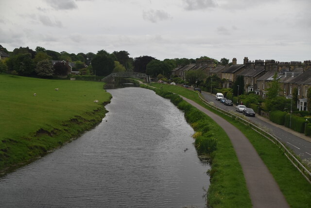
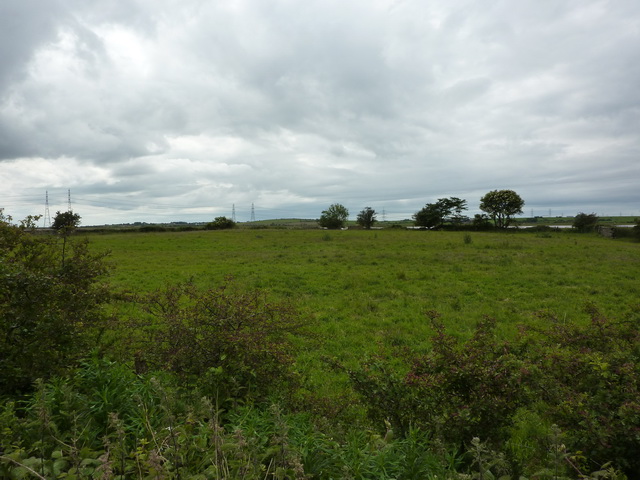
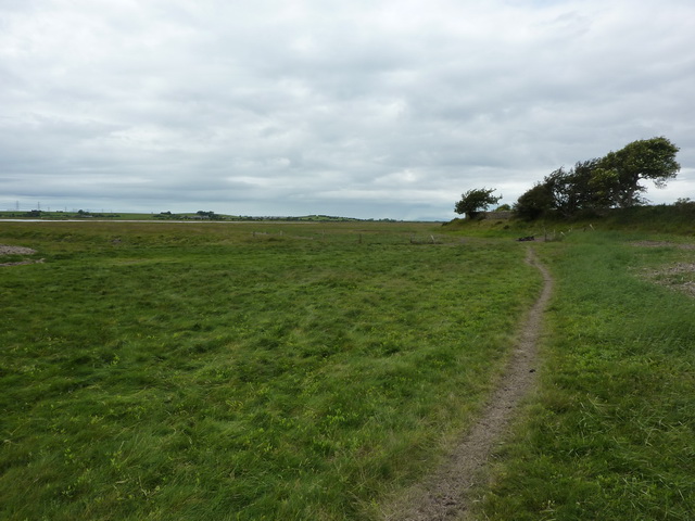
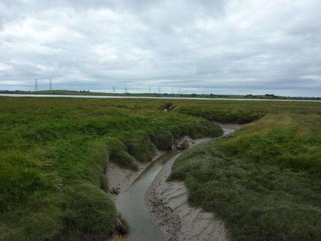
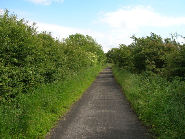
Aldcliffe Marsh, located in Lancashire, England, is a picturesque coastal marshland and saltings area. Covering an extensive stretch of land, it is situated on the southern periphery of the city of Lancaster. This marshland is a significant natural habitat, characterized by its diverse and unique ecological features.

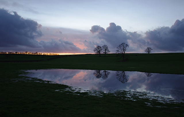
Aldcliffe Marsh boasts a rich variety of flora and fauna, making it an important site for conservation. The marshland is home to a range of plant species, including reeds, grasses, and wildflowers, which thrive in the brackish water environment. These plants provide a vital source of food and shelter for numerous bird species that inhabit the area.

Speaking of its avian inhabitants, Aldcliffe Marsh attracts a plethora of birdlife, both resident and migratory. The marshland serves as a crucial nesting ground for various species, including lapwings, redshanks, and curlews. During the migration seasons, it becomes a temporary haven for numerous waterfowl, such as teal and wigeon, seeking refuge and sustenance.

Aldcliffe Marsh also plays a vital role in the local ecosystem by acting as a floodplain. The marshland acts as a natural buffer, absorbing excess water during times of heavy rainfall or high tides, thus protecting nearby residential areas from flooding.

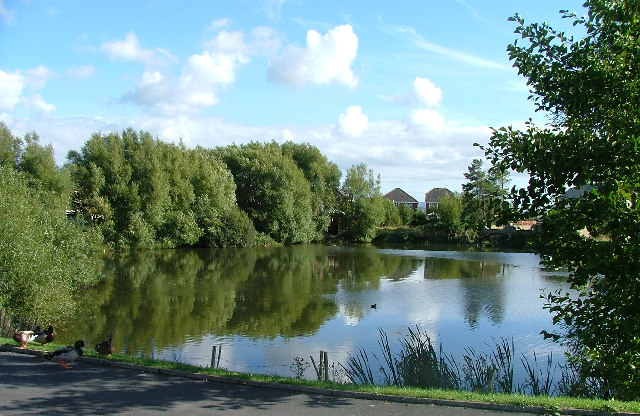
Furthermore, the marshland offers a beautiful and serene landscape, attracting visitors who appreciate its natural beauty and tranquility. It provides ample walking and bird-watching opportunities, allowing people to immerse themselves in the peaceful surroundings and observe the diverse wildlife that calls Aldcliffe Marsh home.

In conclusion, Aldcliffe Marsh in Lancashire is a valuable and ecologically significant coastal marshland and saltings area. Its diverse plant and bird species, along with its role in flood prevention, make it a cherished natural habitat and a popular destination for nature enthusiasts and visitors alike.

If you have any feedback on the listing, please let us know in the comments section below.

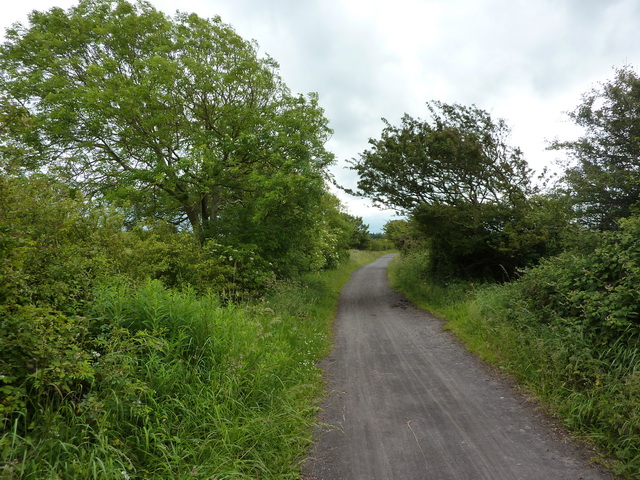
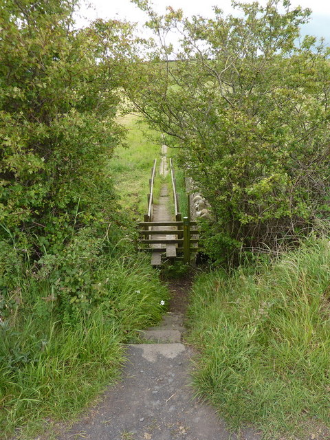
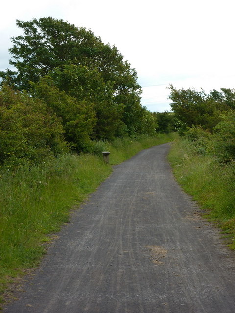
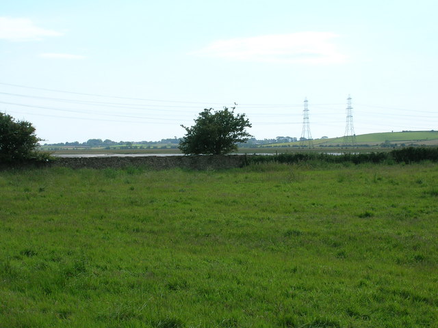
Aldcliffe Marsh Images

Images are sourced within 2km of 54.037859/-2.8341823 or Grid Reference SD4560. Thanks to Geograph Open Source API. All images are credited.

Lancaster Canal The Lancaster Canal was originally planned to run from Westhoughton in Lancashire to Kendal in South Cumbria. The section around the crossing of the River Ribble was never completed.The southern part, from Johnson's Hillock to Wigan Top Lock, remains navigable as part of the Leeds and Liverpool Canal. The planned continuation to Westhoughton was never built.

The Lancaster canal is currently only open to navigation for 42 miles from Preston to Tewitfield near Carnforth. The northern terminus at Kendal can no longer be reached; the canal north of Tewitfield having been severed in three places by the construction of the M6 motorway, and by the A590 road near Kendal in the 1960s 

<span class="nowrap"><a title="http://www.canaljunction.com/canal/lancaster.htm" rel="nofollow ugc noopener" href="http://www.canaljunction.com/canal/lancaster.htm">Link</a><img style="margin-left:2px;" alt="External link" title="External link - shift click to open in new window" src="https://s1.geograph.org.uk/img/external.png" width="10" height="10"/></span> Canal Junction
<span class="nowrap"><a title="http://en.wikipedia.org/wiki/Lancaster_Canal" rel="nofollow ugc noopener" href="http://en.wikipedia.org/wiki/Lancaster_Canal">Link</a><img style="margin-left:2px;" alt="External link" title="External link - shift click to open in new window" src="https://s1.geograph.org.uk/img/external.png" width="10" height="10"/></span> Wikipedia
<span class="nowrap"><a title="http://www.lctrust.co.uk/" rel="nofollow ugc noopener" href="http://www.lctrust.co.uk/">Link</a><img style="margin-left:2px;" alt="External link" title="External link - shift click to open in new window" src="https://s1.geograph.org.uk/img/external.png" width="10" height="10"/></span> Lancaster Canal Trust
Lancaster Canal
The Lancaster Canal was originally planned to run from Westhoughton in Lancashire to Kendal in South Cumbria. The section around the crossing of the River Ribble was never completed.The southern part, from Johnson's Hillock to Wigan Top Lock, remains navigable as part of the Leeds and Liverpool Canal. The planned continuation to Westhoughton was never built. The Lancaster canal is currently only open to navigation for 42 miles from Preston to Tewitfield near Carnforth. The northern terminus at Kendal can no longer be reached; the canal north of Tewitfield having been severed in three places by the construction of the M6 motorway, and by the A590 road near Kendal in the 1960s LinkExternal link Canal Junction LinkExternal link Wikipedia LinkExternal link Lancaster Canal Trust
The road near Heaton
Pasture south of Aldcliffe Marsh
Footpath, Aldcliffe Marsh Looking at the footprints on the path it would seem it is regularly used by sheep and not humans
Footpath, Aldcliffe Marsh
Looking at the footprints on the path it would seem it is regularly used by sheep and not humans
Tidal creek on Aldcliffe Marsh
National Cycle Route No6 northwest of Arna Wood The cycle route utilises the on defunct Lancaster to Glasson Dock railway line
National Cycle Route No6 northwest of Arna Wood
The cycle route utilises the on defunct Lancaster to Glasson Dock railway line
Footpath to Aldcliffe
National Cycle Route No6 northwest of Arna Wood
Minor road towards Heaton
Farmland near Aldcliffe
Cycle track towards Ashton Hall
Start of the footpath to Aldcliffe
The River Lune from north of Low Wood
Power lines cross the River Lune
Track towards Stodday
Lower reaches of the River Lune Flanked by marshes, seen from the railway path which runs from Lancaster to Glasson Dock. The line of pylons is converging on the Heysham Nuclear Power Station.
Lower reaches of the River Lune
Flanked by marshes, seen from the railway path which runs from Lancaster to Glasson Dock. The line of pylons is converging on the Heysham Nuclear Power Station.
Sunset over waterlogged field Between Aldcliffe and Stodday, SW of Lancaster.
Sunset over waterlogged field
Between Aldcliffe and Stodday, SW of Lancaster.
Lancaster Canal With a moored narrow boat.
Lancaster Canal
With a moored narrow boat.
Show me another place!

Aldcliffe Marsh is located at Grid Ref: SD4560 (Lat: 54.037859, Lng: -2.8341823)

Administrative County: Lancashire

District: Lancaster

Police Authority: Lancashire

What 3 Words

///simple.intervene.investors. Near Lancaster, Lancashire

Nearby Locations

Aldcliffe Marsh

Related Wikis

Heaton-with-Oxcliffe

Heaton-with-Oxcliffe is a civil parish situated near the River Lune. it is in the City of Lancaster and the English county of Lancashire. The parish...

Abraham Heights

Abraham Heights is a suburb of Lancaster, Lancashire, England. == Geography == It is west of the city centre, with the River Lune to the north and west...

Aldcliffe

Aldcliffe is a hamlet, and former township and civil parish, now in the parish of Aldcliffe-with-Stodday, south-west of Lancaster, in the Lancaster district...

Aldcliffe Hall

Aldcliffe Hall was a 19th-century country house, now demolished, which replaced a previous mediaeval building, on the bank of the Lune estuary in Aldcliffe...

Aldcliffe-with-Stodday

Aldcliffe-with-Stodday or Aldcliffe with Stodday is a civil parish in City of Lancaster district, Lancashire, England. It lies to the south west of central...

Westfield War Memorial Village

Westfield War Memorial Village (established 1924) is a residence in the City of Lancaster, England. Initially created for ex-service men, women and families...

Lancaster Steiner School

Lancaster Steiner School is an independent coeducational school in Lancaster, England, with classes for nursery, kindergarten and grades 1–5. The curriculum...

Lune Road Ground

Lune Road Ground is a cricket ground in Lancaster, Lancashire. The ground is situated on the bank of the River Lune. The first recorded match on the...

Nearby Amenities

Located within 500m of 54.037859,-2.8341823
The data included in this document is from www.openstreetmap.org. The data is made available under ODbL.

Have you been to Aldcliffe Marsh?

Leave your review of Aldcliffe Marsh below (or comments, questions and feedback).