Beck Foot

Settlement in Westmorland South Lakeland

England

Beck Foot

OS Bench Mark OS cut bench mark from the 19th century levelling, on the corner of Rose Cottage. 469.3 feet above old datum. Badly eroded and almost illegible.
OS Bench Mark Credit: Phil Johnstone

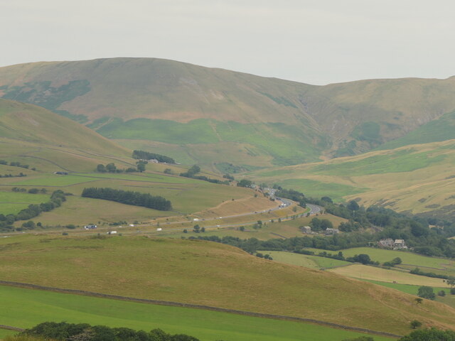
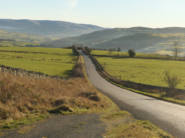
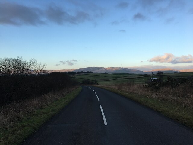
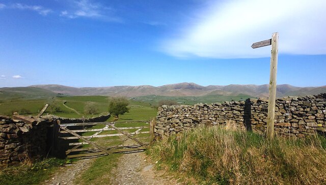
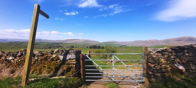
Beck Foot is a small hamlet located in the county of Westmorland, in the North West region of England. Situated in the picturesque Lake District National Park, Beck Foot is surrounded by breathtaking natural beauty, with rolling hills, lush green meadows, and crystal-clear lakes.

The hamlet itself consists of a handful of traditional stone houses, exuding a charming and rustic atmosphere. It is nestled along the banks of a meandering beck, from which it derives its name. The beck, a small stream, adds to the tranquility and idyllic setting of the area.

Beck Foot is a peaceful and secluded spot, perfect for those seeking a retreat from the hustle and bustle of city life. With its close proximity to the Lake District, it offers an abundance of outdoor activities and opportunities for exploration. Hiking and walking trails are aplenty, allowing visitors to immerse themselves in the stunning natural landscapes and possibly catch a glimpse of the local wildlife.

Although Beck Foot does not have any major amenities or services, the nearby town of Kendal is within easy reach, providing access to a wider range of facilities including shops, restaurants, and recreational activities. The hamlet's remote location is part of its appeal, attracting those seeking a tranquil and unspoiled environment.

Overall, Beck Foot is a hidden gem in Westmorland, offering a peaceful retreat amidst the stunning landscapes of the Lake District National Park.

If you have any feedback on the listing, please let us know in the comments section below.
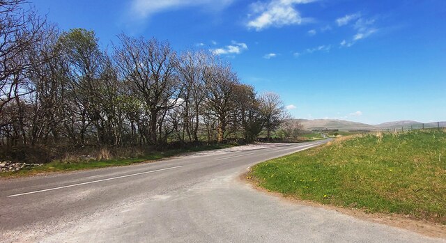
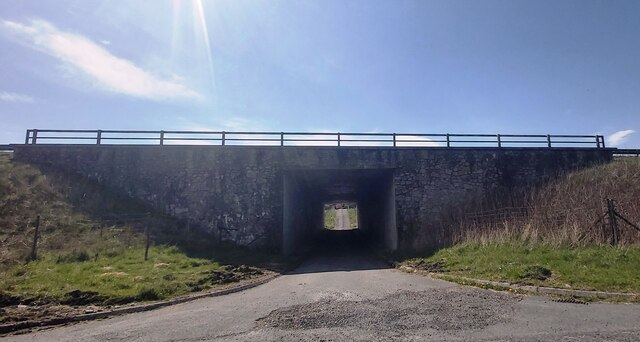
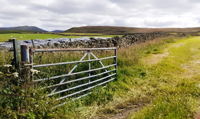
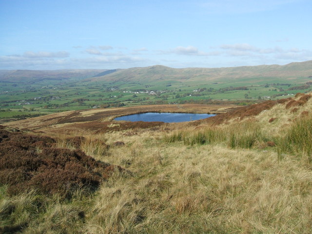
Beck Foot Images

Images are sourced within 2km of 54.358026/-2.6016217 or Grid Reference SD6196. Thanks to Geograph Open Source API. All images are credited.

OS Bench Mark OS cut bench mark from the 19th century levelling, on the corner of Rose Cottage. 469.3 feet above old datum. Badly eroded and almost illegible.
OS Bench Mark
OS cut bench mark from the 19th century levelling, on the corner of Rose Cottage. 469.3 feet above old datum. Badly eroded and almost illegible.
Stile, Firbank Fell A gap stile where a path leaves the road.
Stile, Firbank Fell
A gap stile where a path leaves the road.
Firbank Fell Used by the Westmorland Motor Club, but quiet today.
Firbank Fell
Used by the Westmorland Motor Club, but quiet today.
Firbank Fell summit
Firbank Fell summit
M6, Lunedale
M6, Lunedale
Lowgill Viaduct On the Ingleton Branch between Tebay and Clapham. The line closed gradually with various services being withdrawn over the 1950s and 1960s with the tracks finally lifted in 1967.
Lowgill Viaduct
On the Ingleton Branch between Tebay and Clapham. The line closed gradually with various services being withdrawn over the 1950s and 1960s with the tracks finally lifted in 1967.
B6257 Passing Lowgill Viaduct.
B6257
Passing Lowgill Viaduct.
Bridge  - M6 northbound
Bridge - M6 northbound
 M6 northbound
M6 northbound
B6257 A very quiet road in Westmorland.
B6257
A very quiet road in Westmorland.
Lowgill Viaduct Lowgill Viaduct, Ingleton branch. The Ingleton branch left the Skipton - Lancaster line at Clapham Junction and ran through Ingleton, Kirkby Lonsdale & Sedburgh, joining what is now the WCML at Lowgill, south of Tebay. Had the Midland and the LNWR reached agreement before parliament forced the Midland to build the S&C, this would have been the Midland’s main line to Scotland. As it was, the Midland was ordered to follow through with its plans for the S&C, and the Ingleton branch operated for around a century as a country backwater and sometime diversionary route. Opened 1861, closed to passengers 1954 and closed outright 1967.
Lowgill Viaduct
Lowgill Viaduct, Ingleton branch. The Ingleton branch left the Skipton - Lancaster line at Clapham Junction and ran through Ingleton, Kirkby Lonsdale & Sedburgh, joining what is now the WCML at Lowgill, south of Tebay. Had the Midland and the LNWR reached agreement before parliament forced the Midland to build the S&C, this would have been the Midland’s main line to Scotland. As it was, the Midland was ordered to follow through with its plans for the S&C, and the Ingleton branch operated for around a century as a country backwater and sometime diversionary route. Opened 1861, closed to passengers 1954 and closed outright 1967.
Old Scotch Road near Beck Foot
Boundary Marker Cast-iron county bridge marker at SE end of Crook of Lune Bridge. 'WR' on both faces.

Milestone Society National ID: YW_SEDB05br
Boundary Marker
Cast-iron county bridge marker at SE end of Crook of Lune Bridge. 'WR' on both faces. Milestone Society National ID: YW_SEDB05br
Footpath on Firbank Fell
Gated Path Towards Birchfield
Old Scotch Road
Old Scotch Road
Underbridge to Lambrigg Park Farm
Field gateway on east side of minor road south of Green Dykes
Show me another place!

Beck Foot is located at Grid Ref: SD6196 (Lat: 54.358026, Lng: -2.6016217)

Administrative County: Cumbria

District: South Lakeland

Police Authority: Cumbria

What 3 Words

///polka.yachting.sharper. Near Sedbergh, Cumbria

Related Wikis

Beck Foot

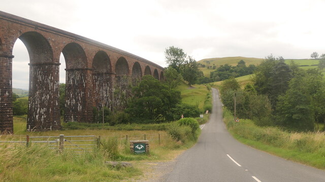
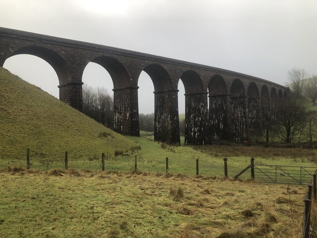
Beck Foot is a hamlet in Cumbria, England, situated on the B6257 road south of Lowgill, the West Coast Main Line and M6 motorway. The disused Lowgill Viaduct...

Grayrigg railway station

Grayrigg railway station in Lambrigg parish, was situated on the course of the original Lancaster and Carlisle Railway (L&CR) (the West Coast Main Line...

Lambrigg

Lambrigg is a civil parish in the South Lakeland district of the English county of Cumbria. It includes the hamlets of Cross Houses and Lambrigg Head...

Low Gill railway station

Low Gill railway station served the hamlet of Lowgill, Westmorland (now in Cumbria), England, from 1846 to 1966 on the Lancaster and Carlisle Railway....

Nearby Amenities

Located within 500m of 54.358026,-2.6016217
Phone
Check Date: 2023-11-13
Emergency: phone
Lat/Long: 54.3605168/-2.6059413
Phone
Check Date: 2023-11-13
Emergency: phone
Lat/Long: 54.360829/-2.6062104
Power: pole
Lat/Long: 54.3586297/-2.5943636
Power: pole
Lat/Long: 54.3584724/-2.595685
Power: pole
Lat/Long: 54.3583016/-2.5971637
Power: pole
Lat/Long: 54.3582302/-2.5983609
Power: pole
Lat/Long: 54.3581163/-2.6002122
Power: pole
Lat/Long: 54.3580311/-2.6016644
Power: pole
Lat/Long: 54.3579784/-2.6025619
Power: pole
Lat/Long: 54.3578963/-2.603976
Power: pole
Lat/Long: 54.3576493/-2.6053603
Power: pole
Lat/Long: 54.3574091/-2.6067148
Power: pole
Lat/Long: 54.3571891/-2.6080213
Power: pole
Lat/Long: 54.3572315/-2.6017174
Power: pole
Lat/Long: 54.356474/-2.6017455
Power: pole
Lat/Long: 54.3557262/-2.6017969
High House
Place: farm
Source Name: OS_OpenData_StreetView
Lat/Long: 54.3574409/-2.5967887
Hiking: yes
Information: route_marker
Tourism: information
Lat/Long: 54.3611118/-2.5965674
The data included in this document is from www.openstreetmap.org. The data is made available under ODbL.

Have you been to Beck Foot?

Leave your review of Beck Foot below (or comments, questions and feedback).