Bog of Culsh
Coastal Marsh, Saltings in Aberdeenshire
Scotland
Bog of Culsh

The Bog of Culsh is a coastal marsh located in Aberdeenshire, Scotland. Situated near the village of Newburgh, it covers an area of approximately 1,500 hectares. This unique landscape is characterized by its diverse habitats, including salt marshes, mudflats, and sand dunes, making it an important site for wildlife conservation.
The coastal marsh is influenced by the tides of the North Sea, resulting in a constantly changing environment. During high tides, the area becomes flooded, creating a haven for various bird species. The Bog of Culsh is renowned for its birdlife, attracting both resident and migratory birds throughout the year. Species such as curlews, redshanks, oystercatchers, and various types of gulls can be spotted in this marshland. It is also an important breeding ground for terns and other seabirds.
The area is rich in plant life as well, with a diverse range of salt-tolerant vegetation. Sea lavender, sea purslane, and saltmarsh grasses are some of the common plants found in the Bog of Culsh. These plants play a crucial role in stabilizing the soil and providing habitat for small mammals and insects.
Aside from its ecological significance, the Bog of Culsh also offers recreational opportunities for visitors. There are several nature trails and bird hides, allowing visitors to explore and observe the wildlife in a peaceful and unobtrusive manner. The coastal marsh is a designated Site of Special Scientific Interest (SSSI) and is managed by nature conservation organizations to protect its fragile ecosystem.
Overall, the Bog of Culsh in Aberdeenshire is a fascinating and valuable coastal marsh, providing a sanctuary for various bird species and serving as an important ecological region in Scotland.
If you have any feedback on the listing, please let us know in the comments section below.
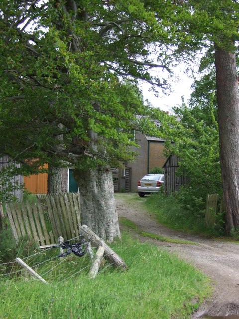
Bog of Culsh Images
Images are sourced within 2km of 57.250982/-2.9282383 or Grid Reference NJ4418. Thanks to Geograph Open Source API. All images are credited.


Bog of Culsh is located at Grid Ref: NJ4418 (Lat: 57.250982, Lng: -2.9282383)
Unitary Authority: Aberdeenshire
Police Authority: North East
What 3 Words
///tuxedos.greed.chiefs. Near Alford, Aberdeenshire
Nearby Locations
Related Wikis
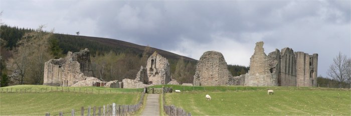
Kildrummy Castle
Kildrummy Castle is a ruined castle near Kildrummy, in Aberdeenshire, Scotland. Though ruined, it is one of the most extensive castles dating from the...

Scottish Sculpture Open
The Scottish Sculpture Open exhibition, sometimes known as the Kildrummy Open, was organised by the Scottish Sculpture Workshop from 1981 to 1997. The...

Kildrummy
Kildrummy (Scottish Gaelic: Cionn Droma) is a hamlet in Aberdeenshire, Scotland near the River Don, 7 miles (11 kilometres) west of Alford. The hamlet...
Clova Monastery
Clova Monastery (also called Cloveth) was a medieval Culdee monastery in Kildrummy, Aberdeenshire, Scotland. == Founding == Clova was founded in the late...
Have you been to Bog of Culsh?
Leave your review of Bog of Culsh below (or comments, questions and feedback).