Black Scars

Coastal Marsh, Saltings in Lancashire South Lakeland

England

Black Scars

Ulverston Canal Ulverston's disused Ship Canal from the Sea end at Canal Foot (the other end about a mile and a quarter away is Canal Head).
Ulverston Canal Credit: Ben Stafford

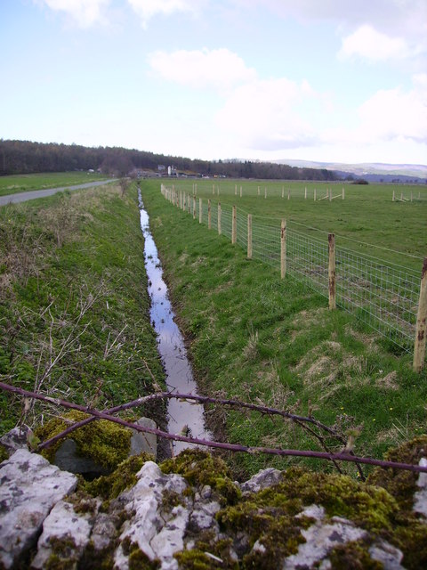
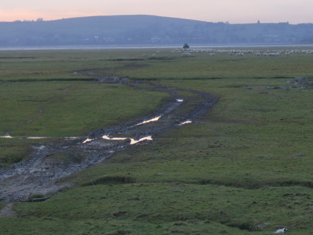
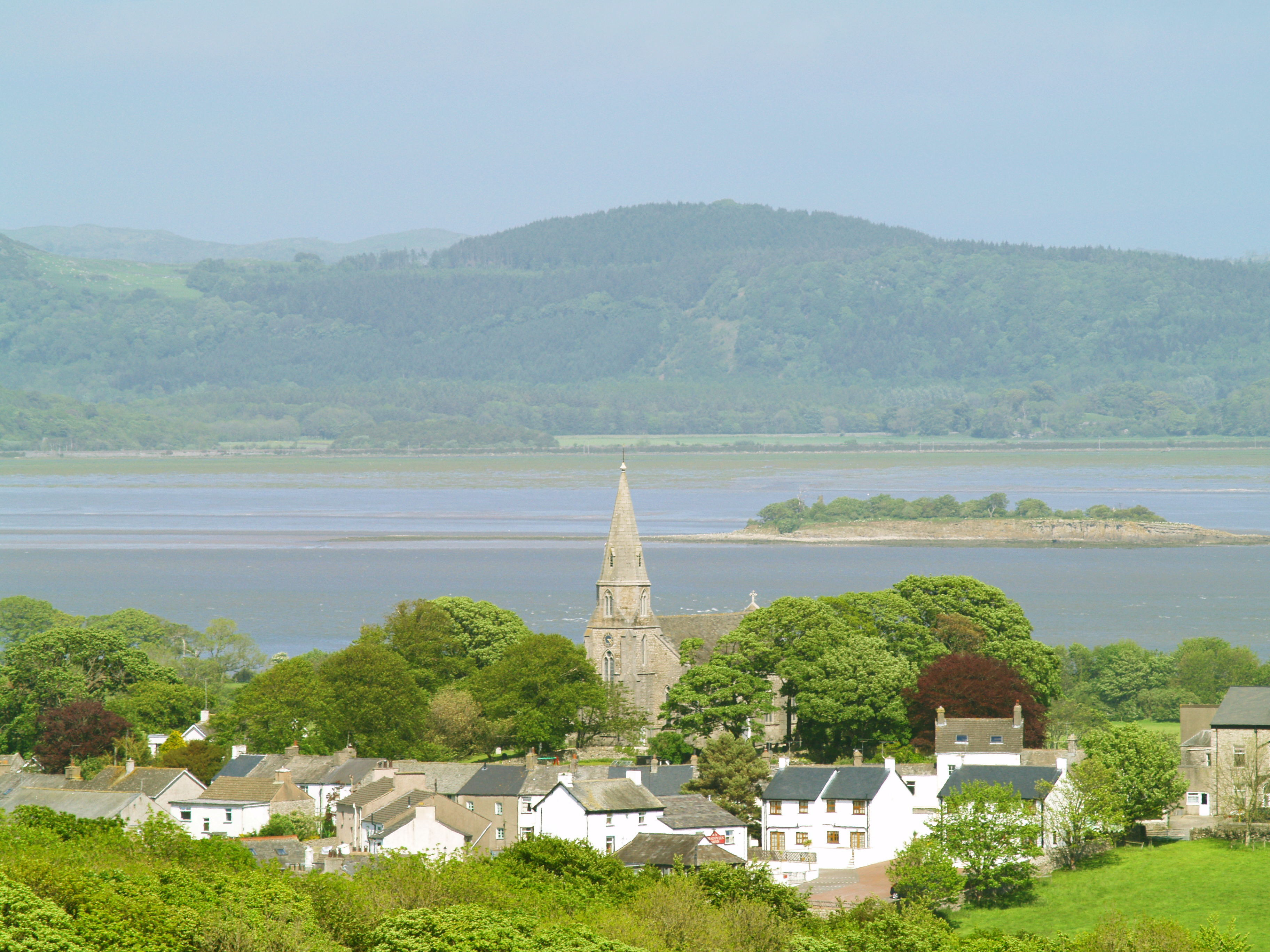
Black Scars, located in Lancashire, is a coastal marshland characterized by its unique saltings. Stretching across a vast area, the landscape is marked by its distinctive black coloration, hence the name Black Scars. This phenomenon is a result of the high concentration of organic matter in the soil, giving it a dark appearance.

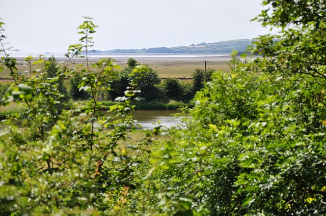
The marshland is situated adjacent to the coast, creating a transitional zone between the land and sea. It is influenced by tidal movements and is subject to regular flooding, contributing to its ecological significance. The saline water from the nearby sea often penetrates the marshland, creating conditions suitable for halophyte vegetation to thrive.

The saltings of Black Scars are renowned for their diverse flora and fauna. The unique environment supports a variety of plant species that have adapted to the saline conditions. Common examples include samphire, sea lavender, and sea purslane. These plants provide important habitats and food sources for various bird species, such as waders and waterfowl, making it a popular destination for birdwatchers.

Black Scars also plays a crucial role in coastal protection. The marshland acts as a natural buffer, absorbing wave energy and reducing the impact of coastal erosion. It serves as a vital barrier, protecting the adjacent land from storm surges and flooding events.

Due to its ecological significance and natural beauty, Black Scars is often designated as a protected area, ensuring its preservation for future generations. Visitors can explore the marshland via designated trails and observe the unique plant and animal life that thrives in this distinctive coastal environment.

If you have any feedback on the listing, please let us know in the comments section below.

Black Scars Images

Images are sourced within 2km of 54.184652/-3.0319459 or Grid Reference SD3277. Thanks to Geograph Open Source API. All images are credited.

Ulverston Canal Ulverston's disused Ship Canal from the Sea end at Canal Foot (the other end about a mile and a quarter away is Canal Head).
Ulverston Canal
Ulverston's disused Ship Canal from the Sea end at Canal Foot (the other end about a mile and a quarter away is Canal Head).
Leven Viaduct from Canal Foot The Leven Viaduct carries the Cumbrian Coast Line from the Cartmel Peninsula to the Furness Peninsula. It is to be closed for maintenance for 3 months in 2006, entailing a 15-mile diversion for passengers on coaches.
Leven Viaduct from Canal Foot
The Leven Viaduct carries the Cumbrian Coast Line from the Cartmel Peninsula to the Furness Peninsula. It is to be closed for maintenance for 3 months in 2006, entailing a 15-mile diversion for passengers on coaches.
Ditch Old Park Old park Wood in view
Ditch Old Park
Old park Wood in view
Plumpton Bight Leven Viaduct in view across the Bight
Plumpton Bight
Leven Viaduct in view across the Bight
A driver's view A driver's view of the Leven Viaduct from one of the older style diesel units.
A driver's view
A driver's view of the Leven Viaduct from one of the older style diesel units.
Chapel Island Along the shingle "beach" to Chapel Island. The ruined Chapel is now largely hidden by the trees. You can walk to this island at low tide (watch out for the channels and the quicksands); this picture was however taken only minutes after a high tide.
Chapel Island
Along the shingle "beach" to Chapel Island. The ruined Chapel is now largely hidden by the trees. You can walk to this island at low tide (watch out for the channels and the quicksands); this picture was however taken only minutes after a high tide.
North Spit on Chapel Island The far end of this rocky spit is the only part of the 1km square that is above water at high tide (as when the picture was taken). The whole square is sand at low water.
North Spit on Chapel Island
The far end of this rocky spit is the only part of the 1km square that is above water at high tide (as when the picture was taken). The whole square is sand at low water.
Capeshead Embankment A Lancaster to Barrow train
Capeshead Embankment
A Lancaster to Barrow train
Capeshead Embankment A Sellafield to Heysham flask train passes the rocky promentry of Capes Head on the right
Capeshead Embankment
A Sellafield to Heysham flask train passes the rocky promentry of Capes Head on the right
Capeshead Embankment A view from Capes Head of a Barrow to Manchester train crossing Capeshead Embankment with the Levens Estuary and the "replica" Eddystone Lighthouse on Hoad hill above Ulverston in the background.
Capeshead Embankment
A view from Capes Head of a Barrow to Manchester train crossing Capeshead Embankment with the Levens Estuary and the "replica" Eddystone Lighthouse on Hoad hill above Ulverston in the background.
Plumpton Junction The site of the junction for the branch to Lakeside (now truncated from Haverthwaite) and also a further branch to the Glaxo Works and Conishead Priory which ran across the fields to the left.
Plumpton Junction
The site of the junction for the branch to Lakeside (now truncated from Haverthwaite) and also a further branch to the Glaxo Works and Conishead Priory which ran across the fields to the left.
Train crossing the Leven viaduct The picture shows just the start of the viaduct which has 48 piers supporting it across the estuary. The picture was taken at high tide.
Train crossing the Leven viaduct
The picture shows just the start of the viaduct which has 48 piers supporting it across the estuary. The picture was taken at high tide.
Plumpton Bight at high tide Looking towards the Leven viaduct this picture shows the extent of this estuary when the tide is high.
Plumpton Bight at high tide
Looking towards the Leven viaduct this picture shows the extent of this estuary when the tide is high.
Leven Viaduct
Leven Viaduct
Sheep on Cartmel Sands Despite the name, this part of the Cartmel Sands is now more like pastureland, as the sheep and the muddy track show.
Sheep on Cartmel Sands
Despite the name, this part of the Cartmel Sands is now more like pastureland, as the sheep and the muddy track show.
Old Park estate entrance An entrance road ('the' entrance road?) to the Old Park estate.
Old Park estate entrance
An entrance road ('the' entrance road?) to the Old Park estate.
Old Park Estate track One of the accessible (with estate permission) tracks in the Old Park estate.
Old Park Estate track
One of the accessible (with estate permission) tracks in the Old Park estate.
Old Park wood lake The lake on the Southern edge of Old Park wood. The land in the background is the headland South of Ulverston.
Old Park wood lake
The lake on the Southern edge of Old Park wood. The land in the background is the headland South of Ulverston.
Show me another place!

Black Scars is located at Grid Ref: SD3277 (Lat: 54.184652, Lng: -3.0319459)

Administrative County: Cumbria

District: South Lakeland

Police Authority: Cumbria

What 3 Words

///eruptions.magically.mammals. Near Flookburgh, Cumbria

Nearby Locations

Black Scars

Related Wikis

Chapel Island

Chapel Island is a limestone outcrop that lies in the Leven estuary of Morecambe Bay in England, less than one mile (1.6 km) from the shoreline at Bardsea...

Canal Foot

Canal Foot is an industrial village in Cumbria, England, on the Leven estuary. It is located 1.7 miles (2.7 km) by road to the east of the centre of Ulverston...
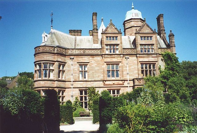
Conishead Priory

Conishead Priory is a large Gothic Revival building on the Furness peninsula near Ulverston in Cumbria. The priory's name translates literally as "King...
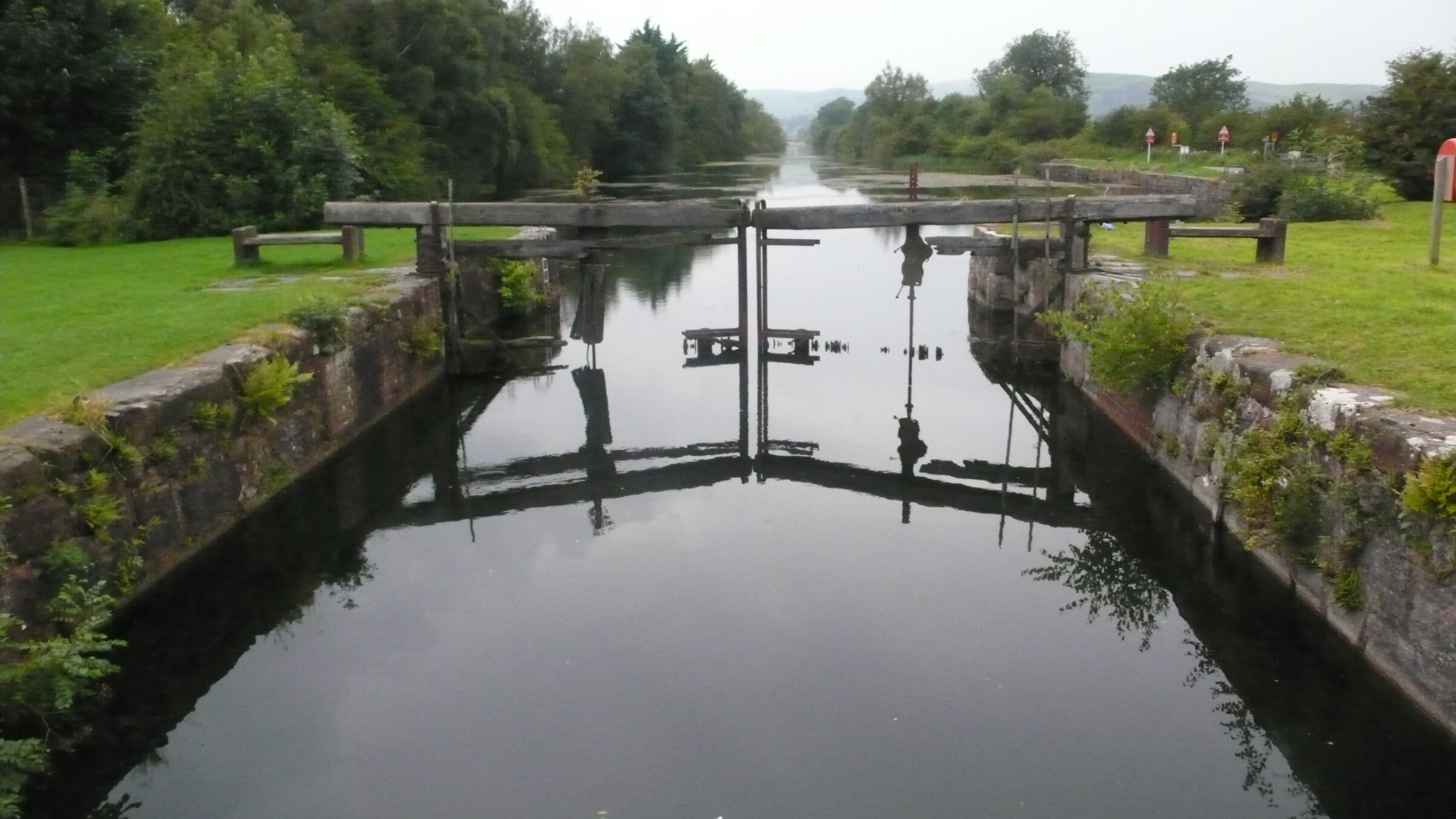
Ulverston Canal

The Ulverston Canal is a 1.25 miles (2 km) ship canal that connects the town of Ulverston, Cumbria, England with Morecambe Bay. The waterway, which is...
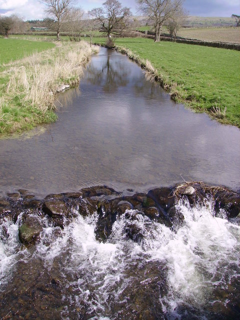
River Eea

The River Eea () is a small river in the Lake District, Cumbria, England running through the Furness region, which until 1974 was part of Lancashire. It...

Holker Hall

Holker Hall (pronounced Hooker by some) is a privately owned country house located about 2 km to the southwest of the village of Cartmel in the ceremonial...
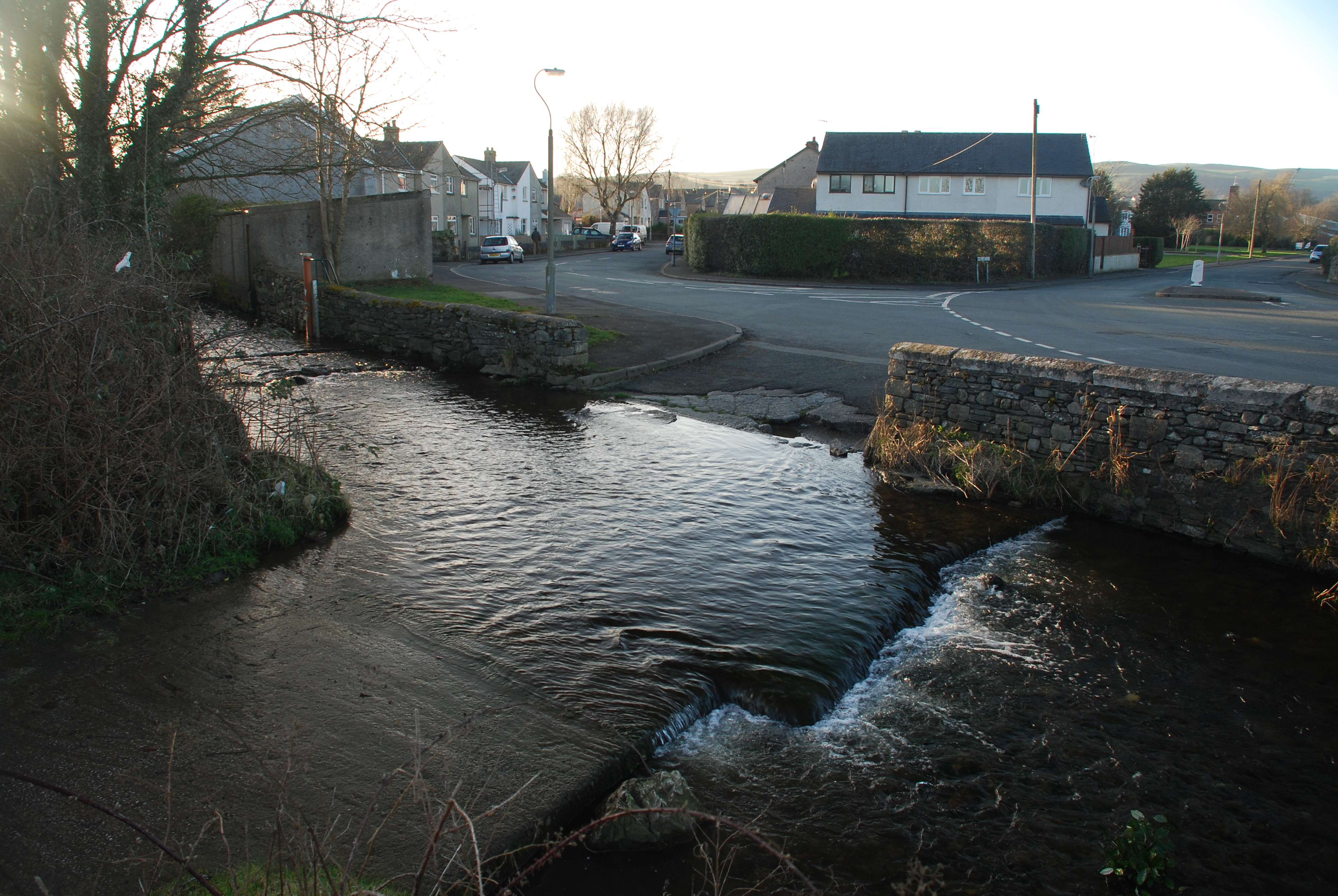
Dragley Beck

Dragley Beck is a hamlet in Cumbria, England. Historically part of Lancashire, it was the birthplace of Sir John Barrow (1764-1848), one of the founders...

Bardsea

Bardsea is a village in the Low Furness area of Cumbria, England. It is two miles to the south-east of Ulverston on the northern coast of Morecambe Bay...

Have you been to Black Scars?

Leave your review of Black Scars below (or comments, questions and feedback).