Angry Brow
Coastal Marsh, Saltings in Lancashire
England
Angry Brow

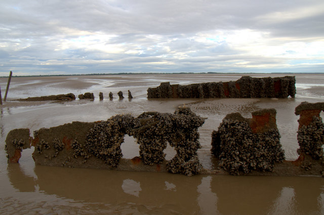
Angry Brow is a coastal marsh and saltings area located in Lancashire, England. Situated along the North West coastline, it stretches over an approximate area of 100 acres. The site is known for its unique natural features and diverse wildlife.
The marshland is characterized by its muddy terrain, reed beds, and salt marsh vegetation, which provide an ideal habitat for various bird species. Angry Brow is particularly renowned for being a significant breeding ground and wintering site for migratory birds. Visitors can spot a variety of avian species, including waders like redshanks, dunlins, and curlews, as well as ducks such as teal and wigeons.
The area also boasts a rich biodiversity, with other wildlife such as hares, rabbits, and voles inhabiting the marshland. Additionally, the marsh supports a range of plant species that are adapted to the saline conditions, including sea aster, sea lavender, and cord grass.
Angry Brow is a popular destination for nature enthusiasts, birdwatchers, and photographers who appreciate the tranquil ambiance and stunning natural scenery. The site offers several walking trails and observation points that allow visitors to explore and appreciate the marshland's beauty.
It is worth noting that access to Angry Brow may be restricted during certain times of the year to protect nesting birds and other wildlife. Visitors are advised to follow any guidelines or restrictions in place to preserve the delicate ecosystem of this unique coastal marsh and saltings area.
If you have any feedback on the listing, please let us know in the comments section below.
Angry Brow Images
Images are sourced within 2km of 53.66393/-3.0616599 or Grid Reference SD2919. Thanks to Geograph Open Source API. All images are credited.


Angry Brow is located at Grid Ref: SD2919 (Lat: 53.66393, Lng: -3.0616599)
Unitary Authority: Sefton
Police Authority: Merseyside
What 3 Words
///spends.diary.labs. Near Southport, Merseyside
Nearby Locations
Related Wikis

Southport Pier
Southport Pier is a pleasure pier in Southport, Merseyside, England. Opened in August 1860, it is the oldest iron pier in the country. Its length of 1...

Pleasureland Southport
Southport Pleasureland is an amusement park located in Southport, Merseyside, England. The park originally operated from 1913 to 2006 as Pleasureland Theme...
Southport Zoo
Southport Zoo was a 6-acre (2.4 ha) zoological garden in Southport, Merseyside, England run by Carol and Douglas Petrie. Historically within Lancashire...
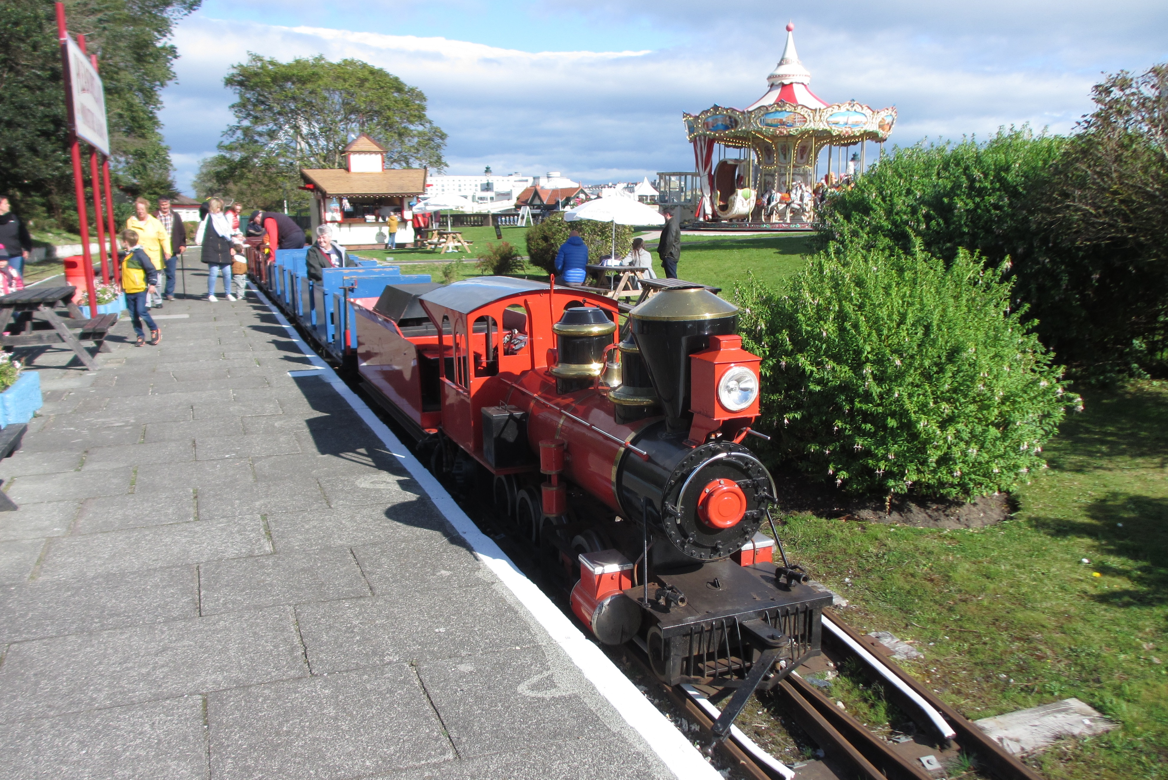
Lakeside Miniature Railway
The 15 in (381 mm) gauge, single track Lakeside Miniature Railway runs along the seaward side of the Marine Lake in Southport, England. == Route == The...
Have you been to Angry Brow?
Leave your review of Angry Brow below (or comments, questions and feedback).